Trychrug

Heritage Site in Carmarthenshire

Wales

Trychrug

Capel y Graig, Welsh Independent Chapel, Trelech The first meeting house on this site was built in 1703. Prior to that from 1670 meetings were in local farms.
The two arched windows have 20th century coloured lead glass.
There were several stages of rebuilding, in particular in 1791, 1801 and 1827 during the time of Morgan Jones the then minister. It is recorded that at times the chapel was so full that the minister had to preach to the congregation through a chapel window. In 1829 there were 556 members added to the church. Each month the new members were welcomed personally by the minister in ‘giving the right hand of fellowship’. In May of that year 110 were welcome with the queue emerging from one of the doors and in a large circle around the front of the chapel and back through the other door.
Capel y Graig, Welsh Independent Chapel, Trelech Credit: Robin Drayton

Trychrug is a historic heritage site located in Carmarthenshire, Wales. Situated near the village of Llansawel, this site holds significant historical and cultural value. It is a well-preserved Iron Age hillfort, dating back to approximately 600 BC. The name Trychrug translates to "three hills," accurately describing the fort's location, nestled between three prominent hills.

The hillfort is surrounded by impressive earthwork ramparts, which enclose an area of approximately 2.5 acres. These ramparts, consisting of ditches and banks, were constructed using locally sourced stone and earth. They provide a visual testament to the fort's defensive capabilities and the engineering skills of its ancient inhabitants.

Within the fort's boundaries, archaeological excavations have revealed evidence of roundhouses and other domestic structures, showcasing the way of life during the Iron Age. It is believed that Trychrug was inhabited by a small farming community, with evidence of farming activities found in the form of grain storage pits and traces of cultivation.

The site offers remarkable panoramic views of the surrounding countryside, providing insight into the strategic location chosen by its original inhabitants. Trychrug's importance as a defensive settlement is further demonstrated by its proximity to other Iron Age forts in the area, suggesting possible connections and interactions between these communities.

Today, Trychrug is a popular heritage attraction, drawing visitors interested in exploring its ancient history and enjoying the picturesque landscape. It serves as a valuable educational resource, offering a glimpse into the Iron Age civilization and the rich cultural heritage of Carmarthenshire.

If you have any feedback on the listing, please let us know in the comments section below.
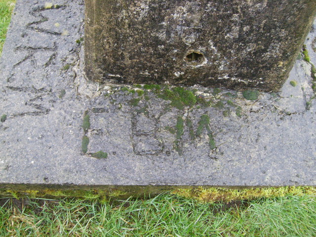
Trychrug Images

Images are sourced within 2km of 51.955/-4.482 or Grid Reference SN2931. Thanks to Geograph Open Source API. All images are credited.

Capel y Graig, Welsh Independent Chapel, Trelech The first meeting house on this site was built in 1703. Prior to that from 1670 meetings were in local farms.
The two arched windows have 20th century coloured lead glass.
There were several stages of rebuilding, in particular in 1791, 1801 and 1827 during the time of Morgan Jones the then minister. It is recorded that at times the chapel was so full that the minister had to preach to the congregation through a chapel window. In 1829 there were 556 members added to the church. Each month the new members were welcomed personally by the minister in ‘giving the right hand of fellowship’. In May of that year 110 were welcome with the queue emerging from one of the doors and in a large circle around the front of the chapel and back through the other door.
Capel y Graig, Welsh Independent Chapel, Trelech
The first meeting house on this site was built in 1703. Prior to that from 1670 meetings were in local farms. The two arched windows have 20th century coloured lead glass. There were several stages of rebuilding, in particular in 1791, 1801 and 1827 during the time of Morgan Jones the then minister. It is recorded that at times the chapel was so full that the minister had to preach to the congregation through a chapel window. In 1829 there were 556 members added to the church. Each month the new members were welcomed personally by the minister in ‘giving the right hand of fellowship’. In May of that year 110 were welcome with the queue emerging from one of the doors and in a large circle around the front of the chapel and back through the other door.
Ordnance Survey Cut Mark This OS cut mark can be found on the brick gatepost NW side of the road. It marks a point 225.195m above mean sea level.
Ordnance Survey Cut Mark
This OS cut mark can be found on the brick gatepost NW side of the road. It marks a point 225.195m above mean sea level.
Ordnance Survey Cut Mark This OS cut mark can be found on the wall post of Maesybont. It marks a point 192.570m above mean sea level.
Ordnance Survey Cut Mark
This OS cut mark can be found on the wall post of Maesybont. It marks a point 192.570m above mean sea level.
Trig point 289 m Crugievan it is called on the OS map the nearest village is Bryn Iwan,
Trig point 289 m
Crugievan it is called on the OS map the nearest village is Bryn Iwan,
Date of concrete base laid Apl 1976 scratched into wet concrete base.
Date of concrete base laid
Apl 1976 scratched into wet concrete base.
E.B.M. and W.R.M Possibly the initials of the workmen that laid the base and pedestal,at this Trig Point.
E.B.M. and W.R.M
Possibly the initials of the workmen that laid the base and pedestal,at this Trig Point.
E.B.M. F. Lab E.B.M. has added his qualifications on this base!
E.B.M. F. Lab
E.B.M. has added his qualifications on this base!
Ordnance Survey Trig Pillar S5811 This pillar at Crugieuan is highly visible from the adjacent road.
Ordnance Survey Trig Pillar S5811
This pillar at Crugieuan is highly visible from the adjacent road.
View from Crug Ieuan Trig Point
Crug Ieuan Trig Point Flush Bracket S5811
Farm lane from bend in B4333 Lane carrying public footpath; viewed from Crugieuan tumulus.
Farm lane from bend in B4333
Lane carrying public footpath; viewed from Crugieuan tumulus.
View towards Bryn Iwan village Elevated view from Crugieuan tumulus.
View towards Bryn Iwan village
Elevated view from Crugieuan tumulus.
Crug Ieuan round barrow Bronze Age barrow, with trig point pillar <a href="https://www.geograph.org.uk/photo/7315660">SN3131 : Crug Ieuan Trig Point Flush Bracket S5811</a>, on top of a low round hill.
Crug Ieuan round barrow
Bronze Age barrow, with trig point pillar SN3131 : Crug Ieuan Trig Point Flush Bracket S5811, on top of a low round hill.
Churn Stand
Churn Stand
Ordnance Survey Cut Mark This OS cut mark can be found on the rock face at old quarry SW side of the road. It marks a point 219.887m above mean sea level.
Ordnance Survey Cut Mark
This OS cut mark can be found on the rock face at old quarry SW side of the road. It marks a point 219.887m above mean sea level.
Junction on the B4299
Garage at Lodge crossroads
Cattle Crossing A herd of Friesian dairy cows entering the farm yard of Maniwan from  a pasture field just off the minor road between Maniwan and Parcmynydd
Cattle Crossing
A herd of Friesian dairy cows entering the farm yard of Maniwan from a pasture field just off the minor road between Maniwan and Parcmynydd
Show me another place!

Trychrug is located at Grid Ref: SN2931 (Lat: 51.955, Lng: -4.482)

Unitary Authority: Carmarthenshire

Police Authority: Dyfed Powys

What 3 Words

///storybook.spoken.puzzles. Near Trelech, Carmarthenshire

Nearby Locations

Crug-glas Trychrug

Related Wikis

Trelech

Trelech (Welsh: Tre-lech) is a village in the parish of Tre-lech a'r Betws, Carmarthenshire, in south-west Wales. It is also the name of the community...

Dyfed

Dyfed (Welsh pronunciation: [ˈdəvɛd]) is a preserved county in southwestern Wales. It is a mostly rural area with a coastline on the Irish Sea and the...

Cilrhedyn

Cilrhedyn is a hamlet and parish in the counties of Carmarthenshire and Pembrokeshire, Wales, in the hill country to the south of the Teifi valley. The...

De Noord (Rotterdam)

De Noord (English: The North) was a tower mill located on the Oostplein in Rotterdam, Netherlands. It was built between 1695 and 1711 as a replacement...

Nearby Amenities

Located within 500m of 51.955,-4.482
Give Way
Direction: forward
Lat/Long: 51.95873/-4.478765
Give Way
Direction: backward
Lat/Long: 51.9514498/-4.4784632
The data included in this document is from www.openstreetmap.org. The data is made available under ODbL.

Have you been to Trychrug?

Leave your review of Trychrug below (or comments, questions and feedback).