Swarkestone Bridge
Heritage Site in Derbyshire South Derbyshire
England
Swarkestone Bridge

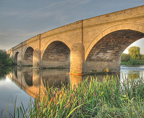
Swarkestone Bridge, located in Derbyshire, England, is a historic and iconic structure that holds significant heritage value. Spanning the River Trent, it is one of the longest stone bridges in the country, measuring an impressive 700 feet (213 meters) in length. The bridge is a Grade I listed building and a Scheduled Ancient Monument, recognized for its architectural and historical importance.
Built in the 13th century, Swarkestone Bridge served as a crucial crossing point on the old route from London to York, connecting the Midlands with the north of England. It was constructed primarily with locally quarried sandstone blocks, featuring a series of pointed arches and triangular cutwaters that provide stability against the river's flow.
The bridge's design displays a blend of medieval and Gothic architectural styles, showcasing the craftsmanship of the time. Over the centuries, it has undergone repairs and alterations, including the addition of parapets in the 18th century. Despite these modifications, the essence of the original structure has been well-preserved, allowing visitors to appreciate its historical significance.
Besides its architectural merit, Swarkestone Bridge holds a place in history due to its connection with the Civil War. In 1645, during the Battle of Swarkestone, Parliamentarian forces defending the bridge were defeated by Royalist troops. This event marked a turning point in the conflict and contributed to the eventual victory of the Royalists.
Today, Swarkestone Bridge remains an impressive testament to the engineering skills of centuries past and stands as a popular attraction for tourists and history enthusiasts alike. It offers breathtaking views of the surrounding countryside and provides a tangible link to the region's rich heritage.
If you have any feedback on the listing, please let us know in the comments section below.
Swarkestone Bridge Images
Images are sourced within 2km of 52.843/-1.443 or Grid Reference SK3727. Thanks to Geograph Open Source API. All images are credited.


Swarkestone Bridge is located at Grid Ref: SK3727 (Lat: 52.843, Lng: -1.443)
Administrative County: Derbyshire
District: South Derbyshire
Police Authority: Derbyshire
What 3 Words
///cigar.dished.parsnips. Near Melbourne, Derbyshire
Nearby Locations
Related Wikis

Stanton by Bridge
Stanton by Bridge is a village and civil parish in the English county of Derbyshire. The population of the civil parish at the 2011 census was 246. �...
Swarkestone Bridge
Swarkestone Bridge is a medieval bridge crossing the River Trent between the villages of Swarkestone and Stanton by Bridge, about 6 miles south of Derby...
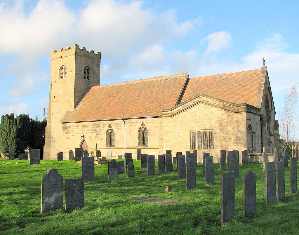
St Michael's Church, Stanton by Bridge
St Michael's Church, Stanton by Bridge is a Grade I listed parish church in the Church of England in Stanton by Bridge, Derbyshire. == History == The church...
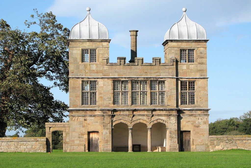
Swarkestone Hall Pavilion
Swarkestone Hall Pavilion, also known as Swarkestone Stand and The Grandstand, is a 17th-century pavilion 200 metres north of the ruins of Swarkestone...

Swarkestone
Swarkestone is a village and civil parish in the South Derbyshire district of Derbyshire, England. The population at the 2011 Census was 187.Swarkestone...
St James' Church, Swarkestone
St James’ Church, Swarkestone is a Grade II* listed parish church in the Church of England in Swarkestone, Derbyshire. == History == The church dates from...

Kings Newton
Kings Newton is a village in South Derbyshire. The population of the village is included in Melbourne. The Holy well (pictured) was constructed around...

St Mary the Virgin's Church, Weston-on-Trent
St Mary the Virgin's Church, Weston-on-Trent is a Grade I listed parish church in the Church of England in Weston-on-Trent, Derbyshire. == History... ==
Nearby Amenities
Located within 500m of 52.843,-1.443Have you been to Swarkestone Bridge?
Leave your review of Swarkestone Bridge below (or comments, questions and feedback).