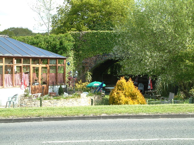
Stephen's Castle

Heritage Site in Dorset

England

Stephen's Castle

Frosty pine at Pistle Hill
Frosty pine at Pistle Hill Credit: Clive Perrin

Stephen's Castle is a heritage site located in the county of Dorset, England. Situated near the village of Worth Matravers, it is an ancient hillfort that dates back to the Iron Age. The castle is perched on a hilltop, providing stunning panoramic views of the surrounding countryside and the English Channel.

The origins of Stephen's Castle can be traced back to around 600 BC when it was constructed as a defensive fortification. The site consists of a series of earthworks and ramparts, which were likely built using local stone and earth. The castle's strategic location on the hilltop would have provided its occupants with a commanding position to monitor and defend against potential threats.

Excavations carried out at Stephen's Castle have revealed evidence of human occupation spanning several centuries. Archaeological finds include pottery fragments, tools, and animal bones, providing insight into the daily lives of its ancient inhabitants.

In addition to its historical significance, Stephen's Castle is also known for its natural beauty. Surrounded by rolling hills and picturesque countryside, the site is a popular destination for hikers and nature enthusiasts. The castle's elevated position also offers breathtaking views of the Jurassic Coast, a UNESCO World Heritage Site renowned for its geology and fossil records.

Today, Stephen's Castle is managed by the National Trust, who have undertaken conservation work to preserve and protect the site for future generations. Visitors can explore the castle's earthworks and enjoy the tranquil surroundings, immersing themselves in the rich history and natural splendor of this ancient hillfort.

If you have any feedback on the listing, please let us know in the comments section below.

Stephen's Castle Images

Images are sourced within 2km of 50.883/-1.865 or Grid Reference SU0909. Thanks to Geograph Open Source API. All images are credited.

Frosty pine at Pistle Hill
Rest a while on the edge of Telegraph Plantation
A field at Potterne Farm - summer at last! A rare event so far down south this year, a blazing hot summer's day with more to come - at least for a couple more days.
A field at Potterne Farm - summer at last!
A rare event so far down south this year, a blazing hot summer's day with more to come - at least for a couple more days.
Pylon at Potterne Farm
Roundabout on Champtoceaux Avenue, Verwood The house on the left appeared by magic from a field since 2011
Roundabout on Champtoceaux Avenue, Verwood
The house on the left appeared by magic from a field since 2011
Station Road, Verwood
Eastworth Farm, Verwood
Lilies by Eastworth Farm, Verwood
War Memorial in Verwood Modern memorial on Ferret Green.
War Memorial in Verwood
Modern memorial on Ferret Green.
Old Direction Sign - Signpost by Edmondsham Road, Verwood Parish Annulus & bar finial - 2 arms; Dorset halo with NGR by the UC road, in parish of Verwood (East Dorset District), Verwood, T-junction of Edmondsham Road and Eastworth Road, opposite Eastworth Farmhouse, on verge.

Surveyed

Milestone Society National ID: DO_SU0809.
Old Direction Sign - Signpost by Edmondsham Road, Verwood Parish
Annulus & bar finial - 2 arms; Dorset halo with NGR by the UC road, in parish of Verwood (East Dorset District), Verwood, T-junction of Edmondsham Road and Eastworth Road, opposite Eastworth Farmhouse, on verge. Surveyed Milestone Society National ID: DO_SU0809.
Late sunlight on recreation ground at Verwood
Forest view near Wild Church Bottom
Forest track next to Stephen's Castle Nature Reserve
Ringwood Road, Verwood
Houses in Old Sawmill Close
Sleepbrook Close
Sleepbrook Close
Path on Dewlands Common
Path across Dewlands Common
Show me another place!

Stephen's Castle is located at Grid Ref: SU0909 (Lat: 50.883, Lng: -1.865)

What 3 Words

///ripples.buzzing.tiredness. Near Verwood, Dorset

Nearby Locations

Stephen's Castle

Related Wikis

Verwood

Verwood is a town and civil parish in eastern Dorset, England. The town lies 10 miles (16 km) north of Bournemouth and 13 miles (21 km) north east of Poole...

The Hub (Verwood)

The Hub (also known as the Verwood Hub) is a multi-purpose venue based in Verwood, Dorset, England, hosting a range of live music, theatre, art, conferences...

Verwood railway station

Verwood railway station served the town of Verwood, Dorset, and its hinterland, from 1866 to 1964. It was one of many casualties of the mass closure of...

Verwood Town F.C.

Verwood Town Football Club are a football club based in Verwood, Dorset, England. The club is affiliated to the Dorset County Football Association and...

Nearby Amenities

Located within 500m of 50.883,-1.865
Traffic Signals
Lat/Long: 50.8789629/-1.8654166
Fuel
Shell Verwood
Lat/Long: 50.8795266/-1.8670704
Restaurant
Al Trullo
Addr Housenumber: 60
Addr Postcode: BH31 7AJ
Addr Street: Ringwood Road
Cuisine: italian
Fhrs Id: 799995
Source Addr: FHRS Open Data
Source Name: FHRS Open Data
Lat/Long: 50.8796802/-1.8690035
Turning Circle
Lat/Long: 50.8797791/-1.8612547
Turning Circle
Lat/Long: 50.880236/-1.8671874
Turning Circle
Lat/Long: 50.8791614/-1.8628884
Post Box
Mapillary: 952689868866259
Post Box Mounting: pier
Post Box Type: lamp
Ref: BH31 17
Ref GB Uprn: 10015479704
Survey Date: 2020-08-14
Lat/Long: 50.879872/-1.869172
Co-op Food
Addr Housenumber: 92
Addr Postcode: BH31 7AL
Addr Street: Ringwood Road
Brand: Co-op Food
Brand Wikidata: Q3277439
Brand Wikipedia: en:Co-op Food
Check Date Opening Hours: 2023-09-08
Fhrs Id: 1063708
Opening Hours: Mo-Su 07:00-22:00
Operator: The Southern Co-operative
Operator Wikidata: Q7569773
Shop: supermarket
Source Addr: FHRS Open Data
Website: https://stores.southern.coop/dorset/dorset/ringwood-road.html
Lat/Long: 50.8786429/-1.8653232
Central Stores
Addr City: Verwood
Addr Housenumber: 95-97
Addr Postcode: BH31 7AD
Fhrs Id: 643918
Shop: convenience
Lat/Long: 50.8794189/-1.8669173
Bus Stop
St Stephens Lane
Bus: yes
Naptan AtcoCode: 1200POA10820
Naptan Bearing: W
Naptan BusStopType: CUS
Naptan CommonName: Opposite St Stephens Lane
Naptan Indicator: W-bound
Naptan NaptanCode: dordgwtw
Naptan Street: Ringwood Road
Naptan Verified: no
Public Transport: platform
Lat/Long: 50.8798502/-1.8695962
Bus Stop
St Stephens Lane
Bus: yes
Naptan AtcoCode: 1200POA10819
Naptan Bearing: SE
Naptan CommonName: St Stephens Lane
Naptan Indicator: SE-bound
Naptan NaptanCode: dordjada
Naptan Street: Ringwood Road
Naptan Verified: no
Public Transport: platform
Lat/Long: 50.8799653/-1.8695319
Bus Stop
Ringwood Road Stores
Bus: yes
Naptan AtcoCode: 1200DOA25063
Naptan Bearing: E
Naptan CommonName: Ringwood Road Stores
Naptan Indicator: E-bound
Naptan NaptanCode: dordmgma
Naptan Street: Ringwood Road
Naptan Verified: no
Public Transport: platform
Lat/Long: 50.8790806/-1.865809
Bus Stop
Ringwood Road Stores
Bus: yes
Naptan AtcoCode: 1200POA11930
Naptan Bearing: W
Naptan BusStopType: CUS
Naptan CommonName: Ringwood Road Stores
Naptan Indicator: W-bound
Naptan NaptanCode: dordjajg
Naptan Street: Ringwood Road
Naptan Verified: no
Public Transport: platform
Lat/Long: 50.8790006/-1.8660497
The data included in this document is from www.openstreetmap.org. The data is made available under ODbL.

Have you been to Stephen's Castle ?

Leave your review of Stephen's Castle below (or comments, questions and feedback).