Bellabeg

Settlement in Aberdeenshire

Scotland

Bellabeg

The Spar shop at Bellabeg And the proprietor is a fount of local knowledge - very helpful to the tourist!  There is even a "Tourist Information" sign on the leaning pole - it must have had 'an incident'!
The Spar shop at Bellabeg Credit: Gordon Brown

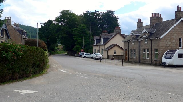
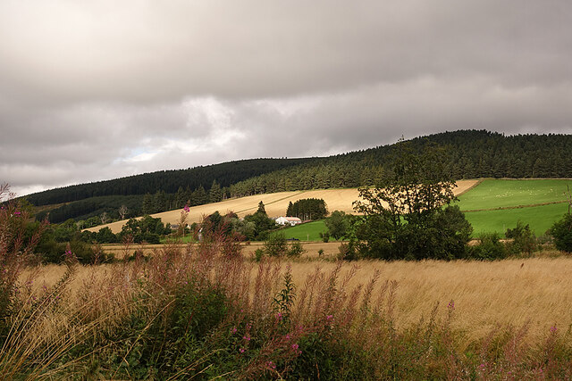
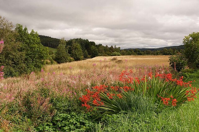
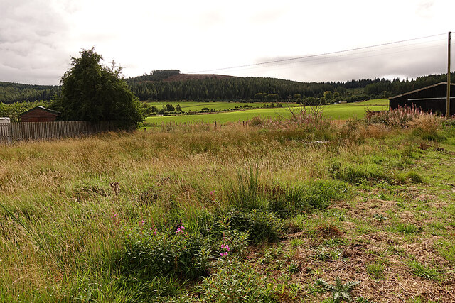
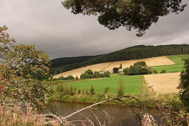
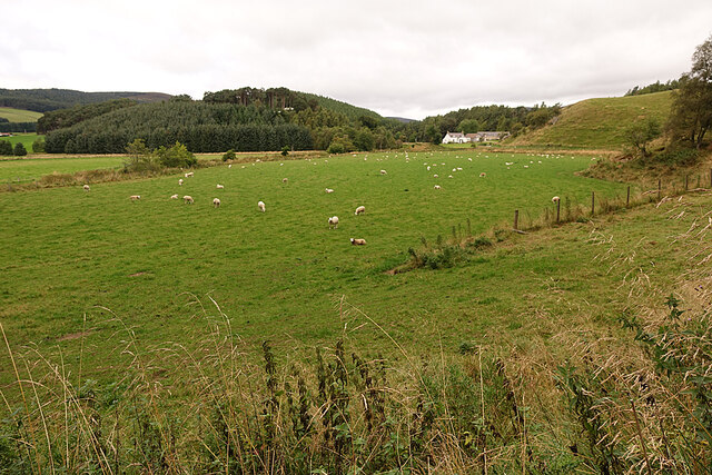
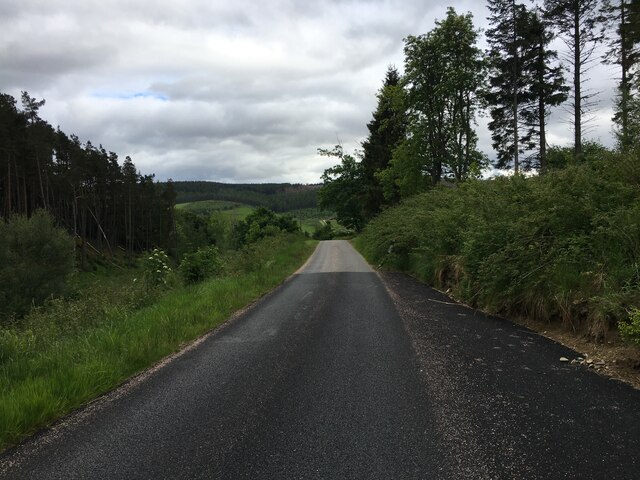
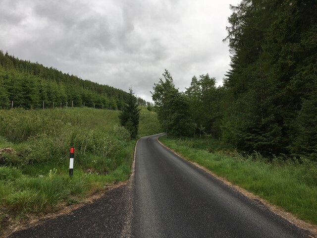
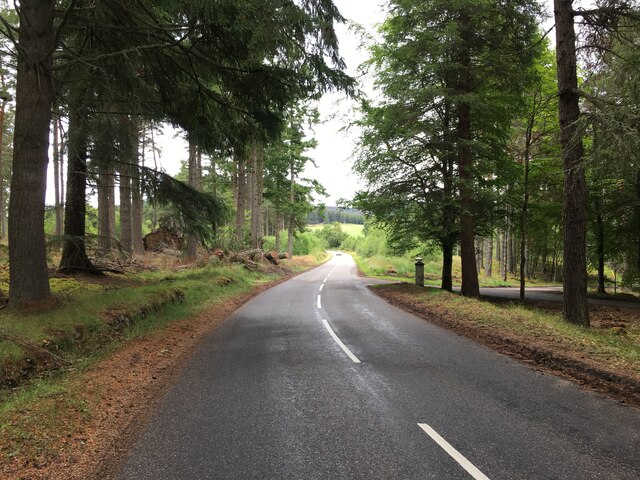
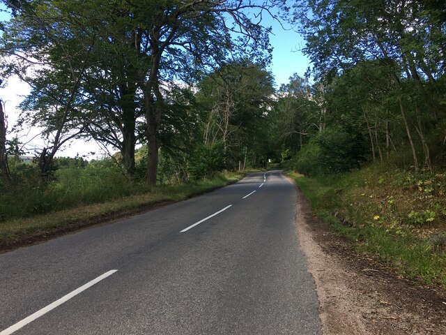
Bellabeg is a small village located in the Aberdeenshire region of Scotland. Situated in the picturesque Strathdon Valley, it is nestled within the Cairngorms National Park, offering stunning views of the surrounding mountainous landscape.

With a population of around 200 residents, Bellabeg exudes a charming rural atmosphere. The village is known for its tranquil and idyllic setting, making it a popular destination for those seeking a peaceful retreat.

One of Bellabeg's notable landmarks is the Bellabeg Park, a recreational area where locals and visitors can enjoy leisurely walks or picnics amidst lush greenery. The park also features a children's playground, providing a safe and fun space for families.

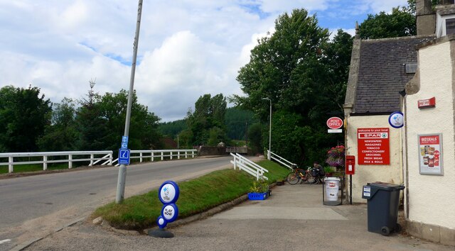
The village is home to a few essential amenities, including a post office and a small convenience store, catering to the everyday needs of its residents. Additionally, visitors can find accommodation options in the form of cozy bed and breakfasts or self-catering cottages, allowing them to immerse themselves in the village's tranquil ambiance.

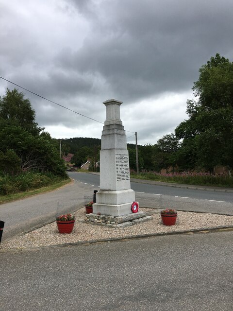
Bellabeg also boasts a rich cultural heritage, hosting various events throughout the year. One such event is the Lonach Highland Gathering, a traditional Scottish gathering that attracts participants and spectators from far and wide. The gathering showcases Highland games, traditional dancing, and bagpipe performances, providing an authentic experience of Scottish culture.

In summary, Bellabeg offers a serene and picturesque escape within the heart of Aberdeenshire. Its stunning natural surroundings, coupled with its warm and welcoming community, make it a charming destination for those seeking a peaceful and authentic Scottish experience.

If you have any feedback on the listing, please let us know in the comments section below.

Bellabeg Images

Images are sourced within 2km of 57.203668/-3.071176 or Grid Reference NJ3513. Thanks to Geograph Open Source API. All images are credited.

The Spar shop at Bellabeg And the proprietor is a fount of local knowledge - very helpful to the tourist!  There is even a "Tourist Information" sign on the leaning pole - it must have had 'an incident'!
The Spar shop at Bellabeg
And the proprietor is a fount of local knowledge - very helpful to the tourist! There is even a "Tourist Information" sign on the leaning pole - it must have had 'an incident'!
Quiet Bellabeg street
Strathdon Looking across the River Don to the Colquhonnie Hotel, which stands on the northern slope above the strath.
Strathdon
Looking across the River Don to the Colquhonnie Hotel, which stands on the northern slope above the strath.
Haugh Land in Strathdon A haugh is an area of flat land beside a river, the equivalent of a flood plain or water meadow in England.
Haugh Land in Strathdon
A haugh is an area of flat land beside a river, the equivalent of a flood plain or water meadow in England.
Looking towards Bluefold Bluefold is the farm at the top of the fields, just below the edge of the forest on Tom a' Chaorainn.
Looking towards Bluefold
Bluefold is the farm at the top of the fields, just below the edge of the forest on Tom a' Chaorainn.
Looking towards Colquhonnie The River Don is in the foreground, and Colquhonnie is part-way up the sunlit fields on the far side.
Looking towards Colquhonnie
The River Don is in the foreground, and Colquhonnie is part-way up the sunlit fields on the far side.
Strathdon Parish Kirk This surprisingly elaborate Gothic kirk in a very rural parish was opened in 1852. It was funded by Charles Forbes of Newe and designed by James Matthews not long after his return from working with George Gilbert Scott in London. It occupies the same site as at least two earlier kirks, separated from the hamlet of Bellabeg by the River Don.
Strathdon Parish Kirk
This surprisingly elaborate Gothic kirk in a very rural parish was opened in 1852. It was funded by Charles Forbes of Newe and designed by James Matthews not long after his return from working with George Gilbert Scott in London. It occupies the same site as at least two earlier kirks, separated from the hamlet of Bellabeg by the River Don.
Sheep in Strathdon A flock of sheep grazes in a field beside the River Don. The house is at Brughs, in the next grid square.
Sheep in Strathdon
A flock of sheep grazes in a field beside the River Don. The house is at Brughs, in the next grid square.
River Don Looking downstream from the road above where the river turns 90º to the left.
River Don
Looking downstream from the road above where the river turns 90º to the left.
Minor road near Coull of Newe
Minor road to Glen Buchat
A944 near Roughpark
A944 near Roughpark
War memorial, Strathdon
A944 near Strathdon
A944 near Strathdon
Minor road, Strathdon
A944 near Strathdon
A944 near Strathdon
Bellabeg Bridge This bridge carries the A944 road over the Water of Nochty.

The plaque on the bridge says:

Blaikie Brothers
Engineers
1881
Aberdeen
Bellabeg Bridge
This bridge carries the A944 road over the Water of Nochty. The plaque on the bridge says: Blaikie Brothers Engineers 1881 Aberdeen
Shop and post office, Bellabeg A Spar shop and post office, with a postbox outside.

This building was originally a bank and bank house. It is a Category C listed building. <span class="nowrap"><a title="https://portal.historicenvironment.scot/designation/LB50623" rel="nofollow ugc noopener" href="https://portal.historicenvironment.scot/designation/LB50623">Link</a><img style="margin-left:2px;" alt="External link" title="External link - shift click to open in new window" src="https://s1.geograph.org.uk/img/external.png" width="10" height="10"/></span>
Shop and post office, Bellabeg
A Spar shop and post office, with a postbox outside. This building was originally a bank and bank house. It is a Category C listed building. LinkExternal link
Show me another place!

Bellabeg is located at Grid Ref: NJ3513 (Lat: 57.203668, Lng: -3.071176)

Unitary Authority: Aberdeenshire

Police Authority: North East

What 3 Words

///beauty.soils.dusty. Near Ballater, Aberdeenshire

Related Wikis

Doune of Invernochty

The Doune of Invernochty is a 12th-century castle in the Cairngorms National Park in Scotland, of which only earthworks survive. The Royal Commission on...

Lost, Aberdeenshire

Lost (Lòsda in Scottish Gaelic; population: less than 24; grid reference NJ349132 or on 1869 map) is a hamlet in Aberdeenshire, Scotland. It lies 40 miles...

Strathdon

Strathdon (; Gaelic: Srath Dheathain) is an area in Aberdeenshire, Scotland. It is situated in the strath of the River Don, 45 miles west of Aberdeen in...

Bellabeg

Bellabeg (an anglicisation of Scottish Gaelic: Am Baile Beag, 'the small farmtown') is a small roadside settlement in Strathdon, Aberdeenshire, Scotland...

Colquhonnie Castle

Colquhonnie Castle is a ruined 16th-century tower house, about 10.5 miles (16.9 km) north of Ballater, Aberdeenshire, Scotland, around 1.0 mile (1.6 km...

Castle Newe

Castle Newe was a castellated mansion house, situated in Aberdeenshire, and designed in 1831 by Archibald Simpson. It was based on an existing Z-plan castle...

Glenbuchat Castle

Glenbuchat Castle is a historic Z plan Scottish castle built in 1590 for John Gordon of Cairnbarrow to mark his wedding. It is located above the River...

Peatfold Burn

Peatfold Burn is a burn which marks the boundary of the parish of Huntly, Aberdeenshire, Scotland. == References ==

Nearby Amenities

Located within 500m of 57.203668,-3.071176
Strathdon
Is In: Aberdeenshire
Name Gd: Srath Dheathain
Name Sco: Strathdon
Old Name: Invernochty
Place: village
Wikidata: Q3982
Wikipedia: en:Strathdon
Lat/Long: 57.2008971/-3.0692553
Parking
Lat/Long: 57.2030725/-3.072812
Recycling
Lat/Long: 57.2030841/-3.0727122
Toilets
Lat/Long: 57.2030256/-3.0726309
Spar
Addr City: Bellabeg
Addr Housename: Bellabeg Shop
Addr Postcode: AB36 8UL
Brand: Spar
Brand Wikidata: Q610492
Brand Wikipedia: en:SPAR (retailer)
Shop: convenience
Website: https://www.spar.co.uk/store-locator/lan05427-spar-bellabeg/
Lat/Long: 57.2042302/-3.0707418
Tourism: viewpoint
Lat/Long: 57.1998186/-3.0699917
Bellabeg
Name Gd: Am Baile Beag
Place: village
Wikidata: Q4883399
Wikipedia: en:Bellabeg
Lat/Long: 57.2039718/-3.0708951
Noexit: yes
Lat/Long: 57.2037187/-3.0708953
Power: pole
Lat/Long: 57.2018921/-3.0784118
Power: pole
Lat/Long: 57.2022821/-3.0776678
Power: pole
Lat/Long: 57.2026677/-3.0769178
Power: pole
Lat/Long: 57.2030805/-3.0761217
Power: pole
Lat/Long: 57.2034835/-3.0753095
Power: pole
Lat/Long: 57.2037442/-3.0743931
Power: pole
Lat/Long: 57.2040841/-3.07321
Power: pole
Lat/Long: 57.2041167/-3.0730977
Power: pole
Lat/Long: 57.2041688/-3.0729132
Power: pole
Lat/Long: 57.2044491/-3.0719286
Power: pole
Lat/Long: 57.2045392/-3.0716217
Power: pole
Lat/Long: 57.204814/-3.0707775
Power: pole
Lat/Long: 57.2039592/-3.075502
Power: pole
Lat/Long: 57.20441/-3.0756825
Power: pole
Lat/Long: 57.2045501/-3.0758891
Power: pole
Lat/Long: 57.2047641/-3.0763463
Power: pole
Lat/Long: 57.2051322/-3.0772252
Power: pole
Lat/Long: 57.2054425/-3.077921
Power: pole
Lat/Long: 57.2044675/-3.0681545
Power: pole
Lat/Long: 57.2045349/-3.0693758
Power: pole
Lat/Long: 57.2046077/-3.0697748
Power: pole
Lat/Long: 57.2046783/-3.0701919
Power: pole
Lat/Long: 57.2050877/-3.0710181
Power: pole
Lat/Long: 57.2055092/-3.0718684
Power: pole
Lat/Long: 57.205911/-3.0726625
Power: pole
Lat/Long: 57.2063987/-3.0736231
Power: pole
Lat/Long: 57.2068397/-3.0737935
Power: pole
Lat/Long: 57.2072937/-3.073976
Power: pole
Lat/Long: 57.2075706/-3.0746839
Power: pole
Lat/Long: 57.204372/-3.0669413
Power: pole
Lat/Long: 57.2042916/-3.0659286
Power: pole
Lat/Long: 57.2042232/-3.065329
Power: pole
Lat/Long: 57.2041178/-3.0644226
Power: pole
Lat/Long: 57.2040494/-3.0638611
Power: pole
Lat/Long: 57.2035671/-3.0651385
Power: pole
Lat/Long: 57.2030294/-3.0658043
Power: pole
Lat/Long: 57.2025059/-3.0664881
Power: pole
Lat/Long: 57.2020008/-3.0671318
Power: pole
Lat/Long: 57.201563/-3.0676813
Power: pole
Lat/Long: 57.2039484/-3.063081
Material: wood
Power: pole
Lat/Long: 57.2016337/-3.074955
Material: wood
Power: pole
Lat/Long: 57.201393/-3.0756101
Material: wood
Power: pole
Lat/Long: 57.2011232/-3.0763188
Post Box
Brand: Royal Mail
Brand Wikidata: Q638098
Operator: Royal Mail
Operator Wikidata: Q638098
Post Box Type: lamp
Ref: AB36 489
Royal Cypher: scottish_crown
Source: survey
Lat/Long: 57.204229/-3.0706642
Defibrillator
Emergency: defibrillator
Indoor: no
Lat/Long: 57.2043131/-3.070648
Leisure: picnic_table
Lat/Long: 57.203405/-3.0742594
Bench
Lat/Long: 57.2039522/-3.0726605
Information: board
Tourism: information
Lat/Long: 57.2039129/-3.0726469
Historic: memorial
Memorial: war_memorial
Lat/Long: 57.2038994/-3.0723465
Leisure: picnic_table
Lat/Long: 57.2038012/-3.072933
Leisure: picnic_table
Lat/Long: 57.2037094/-3.0728652
Barrier: bollard
Lat/Long: 57.2039496/-3.0704346
Man Made: tower
Tower Construction: lattice
Lat/Long: 57.2033493/-3.0698807
Post Office
Brand: Post Office
Brand Wikidata: Q1783168
Lat/Long: 57.2042656/-3.0706736
The data included in this document is from www.openstreetmap.org. The data is made available under ODbL.

Have you been to Bellabeg?

Leave your review of Bellabeg below (or comments, questions and feedback).