St Ninian's Well

Heritage Site in Cumberland Carlisle

England

St Ninian's Well

Road under the M6 near Wreay
Road under the M6 near Wreay Credit: Steven Brown

St Ninian's Well, located in Cumberland, is a significant heritage site known for its historical and religious importance. Situated in a serene and picturesque setting, this well holds great significance for the local community and visitors alike.

The well is believed to date back to the early medieval period and is dedicated to St Ninian, a Christian missionary who played a major role in spreading Christianity in the area. It is said that St Ninian used the water from this well for baptisms, adding to its religious significance.

The well itself is made of stone and is situated within a small stone structure. It is surrounded by lush greenery, creating a peaceful atmosphere for those who visit. The water from the well is clear and pure, with some locals believing in its healing properties.

St Ninian's Well is often visited by pilgrims and tourists seeking spiritual solace or seeking to connect with the area's rich religious history. Many visitors come to the well to gather water and take part in rituals or prayers. The site also attracts history enthusiasts and those interested in the cultural heritage of the region.

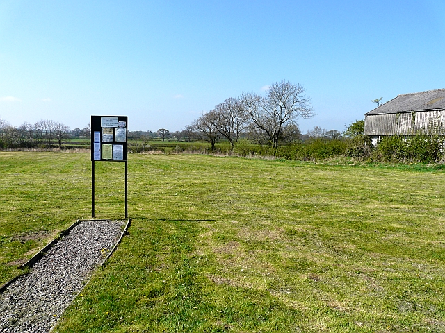
Efforts have been made to preserve and maintain the well, ensuring its longevity for future generations. The site is well-maintained, with informative signage providing details about its history and significance. St Ninian's Well continues to be a cherished heritage site, playing a vital role in preserving the religious and historical heritage of Cumberland.

If you have any feedback on the listing, please let us know in the comments section below.

St Ninian's Well Images

Images are sourced within 2km of 54.855/-2.895 or Grid Reference NY4251. Thanks to Geograph Open Source API. All images are credited.

Road under the M6 near Wreay
M6, South of Junction 42 The M6 motorway runs from junction 19 of the M1 at the Catthorpe Interchange, near Rugby to the Gretna junction (J45). Here it becomes the A74(M) and M74 which continues to Glasgow.

The M6 is the longest motorway in the United Kingdom (232 miles) and one of the busiest. It incorporates the first length of motorway opened in the UK (the Preston bypass in 1958) and forms part of a motorway "Backbone of Britain", running north-south between London and Glasgow via the industrial north of England. It is also part of the east-west route between the Midlands and the east coast ports.
M6, South of Junction 42
The M6 motorway runs from junction 19 of the M1 at the Catthorpe Interchange, near Rugby to the Gretna junction (J45). Here it becomes the A74(M) and M74 which continues to Glasgow. The M6 is the longest motorway in the United Kingdom (232 miles) and one of the busiest. It incorporates the first length of motorway opened in the UK (the Preston bypass in 1958) and forms part of a motorway "Backbone of Britain", running north-south between London and Glasgow via the industrial north of England. It is also part of the east-west route between the Midlands and the east coast ports.
M6 northbound near Ravenside Farm
Grass fields at Woodside Farm
Benchmark on Ravenside Lodge Ordnance Survey cut mark benchmark levelled at 75.660m above Newlyn Datum verified 1970
Benchmark on Ravenside Lodge
Ordnance Survey cut mark benchmark levelled at 75.660m above Newlyn Datum verified 1970
Ravenside Lodge, Kennels and Cattery There is an Ordnance Survey benchmark on the near corner (behind a bush), right hand face of the building's jut.
Ravenside Lodge, Kennels and Cattery
There is an Ordnance Survey benchmark on the near corner (behind a bush), right hand face of the building's jut.
City of Carlisle : The M6 Motorway Heading north through Cumbria on the M6 Motorway.
City of Carlisle : The M6 Motorway
Heading north through Cumbria on the M6 Motorway.
Newbiggin Bridge This bridge, over the River Petteril south of Carlisle, was severely damaged during the floods in January 2005.There are plans to restore it. It can be seen from the M6 which passes about fifty yards behind the point at which this photograph was taken.
Newbiggin Bridge
This bridge, over the River Petteril south of Carlisle, was severely damaged during the floods in January 2005.There are plans to restore it. It can be seen from the M6 which passes about fifty yards behind the point at which this photograph was taken.
Garlands and Cumwhinton Turning On the A6 at Carleton, approaching Carlisle. The side road on the right leads to two smaller villages.
Garlands and Cumwhinton Turning
On the A6 at Carleton, approaching Carlisle. The side road on the right leads to two smaller villages.
Fox Cottage, Brisco, near Carlisle Although thatched roof buildings may be fairly common in other parts of England, they are quite rare in the north.
Fox Cottage, Brisco, near Carlisle
Although thatched roof buildings may be fairly common in other parts of England, they are quite rare in the north.
Thatched cottage at Brisco
Parkland south of Carlisle Seen from the road between Brisco and Wreay
Parkland south of Carlisle
Seen from the road between Brisco and Wreay
Crossroads House, Brisco A bed-and-breakfast establishment conveniently situated near M6 junction 42 on what is effectively the southern Carlisle by-pass. <span class="nowrap"><a title="http://www.crossroadshouse.co.uk" rel="nofollow ugc noopener" href="http://www.crossroadshouse.co.uk">Link</a><img style="margin-left:2px;" alt="External link" title="External link - shift click to open in new window" src="https://s1.geograph.org.uk/img/external.png" width="10" height="10"/></span> An unexpected feature is the Roman well located inside the house (see supplemental image)
Crossroads House, Brisco
A bed-and-breakfast establishment conveniently situated near M6 junction 42 on what is effectively the southern Carlisle by-pass. LinkExternal link An unexpected feature is the Roman well located inside the house (see supplemental image)
Roman well in Crossroads House, Brisco A 100-foot deep Roman well inside Crossroads House
Roman well in Crossroads House, Brisco
A 100-foot deep Roman well inside Crossroads House
Double Gates
Double Gates
The M6 approaching Carlisle A view looking north over the M6 near Carlisle, as a Norbert dentressangle truck sneaks through Eddie Stobart home territory.
The M6 approaching Carlisle
A view looking north over the M6 near Carlisle, as a Norbert dentressangle truck sneaks through Eddie Stobart home territory.
The M6 approaching Junction 42 A view looking to the south from an overbridge, along the M6 towards junction 42, just visible in the distance.
The M6 approaching Junction 42
A view looking to the south from an overbridge, along the M6 towards junction 42, just visible in the distance.
Low Burthwaite A view looking to the north towards Low Burthwaite and the entrance (right) to the track to Burthwaite Hill.
Low Burthwaite
A view looking to the north towards Low Burthwaite and the entrance (right) to the track to Burthwaite Hill.
Show me another place!

St Ninian's Well is located at Grid Ref: NY4251 (Lat: 54.855, Lng: -2.895)

Administrative County: Cumbria

District: Carlisle

Police Authority: Cumbria

What 3 Words

///bike.tiles.marker. Near Scotby, Cumbria

Related Wikis

Brisco railway station

Brisco railway station (NY4313251259) in St Cuthbert Without parish, was situated on the Lancaster and Carlisle Railway (the West Coast Main Line) between...

Brisco, Cumbria

Brisco or Birksceugh is a village in the civil parish of St Cuthbert Without, in the Carlisle district, in the county of Cumbria, England. It is located...

St Cuthbert Without

St Cuthbert Without, or simply St Cuthbert, is a civil parish within the Cumberland unitary authority area in Cumbria, England. The parish lies immediately...

Carleton, St Cuthbert Without

Carleton is a hamlet on the A6 road, in the Carlisle district, in the county of Cumbria, England. In the Imperial Gazetteer of England and Wales of 1870...

Nearby Amenities

Located within 500m of 54.855,-2.895
On Common
Local Ref: ON
Naptan AtcoCode: 090033361829
Naptan Bearing: W
Naptan BusStopType: CUS
Naptan CommonName: On Common
Naptan Indicator: on
Naptan Landmark: Brisco Common
Naptan NaptanCode: cumatdma
Naptan Street: No name
Naptan Verified: no
Source: naptan_import
Lat/Long: 54.8558954/-2.900232
The data included in this document is from www.openstreetmap.org. The data is made available under ODbL.

Have you been to St Ninian's Well?

Leave your review of St Ninian's Well below (or comments, questions and feedback).