South Cadeby Village

Heritage Site in Lincolnshire

England

South Cadeby Village

Gayton le Wold - St Peter's Church
Gayton le Wold - St Peter's Church Credit: Colin Park

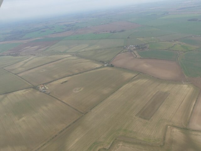
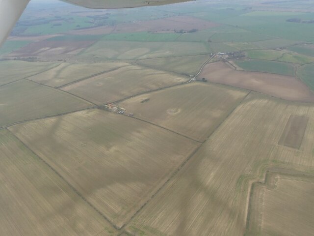
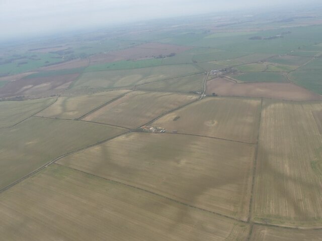
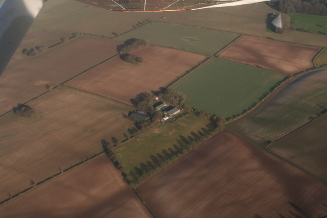
South Cadeby Village is a small hamlet located in the county of Lincolnshire, England. Situated near the town of Market Rasen, this charming village has gained recognition as a designated Heritage Site due to its historical significance and well-preserved architectural features.

The village dates back to the Anglo-Saxon period, with evidence of settlement in the area dating as far back as the 7th century. Its prime location, nestled amidst the picturesque Lincolnshire Wolds, has attracted settlers and visitors throughout the centuries.

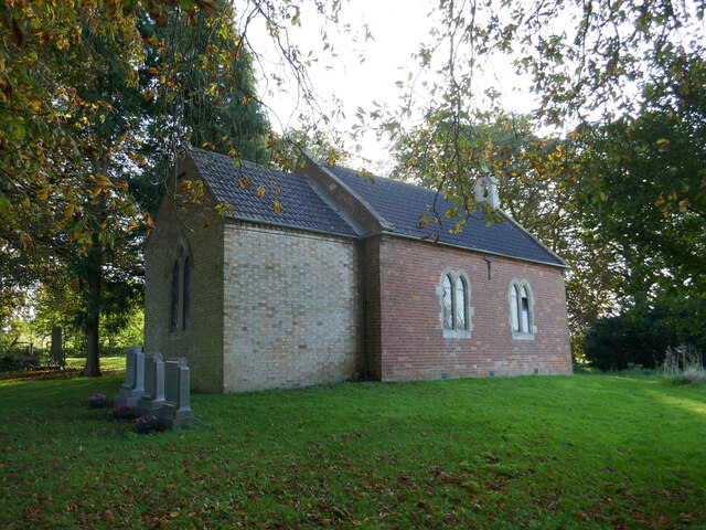
Throughout its history, South Cadeby has undergone various transformations, including the construction of a Norman church in the 12th century, which still stands as a testament to the village's past. The church, dedicated to St. Stephen, showcases stunning Norman architecture, with its distinctive rounded arches and intricate stone carvings.

In addition to the church, South Cadeby Village boasts a collection of well-preserved cottages and farmhouses that showcase the traditional Lincolnshire architectural style. These buildings, constructed using local materials such as limestone and red bricks, provide a glimpse into the village's rural heritage.

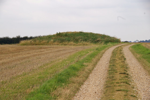
Visitors to South Cadeby Village can explore the scenic surroundings, taking in the rolling hills and meandering streams that epitomize the beauty of the Lincolnshire Wolds. The village's tranquil atmosphere and unspoiled landscapes make it an ideal destination for nature lovers and those seeking a peaceful retreat.

Overall, South Cadeby Village in Lincolnshire is a captivating Heritage Site that offers a glimpse into the region's rich history and showcases the beauty of the surrounding countryside.

If you have any feedback on the listing, please let us know in the comments section below.

South Cadeby Village Images

Images are sourced within 2km of 53.368/-0.128 or Grid Reference TF2487. Thanks to Geograph Open Source API. All images are credited.

Gayton le Wold - St Peter's Church
Grim's Mound, Grimblethorpe, Lincs The monument includes the earthwork remains of a bowl barrow known as Grim's
Mound located 110m above sea level in a commanding position on the summit of a
spur between the River Bain and one of its tributaries. It is a grassy mound
some 19m in diameter and 2.6m high, situated adjacent to a trackway running
between the sites of the medieval villages of Biscathorpe and Calcethorpe.
This trackway, which is today known as the Viking Way, overlies the eastern
perimeter of the monument and it bends slightly at this point.
Chance finds of worked flint have been recovered from the plough soil around
the monument which itself is largely undisturbed. Although the encircling
ditch, from which material for the mound was quarried, is not visible, it is
thought to survive buried beneath the present ground surface. (source ancientmonuments.co.uk)
Grim's Mound, Grimblethorpe, Lincs
The monument includes the earthwork remains of a bowl barrow known as Grim's Mound located 110m above sea level in a commanding position on the summit of a spur between the River Bain and one of its tributaries. It is a grassy mound some 19m in diameter and 2.6m high, situated adjacent to a trackway running between the sites of the medieval villages of Biscathorpe and Calcethorpe. This trackway, which is today known as the Viking Way, overlies the eastern perimeter of the monument and it bends slightly at this point. Chance finds of worked flint have been recovered from the plough soil around the monument which itself is largely undisturbed. Although the encircling ditch, from which material for the mound was quarried, is not visible, it is thought to survive buried beneath the present ground surface. (source ancientmonuments.co.uk)
Calcethorpe: aerial 2022
Calcethorpe DMV: aerial 2023 (1) Calcethorpe was depopulated and the church taken down by about 1450. In 1563 there were 4 or 7 families.

The area of the site was reduced to about 6ha by illegal levelling in 1977 whilst the site was protected by an interim preservation notice. It was mainly strip fields that were lost.

There are indications of house platforms, streets and ridge and furrow round the village. On the east side there is a marked rectangular enclosure. 

The settlement and field system remains extend beyond the scheduled area. 

See: <span class="nowrap"><a title="https://www.heritagegateway.org.uk/Gateway/Results_Single.aspx?uid=MLI43548&resourceID=1006" rel="nofollow ugc noopener" href="https://www.heritagegateway.org.uk/Gateway/Results_Single.aspx?uid=MLI43548&resourceID=1006">Link</a><img style="margin-left:2px;" alt="External link" title="External link - shift click to open in new window" src="https://s1.geograph.org.uk/img/external.png" width="10" height="10"/></span>
Calcethorpe DMV: aerial 2023 (1)
Calcethorpe was depopulated and the church taken down by about 1450. In 1563 there were 4 or 7 families. The area of the site was reduced to about 6ha by illegal levelling in 1977 whilst the site was protected by an interim preservation notice. It was mainly strip fields that were lost. There are indications of house platforms, streets and ridge and furrow round the village. On the east side there is a marked rectangular enclosure. The settlement and field system remains extend beyond the scheduled area. See: LinkExternal link
Calcethorpe DMV: aerial 2023 (2) Calcethorpe was depopulated and the church taken down by about 1450. In 1563 there were 4 or 7 families.

The area of the site was reduced to about 6ha by illegal levelling in 1977 whilst the site was protected by an interim preservation notice. It was mainly strip fields that were lost.

There are indications of house platforms, streets and ridge and furrow round the village. On the east side there is a marked rectangular enclosure. 

The settlement and field system remains extend beyond the scheduled area. 

See: <span class="nowrap"><a title="https://www.heritagegateway.org.uk/Gateway/Results_Single.aspx?uid=MLI43548&resourceID=1006" rel="nofollow ugc noopener" href="https://www.heritagegateway.org.uk/Gateway/Results_Single.aspx?uid=MLI43548&resourceID=1006">Link</a><img style="margin-left:2px;" alt="External link" title="External link - shift click to open in new window" src="https://s1.geograph.org.uk/img/external.png" width="10" height="10"/></span>
Calcethorpe DMV: aerial 2023 (2)
Calcethorpe was depopulated and the church taken down by about 1450. In 1563 there were 4 or 7 families. The area of the site was reduced to about 6ha by illegal levelling in 1977 whilst the site was protected by an interim preservation notice. It was mainly strip fields that were lost. There are indications of house platforms, streets and ridge and furrow round the village. On the east side there is a marked rectangular enclosure. The settlement and field system remains extend beyond the scheduled area. See: LinkExternal link
Soilmarks near Poke Holes: aerial (1)
Soilmarks near Poke Holes: aerial (2)
Soilmarks near Poke Holes: aerial (3)
Soilmarks of old quarries east of Grimblethorpe: aerial 2023
Cattle at Gayton Manor
Gayton le Wold - St Peter's Church
Cracked pane of glass above the altar Gayton le Wold - St Peter's Church
Cracked pane of glass above the altar
Gayton le Wold - St Peter's Church
Approaching the church in Gayton-le-Wold
St Peter's church, Gayton le Wold A tiny church of 1889 <span class="nowrap"><a title="https://historicengland.org.uk/listing/the-list/list-entry/1063138?section=official-list-entry" rel="nofollow ugc noopener" href="https://historicengland.org.uk/listing/the-list/list-entry/1063138?section=official-list-entry">Link</a><img style="margin-left:2px;" alt="External link" title="External link - shift click to open in new window" src="https://s1.geograph.org.uk/img/external.png" width="10" height="10"/></span> paste serving a community of about 20 people.
St Peter's church, Gayton le Wold
A tiny church of 1889 LinkExternal link paste serving a community of about 20 people.
Site of Calcethorpe DMV: aerial 2023 (1)
Site of Calcethorpe DMV: aerial 2023 (2)
Welton le Wold: aerial 2017 Manor Warren Farm.
Welton le Wold: aerial 2017
Manor Warren Farm.
Southorpe, Gayton le Wold: aerial 2017 By Grange Farm.

Possible Medieval or Post Medieval water channels, ponds and quarries seen as earthworks. Possible site of a hamlet or grange, possibly the site of the lost hamlet of Southorpe.

However the description then becomes complex, mentioning quarrying, banks to control water flow, and no signs of habitation. Looks like the jury's out on this on - see <span class="nowrap"><a title="http://www.pastscape.org.uk/hob.aspx?hob_id=353073&sort=2&rational=m&recordsperpage=10&maplat=53.35015336&maplong=-0.13316162&mapisa=100&mapist=os&mapilo=-0.1332&mapila=53.3502&mapiloe=w&mapilan=n&mapios=TF242853&mapigrn=385350&mapigre=524250&mapipc=#aRt" rel="nofollow ugc noopener" href="http://www.pastscape.org.uk/hob.aspx?hob_id=353073&sort=2&rational=m&recordsperpage=10&maplat=53.35015336&maplong=-0.13316162&mapisa=100&mapist=os&mapilo=-0.1332&mapila=53.3502&mapiloe=w&mapilan=n&mapios=TF242853&mapigrn=385350&mapigre=524250&mapipc=#aRt">Link</a><img style="margin-left:2px;" alt="External link" title="External link - shift click to open in new window" src="https://s1.geograph.org.uk/img/external.png" width="10" height="10"/></span>

What an amazing countryside, so many earthworks and so many mysteries remaining.
Southorpe, Gayton le Wold: aerial 2017
By Grange Farm. Possible Medieval or Post Medieval water channels, ponds and quarries seen as earthworks. Possible site of a hamlet or grange, possibly the site of the lost hamlet of Southorpe. However the description then becomes complex, mentioning quarrying, banks to control water flow, and no signs of habitation. Looks like the jury's out on this on - see LinkExternal link What an amazing countryside, so many earthworks and so many mysteries remaining.
Show me another place!

South Cadeby Village is located at Grid Ref: TF2487 (Lat: 53.368, Lng: -0.128)

Division: Parts of Lindsey

What 3 Words

///pile.broth.circular. Near Louth, Lincolnshire

Nearby Locations

South Cadeby Village

Related Wikis

Grimblethorpe

Grimblethorpe is a hamlet in the East Lindsey district of Lincolnshire, England. It is situated 6 miles (10 km) west from Louth and just north of the village...

Calcethorpe

Calcethorpe is a hamlet and deserted medieval village (DMV), in the East Lindsey district of Lincolnshire, England. It is situated approximately 5 miles...

Gayton le Wold

Gayton le Wold is a village and civil parish in the East Lindsey district of Lincolnshire, England. It lies 6 miles (10 km) west from Louth, 3 miles (5...

East Wykeham

East Wykeham is a deserted medieval village or DMV, seen as earthworks, in the East Lindsey district of Lincolnshire, England. The earthworks are situated...

Have you been to South Cadeby Village?

Leave your review of South Cadeby Village below (or comments, questions and feedback).