Skinnard Village
Heritage Site in Lincolnshire
England
Skinnard Village

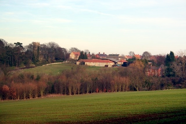
Skinnard Village is a charming and historically significant heritage site located in the county of Lincolnshire, England. Situated amidst the picturesque Lincolnshire Wolds, this village is renowned for its well-preserved medieval architecture and rich heritage.
Dating back to the 12th century, Skinnard Village boasts an array of historic buildings that tell the story of its past. One of the most prominent landmarks is the St. Mary's Church, a magnificent structure that showcases remarkable craftsmanship and intricate stone carvings. Visitors can marvel at its stunning stained glass windows and explore the churchyard, which is home to ancient tombstones and memorials.
The village is also home to several timber-framed houses, which are a testament to its medieval roots. These well-preserved dwellings feature characteristic thatched roofs, exposed beams, and ornate facades, offering a glimpse into the daily lives of the villagers from centuries ago.
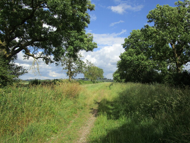
Skinnard Village is not only known for its architectural heritage but also for its natural beauty. Surrounded by rolling hills and lush green landscapes, it provides a serene environment for leisurely walks and outdoor activities. The village is also a popular destination for birdwatching enthusiasts, as it offers a habitat for various species of birds.
Additionally, Skinnard Village hosts an annual heritage festival, attracting both locals and tourists. This event celebrates the village's history and culture through traditional music, dance, and crafts. Visitors can immerse themselves in the vibrant atmosphere, sample local delicacies, and purchase handmade souvenirs.
Overall, Skinnard Village in Lincolnshire is a captivating heritage site that showcases the region's rich history and natural beauty. It is a must-visit destination for history enthusiasts, architecture lovers, and those seeking a tranquil escape in the heart of the English countryside.
If you have any feedback on the listing, please let us know in the comments section below.
Skinnard Village Images
Images are sourced within 2km of 53.105/-0.588 or Grid Reference SK9457. Thanks to Geograph Open Source API. All images are credited.


Skinnard Village is located at Grid Ref: SK9457 (Lat: 53.105, Lng: -0.588)
Division: Parts of Kesteven
What 3 Words
///rather.sometimes.slime. Near Navenby, Lincolnshire
Nearby Locations
Related Wikis

Skinnand
Skinnand is a deserted medieval village in Lincolnshire, England. It was a small farming community situated 9 miles (14 km) south of Lincoln and 11.5 miles...

Somerton Castle
Somerton Castle is located approximately 1 mile (1.6 km) west of the village of Boothby Graffoe in Lincolnshire, England and to the south of the city of...
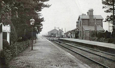
Navenby railway station
Navenby railway station was a railway station in Navenby, Lincolnshire on the Grantham and Lincoln railway line. The station closed for passengers in...

Wellingore
Wellingore is a village and civil parish in the North Kesteven district of Lincolnshire, England. The population of the civil parish at the 2011 census...

Welbourn
Welbourn is a village and civil parish in the North Kesteven district of Lincolnshire, England. The population of the civil parish at the 2011 census was...
Navenby
Navenby is a village and civil parish in the North Kesteven district of Lincolnshire, England. Lying 8 miles (13 km) south from Lincoln and 9 miles (14...

Brant Broughton
Brant Broughton (pronounced Brew-ton) is a small village in the Brant Broughton and Stragglethorpe civil parish (where the population is listed), in the...

Carlton-le-Moorland
Carlton-le-Moorland, is a village and civil parish in the North Kesteven district of Lincolnshire, England, between Newark-on-Trent and Lincoln. The parish...
Nearby Amenities
Located within 500m of 53.105,-0.588Have you been to Skinnard Village?
Leave your review of Skinnard Village below (or comments, questions and feedback).