Salford Hall

Heritage Site in Warwickshire Stratford-on-Avon

England

Salford Hall

Footpath on Cleeve Hill
Footpath on Cleeve Hill Credit: Row17

Salford Hall is a historic Grade I listed building located in the village of Abbots Salford, Warwickshire, England. It is a well-preserved Tudor manor house, dating back to the late 15th century, and is considered a significant heritage site in the region.

The hall is constructed in the traditional half-timbered style, with a striking black and white facade that exemplifies the architectural features of the Tudor period. It consists of two main wings, enclosing a central courtyard, and is surrounded by picturesque gardens and extensive grounds.

Throughout its history, Salford Hall has been associated with various notable figures, including the family of Shakespeare's mother, Mary Arden. The hall was also known to have connections with the Knights Templar, a medieval Christian military order.

Today, the hall operates as a luxury hotel and wedding venue, offering visitors a unique glimpse into the past. The interior has been carefully restored to reflect its original splendor, with oak-panelled walls, ornate fireplaces, and period furnishings. The Great Hall, in particular, showcases a magnificent hammer beam ceiling, adorned with intricate carvings and heraldic symbols.

In addition to its architectural significance, Salford Hall boasts stunning gardens, which feature manicured lawns, flower beds, and a charming orchard. The estate also includes a tranquil lake and offers picturesque views of the surrounding countryside.

The hall and its grounds are open to the public, allowing visitors to experience the rich history and beauty of this exceptional Tudor manor house.

If you have any feedback on the listing, please let us know in the comments section below.

Salford Hall Images

Images are sourced within 2km of 52.143/-1.905 or Grid Reference SP0649. Thanks to Geograph Open Source API. All images are credited.
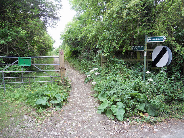
Footpath on Cleeve Hill
Footpath on Cleeve Hill ridge
Track passing Island Barn
Footpath beside the gallops
Layby, A46 A view of the layby shown in <a href="https://www.geograph.org.uk/photo/2054338">SP0548 : A46 near Harvington</a>. This was formerly the A435. It's useful when driving off from this layby to make sure the car boot is properly closed ...
Layby, A46
A view of the layby shown in SP0548 : A46 near Harvington. This was formerly the A435. It's useful when driving off from this layby to make sure the car boot is properly closed ...
Harvington Mill This ruinous watermill building is listed GII but is in poor condition. There are the remains of two water wheels - one on the right hand gable wall and one inside the big arch to the left. Some machinery can be seen through the barred windows but access was neither sensible nor possible, although urban explorers have found a way in.
Harvington Mill
This ruinous watermill building is listed GII but is in poor condition. There are the remains of two water wheels - one on the right hand gable wall and one inside the big arch to the left. Some machinery can be seen through the barred windows but access was neither sensible nor possible, although urban explorers have found a way in.
Passing Harvington Mill In the background and very largely obscured by vegetation is the ruinous and GII listed Harvington Mill. See <span class="nowrap"><a title="http://www.britishlistedbuildings.co.uk/en-354837-harvington-mill-harvington" rel="nofollow ugc noopener" href="http://www.britishlistedbuildings.co.uk/en-354837-harvington-mill-harvington">Link</a><img style="margin-left:2px;" alt="External link" title="External link - shift click to open in new window" src="https://s1.geograph.org.uk/img/external.png" width="10" height="10"/></span>
Passing Harvington Mill
In the background and very largely obscured by vegetation is the ruinous and GII listed Harvington Mill. See LinkExternal link
Harvington Mill, Machinery This is the west end seen through a window. The hurst frame, wallower, great spur wheel and one stone nut with its tentering gear are all seen. The drum of a cement mixer lies loose behind the main door. There was no obvious access to this potential deathtrap.
Harvington Mill, Machinery
This is the west end seen through a window. The hurst frame, wallower, great spur wheel and one stone nut with its tentering gear are all seen. The drum of a cement mixer lies loose behind the main door. There was no obvious access to this potential deathtrap.
Harvington Mill - waterwheel This is the internal wheel at the east end of this ruinous listed watermill. I presume it was breastshot. The external wheel at the west end is even more ruinous and overgrown.
Harvington Mill - waterwheel
This is the internal wheel at the east end of this ruinous listed watermill. I presume it was breastshot. The external wheel at the west end is even more ruinous and overgrown.
Harvington Watermill - waterwheel This ruinous and very overgrown wheel is at the west end of the mill. This site is listed but clearly unloved.
Harvington Watermill - waterwheel
This ruinous and very overgrown wheel is at the west end of the mill. This site is listed but clearly unloved.
Harvington Watermill - the interior Looking in to the east end of the mill with the camera held through the bars of the window. A ruined cement mixer is prominent in the foreground and some gearing is seen in the gloom at the back. The mill had two wheels with associated gearing and stones.
Harvington Watermill - the interior
Looking in to the east end of the mill with the camera held through the bars of the window. A ruined cement mixer is prominent in the foreground and some gearing is seen in the gloom at the back. The mill had two wheels with associated gearing and stones.
Field Barn Field Barn is a farm sitting on top of the Cleeve Hill scarp slope above the river Avon. It is halfway between Cleeve Prior and the Littletons.
Field Barn
Field Barn is a farm sitting on top of the Cleeve Hill scarp slope above the river Avon. It is halfway between Cleeve Prior and the Littletons.
Along the track towards Harvington Lodge Track NW/SE between Harvington and Atch Lench.
Along the track towards Harvington Lodge
Track NW/SE between Harvington and Atch Lench.
Anchor Lane Bridge crossing the A46 The A46 is an important cross-country route which runs from the West Country to the North Sea.  It starts to the east of Bath in Somerset and ends in Cleethorpes in North East Lincolnshire.  It is no longer a continuous route as large portions of the old (1923) road have been lost, bypassed, or replaced by motorway development. For more detail, see <span class="nowrap"><a title="http://en.wikipedia.org/wiki/A46_road" rel="nofollow ugc noopener" href="http://en.wikipedia.org/wiki/A46_road">Link</a><img style="margin-left:2px;" alt="External link" title="External link - shift click to open in new window" src="https://s1.geograph.org.uk/img/external.png" width="10" height="10"/></span> (Wikipedia Article).
Anchor Lane Bridge crossing the A46
The A46 is an important cross-country route which runs from the West Country to the North Sea. It starts to the east of Bath in Somerset and ends in Cleethorpes in North East Lincolnshire. It is no longer a continuous route as large portions of the old (1923) road have been lost, bypassed, or replaced by motorway development. For more detail, see LinkExternal link (Wikipedia Article).
Entrance to Castle Fields Farm The entrance off the Evesham Road.
Entrance to Castle Fields Farm
The entrance off the Evesham Road.
Rainbow on a summer's day, New Inn Lane Nurseries Fuchsias and tomatoes are grown here.
Rainbow on a summer's day, New Inn Lane Nurseries
Fuchsias and tomatoes are grown here.
Glasshouse full of tomatoes, New Inn Lane Nurseries Fuchsias are also grown here, at Pitchill.
Glasshouse full of tomatoes, New Inn Lane Nurseries
Fuchsias are also grown here, at Pitchill.
New Inn Lane [1] Between Abbot's Salford and Pitchill. Looking north-west.
New Inn Lane [1]
Between Abbot's Salford and Pitchill. Looking north-west.
Show me another place!

Salford Hall is located at Grid Ref: SP0649 (Lat: 52.143, Lng: -1.905)

Administrative County: Warwickshire

District: Stratford-on-Avon

Police Authority: Warwickshire

What 3 Words

///contained.flukes.political. Near Harvington, Worcestershire

Related Wikis

Harvington railway station

Harvington railway station was a station in Harvington, Worcestershire, England. The station was opened on 17 September 1866, train services were withdrawn...

Abbot's Salford

Abbot's Salford is the name of a village in the English county of Warwickshire. It is found six miles south of Alcester, about the same distance from Evesham...

Harvington

Harvington is a village near Evesham in Worcestershire, England. Bounded by the River Avon to the south and the Lench Hills to the north, three miles northeast...

Salford Priors

Salford Priors is a rural, agricultural village and civil parish about four miles south-west of Alcester, Warwickshire, England. The population of the...

Nearby Amenities

Located within 500m of 52.143,-1.905
The data included in this document is from www.openstreetmap.org. The data is made available under ODbL.

Have you been to Salford Hall?

Leave your review of Salford Hall below (or comments, questions and feedback).