Rey Cross

Heritage Site in Yorkshire

England

Rey Cross

Beldoo Hill
Beldoo Hill Credit: David Brown

The requested URL returned error: 429 Too Many Requests

If you have any feedback on the listing, please let us know in the comments section below.

Rey Cross Images

Images are sourced within 2km of 54.508/-2.147 or Grid Reference NY9012. Thanks to Geograph Open Source API. All images are credited.
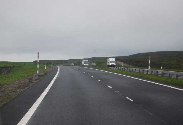
Beldoo Hill
Beldoo Hill
A66 near Rowtonbridge Sike This area of North Stainmore is featureless and treacherous with deep ditches and soft bog. I passed an area of bog no larger than a bathtub with at least four dead sheep in it.
A66 near Rowtonbridge Sike
This area of North Stainmore is featureless and treacherous with deep ditches and soft bog. I passed an area of bog no larger than a bathtub with at least four dead sheep in it.
View south from the A66
The county border on the A66 at Stainmore
The A66 at Stainmore
Running into County Durham on A66 Large lay by on opposite carriageway straddles the boundary
Running into County Durham on A66
Large lay by on opposite carriageway straddles the boundary
Crossing the border County Durham signs on left
Crossing the border
County Durham signs on left
Yardstone Beck Valley
Layby on the border A layby by the A66 by the Durham, Cumbria border.
Layby on the border
A layby by the A66 by the Durham, Cumbria border.
White Brow Moorland
White Brow Moorland
Approaching the summit, A66 The A66 is a major road in northern England running from near Middlesbrough to Workington. The section between Scotch Corner and Penrith is a Trans-Pennine route between the A1 and M6, following an old Roman Road.
Wikipedia: <span class="nowrap"><a title="http://en.wikipedia.org/wiki/A66_road" rel="nofollow ugc noopener" href="http://en.wikipedia.org/wiki/A66_road">Link</a><img style="margin-left:2px;" alt="External link" title="External link - shift click to open in new window" src="https://s1.geograph.org.uk/img/external.png" width="10" height="10"/></span>
Approaching the summit, A66
The A66 is a major road in northern England running from near Middlesbrough to Workington. The section between Scotch Corner and Penrith is a Trans-Pennine route between the A1 and M6, following an old Roman Road. Wikipedia: LinkExternal link
A66 from Brough
A66 from Brough
Fence line crossing Beldoo Hill Beldoo Hill is a minor feature along the County Durham / Cumbria boundary north of the A66. The rock marks the high point and presumably also acts as a boundary stone. According to OS mapping at 1:25 000, the fence line and the boundary don't quite coincide, here and for a distance both north and south. The territorial advantage (if there is one), goes to Cumbria!
Little Fell, Mickle Fell and Bink Moss are the hills along the horizon.
Fence line crossing Beldoo Hill
Beldoo Hill is a minor feature along the County Durham / Cumbria boundary north of the A66. The rock marks the high point and presumably also acts as a boundary stone. According to OS mapping at 1:25 000, the fence line and the boundary don't quite coincide, here and for a distance both north and south. The territorial advantage (if there is one), goes to Cumbria! Little Fell, Mickle Fell and Bink Moss are the hills along the horizon.
Rush-filled stream groove The stream lies to the west of Flat Moss; its water will feed into Deepdale Beck.
Bink Moss is on the skyline at the centre of the image.
Rush-filled stream groove
The stream lies to the west of Flat Moss; its water will feed into Deepdale Beck. Bink Moss is on the skyline at the centre of the image.
Old Boundary Marker on Beldoo Hill Estate Boundary Marker on Beldoo Hill. On the boundary of Stainmore parish, Westmorland, now Cumbria, and Bowes parish, North Riding, now County Durham. Inscribed B and 1 on opposite faces.

Milestone Society National ID: WE_CBDM113em
Old Boundary Marker on Beldoo Hill
Estate Boundary Marker on Beldoo Hill. On the boundary of Stainmore parish, Westmorland, now Cumbria, and Bowes parish, North Riding, now County Durham. Inscribed B and 1 on opposite faces. Milestone Society National ID: WE_CBDM113em
Old Boundary Marker south of Beldoo Hill Estate Boundary Marker 250 metres south of Beldoo Hill. On the boundary of Stainmore parish, Westmorland, now Cumbria, and Bowes parish, North Riding, now County Durham. Inscribed B.

Milestone Society National ID: WE_CBDM114em
Old Boundary Marker south of Beldoo Hill
Estate Boundary Marker 250 metres south of Beldoo Hill. On the boundary of Stainmore parish, Westmorland, now Cumbria, and Bowes parish, North Riding, now County Durham. Inscribed B. Milestone Society National ID: WE_CBDM114em
Old Boundary Marker south of Beldoo Hill Estate Boundary Marker 440 metres south of Beldoo Hill. Inscribed B. On the boundary of Stainmore parish, Westmorland, now Cumbria, and Bowes parish, North Riding, now County Durham.

Milestone Society National ID: WE_CBDM115em
Old Boundary Marker south of Beldoo Hill
Estate Boundary Marker 440 metres south of Beldoo Hill. Inscribed B. On the boundary of Stainmore parish, Westmorland, now Cumbria, and Bowes parish, North Riding, now County Durham. Milestone Society National ID: WE_CBDM115em
Old Boundary Marker south of Beldoo Hill Estate Boundary Marker 900 metres south of Beldoo Hill. On the boundary of Stainmore parish, Westmorland, now Cumbria, and Bowes parish, North Riding, now County Durham.

Milestone Society National ID: WE_CBDM116em
Old Boundary Marker south of Beldoo Hill
Estate Boundary Marker 900 metres south of Beldoo Hill. On the boundary of Stainmore parish, Westmorland, now Cumbria, and Bowes parish, North Riding, now County Durham. Milestone Society National ID: WE_CBDM116em
Show me another place!

Rey Cross is located at Grid Ref: NY9012 (Lat: 54.508, Lng: -2.147)

Division: North Riding

What 3 Words

///pity.objecting.outhouse. Near Bowes, Co. Durham

Nearby Locations

Rey Cross

Related Wikis

Rey Cross

Rey Cross is the remains of a stone cross at Stainmore. It is also known as Rere Cross and is a Grade II* listed structure and a scheduled monument. It...

Bowes Moor

Bowes Moor is a Site of Special Scientific Interest in the County Durham district in south-west County Durham, England. It is an extensive area of moorland...

Stainmore Summit

Stainmore Summit is the highest point on the trans-Pennine South Durham & Lancashire Union Railway, also known as the Stainmore Railway in Northern England...

Snowdrift at Bleath Gill

Snowdrift at Bleath Gill is a 1955 British Transport Film documentary directed by Kenneth Fairbairn. The 10-minute-long film presents a first-hand account...

Nearby Amenities

Located within 500m of 54.508,-2.147
Information: board
Tourism: information
Lat/Long: 54.5057865/-2.1486385
Rey Cross
HE Ref: 1016467
Designation: scheduled_monument
Historic: wayside_cross
Image: https://www.geograph.org.uk/photo/846388
Wikidata: Q7319402
Wikipedia: en:Rey Cross
Lat/Long: 54.5057897/-2.1486828
The data included in this document is from www.openstreetmap.org. The data is made available under ODbL.

Have you been to Rey Cross?

Leave your review of Rey Cross below (or comments, questions and feedback).