Middleton

Settlement in Hampshire

England

Middleton

Fields near Warren Farm The most westerly farm on the island, with fields in the valley between Headon Hill and West High Down.
Fields near Warren Farm Credit: Des Blenkinsopp

Middleton is a picturesque village located in the county of Hampshire, England. Situated on the edge of the South Downs National Park, it enjoys a tranquil setting amidst rolling hills and lush greenery. With a population of around 1,500 residents, Middleton exudes a strong sense of community and offers a peaceful retreat from the hustle and bustle of city life.

One of the defining features of Middleton is its charming architecture. The village boasts a mix of historic thatched cottages, Georgian houses, and modern homes, creating a unique blend of old and new. The local church, St. Mary's, is a notable landmark, dating back to the 12th century and showcasing beautiful stained glass windows.

Nature enthusiasts will be delighted by Middleton's natural surroundings. The village is surrounded by stunning countryside, offering ample opportunities for outdoor activities such as hiking, cycling, and horse riding. The nearby South Downs Way, a long-distance footpath, provides breathtaking views of the Hampshire countryside.

Despite its rural setting, Middleton is well-connected to neighboring towns and cities. The market town of Petersfield is just a short drive away, offering a range of amenities including shops, restaurants, and leisure facilities. Additionally, the city of Portsmouth, with its historic dockyard and vibrant waterfront, is within easy reach.

Middleton also benefits from a strong community spirit, with various local events and activities taking place throughout the year. These include summer fairs, village fetes, and sports tournaments, providing opportunities for residents to come together and socialize.

Overall, Middleton is a charming village that offers a peaceful and idyllic lifestyle, surrounded by natural beauty and a strong sense of community.

If you have any feedback on the listing, please let us know in the comments section below.
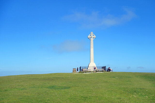
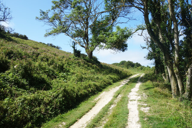
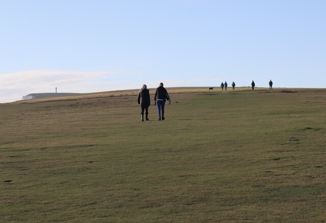
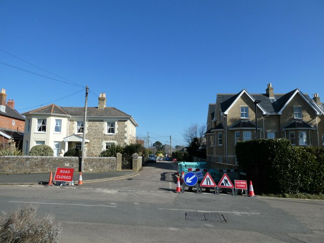
Middleton Images

Images are sourced within 2km of 50.676608/-1.530374 or Grid Reference SZ3386. Thanks to Geograph Open Source API. All images are credited.

Fields near Warren Farm The most westerly farm on the island, with fields in the valley between Headon Hill and West High Down.
Fields near Warren Farm
The most westerly farm on the island, with fields in the valley between Headon Hill and West High Down.
Windswept Tree, West High Down Probably the last tree along the path to The Needles. Open grassland from now on, and it can get a bit breezy.
Windswept Tree, West High Down
Probably the last tree along the path to The Needles. Open grassland from now on, and it can get a bit breezy.
Gate on the Downs A fenceline separates West High Down and Tennyson Down. There's not a lot of difference between them apart from Tennyson Down having more trees along the north slope and a big monument on top.
Gate on the Downs
A fenceline separates West High Down and Tennyson Down. There's not a lot of difference between them apart from Tennyson Down having more trees along the north slope and a big monument on top.
Grass & Heather, Tennyson Down Does someone really come up here and mow this great wide footpath? It seems a lot of work, but why else would the heather stop growing in such a neat line.
Grass & Heather, Tennyson Down
Does someone really come up here and mow this great wide footpath? It seems a lot of work, but why else would the heather stop growing in such a neat line.
Monument to a Poet The impressive monument to Alfred Tennyson, 1st Baron Tennyson, who was Poet Laureate for much of the Victorian era.
He lived at nearby Farringford House for nearly 40 years and used to walk on the down almost every day, saying that the air was worth 'sixpence a pint'.
I looked up about why he was Alfred Lord Tennyson and not Lord Alfred Tennyson. The following link gives an answer, but what a rigmarole.  
<span class="nowrap"><a title="https://english.stackexchange.com/questions/240339/why-is-lord-alfred-tennyson-often-written-as-alfred-lord-tennyson" rel="nofollow ugc noopener" href="https://english.stackexchange.com/questions/240339/why-is-lord-alfred-tennyson-often-written-as-alfred-lord-tennyson">Link</a><img style="margin-left:2px;" alt="External link" title="External link - shift click to open in new window" src="https://s1.geograph.org.uk/img/external.png" width="10" height="10"/></span>
Monument to a Poet
The impressive monument to Alfred Tennyson, 1st Baron Tennyson, who was Poet Laureate for much of the Victorian era. He lived at nearby Farringford House for nearly 40 years and used to walk on the down almost every day, saying that the air was worth 'sixpence a pint'. I looked up about why he was Alfred Lord Tennyson and not Lord Alfred Tennyson. The following link gives an answer, but what a rigmarole. LinkExternal link
Track up Tennyson Down The north side of Tennyson Down faces away from the sea and is much more sheltered. It is quite thickly wooded in places.
Track up Tennyson Down
The north side of Tennyson Down faces away from the sea and is much more sheltered. It is quite thickly wooded in places.
Freshwater Bay Freshwater Bay has formed in a break in the chalk cliffs. The rocks shown here are at the SE corner of the bay, viewed from the promenade - Stag Rock, Arched Rock & Mermaid Rock (right to left). A cave is also visible. A fishing boat is moored. Photo taken in June or July 1973.  Arched Rock subsequently collapsed in 1992.
Freshwater Bay
Freshwater Bay has formed in a break in the chalk cliffs. The rocks shown here are at the SE corner of the bay, viewed from the promenade - Stag Rock, Arched Rock & Mermaid Rock (right to left). A cave is also visible. A fishing boat is moored. Photo taken in June or July 1973. Arched Rock subsequently collapsed in 1992.
Walkers on Tennyson Down
Grazing above Freshwater Bay
Bus terminus, Freshwater Bay – 1978 Southern Vectis was the principal operator on the island from the 1930s having come under control of the Southern Railway in 1929. By 1978 it was part of the National Bus Company. Bus 673, a Bristol VR with ECW bodywork, is seen in the standard NBC livery of leaf green, and is representative of what was effectively the standard NBC double deck bus of the period. It is parked at the entrance to the Freshwater Bay Golf Club on Southdown Road waiting for its return to Sandown.

This is one of a series of views featuring buses in the 60s, 70s, and 80s. <a title="https://www.geograph.org.uk/search.php?i=137652761" href="https://www.geograph.org.uk/search.php?i=137652761">Link</a>
Bus terminus, Freshwater Bay – 1978
Southern Vectis was the principal operator on the island from the 1930s having come under control of the Southern Railway in 1929. By 1978 it was part of the National Bus Company. Bus 673, a Bristol VR with ECW bodywork, is seen in the standard NBC livery of leaf green, and is representative of what was effectively the standard NBC double deck bus of the period. It is parked at the entrance to the Freshwater Bay Golf Club on Southdown Road waiting for its return to Sandown. This is one of a series of views featuring buses in the 60s, 70s, and 80s. Link
Road works at the junction of Gate Lane and The Square
Dimbola: late February 2022 The home of photographic pioneer Julia Margaret Cameron <span class="nowrap"><a title="https://www.dimbola.co.uk/" rel="nofollow ugc noopener" href="https://www.dimbola.co.uk/">Link</a><img style="margin-left:2px;" alt="External link" title="External link - shift click to open in new window" src="https://s1.geograph.org.uk/img/external.png" width="10" height="10"/></span> On the day of my visit there was an excellent exhibition about Jimi Hendrix <span class="nowrap"><a title="https://en.wikipedia.org/wiki/Jimi_Hendrix" rel="nofollow ugc noopener" href="https://en.wikipedia.org/wiki/Jimi_Hendrix">Link</a><img style="margin-left:2px;" alt="External link" title="External link - shift click to open in new window" src="https://s1.geograph.org.uk/img/external.png" width="10" height="10"/></span>
Dimbola: late February 2022
The home of photographic pioneer Julia Margaret Cameron LinkExternal link On the day of my visit there was an excellent exhibition about Jimi Hendrix LinkExternal link
Dimbola: blue plaque The home of photographic pioneer Julia Margaret Cameron <span class="nowrap"><a title="https://www.dimbola.co.uk/" rel="nofollow ugc noopener" href="https://www.dimbola.co.uk/">Link</a><img style="margin-left:2px;" alt="External link" title="External link - shift click to open in new window" src="https://s1.geograph.org.uk/img/external.png" width="10" height="10"/></span> On the day of my visit there was an excellent exhibition about Jimi Hendrix <span class="nowrap"><a title="https://en.wikipedia.org/wiki/Jimi_Hendrix" rel="nofollow ugc noopener" href="https://en.wikipedia.org/wiki/Jimi_Hendrix">Link</a><img style="margin-left:2px;" alt="External link" title="External link - shift click to open in new window" src="https://s1.geograph.org.uk/img/external.png" width="10" height="10"/></span>
Dimbola: blue plaque
The home of photographic pioneer Julia Margaret Cameron LinkExternal link On the day of my visit there was an excellent exhibition about Jimi Hendrix LinkExternal link
Dimbola: a snapshot in time (a) The home of photographic pioneer Julia Margaret Cameron <span class="nowrap"><a title="https://www.dimbola.co.uk/" rel="nofollow ugc noopener" href="https://www.dimbola.co.uk/">Link</a><img style="margin-left:2px;" alt="External link" title="External link - shift click to open in new window" src="https://s1.geograph.org.uk/img/external.png" width="10" height="10"/></span> On the day of my visit there was an excellent exhibition about Jimi Hendrix <span class="nowrap"><a title="https://en.wikipedia.org/wiki/Jimi_Hendrix" rel="nofollow ugc noopener" href="https://en.wikipedia.org/wiki/Jimi_Hendrix">Link</a><img style="margin-left:2px;" alt="External link" title="External link - shift click to open in new window" src="https://s1.geograph.org.uk/img/external.png" width="10" height="10"/></span>
Dimbola: a snapshot in time (a)
The home of photographic pioneer Julia Margaret Cameron LinkExternal link On the day of my visit there was an excellent exhibition about Jimi Hendrix LinkExternal link
Dimbola: a snapshot in time (b) The home of photographic pioneer Julia Margaret Cameron <span class="nowrap"><a title="https://www.dimbola.co.uk/" rel="nofollow ugc noopener" href="https://www.dimbola.co.uk/">Link</a><img style="margin-left:2px;" alt="External link" title="External link - shift click to open in new window" src="https://s1.geograph.org.uk/img/external.png" width="10" height="10"/></span> On the day of my visit there was an excellent exhibition about Jimi Hendrix <span class="nowrap"><a title="https://en.wikipedia.org/wiki/Jimi_Hendrix" rel="nofollow ugc noopener" href="https://en.wikipedia.org/wiki/Jimi_Hendrix">Link</a><img style="margin-left:2px;" alt="External link" title="External link - shift click to open in new window" src="https://s1.geograph.org.uk/img/external.png" width="10" height="10"/></span>
Dimbola: a snapshot in time (b)
The home of photographic pioneer Julia Margaret Cameron LinkExternal link On the day of my visit there was an excellent exhibition about Jimi Hendrix LinkExternal link
Dimbola: a snapshot in time (c) The home of photographic pioneer Julia Margaret Cameron <span class="nowrap"><a title="https://www.dimbola.co.uk/" rel="nofollow ugc noopener" href="https://www.dimbola.co.uk/">Link</a><img style="margin-left:2px;" alt="External link" title="External link - shift click to open in new window" src="https://s1.geograph.org.uk/img/external.png" width="10" height="10"/></span> On the day of my visit there was an excellent exhibition about Jimi Hendrix <span class="nowrap"><a title="https://en.wikipedia.org/wiki/Jimi_Hendrix" rel="nofollow ugc noopener" href="https://en.wikipedia.org/wiki/Jimi_Hendrix">Link</a><img style="margin-left:2px;" alt="External link" title="External link - shift click to open in new window" src="https://s1.geograph.org.uk/img/external.png" width="10" height="10"/></span>
Dimbola: a snapshot in time (c)
The home of photographic pioneer Julia Margaret Cameron LinkExternal link On the day of my visit there was an excellent exhibition about Jimi Hendrix LinkExternal link
Dimbola: a snapshot in time (d) The home of photographic pioneer Julia Margaret Cameron <span class="nowrap"><a title="https://www.dimbola.co.uk/" rel="nofollow ugc noopener" href="https://www.dimbola.co.uk/">Link</a><img style="margin-left:2px;" alt="External link" title="External link - shift click to open in new window" src="https://s1.geograph.org.uk/img/external.png" width="10" height="10"/></span> On the day of my visit there was an excellent exhibition about Jimi Hendrix <span class="nowrap"><a title="https://en.wikipedia.org/wiki/Jimi_Hendrix" rel="nofollow ugc noopener" href="https://en.wikipedia.org/wiki/Jimi_Hendrix">Link</a><img style="margin-left:2px;" alt="External link" title="External link - shift click to open in new window" src="https://s1.geograph.org.uk/img/external.png" width="10" height="10"/></span>
Dimbola: a snapshot in time (d)
The home of photographic pioneer Julia Margaret Cameron LinkExternal link On the day of my visit there was an excellent exhibition about Jimi Hendrix LinkExternal link
Dimbola: a snapshot in time (e) The home of photographic pioneer Julia Margaret Cameron <span class="nowrap"><a title="https://www.dimbola.co.uk/" rel="nofollow ugc noopener" href="https://www.dimbola.co.uk/">Link</a><img style="margin-left:2px;" alt="External link" title="External link - shift click to open in new window" src="https://s1.geograph.org.uk/img/external.png" width="10" height="10"/></span> On the day of my visit there was an excellent exhibition about Jimi Hendrix <span class="nowrap"><a title="https://en.wikipedia.org/wiki/Jimi_Hendrix" rel="nofollow ugc noopener" href="https://en.wikipedia.org/wiki/Jimi_Hendrix">Link</a><img style="margin-left:2px;" alt="External link" title="External link - shift click to open in new window" src="https://s1.geograph.org.uk/img/external.png" width="10" height="10"/></span>
Dimbola: a snapshot in time (e)
The home of photographic pioneer Julia Margaret Cameron LinkExternal link On the day of my visit there was an excellent exhibition about Jimi Hendrix LinkExternal link
Show me another place!

Middleton is located at Grid Ref: SZ3386 (Lat: 50.676608, Lng: -1.530374)

Unitary Authority: Isle of Wight

Police Authority: Hampshire

What 3 Words

///singled.recitals.clogging. Near Totland, Isle of Wight

Related Wikis

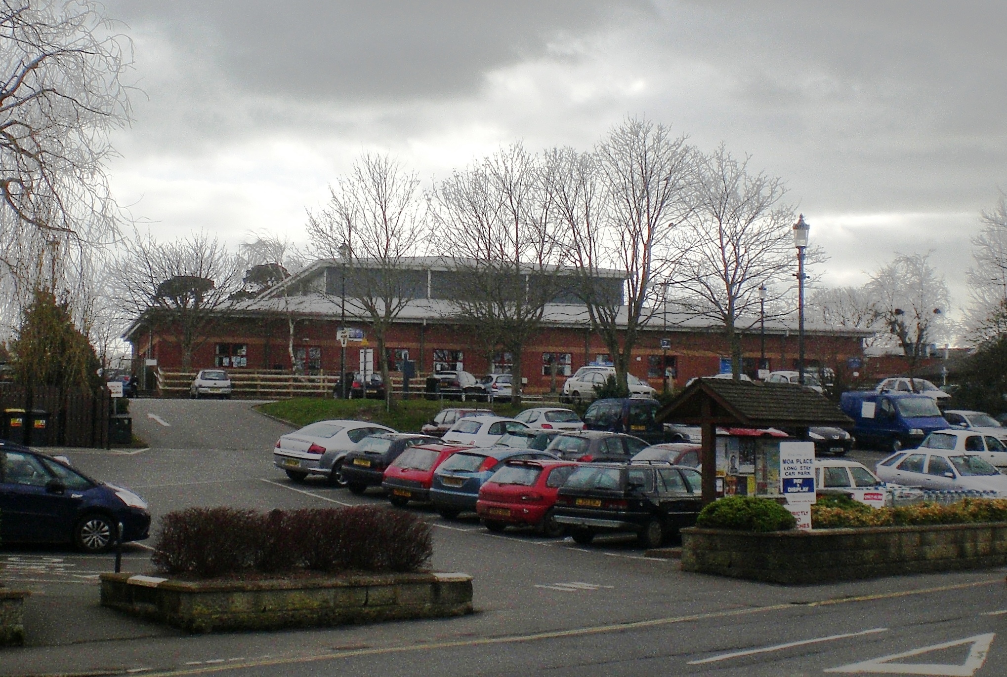
West Wight Sports Centre

West Wight Sports and Community Centre is a registered charity (reg number 273334) providing sports, health and fitness to the West Wight. Based in Moa...

Freshwater, Isle of Wight

Freshwater is a large village and civil parish at the western end of the Isle of Wight, England. The southern, coastal part of the village is Freshwater...

St Agnes' Church, Freshwater

St Agnes' Church, Freshwater is a parish church in the Church of England located in Freshwater, Isle of Wight. == History == The church dates from 1908...

Medina, Isle of Wight

Medina was a non-metropolitan district with the status of a borough on the Isle of Wight in England from 1974 to 1995. The district was formed by the Local...

Nearby Amenities

Located within 500m of 50.676608,-1.530374
Noexit: yes
Lat/Long: 50.6796465/-1.5347555
Turning Circle
Lat/Long: 50.6790206/-1.534405
Source: Bing
Lat/Long: 50.6725439/-1.5286391
Source: Bing
Lat/Long: 50.6728208/-1.528532
Source: Bing
Lat/Long: 50.6730687/-1.5283194
Source: Bing
Lat/Long: 50.6735215/-1.5281866
Source: Bing
Lat/Long: 50.6738389/-1.5282015
Source: Bing
Lat/Long: 50.6739226/-1.5282454
Source: Bing
Lat/Long: 50.6739734/-1.5280606
Source: Bing
Lat/Long: 50.6740507/-1.5272541
Source: Bing
Lat/Long: 50.6740503/-1.5264417
Source: Bing
Lat/Long: 50.6740285/-1.525748
Source: Locally rectified NPE map
Lat/Long: 50.6763459/-1.5366942
Source: Locally rectified NPE map
Lat/Long: 50.6758191/-1.5336009
Source: Locally rectified NPE map
Lat/Long: 50.6755797/-1.5322842
Source: Locally rectified NPE map
Lat/Long: 50.6771494/-1.5284517
Source: Locally rectified NPE map
Lat/Long: 50.677298/-1.5279418
Source: Locally rectified NPE map
Lat/Long: 50.6778857/-1.5265615
Source: Locally rectified NPE map
Lat/Long: 50.6780444/-1.5260886
Source: Locally rectified NPE map
Lat/Long: 50.6795944/-1.5353861
Source: Bing
Lat/Long: 50.6798069/-1.5283119
Bus Stop
West Wight Middle
Bus: yes
Naptan AtcoCode: 230000012870
Naptan Bearing: S
Naptan CommonName: West Wight Middle
Naptan Indicator: Adj
Naptan Landmark: Outside school gate
Naptan NaptanCode: iowjtmw
Naptan Street: Queens Road
Naptan Verified: no
Public Transport: platform
Shelter: no
Lat/Long: 50.6793911/-1.5249958
Pound Green Corner
Naptan AtcoCode: 230000012890
Naptan Bearing: SW
Naptan CommonName: Pound Green Corner
Naptan Indicator: Adj
Naptan NaptanCode: iowjtpd
Naptan Street: Camp Road
Shelter: no
Was Highway: bus_stop
Lat/Long: 50.6776182/-1.5251392
Pound Green Corner
Naptan AtcoCode: 230000012900
Naptan Bearing: N
Naptan CommonName: Pound Green Corner
Naptan Indicator: opp
Naptan NaptanCode: iowjtpg
Naptan Street: Camp Road
Shelter: no
Was Highway: bus_stop
Lat/Long: 50.6778386/-1.5253536
Post Box
Check Date Collection Times: 2018-06-03
Collection Plate: CP7D
Collection Times: Mo-Fr 09:00; Sa 07:00; Su off
Operator: Royal Mail
Operator Wikidata: Q638098
Post Box Type: lamp
Ref: PO40 33D
Ref GB Uprn: 10015280247
Royal Cypher: EIIR
Royal Cypher Wikidata: Q33102113
Website: https://www.royalmail.com/services-near-you/postbox/locksley-po39-0aa/0000PO4033
Lat/Long: 50.6770738/-1.5264447
Post Box
Check Date Collection Times: 2017-10-02
Collection Plate: CP7D
Collection Times: Mo-Fr 09:00; Sa 07:00; Su off
Operator: Royal Mail
Operator Wikidata: Q638098
Post Box Type: lamp
Ref: PO39 20D
Ref GB Uprn: 10015409412
Royal Cypher: EIIR
Royal Cypher Wikidata: Q33102113
Website: https://www.royalmail.com/services-near-you/postbox/summers-lane-po39-0aa/0000PO3920
Lat/Long: 50.6782003/-1.5335963
Source: Bing
Lat/Long: 50.6781977/-1.5296267
Source: Bing
Lat/Long: 50.6787109/-1.5293229
Source: Bing
Lat/Long: 50.67962/-1.5286109
Source: Bing
Lat/Long: 50.6741074/-1.5263403
Give Way
Source: Bing
Lat/Long: 50.6760389/-1.5269254
Addr City: Freshwater
Addr Country: GB
Addr County: Isle of Wight
Addr Housename: Whitegates
Addr Street: Moons Hill
Lat/Long: 50.6737206/-1.5304763
Addr City: Freshwater
Addr Country: GB
Addr County: Isle of Wight
Addr Housename: Pinhays
Addr Street: Moons Hill
Lat/Long: 50.6737398/-1.5303552
Bench
Lat/Long: 50.6769857/-1.5243208
Information: board
Tourism: information
Lat/Long: 50.6766232/-1.5238491
Bench
Lat/Long: 50.6765978/-1.523829
Bench
Lat/Long: 50.6761567/-1.5234009
Source: Locally rectified NPE map
Lat/Long: 50.6771459/-1.5284624
Source: Bing
Lat/Long: 50.6781921/-1.529641
Addr City: Freshwater
Addr Country: GB
Addr County: Isle of Wight
Addr Housename: Woodlands
Addr Street: Camp Road
Lat/Long: 50.6781961/-1.523832
Addr City: Freshwater
Addr Housename: Groves Cottage
Addr Street: Summers Lane
Lat/Long: 50.6779698/-1.535176
Middleton
Is In: Freshwater, Isle of Wight, UK
Place: suburb
Lat/Long: 50.6767928/-1.5308118
Hiking: yes
Information: guidepost
Tourism: information
Lat/Long: 50.6783803/-1.5298972
Addr City: Freshwater
Addr Housename: 1 Jessamine Cottages
Addr Street: Queens Road
Lat/Long: 50.678409/-1.5251255
Addr City: Freshwater
Addr Housename: 1 Clarence Cottages
Addr Street: Queens Road
Lat/Long: 50.678579/-1.5251067
Addr City: Freshwater
Addr Housename: 2 Clarence Cottages
Addr Street: Queens Road
Lat/Long: 50.6785535/-1.5251094
Addr City: Freshwater
Addr Housename: 1 Bradfield Cottages
Addr Street: Queens Road
Lat/Long: 50.6786742/-1.5251148
Addr City: Freshwater
Addr Housename: 2 Bradfield Cottages
Addr Street: Queens Road
Lat/Long: 50.6786436/-1.5251094
Addr City: Freshwater
Addr Housename: 2 Jessamine Cottages
Addr Street: Queens Road
Lat/Long: 50.6783853/-1.5251174
Addr City: Freshwater
Addr Housename: 3 Jessamine Cottages
Addr Street: Queens Road
Lat/Long: 50.678353/-1.5251148
Addr City: Freshwater
Addr Housename: The Studio
Addr Street: Moons Hill
Lat/Long: 50.6731099/-1.5337811
Addr City: Freshwater
Addr Country: GB
Addr Flats: 1
Addr Housename: Rose Cottage
Addr Street: Middleton
Lat/Long: 50.6770153/-1.5282381
Addr City: Freshwater
Addr Country: GB
Addr Flats: 2
Addr Housename: Rose Cottage
Addr Street: Middleton
Lat/Long: 50.6770591/-1.5282889
Addr City: Freshwater
Addr Country: GB
Addr Flats: 3
Addr Housename: Rose Cottage
Addr Street: Middleton
Lat/Long: 50.6771184/-1.5283051
Addr City: Freshwater
Addr Country: GB
Addr Flats: 4
Addr Housename: Rose Cottage
Addr Street: Middleton
Lat/Long: 50.6770913/-1.528173
Addr City: Freshwater
Addr Housename: Sherborne
Addr Street: Middleton
Lat/Long: 50.6764381/-1.5285561
Addr City: Freshwater
Addr Housename: Potters Heron
Addr Street: Middleton
Lat/Long: 50.6765128/-1.5285722
Addr City: Freshwater
Addr Housename: Lucerne
Addr Street: Middleton
Lat/Long: 50.6768341/-1.5286715
Addr City: Freshwater
Addr Housename: Pippins
Addr Street: Middleton
Lat/Long: 50.6773899/-1.5288887
Addr City: Freshwater
Addr Housename: Millside
Addr Street: Middleton
Lat/Long: 50.677327/-1.5288887
Addr City: Freshwater
Addr Housename: Mill House
Addr Street: Middleton
Lat/Long: 50.6772267/-1.5288646
Addr City: Freshwater
Addr Housename: Old Mill
Addr Street: Middleton
Lat/Long: 50.6772182/-1.5289906
Information: guidepost
Tourism: information
Lat/Long: 50.6759115/-1.5267174
Hiking: yes
Information: guidepost
Tourism: information
Lat/Long: 50.6750319/-1.5265238
Leisure: picnic_table
Lat/Long: 50.6746291/-1.5249559
Leisure: picnic_table
Lat/Long: 50.6746613/-1.5249471
Addr City: Freshwater
Addr Housename: Stonehaven
Addr Postcode: PO40 9NX
Addr Street: Middleton
Lat/Long: 50.6771131/-1.5287583
Addr City: Freshwater
Addr Housename: Millstead
Addr Postcode: PO40 9NX
Addr Street: Middleton
Lat/Long: 50.6770704/-1.5287472
Power: substation
Ref GB Uprn: 10024886117
Lat/Long: 50.6793517/-1.5263245
Give Way
Source: Mapbox
Lat/Long: 50.6781429/-1.5323537
Give Way
Source: Mapbox
Lat/Long: 50.6782295/-1.5323246
Power: substation
Ref GB Uprn: 10024893343
Lat/Long: 50.6776317/-1.5247972
Bus Stop
Farringford House
Bus: yes
Contact Website: https://www.islandbuses.info/stops/2300626
Naptan AtcoCode: 2300626
Naptan NaptanCode: iowmpjt
Public Transport: platform
Survey Date: 2019-04-17
Lat/Long: 50.675898/-1.5267327
Generator Solar Modules: 10
Generator Source: solar
Location: roof
Power: generator
Lat/Long: 50.6771328/-1.5267722
Generator Solar Modules: 26
Generator Source: solar
Location: roof
Power: generator
Lat/Long: 50.6770697/-1.5270729
The data included in this document is from www.openstreetmap.org. The data is made available under ODbL.

Have you been to Middleton?

Leave your review of Middleton below (or comments, questions and feedback).