Rainham Hall
Heritage Site in Essex
England
Rainham Hall

Rainham Hall is a Georgian mansion located in Rainham, Essex, England. Built in 1729, the hall was originally constructed as a merchant's house and has since been recognized as a significant heritage site. It is currently owned and maintained by the National Trust.
The architecture of Rainham Hall reflects the Georgian style, characterized by symmetrical designs and classical proportions. The exterior of the building is made of red brick, while the interior features elegant paneling, intricate plasterwork, and period furnishings. The hall also boasts a beautiful walled garden, which was restored in 2015.
Rainham Hall has a rich history, having been occupied by several prominent figures over the years. Notably, it was the residence of Captain John Harle, a merchant and shipowner who played a significant role in the local community. The hall also served as a boarding school for girls during the Victorian era.
Today, Rainham Hall offers visitors a glimpse into the past through its well-preserved rooms and exhibits. The ground floor houses a café and a gift shop, while the upper floors showcase various displays exploring the hall's history and the lives of its former inhabitants. Guided tours are available, providing in-depth insights into the hall's architecture and the stories behind its occupants.
Visitors can also enjoy the serene atmosphere of the walled garden, which features a mix of formal and informal planting, including fruit trees and fragrant flowers. The garden is a tranquil space where visitors can relax and appreciate the beauty of nature.
Rainham Hall is not only a testament to the architectural heritage of Essex but also a cultural gem that offers an immersive experience of the region's history.
If you have any feedback on the listing, please let us know in the comments section below.
Rainham Hall Images
Images are sourced within 2km of 51.518/0.192 or Grid Reference TQ5282. Thanks to Geograph Open Source API. All images are credited.


Rainham Hall is located at Grid Ref: TQ5282 (Lat: 51.518, Lng: 0.192)
Unitary Authority: Havering
Police Authority: Metropolitan
What 3 Words
///season.unity.piper. Near Elm Park, London
Nearby Locations
Related Wikis
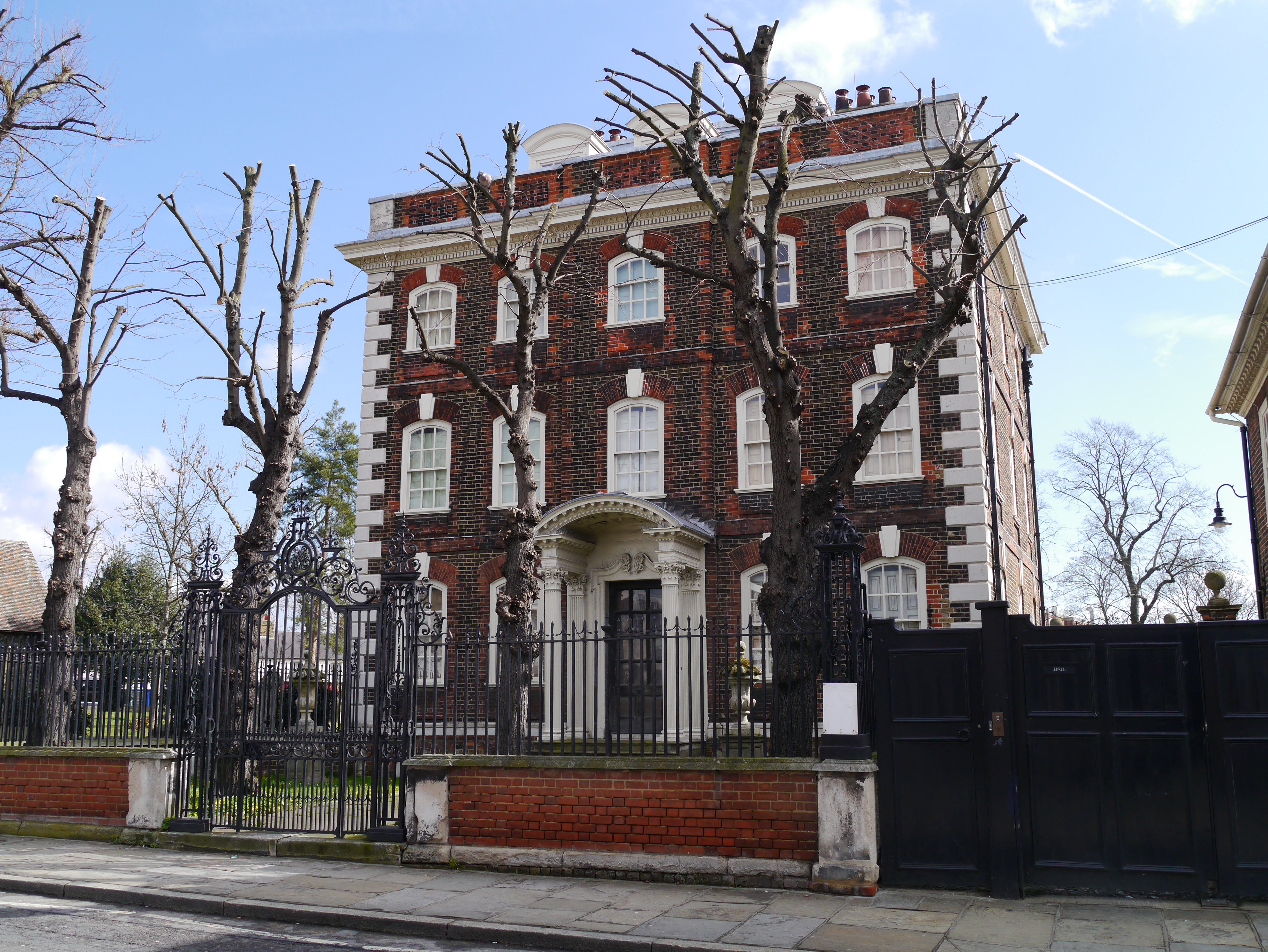
Rainham Hall
Rainham Hall is a Grade II* listed Georgian house, owned by the National Trust, in Rainham, in the London Borough of Havering. Built in 1729 for Captain...

Church of St Helen and St Giles
St Helen and St Giles is a church and landmark of Rainham and is the oldest building in the London Borough of Havering (being Norman). The church retains...
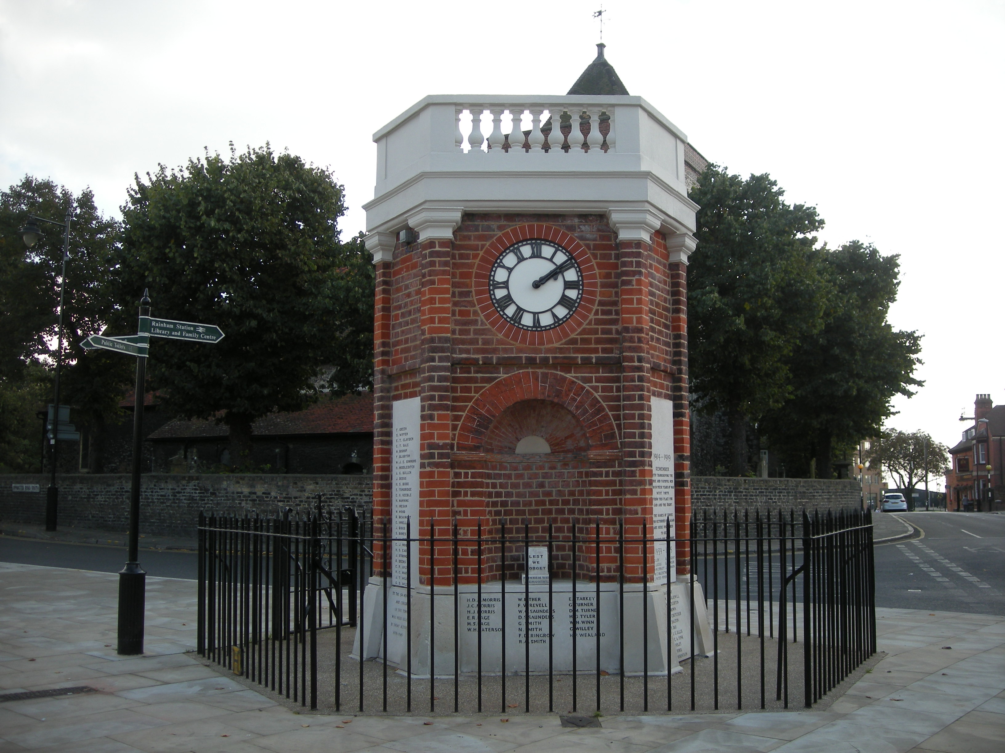
Rainham War Memorial
The Rainham War Memorial commemorates soldiers killed in both World Wars as well as civilian casualties of World War II. == Monument == The monument is...
Rainham railway station (London)
Rainham railway station is on the London, Tilbury and Southend line, serving the town of Rainham in the London Borough of Havering, east London. Historically...
Nearby Amenities
Located within 500m of 51.518,0.192Have you been to Rainham Hall?
Leave your review of Rainham Hall below (or comments, questions and feedback).