Povington Barrow

Heritage Site in Dorset

England

Povington Barrow

Information panel on Povington Hill Viewpoint overlooking Tyneham and the army training area
Information panel on Povington Hill Credit: Graham Hogg

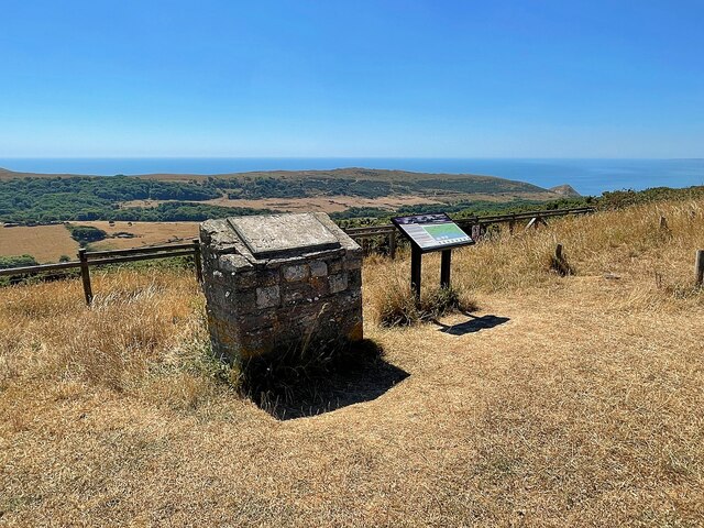
Povington Barrow, located in Dorset, England, is an ancient burial mound that has been designated as a heritage site due to its historical and archaeological significance. The barrow is situated in the picturesque landscape of the Piddle Valley, near the village of Povington.

Dating back to the Neolithic period, Povington Barrow is believed to have been constructed around 4000 to 3500 BCE. It is a round barrow, approximately 20 meters in diameter and 2 meters in height, with a distinctive circular shape that stands out against the surrounding countryside.

The barrow is made of earth and stones, and its construction suggests that it was built as a communal burial site for the local community. Excavations conducted in the late 19th century revealed the presence of human remains, pottery, and other artifacts, providing valuable insights into the lives and burial customs of the people who lived in the area thousands of years ago.

Povington Barrow not only showcases the architectural and engineering skills of the Neolithic people but also serves as a testament to their beliefs and rituals surrounding death and the afterlife. Its location in a serene and idyllic setting adds to its appeal, attracting visitors who are interested in exploring the ancient history and heritage of the region.

Today, Povington Barrow stands as a protected heritage site, managed by the local authorities. It provides a fascinating glimpse into the past, allowing visitors to appreciate the rich cultural heritage of Dorset and the mysteries that lie beneath its ancient landscape.

If you have any feedback on the listing, please let us know in the comments section below.

Povington Barrow Images

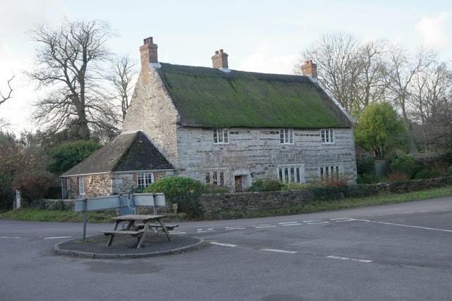
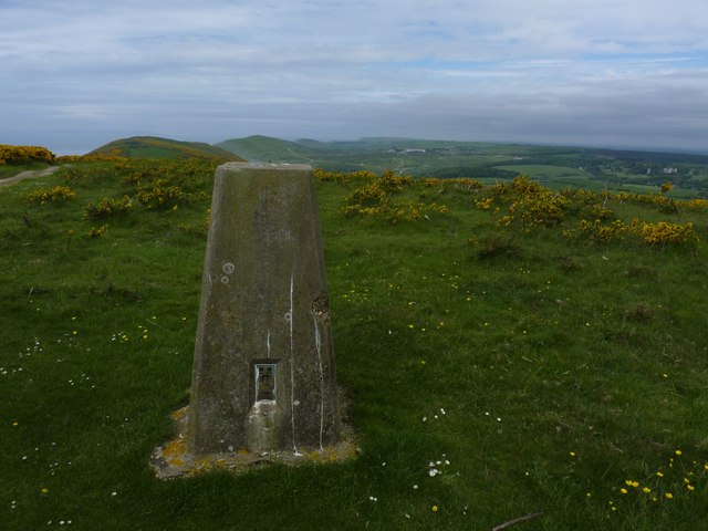
Images are sourced within 2km of 50.642/-2.177 or Grid Reference SY8782. Thanks to Geograph Open Source API. All images are credited.

Information panel on Povington Hill Viewpoint overlooking Tyneham and the army training area
Information panel on Povington Hill
Viewpoint overlooking Tyneham and the army training area
Fields at East Lulworth
The Old School Former school is now a souvenir shop.
The Old School
Former school is now a souvenir shop.
Electricity substation
Thatched cottage For a brief history see <a href="https://www.geograph.org.uk/photo/366188">SY8581 : Manor Cottage</a>
Thatched cottage
For a brief history see SY8581 : Manor Cottage
Pub car park The Weld Arms  is an public house in East Lulworth.  The pub's own web site claims it is 17th century, but the Historic England listing says 18th century.  The name comes from the Weld family who bought the village in 1640, and who still own the Castle and the Pub.   In 1770 the pub landlord was one Richard Champ, a notorious local smuggler.

This is a grade II listed building - see <span class="nowrap"><a title="https://historicengland.org.uk/listing/the-list/list-entry/1172406" rel="nofollow ugc noopener" href="https://historicengland.org.uk/listing/the-list/list-entry/1172406">Link</a><img style="margin-left:2px;" alt="External link" title="External link - shift click to open in new window" src="https://s1.geograph.org.uk/img/external.png" width="10" height="10"/></span>

The pub's own web site is at <span class="nowrap"><a title="http://www.weldarms.co.uk/" rel="nofollow ugc noopener" href="http://www.weldarms.co.uk/">Link</a><img style="margin-left:2px;" alt="External link" title="External link - shift click to open in new window" src="https://s1.geograph.org.uk/img/external.png" width="10" height="10"/></span> 
An account of the village history, including the Inn, is at <span class="nowrap"><a title="http://www.dorsetlife.co.uk/2013/10/dorset-village-walk-east-lulworth/" rel="nofollow ugc noopener" href="http://www.dorsetlife.co.uk/2013/10/dorset-village-walk-east-lulworth/">Link</a><img style="margin-left:2px;" alt="External link" title="External link - shift click to open in new window" src="https://s1.geograph.org.uk/img/external.png" width="10" height="10"/></span>
Pub car park
The Weld Arms is an public house in East Lulworth. The pub's own web site claims it is 17th century, but the Historic England listing says 18th century. The name comes from the Weld family who bought the village in 1640, and who still own the Castle and the Pub. In 1770 the pub landlord was one Richard Champ, a notorious local smuggler. This is a grade II listed building - see LinkExternal link The pub's own web site is at LinkExternal link An account of the village history, including the Inn, is at LinkExternal link
Garage doors Looking run down but with a modern padlock.
Garage doors
Looking run down but with a modern padlock.
The Weld Arms I was amused by the table on the 'traffic island', but the land to the left of the island is part of the pub, not the public highway
The Weld Arms
I was amused by the table on the 'traffic island', but the land to the left of the island is part of the pub, not the public highway
Pub Entrance The Weld Arms  is an public house in East Lulworth.  The pub's own web site claims it is 17th century, but the Historic England listing says 18th century.  The name comes from the Weld family who bought the village in 1640, and who still own the Castle and the Pub.   In 1770 the pub landlord was one Richard Champ, a notorious local smuggler.

This is a grade II listed building - see <span class="nowrap"><a title="https://historicengland.org.uk/listing/the-list/list-entry/1172406" rel="nofollow ugc noopener" href="https://historicengland.org.uk/listing/the-list/list-entry/1172406">Link</a><img style="margin-left:2px;" alt="External link" title="External link - shift click to open in new window" src="https://s1.geograph.org.uk/img/external.png" width="10" height="10"/></span>

The pub's own web site is at <span class="nowrap"><a title="http://www.weldarms.co.uk/" rel="nofollow ugc noopener" href="http://www.weldarms.co.uk/">Link</a><img style="margin-left:2px;" alt="External link" title="External link - shift click to open in new window" src="https://s1.geograph.org.uk/img/external.png" width="10" height="10"/></span> 
An account of the village history, including the Inn, is at <span class="nowrap"><a title="http://www.dorsetlife.co.uk/2013/10/dorset-village-walk-east-lulworth/" rel="nofollow ugc noopener" href="http://www.dorsetlife.co.uk/2013/10/dorset-village-walk-east-lulworth/">Link</a><img style="margin-left:2px;" alt="External link" title="External link - shift click to open in new window" src="https://s1.geograph.org.uk/img/external.png" width="10" height="10"/></span>
Pub Entrance
The Weld Arms is an public house in East Lulworth. The pub's own web site claims it is 17th century, but the Historic England listing says 18th century. The name comes from the Weld family who bought the village in 1640, and who still own the Castle and the Pub. In 1770 the pub landlord was one Richard Champ, a notorious local smuggler. This is a grade II listed building - see LinkExternal link The pub's own web site is at LinkExternal link An account of the village history, including the Inn, is at LinkExternal link
Pub sign The Weld Arms  is an public house in East Lulworth.  The pub's own web site claims it is 17th century, but the Historic England listing says 18th century.  The name comes from the Weld family who bought the village in 1640, and who still own the Castle and the Pub.   In 1770 the pub landlord was one Richard Champ, a notorious local smuggler.

This is a grade II listed building - see <span class="nowrap"><a title="https://historicengland.org.uk/listing/the-list/list-entry/1172406" rel="nofollow ugc noopener" href="https://historicengland.org.uk/listing/the-list/list-entry/1172406">Link</a><img style="margin-left:2px;" alt="External link" title="External link - shift click to open in new window" src="https://s1.geograph.org.uk/img/external.png" width="10" height="10"/></span>

The pub's own web site is at <span class="nowrap"><a title="http://www.weldarms.co.uk/" rel="nofollow ugc noopener" href="http://www.weldarms.co.uk/">Link</a><img style="margin-left:2px;" alt="External link" title="External link - shift click to open in new window" src="https://s1.geograph.org.uk/img/external.png" width="10" height="10"/></span> 
An account of the village history, including the Inn, is at <span class="nowrap"><a title="http://www.dorsetlife.co.uk/2013/10/dorset-village-walk-east-lulworth/" rel="nofollow ugc noopener" href="http://www.dorsetlife.co.uk/2013/10/dorset-village-walk-east-lulworth/">Link</a><img style="margin-left:2px;" alt="External link" title="External link - shift click to open in new window" src="https://s1.geograph.org.uk/img/external.png" width="10" height="10"/></span>
Pub sign
The Weld Arms is an public house in East Lulworth. The pub's own web site claims it is 17th century, but the Historic England listing says 18th century. The name comes from the Weld family who bought the village in 1640, and who still own the Castle and the Pub. In 1770 the pub landlord was one Richard Champ, a notorious local smuggler. This is a grade II listed building - see LinkExternal link The pub's own web site is at LinkExternal link An account of the village history, including the Inn, is at LinkExternal link
In the porch Notice in the pub entrance
"Please remove muddy footwear thank you"
In the porch
Notice in the pub entrance "Please remove muddy footwear thank you"
In the entrance Stowage is provided for Brollies and Broomsticks.
In the entrance
Stowage is provided for Brollies and Broomsticks.
A cosy interior Gloomy, but cosy.  In fact, recommended.
A cosy interior
Gloomy, but cosy. In fact, recommended.
The bar The Weld Arms  is an public house in East Lulworth.  The pub's own web site claims it is 17th century, but the Historic England listing says 18th century.  The name comes from the Weld family who bought the village in 1640, and who still own the Castle and the Pub.   In 1770 the pub landlord was one Richard Champ, a notorious local smuggler.

This is a grade II listed building - see <span class="nowrap"><a title="https://historicengland.org.uk/listing/the-list/list-entry/1172406" rel="nofollow ugc noopener" href="https://historicengland.org.uk/listing/the-list/list-entry/1172406">Link</a><img style="margin-left:2px;" alt="External link" title="External link - shift click to open in new window" src="https://s1.geograph.org.uk/img/external.png" width="10" height="10"/></span>

The pub's own web site is at <span class="nowrap"><a title="http://www.weldarms.co.uk/" rel="nofollow ugc noopener" href="http://www.weldarms.co.uk/">Link</a><img style="margin-left:2px;" alt="External link" title="External link - shift click to open in new window" src="https://s1.geograph.org.uk/img/external.png" width="10" height="10"/></span> 
An account of the village history, including the Inn, is at <span class="nowrap"><a title="http://www.dorsetlife.co.uk/2013/10/dorset-village-walk-east-lulworth/" rel="nofollow ugc noopener" href="http://www.dorsetlife.co.uk/2013/10/dorset-village-walk-east-lulworth/">Link</a><img style="margin-left:2px;" alt="External link" title="External link - shift click to open in new window" src="https://s1.geograph.org.uk/img/external.png" width="10" height="10"/></span>
The bar
The Weld Arms is an public house in East Lulworth. The pub's own web site claims it is 17th century, but the Historic England listing says 18th century. The name comes from the Weld family who bought the village in 1640, and who still own the Castle and the Pub. In 1770 the pub landlord was one Richard Champ, a notorious local smuggler. This is a grade II listed building - see LinkExternal link The pub's own web site is at LinkExternal link An account of the village history, including the Inn, is at LinkExternal link
That's a massive Pike! Originally titled 'carp in a case', my chum Norman corrected me.
That's a massive Pike!
Originally titled 'carp in a case', my chum Norman corrected me.
Road in East Lulworth
Trigpoint on Whiteway Hill
Descending Whiteway Hill to Tyneham
Show me another place!

Povington Barrow is located at Grid Ref: SY8782 (Lat: 50.642, Lng: -2.177)

Unitary Authority: Dorset

Police Authority: Dorset

What 3 Words

///napped.scrubbing.spells. Near Wool, Dorset

Nearby Locations

Povington Barrow Whiteway

Related Wikis

Lulworth Ranges

The Lulworth Ranges are military firing ranges located between Wareham and Lulworth in Dorset, England. They cover an area of more than 2,830 hectares...

Povington Priory

Povington Priory was a Benedictine priory in Tyneham, Dorset, England. It was established as an alien priory of the Abbey of Bec. This term could mean...

East Lulworth

East Lulworth is a village and civil parish nine miles east of Dorchester, near Lulworth Cove, in the county of Dorset, South West England. It consists...

Povington Hill

Povington Hill, at 198 metres (650 ft) high, is one of the highest points on the chain of the Purbeck Hills in south Dorset on the southern coast of England...

Nearby Amenities

Located within 500m of 50.642,-2.177
Railway: switch
Lat/Long: 50.6375716/-2.1761768
Railway: switch
Lat/Long: 50.6395343/-2.1739205
Railway: level_crossing
Lat/Long: 50.642898/-2.1750847
The data included in this document is from www.openstreetmap.org. The data is made available under ODbL.

Have you been to Povington Barrow?

Leave your review of Povington Barrow below (or comments, questions and feedback).