Achnacroish

Settlement in Argyllshire

Scotland

Achnacroish

B8045, Lismore
B8045, Lismore Credit: Richard Webb

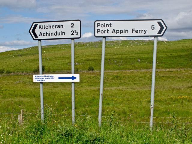
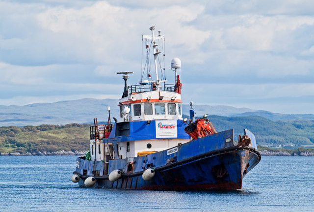
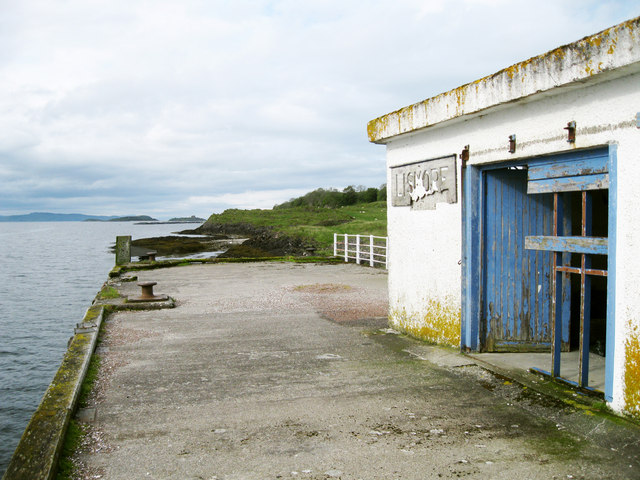
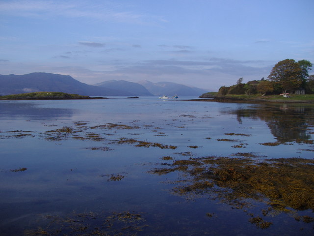
Achnacroish is a small village located in the Argyllshire region of Scotland. Nestled on the Isle of Lismore, the village is situated about 7 miles northwest of Oban. Achnacroish is known for its picturesque surroundings which include stunning views of the Scottish mainland and the surrounding islands.

The village is home to a close-knit community, with a population of around 100 residents. Despite its small size, Achnacroish offers a range of amenities and services to its inhabitants. These include a local shop, a post office, and a primary school, providing essential facilities for the village's residents.

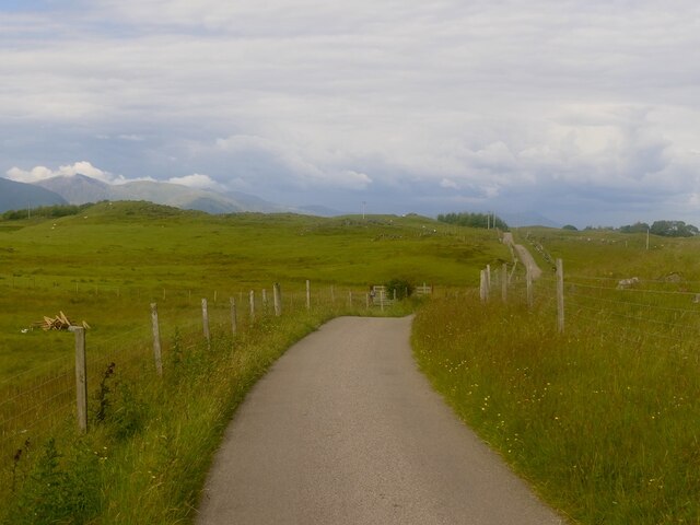
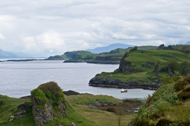
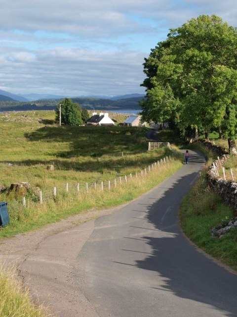
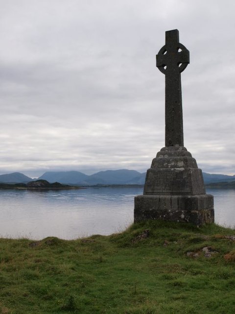
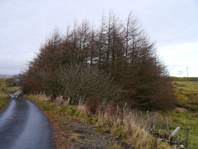
Achnacroish is also a popular destination for tourists seeking tranquility and natural beauty. The village boasts breathtaking landscapes, with rolling hills, lush green meadows, and stunning coastal views. Outdoor enthusiasts can enjoy activities such as hiking, cycling, and fishing in the surrounding area.

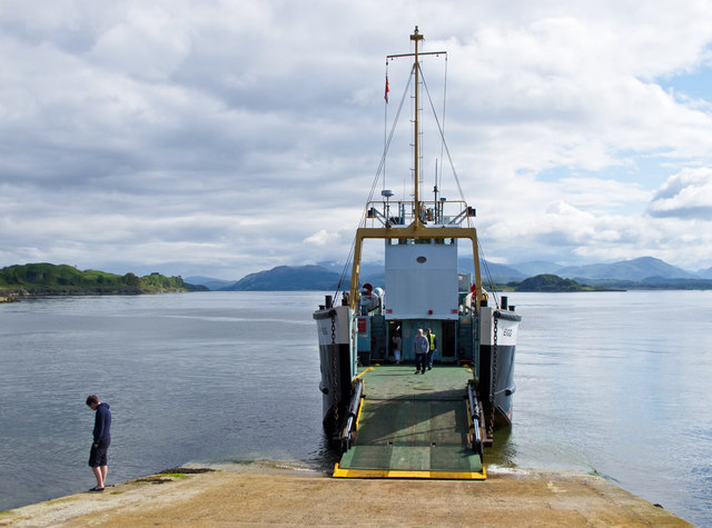
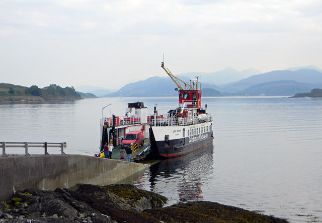
The village is accessible by a regular ferry service from Oban, which takes approximately 50 minutes. This makes Achnacroish an ideal location for those looking to escape the hustle and bustle of city life while still having convenient access to amenities.

Overall, Achnacroish offers a peaceful and idyllic setting, making it a desirable place to live for those seeking a close-knit community and a connection with nature.

If you have any feedback on the listing, please let us know in the comments section below.

Achnacroish Images

Images are sourced within 2km of 56.511666/-5.493848 or Grid Reference NM8540. Thanks to Geograph Open Source API. All images are credited.

B8045, Lismore
B8045, Lismore
Calmac ferry MV Eigg at Achnacroish The Calmac ferry Eigg at Achnacroish, Lismore after unloading vehicles and passengers from an Oban sailing. The Eigg was launched in 1974, and has provided a ferry service to the Isle of Lismore for many years.
Calmac ferry MV Eigg at Achnacroish
The Calmac ferry Eigg at Achnacroish, Lismore after unloading vehicles and passengers from an Oban sailing. The Eigg was launched in 1974, and has provided a ferry service to the Isle of Lismore for many years.
Road signs, Lismore
Road signs, Lismore
Lismore western coastline A view over the western coastline of the Island of Lismore. Largely composed of Dalradian limestone, Lismore is surrounded by raised beaches backed by cliffs. The island overlies the Great Glen fault line, and earth tremors occur here occasionally.
Lismore western coastline
A view over the western coastline of the Island of Lismore. Largely composed of Dalradian limestone, Lismore is surrounded by raised beaches backed by cliffs. The island overlies the Great Glen fault line, and earth tremors occur here occasionally.
The Headcorn at Achnacroish harbour The Headcorn (Clovelly Class A 1766), a work/dive boat approaching the pier at Achnacroish, Lismore. Headcorn is 24.4 metres in length and was launched in 1972.
The Headcorn at Achnacroish harbour
The Headcorn (Clovelly Class A 1766), a work/dive boat approaching the pier at Achnacroish, Lismore. Headcorn is 24.4 metres in length and was launched in 1972.
Old steamer pier, Achnacroish The old pier, with its faded 'Lismore' sign, is no longer used; the car ferry from Oban uses the adjacent slipway. According to a plaque on the wall, it was built in 1880 by contractors A & K Macdonald and J Goodwin & Co, with John Strainge as engineer.
Old steamer pier, Achnacroish
The old pier, with its faded 'Lismore' sign, is no longer used; the car ferry from Oban uses the adjacent slipway. According to a plaque on the wall, it was built in 1880 by contractors A & K Macdonald and J Goodwin & Co, with John Strainge as engineer.
Achnacroish harbour, Lismore The slipway for the Oban ferry is at the left. The disused pier seen in other images (e.g. <a href="https://www.geograph.org.uk/photo/951880">NM8540 : Approaching Achnacroish pier</a>) is just off the right of the picture. In the distance one sees mountains on the mainland: Ben Starav, Beinn a'Bheitheir and summits between.
Achnacroish harbour, Lismore
The slipway for the Oban ferry is at the left. The disused pier seen in other images (e.g. NM8540 : Approaching Achnacroish pier) is just off the right of the picture. In the distance one sees mountains on the mainland: Ben Starav, Beinn a'Bheitheir and summits between.
Road to Achnacroish The picture looks east along the road that runs from the 'main' road along the spine of Lismore, to the terminal for the Oban ferry at Achnacroish.
Road to Achnacroish
The picture looks east along the road that runs from the 'main' road along the spine of Lismore, to the terminal for the Oban ferry at Achnacroish.
Road to Balnagown The 'main' road, that runs the length of Lismore, runs left to right across the picture. To the left side we see the junction with the road that runs to Balnagown (and comes to an end there). The photo was taken from just in front of the cafe at the Lismore historical museum.
Road to Balnagown
The 'main' road, that runs the length of Lismore, runs left to right across the picture. To the left side we see the junction with the road that runs to Balnagown (and comes to an end there). The photo was taken from just in front of the cafe at the Lismore historical museum.
Monument to Waverley Arthur Cameron On the east coast of Lismore this monument commemorates the drowning of Waverley Arthur Cameron in a yachting accident off the shore here on 4 June 1891. It was erected by his father, Duncan Cameron, founder of the Oban Times. Waverley Cameron was editor of the Oban Times at the time of the accident.
Monument to Waverley Arthur Cameron
On the east coast of Lismore this monument commemorates the drowning of Waverley Arthur Cameron in a yachting accident off the shore here on 4 June 1891. It was erected by his father, Duncan Cameron, founder of the Oban Times. Waverley Cameron was editor of the Oban Times at the time of the accident.
Lismore east coast The picture looks along the line of low cliffs with Appin in the distance on the mainland. Such low cliffs are typical of the east coast of Lismore.
Lismore east coast
The picture looks along the line of low cliffs with Appin in the distance on the mainland. Such low cliffs are typical of the east coast of Lismore.
Lismore Heritage Centre Unfortunately closed for the winter, the centre was opened in 2007.  Further information is available here: <span class="nowrap"><a title="http://www.celm.org.uk/index.htm" rel="nofollow ugc noopener" href="http://www.celm.org.uk/index.htm">Link</a><img style="margin-left:2px;" alt="External link" title="External link - shift click to open in new window" src="https://s1.geograph.org.uk/img/external.png" width="10" height="10"/></span>
Lismore Heritage Centre
Unfortunately closed for the winter, the centre was opened in 2007. Further information is available here: LinkExternal link
Boggy Ground A patch of roadside marshland near Balliveolan.
Boggy Ground
A patch of roadside marshland near Balliveolan.
A Small Plantation A small Larch plantation at Baligrundle.
A Small Plantation
A small Larch plantation at Baligrundle.
Loch Baile a'Ghobhainn
Salen Bay, Lismore
Salen Bay, Lismore
Achnacroish slipway - Lismore The CalMac ferry MV Loch Striven unloading at Achnacroish.
Achnacroish slipway - Lismore
The CalMac ferry MV Loch Striven unloading at Achnacroish.
Telephone and Post Box - Achnacroish Situated just above the slipway.
Telephone and Post Box - Achnacroish
Situated just above the slipway.
Show me another place!

Achnacroish is located at Grid Ref: NM8540 (Lat: 56.511666, Lng: -5.493848)

Unitary Authority: Argyll and Bute

Police Authority: Argyll and West Dunbartonshire

What 3 Words

///trickled.earlobe.difficult. Near Oban, Argyll & Bute

Nearby Locations

Achnacroish

Related Wikis

Achnacroish

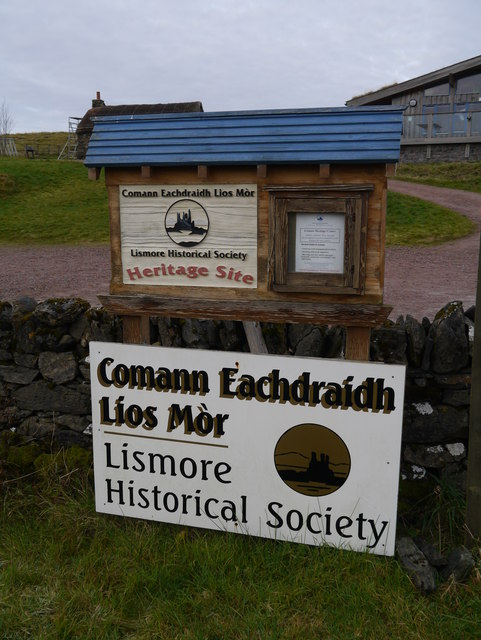
Achnacroish (Scottish Gaelic: Achadh na Croise) is a hamlet on the Scottish island of Lismore. The harbour serves the ferry between Lismore and Oban.The...

Lismore, Scotland

Lismore (Scottish Gaelic: Lios Mòr, pronounced [ʎis̪ ˈmoːɾ] possibly meaning "great enclosure" or "garden") is an island of some 2,351 hectares (9.1 square...

Tirefour Castle

Tirefour Castle, (or Tirefour Broch, also spelled Tirfuir and Tirrefour) is an Iron Age broch located 4 kilometres north of Achnacroish on the island of...

St Moluag's Cathedral, Lismore

St Moluag's Cathedral is located on the Scottish island of Lismore just off the coast of Oban. As a congregation of the Church of Scotland, which is Presbyterian...

Nearby Amenities

Located within 500m of 56.511666,-5.493848
Ferry Terminal
Lat/Long: 56.5118965/-5.4916606
Achnacroish
Name En: Achnacroish
Name Gd: Achadh na Croise
Place: village
Source: OS_OpenData_StreetView
Wikidata: Q3776673
Wikipedia: en:Achnacroish
Lat/Long: 56.5114463/-5.4939988
Source: PGS
Lat/Long: 56.5133304/-5.491195
Toilets
Lat/Long: 56.5112986/-5.4929213
Booth: K6
Covered: booth
Disused Amenity: telephone
Man Made: telephone_box
Tourism: information
Lat/Long: 56.5114231/-5.4933033
Post Box
Post Box Type: lamp
Ref: PA34 58
Royal Cypher: scottish_crown
Lat/Long: 56.5114264/-5.4933394
Power: pole
Lat/Long: 56.5090657/-5.498165
Power: pole
Lat/Long: 56.5097637/-5.4969424
Power: pole
Lat/Long: 56.5101606/-5.4962771
Power: pole
Lat/Long: 56.5103993/-5.4958233
Power: pole
Lat/Long: 56.5117472/-5.4956247
Power: pole
Lat/Long: 56.5123867/-5.4950181
Power: pole
Lat/Long: 56.5129666/-5.4944726
Power: pole
Lat/Long: 56.5115967/-5.4940941
Power: pole
Lat/Long: 56.5118802/-5.4940201
Power: pole
Lat/Long: 56.5126196/-5.493906
Power: pole
Lat/Long: 56.5132247/-5.4950569
Power: pole
Lat/Long: 56.5136489/-5.4963723
Power: pole
Lat/Long: 56.5139693/-5.4971552
Power: pole
Lat/Long: 56.5141788/-5.4985235
Power: pole
Lat/Long: 56.5139985/-5.4962054
Power: pole
Lat/Long: 56.5140102/-5.4949593
Power: pole
Lat/Long: 56.5140205/-5.4940965
The data included in this document is from www.openstreetmap.org. The data is made available under ODbL.

Have you been to Achnacroish?

Leave your review of Achnacroish below (or comments, questions and feedback).