Pendeen House

Heritage Site in Cornwall

England

Pendeen House

OS Flush Bracket S7040 - Higher Boscaswell, St John's Church <span class="nowrap"><a title="https://www.bench-marks.org.uk/bm11683" rel="nofollow ugc noopener" href="https://www.bench-marks.org.uk/bm11683">Link</a><img style="margin-left:2px;" alt="External link" title="External link - shift click to open in new window" src="https://s1.geograph.org.uk/img/external.png" width="10" height="10"/></span>
OS Flush Bracket S7040 - Higher Boscaswell, St John's Church Credit: thejackrustles

Pendeen House, located in Cornwall, England, is a prominent heritage site that holds historical and cultural significance. Situated in the picturesque village of Pendeen, it is a fine example of Cornish architecture from the 19th century.

Originally built in 1830, Pendeen House was constructed as a grand residence for a wealthy local family. The house boasts an elegant Georgian-style design and is characterized by its symmetrical facade, large sash windows, and classical proportions. The building is made primarily of local stone, giving it a distinct and authentic Cornish feel.

Over the years, Pendeen House has witnessed numerous changes and developments. It served as a family home until the mid-20th century when it was converted into a hotel to cater to the growing tourism industry in Cornwall. The hotel operated successfully for several decades, welcoming numerous guests who sought to experience the beauty and charm of the region.

Today, Pendeen House stands as a testament to the rich history and architectural heritage of Cornwall. Although no longer operating as a hotel, the building has been carefully preserved and is now a private residence. Its stunning exterior and well-preserved interior features, such as ornate cornices, fireplaces, and period furniture, offer visitors a glimpse into the past.

Surrounded by picturesque gardens and stunning views of the Cornish countryside, Pendeen House is an attraction for history enthusiasts and architecture lovers alike. Its historical significance, combined with its aesthetic appeal, makes it a noteworthy heritage site in Cornwall.

If you have any feedback on the listing, please let us know in the comments section below.

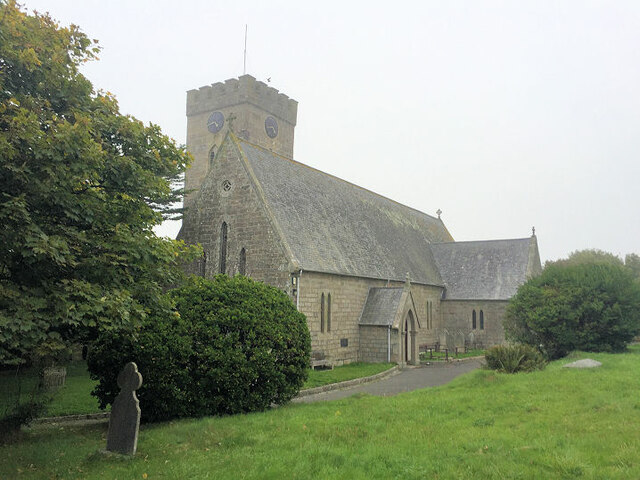
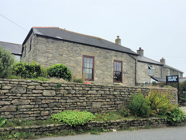
Pendeen House Images

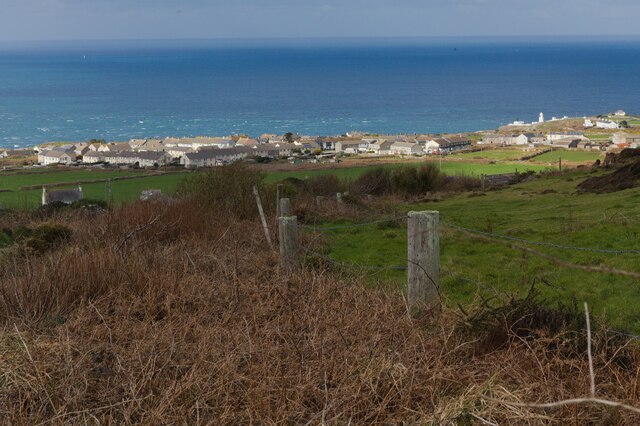
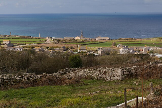
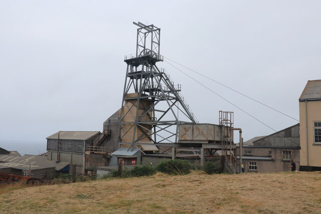
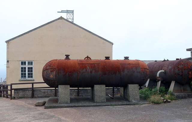
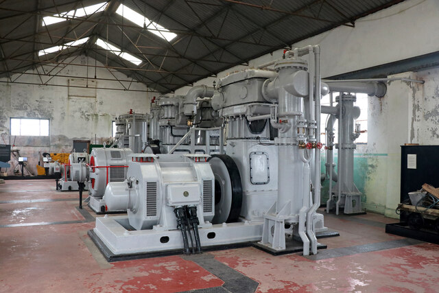
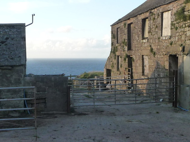
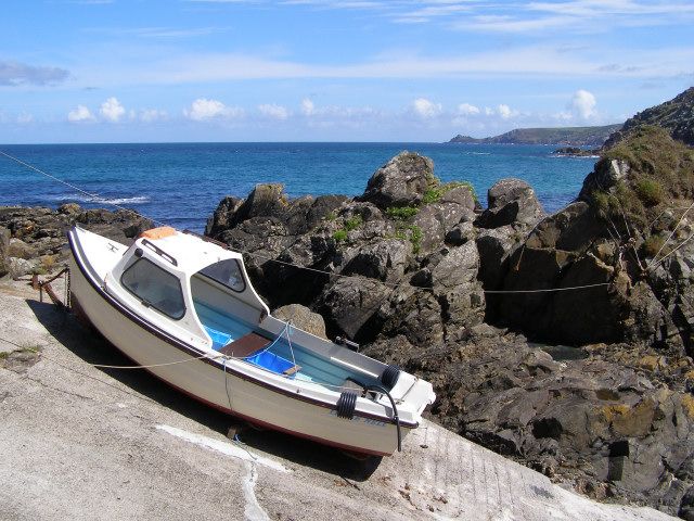
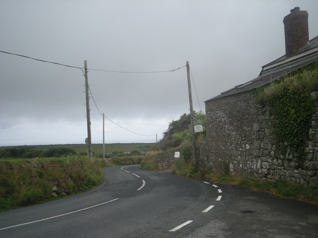
Images are sourced within 2km of 50.162/-5.662 or Grid Reference SW3835. Thanks to Geograph Open Source API. All images are credited.

OS Flush Bracket S7040 - Higher Boscaswell, St John's Church <span class="nowrap"><a title="https://www.bench-marks.org.uk/bm11683" rel="nofollow ugc noopener" href="https://www.bench-marks.org.uk/bm11683">Link</a><img style="margin-left:2px;" alt="External link" title="External link - shift click to open in new window" src="https://s1.geograph.org.uk/img/external.png" width="10" height="10"/></span>
OS Flush Bracket S7040 - Higher Boscaswell, St John's Church
Location of OS Flush Bracket S7040 - Higher Boscaswell, St John's Church
Chimneys of the Levant Mine There are numerous chimneys dotted about the former Levant Mine workings. Some belonged to engine houses such as those required to pump water from the mine, to operate lifts for men, ponies and ore, while others were required for the smelting process or to retrieve minerals. For example, the left-most one seen here was for the 'calciner' where ores were heated to remove such useful minerals as arsenic. The most important elements to be recovered however were Tin and Copper, but this was generally extracted from the ore offsite.
Chimneys of the Levant Mine
There are numerous chimneys dotted about the former Levant Mine workings. Some belonged to engine houses such as those required to pump water from the mine, to operate lifts for men, ponies and ore, while others were required for the smelting process or to retrieve minerals. For example, the left-most one seen here was for the 'calciner' where ores were heated to remove such useful minerals as arsenic. The most important elements to be recovered however were Tin and Copper, but this was generally extracted from the ore offsite.
Pendeen Lighthouse from the Levant Mine Looking along the western coast of Cornwall from the clifftop Levant Mine to Penlee Lighthouse a couple of miles distant.
Pendeen Lighthouse from the Levant Mine
Looking along the western coast of Cornwall from the clifftop Levant Mine to Penlee Lighthouse a couple of miles distant.
Headframe and surrounding buildings at Geevor Tin Mine
Fishermen's hut at Boat Cove, Portheras This hut and associated buildings have been built and maintained by the Pendeen Fishermen's Mission. A steep slipway allows boats to be lowered into the cove below.
Fishermen's hut at Boat Cove, Portheras
This hut and associated buildings have been built and maintained by the Pendeen Fishermen's Mission. A steep slipway allows boats to be lowered into the cove below.
Geevor Tin Mine
Geevor Tin Mine
The Radjel Inn, Boscaswell, Pendeen
Old Cross in Pendeen Churchyard Portherras Cross, the old head and neck of a wayside cross. Moved to the northeast side of Pendeen Churchyard and set close to the gate of the vicarage. St Just parish. A Scheduled Monument <span class="nowrap"><a title="https://historicengland.org.uk/listing/the-list/list-entry/1019166" rel="nofollow ugc noopener" href="https://historicengland.org.uk/listing/the-list/list-entry/1019166">Link</a><img style="margin-left:2px;" alt="External link" title="External link - shift click to open in new window" src="https://s1.geograph.org.uk/img/external.png" width="10" height="10"/></span>. 

Milestone Society National ID: CWPW_SJP05
Old Cross in Pendeen Churchyard
Portherras Cross, the old head and neck of a wayside cross. Moved to the northeast side of Pendeen Churchyard and set close to the gate of the vicarage. St Just parish. A Scheduled Monument LinkExternal link. Milestone Society National ID: CWPW_SJP05
St John The Baptist Church
The Old Chapel
The Old Chapel
Farm access track The access track to Higher Trewellard Hill Farm forks off the public bridleway.
Farm access track
The access track to Higher Trewellard Hill Farm forks off the public bridleway.
Standing stone This standing stone was placed here comparatively recently.
Standing stone
This standing stone was placed here comparatively recently.
View from track 1 As the track rounds the hill there is a view to houses at Lower Boscaswell and the top of Pendeen lighthouse. See also <a href="https://www.geograph.org.uk/photo/7416881">SW3833 : View from track 2</a>.
View from track 1
As the track rounds the hill there is a view to houses at Lower Boscaswell and the top of Pendeen lighthouse. See also SW3833 : View from track 2.
View from track 2 In this view the winding tower of Geevor mine and the chimneys of Levant can be seen. See also <a href="https://www.geograph.org.uk/photo/7416877">SW3833 : View from track 1</a>.
View from track 2
In this view the winding tower of Geevor mine and the chimneys of Levant can be seen. See also SW3833 : View from track 1.
Geevor Mine - Victory Shaft A former tin mine that is now a museum.
Geevor Mine - Victory Shaft
A former tin mine that is now a museum.
Geevor Mine - winding engine house Electric winding engine house with air receivers in front. A former tin mine that is now a museum.
Geevor Mine - winding engine house
Electric winding engine house with air receivers in front. A former tin mine that is now a museum.
Geevor Mine - compressor house A former tin mine now a museum. The three compressors are by Alley & McLellan and are two stage with intercooling and aftercooling.
Geevor Mine - compressor house
A former tin mine now a museum. The three compressors are by Alley & McLellan and are two stage with intercooling and aftercooling.
Show me another place!

Pendeen House is located at Grid Ref: SW3835 (Lat: 50.162, Lng: -5.662)

Unitary Authority: Cornwall

Police Authority: Devon and Cornwall

What 3 Words

///major.smokers.unite. Near St Just, Cornwall

Related Wikis

Pendeen Vau

Pendeen Vau is a fogou on the Cornish coast of England, near the village of Pendeen. It is situated at Pendeen (Manor) farm, once the home of the renowned...

Pendeen

Pendeen (from Cornish: Penn Din meaning "headland fort", previously known as Cornish: Boskaswal Wartha, meaning "Caswal's high dwelling") is a village...

Bojewyan

Bojewyan is a settlement on the Penwith Peninsula in west Cornwall, England, United Kingdom. The village lies along the B3306 road which runs along the...

Higher Boscaswell

Higher Boscaswell is a hamlet near Pendeen in west Cornwall, England. It is east of Pendeen and on the B road from St Ives to St Just. Higher Boscaswell...

Nearby Amenities

Located within 500m of 50.162,-5.662
Source: PGS
Lat/Long: 50.1640804/-5.6566554
Source: PGS
Lat/Long: 50.1636802/-5.6586144
Source: Bing
Lat/Long: 50.1638639/-5.6599465
Source: PGS
Lat/Long: 50.1642291/-5.6605897
Source: PGS
Lat/Long: 50.1647969/-5.6627528
Source: Bing
Lat/Long: 50.1639109/-5.6586291
Source: Bing
Lat/Long: 50.1648233/-5.6565561
Source: Bing
Lat/Long: 50.1648148/-5.6565694
Source: Bing
Lat/Long: 50.1647845/-5.6565713
Source: Bing
Lat/Long: 50.1647589/-5.656596
Source: Bing
Lat/Long: 50.1647322/-5.6565979
Source: Bing
Lat/Long: 50.1646946/-5.6565505
Source: Bing
Lat/Long: 50.1646885/-5.6565315
Source: Bing
Lat/Long: 50.1646812/-5.6564841
Source: Bing
Lat/Long: 50.1646763/-5.6563646
Source: Bing
Lat/Long: 50.1646132/-5.6562887
Source: Bing
Lat/Long: 50.1645852/-5.6562906
Source: Bing
Lat/Long: 50.1645342/-5.6562527
Source: Bing
Lat/Long: 50.1644564/-5.6563608
Source: Bing
Lat/Long: 50.1644528/-5.6563817
Source: Bing
Lat/Long: 50.1644528/-5.6564044
Source: Bing
Lat/Long: 50.1644601/-5.6564177
Source: Bing
Lat/Long: 50.1645135/-5.6564291
Source: Bing
Lat/Long: 50.1645233/-5.656448
Source: Bing
Lat/Long: 50.1645281/-5.6564651
Source: Bing
Lat/Long: 50.1645135/-5.656503
Source: Bing
Lat/Long: 50.1644248/-5.656522
Source: Bing
Lat/Long: 50.1644127/-5.6565144
Source: Bing
Lat/Long: 50.1644455/-5.6566415
Source: Bing
Lat/Long: 50.1644418/-5.6566851
Source: Bing
Lat/Long: 50.1644321/-5.6566965
Source: Bing
Lat/Long: 50.1644188/-5.6566889
Source: Bing
Lat/Long: 50.1644005/-5.6567174
Source: Bing
Lat/Long: 50.1643884/-5.656706
Source: Bing
Lat/Long: 50.1643738/-5.656706
Source: Bing
Lat/Long: 50.1643361/-5.6566605
Source: Bing
Lat/Long: 50.1643259/-5.656718
Source: Bing
Lat/Long: 50.164149/-5.657237
Source: Bing
Lat/Long: 50.1640166/-5.6579046
Source: Bing
Lat/Long: 50.1638708/-5.6591374
Source: Bing
Lat/Long: 50.1638708/-5.6593157
Source: Bing
Lat/Long: 50.1639085/-5.6593062
Source: Bing
Lat/Long: 50.1639097/-5.659348
Source: Bing
Lat/Long: 50.1638854/-5.6593878
Source: Bing
Lat/Long: 50.1638623/-5.6593954
Source: Bing
Lat/Long: 50.1638672/-5.6599985
Source: Bing
Lat/Long: 50.1638793/-5.6600042
Source: Bing
Lat/Long: 50.1639048/-5.6599852
Source: Bing
Lat/Long: 50.1639182/-5.6599909
Source: Bing
Lat/Long: 50.1639267/-5.6600061
Source: Bing
Lat/Long: 50.1639401/-5.660008
Source: Bing
Lat/Long: 50.1639705/-5.6599738
Source: Bing
Lat/Long: 50.164013/-5.6599662
Source: Bing
Lat/Long: 50.1640385/-5.6599776
Source: Bing
Lat/Long: 50.1640652/-5.6600307
Source: Bing
Lat/Long: 50.1641041/-5.6600269
Source: Bing
Lat/Long: 50.1641235/-5.660063
Source: Bing
Lat/Long: 50.164126/-5.6600876
Source: Bing
Lat/Long: 50.1640786/-5.6601407
Source: Bing
Lat/Long: 50.1640689/-5.6601806
Source: Bing
Lat/Long: 50.1640166/-5.6602147
Source: Bing
Lat/Long: 50.164002/-5.6602109
Source: Bing
Lat/Long: 50.163951/-5.6601616
Source: Bing
Lat/Long: 50.1639644/-5.6602128
Source: Bing
Lat/Long: 50.1639559/-5.6602375
Source: Bing
Lat/Long: 50.1639328/-5.6602356
Source: Bing
Lat/Long: 50.1639474/-5.6603247
Source: Bing
Lat/Long: 50.1639862/-5.6604651
Source: Bing
Lat/Long: 50.1640312/-5.6605409
Source: Bing
Lat/Long: 50.1640822/-5.6605959
Source: Bing
Lat/Long: 50.1641211/-5.6606794
Source: Bing
Lat/Long: 50.164149/-5.660704
Source: Bing
Lat/Long: 50.1642025/-5.6607097
Source: Bing
Lat/Long: 50.1642098/-5.6607477
Source: Bing
Lat/Long: 50.1642402/-5.6608273
Source: Bing
Lat/Long: 50.1642547/-5.6608444
Source: Bing
Lat/Long: 50.1642693/-5.6608482
Source: Bing
Lat/Long: 50.1642863/-5.6608766
Source: Bing
Lat/Long: 50.1642997/-5.6608709
Source: Bing
Lat/Long: 50.1643094/-5.6608501
Source: Bing
Lat/Long: 50.1643471/-5.6608766
Source: Bing
Lat/Long: 50.1643787/-5.660869
Source: Bing
Lat/Long: 50.1643872/-5.6608899
Source: Bing
Lat/Long: 50.164403/-5.6609051
Source: Bing
Lat/Long: 50.1644309/-5.6609089
Source: Bing
Lat/Long: 50.1644637/-5.6608311
Source: Bing
Lat/Long: 50.1644759/-5.6607571
Source: Bing
Lat/Long: 50.1644892/-5.6607458
Source: Bing
Lat/Long: 50.1645135/-5.6607609
Source: Bing
Lat/Long: 50.1645439/-5.660797
Source: Bing
Lat/Long: 50.16455/-5.6608804
Source: Bing
Lat/Long: 50.1645366/-5.6609259
Source: Bing
Lat/Long: 50.1645342/-5.6609677
Source: Bing
Lat/Long: 50.1645451/-5.6610075
Source: Bing
Lat/Long: 50.1645378/-5.6610587
Source: Bing
Lat/Long: 50.1645293/-5.6610777
Source: Bing
Lat/Long: 50.1645172/-5.6611725
Source: Bing
Lat/Long: 50.164516/-5.6612673
Source: Bing
Lat/Long: 50.1645245/-5.6612844
Source: Bing
Lat/Long: 50.1645524/-5.6612844
Source: Bing
Lat/Long: 50.1645937/-5.6612787
Source: Bing
Lat/Long: 50.1646362/-5.6612521
Source: Bing
Lat/Long: 50.1646618/-5.6612559
Source: Bing
Lat/Long: 50.1646666/-5.6612939
Source: Bing
Lat/Long: 50.1646824/-5.6613375
Source: Bing
Lat/Long: 50.1646933/-5.6613925
Source: Bing
Lat/Long: 50.1647031/-5.6614039
Source: Bing
Lat/Long: 50.1647055/-5.6615196
Source: Bing
Lat/Long: 50.1646593/-5.6615063
Source: Bing
Lat/Long: 50.1646703/-5.6615158
Source: Bing
Lat/Long: 50.1646848/-5.6615594
Source: Bing
Lat/Long: 50.1646666/-5.6616296
Source: Bing
Lat/Long: 50.1646751/-5.6616637
Source: Bing
Lat/Long: 50.1646885/-5.6616713
Source: Bing
Lat/Long: 50.1646946/-5.6616865
Source: Bing
Lat/Long: 50.1646946/-5.6617415
Source: Bing
Lat/Long: 50.1646848/-5.661768
Source: Bing
Lat/Long: 50.1646605/-5.661751
Source: Bing
Lat/Long: 50.1646545/-5.661768
Source: Bing
Lat/Long: 50.1646545/-5.6618458
Source: Bing
Lat/Long: 50.1646654/-5.6619235
Source: Bing
Lat/Long: 50.1646994/-5.661952
Source: Bing
Lat/Long: 50.1647067/-5.6619729
Source: Bing
Lat/Long: 50.1647018/-5.6620127
Source: Bing
Lat/Long: 50.1646739/-5.6620601
Source: Bing
Lat/Long: 50.1646727/-5.6621018
Source: Bing
Lat/Long: 50.1646557/-5.6621606
Source: Bing
Lat/Long: 50.1646508/-5.6622005
Source: Bing
Lat/Long: 50.1646727/-5.6621777
Source: Bing
Lat/Long: 50.1646788/-5.6621929
Source: Bing
Lat/Long: 50.1647018/-5.662208
Source: Bing
Lat/Long: 50.1647043/-5.6622289
Source: Bing
Lat/Long: 50.164697/-5.6622668
Source: Bing
Lat/Long: 50.1647128/-5.6622991
Source: Bing
Lat/Long: 50.1647128/-5.6623427
Source: Bing
Lat/Long: 50.1647359/-5.6623882
Source: Bing
Lat/Long: 50.1647638/-5.6623806
Source: Bing
Lat/Long: 50.1647735/-5.662392
Source: Bing
Lat/Long: 50.164765/-5.6624546
Source: Bing
Lat/Long: 50.1647723/-5.6624906
Source: Bing
Lat/Long: 50.1648331/-5.6625627
Source: Bing
Lat/Long: 50.164906/-5.6625987
Source: Bing
Lat/Long: 50.1649193/-5.6625665
Source: Bing
Lat/Long: 50.1649072/-5.6625589
Source: Bing
Lat/Long: 50.1648938/-5.6625134
Source: Bing
Lat/Long: 50.1648962/-5.6624698
Source: Bing
Lat/Long: 50.1648853/-5.6624546
Source: Bing
Lat/Long: 50.1648841/-5.662282
Source: Bing
Lat/Long: 50.1648914/-5.6622649
Source: Bing
Lat/Long: 50.1649157/-5.6622498
Source: Bing
Lat/Long: 50.1649315/-5.6621815
Source: Bing
Lat/Long: 50.1649752/-5.6621739
Source: Bing
Lat/Long: 50.1649971/-5.6621986
Source: Bing
Lat/Long: 50.1649959/-5.6622384
Source: Bing
Lat/Long: 50.1650031/-5.662263
Source: Bing
Lat/Long: 50.1650117/-5.6622422
Source: Bing
Lat/Long: 50.1650323/-5.662356
Source: Bing
Lat/Long: 50.1650262/-5.6624774
Source: Bing
Lat/Long: 50.1650068/-5.6625305
Source: Bing
Lat/Long: 50.165008/-5.6625532
Source: Bing
Lat/Long: 50.1650214/-5.6625532
Source: Bing
Lat/Long: 50.1650991/-5.6624868
Source: Bing
Lat/Long: 50.1651246/-5.662428
Source: Bing
Lat/Long: 50.1651356/-5.6624186
Source: Bing
Lat/Long: 50.1651502/-5.6624186
Source: Bing
Lat/Long: 50.1651574/-5.6624318
Source: Bing
Lat/Long: 50.1651659/-5.6625058
Source: Bing
Lat/Long: 50.1652036/-5.6625153
Source: Bing
Lat/Long: 50.1652145/-5.6625267
Source: Bing
Lat/Long: 50.1652231/-5.662557
Source: Bing
Lat/Long: 50.1652279/-5.6626329
Source: Bing
Lat/Long: 50.1652328/-5.6626481
Source: Bing
Lat/Long: 50.1652303/-5.6626063
Source: Bing
Lat/Long: 50.1652607/-5.6626993
Source: Bing
Lat/Long: 50.1652644/-5.6627941
Source: Bing
Lat/Long: 50.1652947/-5.6629193
Source: Bing
Lat/Long: 50.1652789/-5.6630198
Source: Bing
Lat/Long: 50.1653117/-5.6632057
Source: Bing
Lat/Long: 50.16533/-5.6632626
Source: Bing
Lat/Long: 50.1653409/-5.6632739
Source: Bing
Lat/Long: 50.1653385/-5.6633688
Source: Bing
Lat/Long: 50.1653433/-5.6634124
Source: Bing
Lat/Long: 50.1653688/-5.6634579
Source: Bing
Lat/Long: 50.1653348/-5.6635755
Source: Bing
Lat/Long: 50.165364/-5.663566
Source: Bing
Lat/Long: 50.1654587/-5.6635679
Source: Bing
Lat/Long: 50.1654806/-5.6636191
Source: Bing
Lat/Long: 50.1654879/-5.6636912
Source: Bing
Lat/Long: 50.1654721/-5.6637746
Source: Bing
Lat/Long: 50.1654393/-5.6638107
Source: Bing
Lat/Long: 50.1654357/-5.6638524
Source: Bing
Lat/Long: 50.1654211/-5.6638865
Source: Bing
Lat/Long: 50.1654272/-5.6639719
Source: Bing
Lat/Long: 50.1654187/-5.6640402
Source: Bing
Lat/Long: 50.1654369/-5.6640667
Source: Bing
Lat/Long: 50.1654369/-5.6641103
Source: Bing
Lat/Long: 50.1654187/-5.6641691
Source: Bing
Lat/Long: 50.1654101/-5.6642621
Source: Bing
Lat/Long: 50.1654284/-5.6642886
Source: Bing
Lat/Long: 50.1654357/-5.6643872
Source: Bing
Lat/Long: 50.1654563/-5.6644138
Source: Bing
Lat/Long: 50.1654563/-5.6645086
Source: Bing
Lat/Long: 50.1654587/-5.6645333
Source: Bing
Lat/Long: 50.1654697/-5.6645522
Source: Bing
Lat/Long: 50.1654697/-5.6646167
Source: Bing
Lat/Long: 50.1654272/-5.6647666
Source: Bing
Lat/Long: 50.1654199/-5.6648481
Source: Bing
Lat/Long: 50.1654247/-5.6648671
Source: Bing
Lat/Long: 50.1654624/-5.6648329
Source: Bing
Lat/Long: 50.1654855/-5.664776
Source: Bing
Lat/Long: 50.1655001/-5.664759
Source: Bing
Lat/Long: 50.1655304/-5.6647609
Source: Bing
Lat/Long: 50.16559/-5.6649392
Source: Bing
Lat/Long: 50.1656106/-5.6649676
Source: Bing
Lat/Long: 50.1656471/-5.6650492
Source: Bing
Lat/Long: 50.1656604/-5.6651042
Source: Bing
Lat/Long: 50.1656774/-5.665144
Source: Bing
Lat/Long: 50.1656871/-5.6652199
Source: Bing
Lat/Long: 50.1656823/-5.6652369
Source: Bing
Lat/Long: 50.1656677/-5.6652483
Source: Bing
Lat/Long: 50.1656604/-5.6652654
Source: Bing
Lat/Long: 50.1656458/-5.665345
Source: Bing
Lat/Long: 50.1656616/-5.6653754
Source: Bing
Lat/Long: 50.1656944/-5.6654
Source: Bing
Lat/Long: 50.1657175/-5.6653716
Source: Bing
Lat/Long: 50.1657333/-5.6653697
Source: Bing
Lat/Long: 50.165743/-5.6653488
Source: Bing
Lat/Long: 50.165771/-5.6653545
Source: Bing
Lat/Long: 50.1657746/-5.6653716
Source: Bing
Lat/Long: 50.1657722/-5.6654095
Source: Bing
Lat/Long: 50.165754/-5.6654361
Source: Bing
Lat/Long: 50.1657552/-5.6654816
Source: Bing
Lat/Long: 50.1657345/-5.6655897
Source: Bing
Lat/Long: 50.1657297/-5.665675
Source: Bing
Lat/Long: 50.1657491/-5.665749
Source: Bing
Lat/Long: 50.1657503/-5.6657964
Source: Bing
Lat/Long: 50.1657625/-5.6658325
Description: Information either side of gate on panels. Wildlife information
Information: board
Tourism: information
Lat/Long: 50.1638399/-5.6564628
Description: Wildlife and safety information
Direction: 45
Information: board
Tourism: information
Lat/Long: 50.1638753/-5.656493
Power: pole
Transformer: distribution
Lat/Long: 50.1579615/-5.6650481
Power: pole
Lat/Long: 50.1577295/-5.6641388
Power: pole
Lat/Long: 50.1583326/-5.6592008
Power: pole
Lat/Long: 50.1581745/-5.6605634
Power: pole
Lat/Long: 50.1577965/-5.6619287
Power: pole
Transformer: distribution
Lat/Long: 50.1585655/-5.6575788
Power: pole
Lat/Long: 50.1585324/-5.6575694
Power: pole
Lat/Long: 50.1584143/-5.6585625
Power: pole
Transformer: distribution
Lat/Long: 50.1610932/-5.6638719
Power: pole
Lat/Long: 50.1608191/-5.6641173
Power: pole
Lat/Long: 50.160063/-5.6647396
Power: pole
Lat/Long: 50.1597091/-5.665547
Power: pole
Lat/Long: 50.159368/-5.6662524
The data included in this document is from www.openstreetmap.org. The data is made available under ODbL.

Have you been to Pendeen House?

Leave your review of Pendeen House below (or comments, questions and feedback).