Painswick Lodge

Heritage Site in Gloucestershire Stroud

England

Painswick Lodge

Beanfield, Bunnage Farm Opposite Bunnage Farm (not Bunnage Field Farm) was this huge field of beans.
Beanfield, Bunnage Farm Credit: Mike White

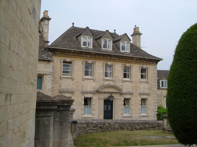
Painswick Lodge is a historic heritage site located in the picturesque town of Painswick in Gloucestershire, England. The lodge dates back to the 18th century and is known for its architectural significance and beautiful surroundings.

The lodge was originally built in 1790 as a hunting lodge for the Painswick House estate. It was designed in the Georgian style, with symmetrical proportions and elegant features. The building is constructed of local Cotswold stone, which adds to its charm and character.

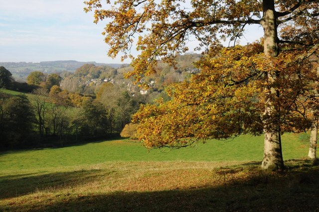
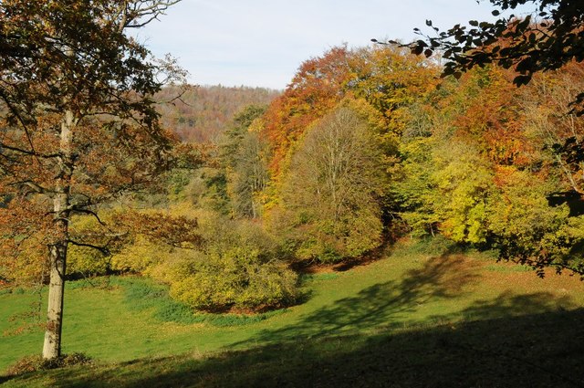
One of the standout features of Painswick Lodge is its stunning landscaped gardens. The lodge is surrounded by acres of lush greenery, including manicured lawns, flower beds, and mature trees. The gardens offer a peaceful retreat and provide a perfect backdrop for leisurely strolls or picnics.

The lodge itself has been carefully restored and maintained over the years, preserving its original charm and architectural details. It now serves as a private residence and is not open to the public. However, visitors can still appreciate the lodge's exterior and gardens from the nearby public footpaths.

Painswick Lodge is a testament to the rich history and architectural heritage of Gloucestershire. Its idyllic setting and well-preserved features make it a popular spot for photography and a must-see for history enthusiasts and nature lovers alike.

If you have any feedback on the listing, please let us know in the comments section below.

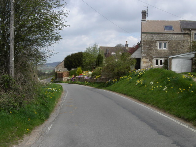
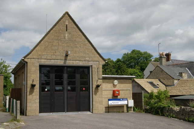
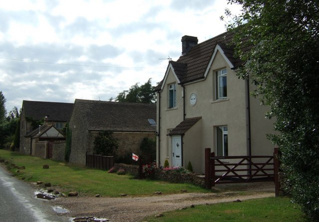
Painswick Lodge Images

Images are sourced within 2km of 51.792/-2.167 or Grid Reference SO8810. Thanks to Geograph Open Source API. All images are credited.

Beanfield, Bunnage Farm Opposite Bunnage Farm (not Bunnage Field Farm) was this huge field of beans.
Beanfield, Bunnage Farm
Opposite Bunnage Farm (not Bunnage Field Farm) was this huge field of beans.
House on the corner of the B4070  and the Miserden junction
House on the corner of the B4070 and the Miserden junction
Sheepscombe valley Autumn colours in the Sheepscombe valley, viewed from the footpath through the woodland on Elder Hill.
Sheepscombe valley
Autumn colours in the Sheepscombe valley, viewed from the footpath through the woodland on Elder Hill.
Autumn colours on Elder Hill Autumn colours on Elder Hill at the head of the Sheepscombe.
Autumn colours on Elder Hill
Autumn colours on Elder Hill at the head of the Sheepscombe.
An interesting manoeuvre on the B4070, 1 A fast stretch of road with a deceptively close bend up ahead.
See <a href="https://www.geograph.org.uk/photo/4865641">SO9010 : An interesting manoeuvre on the B4070, 2</a> taken 2 seconds later.
An interesting manoeuvre on the B4070, 1
A fast stretch of road with a deceptively close bend up ahead. See SO9010 : An interesting manoeuvre on the B4070, 2 taken 2 seconds later.
An interesting manoeuvre on the B4070, 2 Photo taken 2 seconds after <a href="https://www.geograph.org.uk/photo/4865639">SO9010 : An interesting manoeuvre on the B4070, 1</a>.
An interesting manoeuvre on the B4070, 2
Old Milestone by the B4070, east of Sheepscombe Metal plate attached to stone post by the B4070, in parish of MISERDEN (STROUD District), Sheepscombe; 250m West of crossroads to Sheepscombe and Miserden, on the verge, on South side of road. Lightpill plate, erected by the Lightpill & Birdlip turnpike trust in the 19th century. 

Inscription reads:-
CHELTM.
9
STROUD
5  
Carved benchmark and rivet on top.

Milestone Society National ID: GL_SDCM05.
Old Milestone by the B4070, east of Sheepscombe
Metal plate attached to stone post by the B4070, in parish of MISERDEN (STROUD District), Sheepscombe; 250m West of crossroads to Sheepscombe and Miserden, on the verge, on South side of road. Lightpill plate, erected by the Lightpill & Birdlip turnpike trust in the 19th century. Inscription reads:- CHELTM. 9 STROUD 5 Carved benchmark and rivet on top. Milestone Society National ID: GL_SDCM05.
Stone Stile off B4070 between Sheepscombe/Camp junctions  GS9252 Stone slab stile off B4070 between Sheepscombe and Camp junctions. On public right of way MMN52. View from field to road
Stone Stile off B4070 between Sheepscombe/Camp junctions GS9252
Stone slab stile off B4070 between Sheepscombe and Camp junctions. On public right of way MMN52. View from field to road
Stone Stile off B4070 between Sheepscombe/Camp junctions  GS9252 Stone slab stile off B4070 between Sheepscombe and Camp junctions. On public right of way MMN52
Stone Stile off B4070 between Sheepscombe/Camp junctions GS9252
Stone slab stile off B4070 between Sheepscombe and Camp junctions. On public right of way MMN52
Tibbiwell Lane, Painswick This road runs east and then SE down the hill to Brookhouse Mill.
Tibbiwell Lane, Painswick
This road runs east and then SE down the hill to Brookhouse Mill.
Farm trailers near Down Barn Farm, Slad
Track through woodland on Down Hill, Slad
Painswick viewed from across the valley This is a view of Painswick from the south-east, the picture is from the Slad Road near The Frith.
Painswick viewed from across the valley
This is a view of Painswick from the south-east, the picture is from the Slad Road near The Frith.
Longridge Village Longridge overlooks Painswick which lies 1Km to the West.
Longridge Village
Longridge overlooks Painswick which lies 1Km to the West.
Painswick Fire Station Painswick Fire Station, Pullens Road, Painswick, Gloucestershire is station number R06 of the Gloucestershire Fire & Rescue Service.
Painswick Fire Station
Painswick Fire Station, Pullens Road, Painswick, Gloucestershire is station number R06 of the Gloucestershire Fire & Rescue Service.
Longridge Court On the B4070 east of Slad, Longridge is a collection of mainly farming settlements. This is Longridge Court, the largest of the buildings at this location.
Longridge Court
On the B4070 east of Slad, Longridge is a collection of mainly farming settlements. This is Longridge Court, the largest of the buildings at this location.
Longridge The B4070 east of Longridge Court.
Longridge
The B4070 east of Longridge Court.
Vicarage, Painswick The facade of this early C18 clothier's house faces across St Mary's Street onto the churchyard with its yews.
Vicarage, Painswick
The facade of this early C18 clothier's house faces across St Mary's Street onto the churchyard with its yews.
Show me another place!

Painswick Lodge is located at Grid Ref: SO8810 (Lat: 51.792, Lng: -2.167)

Administrative County: Gloucestershire

District: Stroud

Police Authority: Gloucestershire

What 3 Words

///slap.dreams.longer. Near Painswick, Gloucestershire

Nearby Locations

The Green Painswick Lodge

Related Wikis

Painswick Lodge

Painswick Lodge is a grade I listed house in Painswick, Gloucestershire, England. The rubble stone building, which has been extensively reworked and remodelled...

Sheepscombe

Sheepscombe is a small village in the civil parish of Painswick, in the Stroud district, in the county of Gloucestershire, England. Sheepscombe is located...

Workmans Wood, Sheepscombe

Workmans Wood (grid reference SO900109) is a wood just to the east of the village of Sheepscombe, in the Cotswolds, Gloucestershire. It is a biological...
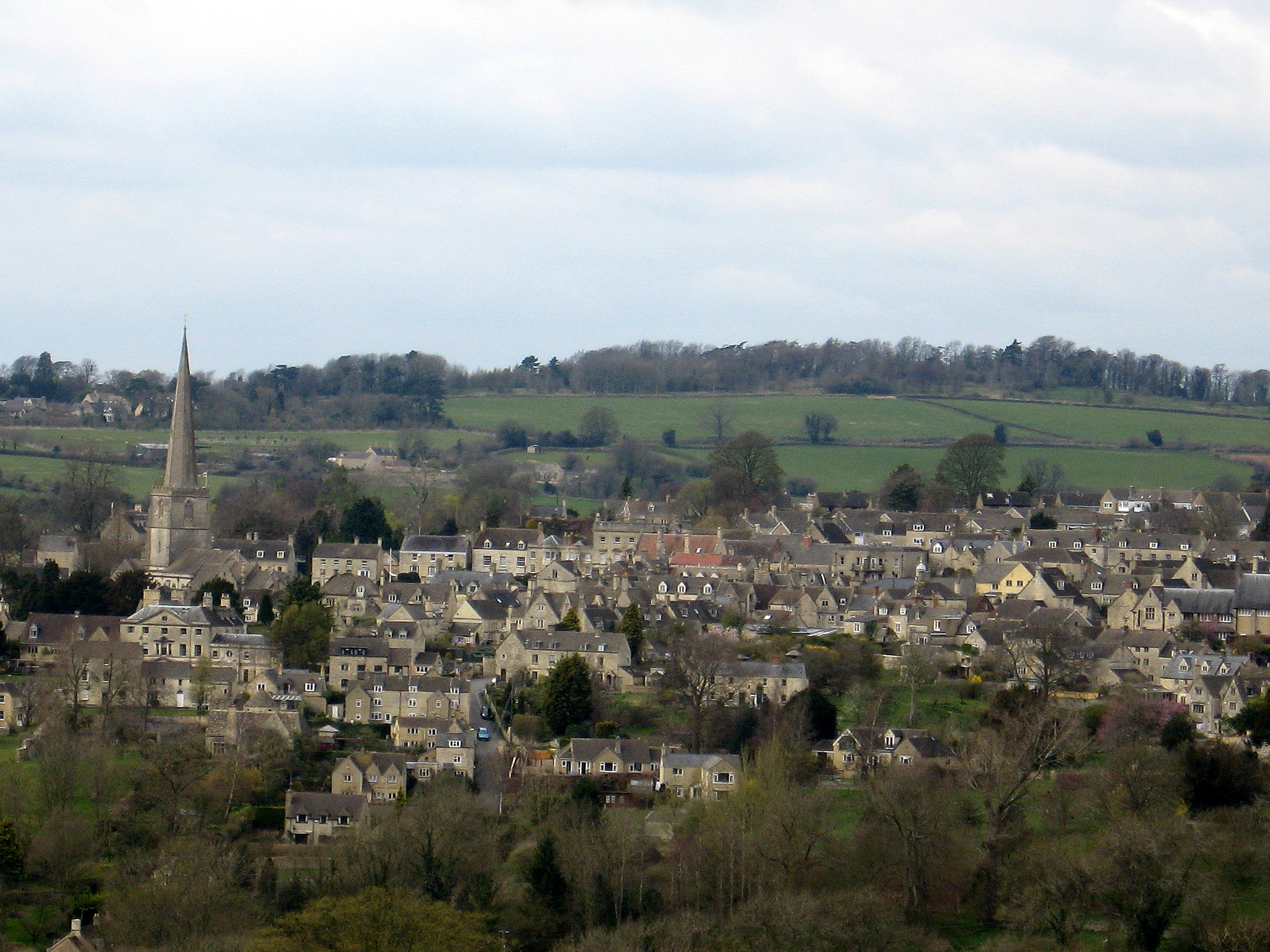
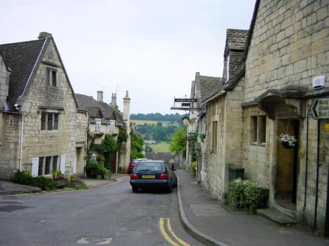
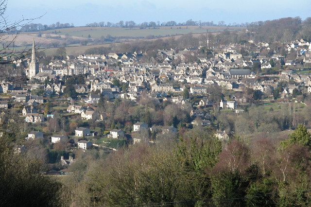
Painswick

Painswick is a town and civil parish in the Stroud District in Gloucestershire, England. Originally the town grew from the wool trade, but it is now best...

Painswick Town Hall

Painswick Town Hall is a municipal building in Victoria Square, Painswick, Gloucestershire, England. The building, which is used as an events venue and...

Beacon House

Beacon House is a grade I listed townhouse at New Street, Painswick, Gloucestershire, England. == History == The Palladian house was built in 1766, possibly...

Court House, Painswick

The Court House is a grade I listed house in Hale Lane, Painswick, Gloucestershire, England, within the Cotswolds. The house was built in the late 16th...

Snows Farm Nature Reserve

Snows Farm Nature Reserve (grid reference SO887081) is a 21.3-hectare (53-acre) nature reserve in Gloucestershire. The site is listed in the ‘Stroud District...

Related Videos

A Breathtaking Walk in a Cotswold Village with Dramatic Views

So, today we are out and about walking in the small Cotswold village of Sheepscombe which is located approximately 10 km (6.5 ...

Serene & Tranquil Early Morning Walk in Painswick | Cotswolds

So, today we are Out and about Walking in the town of Painswick which is a concluding walk following on from this video ...

WALKING WITH NINJA AT PAINSWICK BEACON

Oi oi we are back in the house again just a chill out walk peeps hope you enjoy ...

Walking Around Painswick

Painswick in Gloucestershire lies in the Five Valleys between Gloucester and Stroud. It was the wool trade that made Painswick ...

Nearby Amenities

Located within 500m of 51.792,-2.167
Bus Stop
Pyll House Farm
Naptan AtcoCode: 1600GLS573
Naptan Bearing: E
Naptan CommonName: Pyll House Farm
Naptan NaptanCode: glodjwam
Naptan PlusbusZoneRef: STRUD
Naptan Street: Jack's Green
Naptan Verified: no
Source: naptan_import
Lat/Long: 51.7886265/-2.1680791
Bus Stop
Pyll House Farm
Naptan AtcoCode: 1600GLS574
Naptan Bearing: W
Naptan BusStopType: CUS
Naptan CommonName: Pyll House Farm
Naptan Indicator: Opp
Naptan NaptanCode: glodjwdg
Naptan PlusbusZoneRef: STRUD
Naptan Street: Jack's Green
Naptan Verified: no
Source: naptan_import
Lat/Long: 51.7885094/-2.1676285
Pyll House Farm
Landuse: farm
Note Retag: CS #48756035
Source: OS OpenData StreetView
Lat/Long: 51.7892106/-2.1680845
Holy Well
Man Made: water_well
Source: OS OpenData StreetView
Lat/Long: 51.7942787/-2.1653204
Power: pole
Lat/Long: 51.7882504/-2.1684447
Power: pole
Lat/Long: 51.7878771/-2.1697684
Power: pole
Lat/Long: 51.7926617/-2.1711859
Power: pole
Lat/Long: 51.7933502/-2.1724264
Power: pole
Lat/Long: 51.7914822/-2.1696718
Power: pole
Lat/Long: 51.7925639/-2.172692
Power: transformer
Lat/Long: 51.7943389/-2.1720871
Power: pole
Lat/Long: 51.7927513/-2.1696638
Power: pole
Lat/Long: 51.7928517/-2.1680826
Power: pole
Lat/Long: 51.7929479/-2.1666839
Power: pole
Lat/Long: 51.7928301/-2.1655198
Power: pole
Lat/Long: 51.7898945/-2.1608286
Power: pole
Lat/Long: 51.7891048/-2.1684126
Power: pole
Lat/Long: 51.7925788/-2.1613235
Power: pole
Lat/Long: 51.792563/-2.1629489
Power: pole
Lat/Long: 51.7913561/-2.1622341
Power: pole
Lat/Long: 51.7898488/-2.1619552
Power: pole
Lat/Long: 51.7905431/-2.1620812
Power: pole
Lat/Long: 51.7918745/-2.1618385
Power: pole
Lat/Long: 51.7906866/-2.1692548
Power: pole
Lat/Long: 51.7926742/-2.1640755
Power: pole
Lat/Long: 51.7899318/-2.1688471
Barrier: cattle_grid
Source: Bing
Lat/Long: 51.7938902/-2.1606629
Barrier: stile
Lat/Long: 51.7905206/-2.1630028
Barrier: stile
Lat/Long: 51.7915534/-2.1623196
Barrier: stile
Lat/Long: 51.7932135/-2.1701534
Barrier: stile
Lat/Long: 51.7951681/-2.1691042
Ford: yes
Lat/Long: 51.7915302/-2.1623358
Man Made: water_well
Lat/Long: 51.7936362/-2.1606711
Power: pole
Lat/Long: 51.7939583/-2.161059
Natural: spring
Lat/Long: 51.7909837/-2.1625424
The data included in this document is from www.openstreetmap.org. The data is made available under ODbL.

Have you been to Painswick Lodge?

Leave your review of Painswick Lodge below (or comments, questions and feedback).