New Cross

Heritage Site in Yorkshire

England

New Cross

Heather burning on moors W of Emlin near Low Bradfield
Heather burning on moors W of Emlin near Low Bradfield Credit: Colin Park

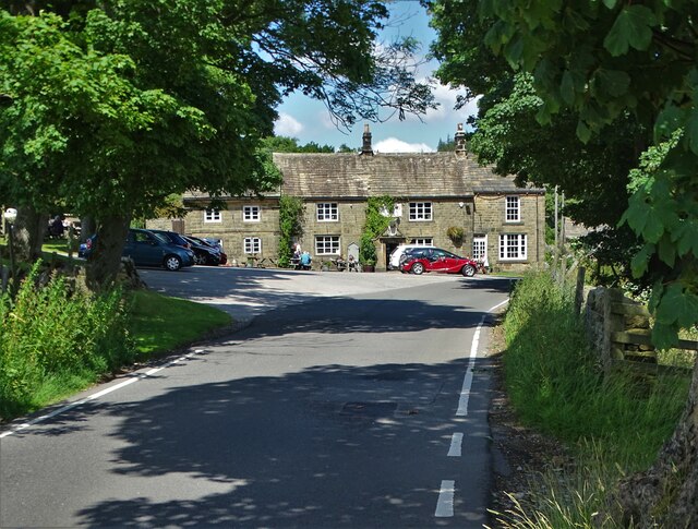
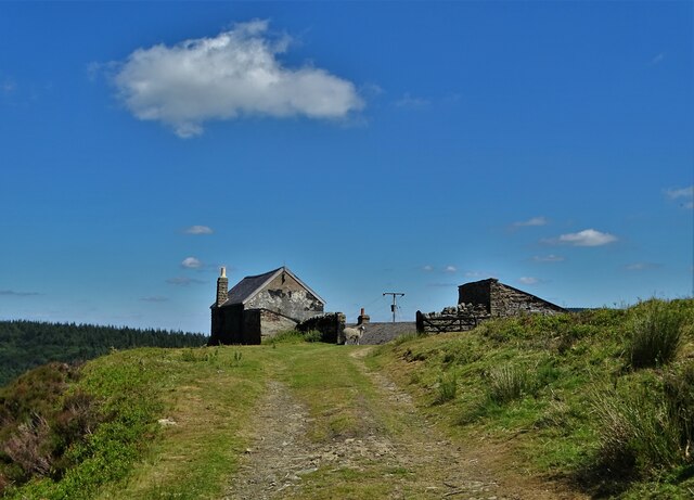
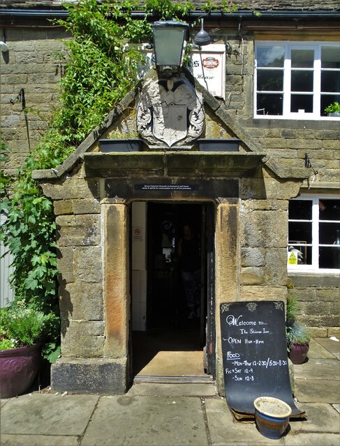
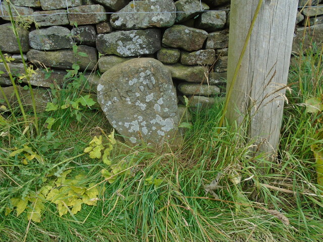
New Cross in Yorkshire is a historic heritage site that dates back to the 15th century. The village is known for its well-preserved medieval buildings, including a church, manor house, and several cottages. The architecture in New Cross is a blend of Gothic and Tudor styles, giving visitors a glimpse into the past.

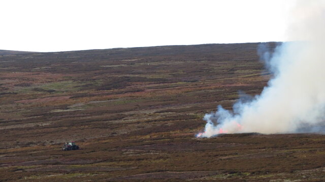
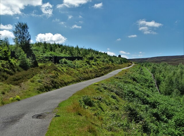
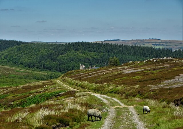
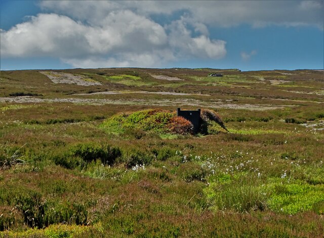
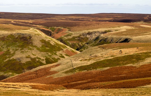
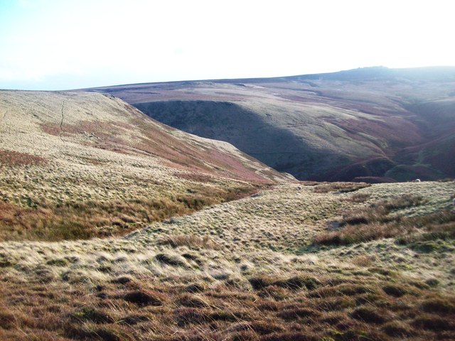
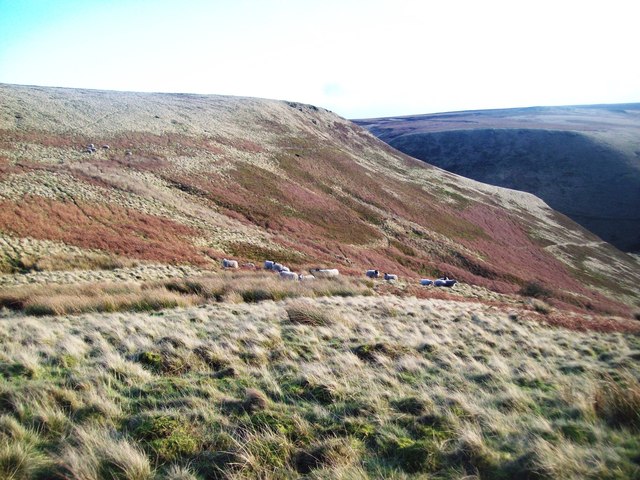
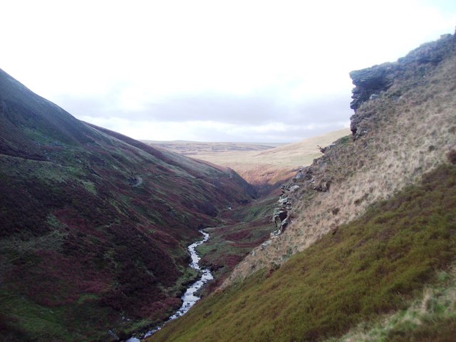
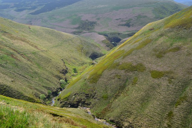
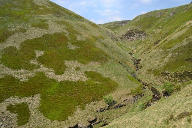
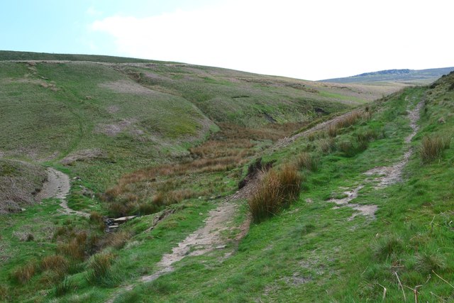
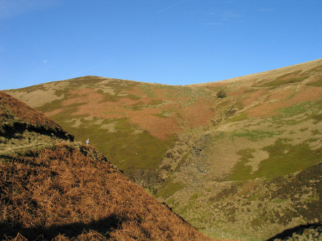
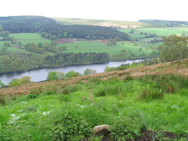
The village is surrounded by picturesque countryside, with rolling hills and lush green fields. The tranquil atmosphere of New Cross makes it a popular destination for those looking to escape the hustle and bustle of city life.

Visitors to New Cross can explore the village on foot, taking in the sights of the historic buildings and enjoying the peaceful surroundings. The church in New Cross is a particularly notable landmark, with its intricate stained glass windows and imposing steeple.

Overall, New Cross in Yorkshire is a charming heritage site that offers a glimpse into the rich history of the region. Visitors can immerse themselves in the past while enjoying the beauty of the surrounding countryside.

If you have any feedback on the listing, please let us know in the comments section below.

New Cross Images

Images are sourced within 2km of 53.428/-1.677 or Grid Reference SK2192. Thanks to Geograph Open Source API. All images are credited.

Heather burning on moors W of Emlin near Low Bradfield
Approaching "Strines Inn"
Foulstone Road It leads to Foulstone Delf and Derwent Moors. The area is under the control of Fitzwilliam Wentworth Estates - mostly for the purposes of grouse shooting.
Foulstone Road
It leads to Foulstone Delf and Derwent Moors. The area is under the control of Fitzwilliam Wentworth Estates - mostly for the purposes of grouse shooting.
Summer cloud over Foulstone Delf This moorland property is part of the Fitzwilliam-Wentworth Estates and is almost certainly connected with grouse shooting and rearing of game birds.
Summer cloud over Foulstone Delf
This moorland property is part of the Fitzwilliam-Wentworth Estates and is almost certainly connected with grouse shooting and rearing of game birds.
Looking back along Foulstone Road To Foulstone Delf - the property to the right of the track
Looking back along Foulstone Road
To Foulstone Delf - the property to the right of the track
Grouse butt No.10 on Foulstone Moor From here, during the shooting season, men with shotguns blast grouse out of the sky. They call it sport.
Grouse butt No.10 on Foulstone Moor
From here, during the shooting season, men with shotguns blast grouse out of the sky. They call it sport.
Entrance to "The Strines Inn" "The building that now houses The Strines Inn was originally a manor house built in 1275. Over the years it was extended and eventually converted into an inn in 1771." - copied from the pub's website.
Entrance to "The Strines Inn"
"The building that now houses The Strines Inn was originally a manor house built in 1275. Over the years it was extended and eventually converted into an inn in 1771." - copied from the pub's website.
Horse stone The Mortimer Road Turnpike first enacted in 1771, renewed 1792, failed by 1813.   Named after Hans Winthrop Mortimer, Lord of the Manor of Bamford.   It failed because it didn't make any money and didn't become an important route.   But it was very hilly!   Extra horses were needed and had to be paid for to help carts and carriages up very steep hills, so a stone such as this 'Take off' was placed at the top.   This one is about 30m north of the 16thC Strines Inn which is 1015ft above sea level.  
The stone is Grade II listed 1203771.
Horse stone
The Mortimer Road Turnpike first enacted in 1771, renewed 1792, failed by 1813. Named after Hans Winthrop Mortimer, Lord of the Manor of Bamford. It failed because it didn't make any money and didn't become an important route. But it was very hilly! Extra horses were needed and had to be paid for to help carts and carriages up very steep hills, so a stone such as this 'Take off' was placed at the top. This one is about 30m north of the 16thC Strines Inn which is 1015ft above sea level. The stone is Grade II listed 1203771.
Horse stone Standing away from the 'Take off' stone near The Strines Inn, its position near a telegraph pole on the east side of Mortimer Road can be seen.  The story of this road can be read in 'The Mortimer Road' by Howard Smith. ISBN 978-1-5272-3446-8.
Horse stone
Standing away from the 'Take off' stone near The Strines Inn, its position near a telegraph pole on the east side of Mortimer Road can be seen. The story of this road can be read in 'The Mortimer Road' by Howard Smith. ISBN 978-1-5272-3446-8.
Abbey Brook The head of Abbey Brook, the confluence of Cartledge Brook and Crook Clough.
Abbey Brook
The head of Abbey Brook, the confluence of Cartledge Brook and Crook Clough.
Foul Clough Small clough which falls sharply towards Abbey Brook further ahead. The heather on the higher ground has given way to tussocks of rough grass in this area.
Foul Clough
Small clough which falls sharply towards Abbey Brook further ahead. The heather on the higher ground has given way to tussocks of rough grass in this area.
Sheep in Foul Clough Hardy sheep grazing above Abbey Clough. Their narrow tracks pick the easiest route down the steep gorge to the brook below.
Sheep in Foul Clough
Hardy sheep grazing above Abbey Clough. Their narrow tracks pick the easiest route down the steep gorge to the brook below.
Abbey Brook and Berristers Tor Looking downstream from a slightly precarious position near the tor which juts out to the right of picture.
Abbey Brook and Berristers Tor
Looking downstream from a slightly precarious position near the tor which juts out to the right of picture.
Looking westwards along Abbey Clough
Looking north to Berristers Tor
Paths meeting in Sheepfold Clough
Howden Edge and Foul Clough Foul Clough is the stream groove descending steeply in the centre of the image. The view is across the gulf of the valley of Abbey Brook from a track in Sheepfold Clough.
Howden Edge and Foul Clough
Foul Clough is the stream groove descending steeply in the centre of the image. The view is across the gulf of the valley of Abbey Brook from a track in Sheepfold Clough.
Top section of the Abbey Brook valley View upstream from the corner by Sheepfold Clough.  In the foreground is one of a couple of curious ridged mounds with dry channels between - the present streams have carved still deeper channels beyond.  An intriguing and memorable spot.
Top section of the Abbey Brook valley
View upstream from the corner by Sheepfold Clough. In the foreground is one of a couple of curious ridged mounds with dry channels between - the present streams have carved still deeper channels beyond. An intriguing and memorable spot.
Show me another place!

New Cross is located at Grid Ref: SK2192 (Lat: 53.428, Lng: -1.677)

Division: West Riding

Unitary Authority: Sheffield

Police Authority: South Yorkshire

What 3 Words

///sooner.redefined.website. Near Bradfield, South Yorkshire

Nearby Locations

New Cross Rushy Flat

Related Wikis

Hallfield House

Hallfield House is a Grade II listed building situated in Bradfield Dale, 1.7 miles (2.74 km) west of the village of Low Bradfield, near Sheffield in England...

Strines Reservoir

Strines Reservoir is a water storage reservoir situated at 53.4099°N 1.6557°W / 53.4099; -1.6557 (Strines_Reservoir), 8 miles (13 km) west of the centre...

Lost Lad

Lost Lad is a hill, 518 metres (1,699 ft) high on the Derwent Edge in the Peak District in the county of Derbyshire in England. It is a subpeak of Back...

Dale Dike Reservoir

Dale Dike Reservoir or Dale Dyke Reservoir (grid reference SK240913) is a reservoir in the north-east Peak District, in the City of Sheffield, South Yorkshire...

Nearby Amenities

Located within 500m of 53.428,-1.677
Natural: peak
Lat/Long: 53.4322708/-1.6754055
Hunting Stand
Hunting Stand: grouse_butt
Lat/Long: 53.4275714/-1.6821994
Hunting Stand
Hunting Stand: grouse_butt
Lat/Long: 53.4278611/-1.6834911
Hunting Stand
Hunting Stand: grouse_butt
Lat/Long: 53.4277382/-1.6829313
Hunting Stand
Hunting Stand: grouse_butt
Lat/Long: 53.4279942/-1.6841355
The data included in this document is from www.openstreetmap.org. The data is made available under ODbL.

Have you been to New Cross?

Leave your review of New Cross below (or comments, questions and feedback).