Mutford Hall

Heritage Site in Suffolk East Suffolk

England

Mutford Hall

Barn Conversion at The Elms <span class="nowrap"><a title="https://historicengland.org.uk/listing/the-list/list-entry/1284275?section=official-list-entry" rel="nofollow ugc noopener" href="https://historicengland.org.uk/listing/the-list/list-entry/1284275?section=official-list-entry">Link</a><img style="margin-left:2px;" alt="External link" title="External link - shift click to open in new window" src="https://s1.geograph.org.uk/img/external.png" width="10" height="10"/></span>
Barn Conversion at The Elms Credit: Sandy Gerrard

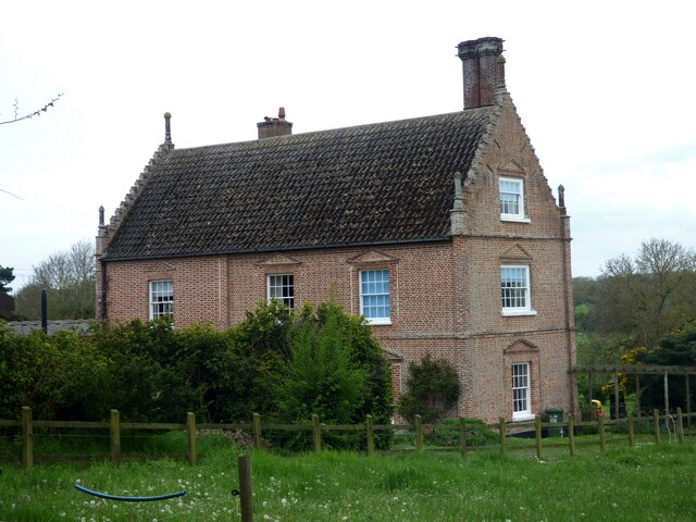
Mutford Hall, located in the county of Suffolk, England, is a historic heritage site renowned for its architectural beauty and rich history. The hall is situated in the village of Mutford, near the town of Beccles.

Originally built in the 16th century, Mutford Hall showcases a stunning example of Tudor architecture. The hall has been well-preserved over the centuries and retains many of its original features, including intricate woodwork, leaded windows, and a grand oak staircase. The exterior of the building is adorned with ornate brickwork, adding to its visual appeal.

The hall has a fascinating history, having been owned by several influential families throughout the years. In the 19th century, it was the residence of Sir Morton Peto, a prominent railway contractor, who made significant renovations to the property. Today, the hall is privately owned and not open to the public, but its striking exterior can still be admired from the outside.

Surrounded by picturesque gardens and set amidst the Suffolk countryside, Mutford Hall offers a tranquil and idyllic setting. The estate features manicured lawns, mature trees, and colorful flowerbeds, creating a delightful ambiance for visitors.

Due to its architectural significance and historical background, Mutford Hall is recognized as an important heritage site in Suffolk. It serves as a reminder of the region's rich past and attracts architecture enthusiasts and history buffs alike.

If you have any feedback on the listing, please let us know in the comments section below.

Mutford Hall Images

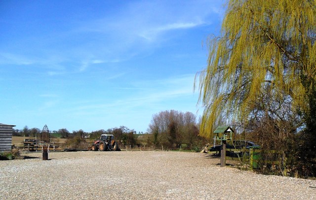
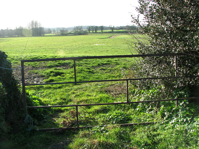
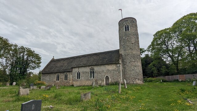
Images are sourced within 2km of 52.428/1.655 or Grid Reference TM4887. Thanks to Geograph Open Source API. All images are credited.

Barn Conversion at The Elms <span class="nowrap"><a title="https://historicengland.org.uk/listing/the-list/list-entry/1284275?section=official-list-entry" rel="nofollow ugc noopener" href="https://historicengland.org.uk/listing/the-list/list-entry/1284275?section=official-list-entry">Link</a><img style="margin-left:2px;" alt="External link" title="External link - shift click to open in new window" src="https://s1.geograph.org.uk/img/external.png" width="10" height="10"/></span>
Barn Conversion at The Elms
Car park, Henstead Art and Craft workshops
Heaps of muck by The Elms
Black Street past The Elms
Bungalow under construction in Black Street
View along Blower's Lane
Duck's Entry According to the map this is the name for the house seen in mid-distance. It currently is the home of Rushmere Boarding Kennels & Cattery in Blower's Lane.
Duck's Entry
According to the map this is the name for the house seen in mid-distance. It currently is the home of Rushmere Boarding Kennels & Cattery in Blower's Lane.
Fields by Blower's Lane
Cottage by Blower's Lane junction
Marsh pastures by Latymere Dam
Pond & Pond Farm View of pond adjacent to Pond Farm (right) looking down Mutford Wood (lane) towards St John the Baptist at Barnby.
Pond & Pond Farm
View of pond adjacent to Pond Farm (right) looking down Mutford Wood (lane) towards St John the Baptist at Barnby.
Bridleway near Mutford
Church of St Michael and All Angels, Rushmere <span class="nowrap"><a title="https://historicengland.org.uk/listing/the-list/list-entry/1032082?section=official-list-entry" rel="nofollow ugc noopener" href="https://historicengland.org.uk/listing/the-list/list-entry/1032082?section=official-list-entry">Link</a><img style="margin-left:2px;" alt="External link" title="External link - shift click to open in new window" src="https://s1.geograph.org.uk/img/external.png" width="10" height="10"/></span>
Church of St Michael and All Angels, Rushmere
Church of St. Andrew, Mutford <span class="nowrap"><a title="https://historicengland.org.uk/listing/the-list/list-entry/1032081?section=official-list-entry" rel="nofollow ugc noopener" href="https://historicengland.org.uk/listing/the-list/list-entry/1032081?section=official-list-entry">Link</a><img style="margin-left:2px;" alt="External link" title="External link - shift click to open in new window" src="https://s1.geograph.org.uk/img/external.png" width="10" height="10"/></span>
Church of St. Andrew, Mutford
Mutford War Memorial <span class="nowrap"><a title="https://historicengland.org.uk/listing/the-list/list-entry/1458638?section=official-list-entry" rel="nofollow ugc noopener" href="https://historicengland.org.uk/listing/the-list/list-entry/1458638?section=official-list-entry">Link</a><img style="margin-left:2px;" alt="External link" title="External link - shift click to open in new window" src="https://s1.geograph.org.uk/img/external.png" width="10" height="10"/></span>
Mutford War Memorial
Rushmere Hall <span class="nowrap"><a title="https://historicengland.org.uk/listing/the-list/list-entry/1284310?section=official-list-entry" rel="nofollow ugc noopener" href="https://historicengland.org.uk/listing/the-list/list-entry/1284310?section=official-list-entry">Link</a><img style="margin-left:2px;" alt="External link" title="External link - shift click to open in new window" src="https://s1.geograph.org.uk/img/external.png" width="10" height="10"/></span>
Rushmere Hall
Show me another place!

Mutford Hall is located at Grid Ref: TM4887 (Lat: 52.428, Lng: 1.655)

Administrative County: Suffolk

District: East Suffolk

Police Authority: Suffolk

What 3 Words

///first.excuse.utensil. Near Kessingland, Suffolk

Related Wikis

Mutford

Mutford is a village and civil parish in the East Suffolk District of the English county of Suffolk. The village is 5 miles (8.0 km) south-west of Lowestoft...

Rushmere, north Suffolk

Rushmere is a village and civil parish in the East Suffolk district of the English county of Suffolk. The village is around 5 miles (8.0 km) south-west...

Henstead with Hulver Street

Henstead with Hulver Street is a civil parish in the East Suffolk district of the English county of Suffolk. It is around 5 miles (8.0 km) south-west of...

Henstead

Henstead is a village near Kessingland and the A12 in the civil parish of Henstead with Hulver Street, in the county of Suffolk, England. It has a church...

Nearby Amenities

Located within 500m of 52.428,1.655
Power: pole
Lat/Long: 52.4247663/1.6545515
Power: pole
Lat/Long: 52.4251694/1.6533995
Power: pole
Lat/Long: 52.4256748/1.6520154
Power: pole
Lat/Long: 52.4262129/1.6504544
Power: pole
Lat/Long: 52.4252529/1.6499448
Power: pole
Lat/Long: 52.4253968/1.6520436
Power: pole
Lat/Long: 52.4255129/1.6541398
Power: pole
Lat/Long: 52.4255996/1.6557303
Power: pole
Lat/Long: 52.4257223/1.6573061
Power: pole
Lat/Long: 52.4257583/1.6582301
Power: pole
Lat/Long: 52.4258449/1.6596195
Power: pole
Lat/Long: 52.4259349/1.6609982
The data included in this document is from www.openstreetmap.org. The data is made available under ODbL.

Have you been to Mutford Hall?

Leave your review of Mutford Hall below (or comments, questions and feedback).