Manor House

Heritage Site in Sussex Rother

England

Manor House

Bridleway at the end of Lakehurst Lane
Bridleway at the end of Lakehurst Lane Credit: Julian P Guffogg

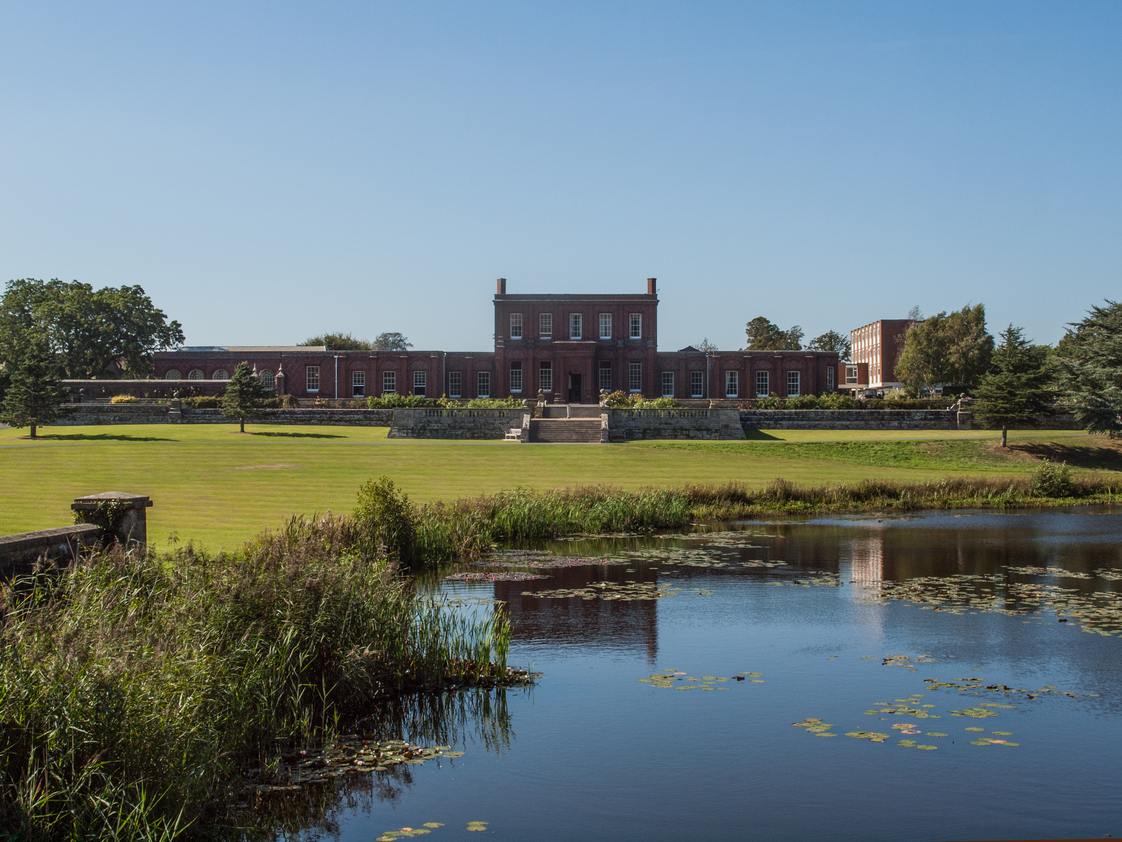
Manor House, Sussex is a historic heritage site located in the picturesque county of Sussex, in southern England. Dating back to the 16th century, the manor house is a prime example of Tudor architecture and is renowned for its beautiful and well-preserved features.

The house is characterized by its timber-framed structure, with intricately carved beams and ornate details that showcase the craftsmanship of the era. The interior of the manor house is equally impressive, with original oak paneling, grand fireplaces, and stunning stained glass windows that add to its charm.

The manor house is set within a sprawling estate, surrounded by lush green gardens and rolling countryside. The gardens are meticulously maintained and feature a variety of plant species, including vibrant flowers and ancient trees. Visitors can enjoy leisurely strolls through the gardens, taking in the serene atmosphere and admiring the natural beauty.

Throughout its history, Manor House has been home to several notable figures, including influential families and even royalty. The house has witnessed significant events and has been witness to many stories, adding to its historical significance.

Today, Manor House, Sussex is open to the public, offering visitors a chance to step back in time and experience the grandeur of the Tudor era. Guided tours are available, allowing visitors to explore the various rooms and learn about the history of the house and its inhabitants. Additionally, the estate hosts various events and exhibitions, providing a unique and immersive experience for all who visit.

If you have any feedback on the listing, please let us know in the comments section below.

Manor House Images

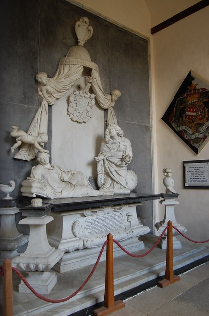
Images are sourced within 2km of 50.922/0.412 or Grid Reference TQ6916. Thanks to Geograph Open Source API. All images are credited.

Bridleway at the end of Lakehurst Lane
Fields near Penshurst
Minor road near Ponts Green, East Sussex The church in the distance is that of the parish of Penhurst.
Minor road near Ponts Green, East Sussex
The church in the distance is that of the parish of Penhurst.
Ashburnham United Reformed Church
Minor road junction, Ponts Green, East Sussex
Trees off Dubbs Lane The 1066 Walk runs along the hedgerow
Trees off Dubbs Lane
The 1066 Walk runs along the hedgerow
Lane to Penshurst
Lane to Penshurst
Bridge on Lane to Penshurst
Stile on 1066 Walk
Stile on 1066 Walk
1066 Country Walk through a Field The path is very clearly marked!
1066 Country Walk through a Field
The path is very clearly marked!
New Footbridge over Ash Bourne The bridge appears to be very new. See <a href="https://www.geograph.org.uk/photo/2190185">TQ6915 : 1066 Country walk crosses Ash Bourne</a>
New Footbridge over Ash Bourne
The bridge appears to be very new. See TQ6915 : 1066 Country walk crosses Ash Bourne
St Peter's Church, Ashburnham Grade I listed. 15th C. tower, but the rest of the  church was rebuilt by John Ashburnham in 1663 - a rare example of Gothic building of the 17th C. Underneath the  east end of the  Church is the Ashburnham vault, containing over 40 coffins of members of the Ashburnham family, covering over 300 years.
St Peter's Church, Ashburnham
Grade I listed. 15th C. tower, but the rest of the church was rebuilt by John Ashburnham in 1663 - a rare example of Gothic building of the 17th C. Underneath the east end of the Church is the Ashburnham vault, containing over 40 coffins of members of the Ashburnham family, covering over 300 years.
Memorial to William Ashburnham and Jane, Countess of Marlborough Fine example of the work of John Bushnell, 1675. Located in the north Chapel over the Ashburnham Vault.
Memorial to William Ashburnham and Jane, Countess of Marlborough
Fine example of the work of John Bushnell, 1675. Located in the north Chapel over the Ashburnham Vault.
Monument to John Ashburnham St Peter's Church, Ashburnham
Monument to John Ashburnham
St Peter's Church, Ashburnham
Children of John Ashburnham Four male (left) and four female children in this unusually late mediaeval tradition of weepers.
Children of John Ashburnham
Four male (left) and four female children in this unusually late mediaeval tradition of weepers.
Marking Stone, Penhurst Church Discovered in 1959, it is thought that this is a 14th C. setting out stone for the tracery of a window
Marking Stone, Penhurst Church
Discovered in 1959, it is thought that this is a 14th C. setting out stone for the tracery of a window
St Peter, Ashburnham
St Peter, Ashburnham - Interior
Show me another place!

Manor House is located at Grid Ref: TQ6916 (Lat: 50.922, Lng: 0.412)

Administrative County: East Sussex

District: Rother

Police Authority: Sussex

What 3 Words

///composts.partners.obliging. Near Ninfield, East Sussex

Related Wikis

Penhurst

Penhurst is a village and civil parish, sharing a parish council with neighbouring Ashburnham, in the Rother district of East Sussex, England. It is located...

Battle of Mercredesburne

The Battle of Mercredesburne was one of three battles fought as part of the conquest of what became the Kingdom of Sussex in southern England. The battles...

Ashburnham Park

Ashburnham Park is a 109.9-hectare (272-acre) biological Site of Special Scientific Interest north-west of Hastings in East Sussex. It is a Nature Conservation...

Ashburnham Place

Ashburnham Place is an English country house, now used as a Christian conference and prayer centre, five miles west of Battle, East Sussex. It was one...

Nearby Amenities

Located within 500m of 50.922,0.412
Penhurst
Place: village
Source: npe
Lat/Long: 50.9238316/0.4090933
Power: pole
Lat/Long: 50.9192088/0.4080819
Power: pole
Lat/Long: 50.9194197/0.41036
Power: pole
Lat/Long: 50.9195726/0.4119967
Power: pole
Lat/Long: 50.9199137/0.4156105
Power: pole
Lat/Long: 50.9197906/0.4142163
Power: pole
Lat/Long: 50.9200701/0.4172556
The data included in this document is from www.openstreetmap.org. The data is made available under ODbL.

Have you been to Manor House?

Leave your review of Manor House below (or comments, questions and feedback).