Maen Achwyfaen

Heritage Site in Flintshire

Wales

Maen Achwyfaen

Guidepost at road junction, Trelogan WHITFORD
HOLYWELL
GLANRAFON
Guidepost at road junction, Trelogan Credit: Meirion

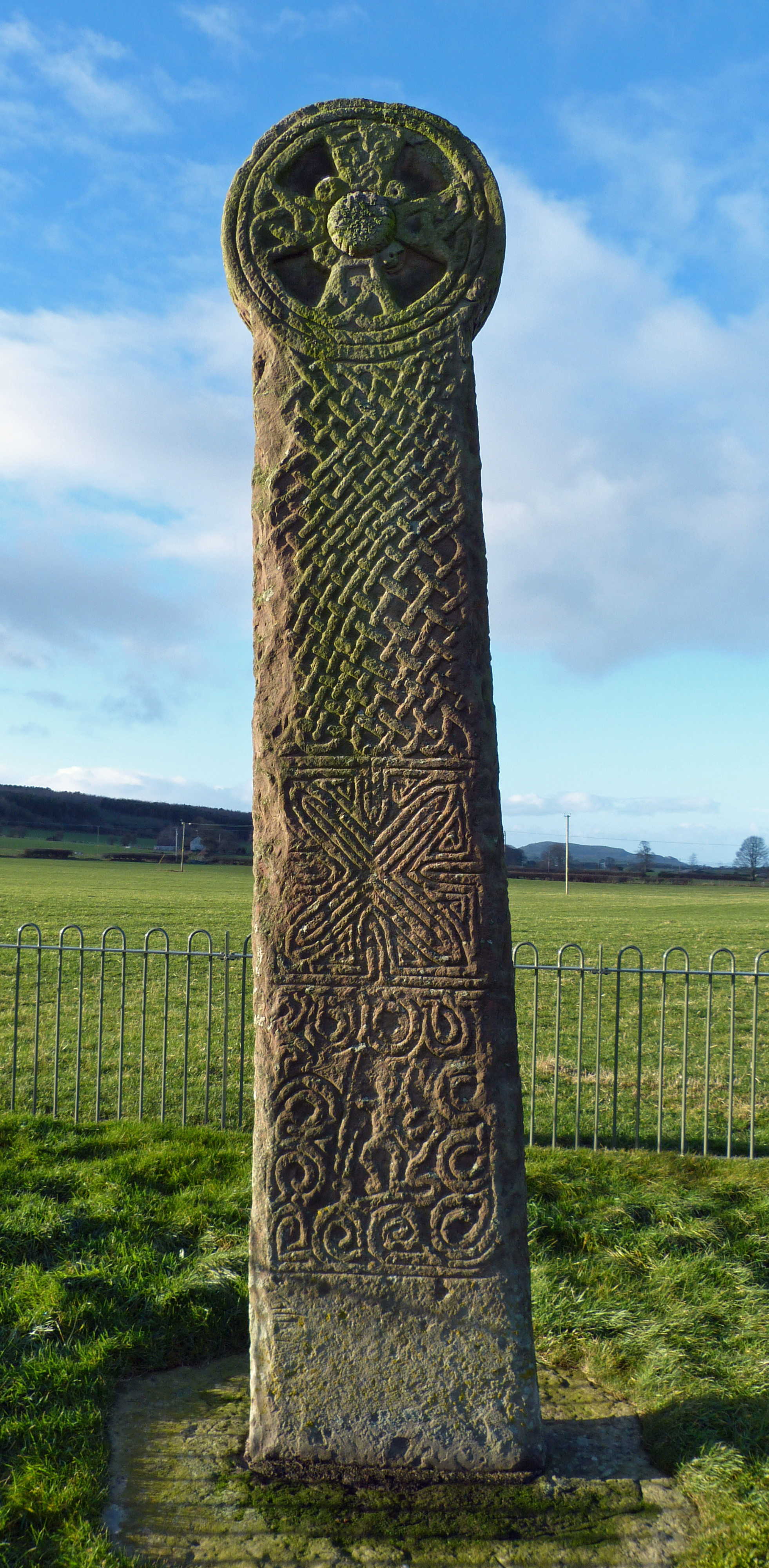
Maen Achwyfaen is a historic standing stone located in Flintshire, Wales. The stone is believed to date back to the Bronze Age, making it over 4,000 years old. It stands at approximately 2.4 meters tall and is made of sandstone.

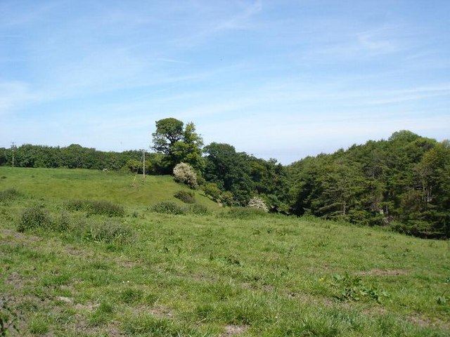
The stone is situated in a picturesque rural landscape, surrounded by fields and trees. It is thought to have been used as a marker or boundary stone by the ancient inhabitants of the area. The name "Achwyfaen" translates to "field of stones," reflecting the presence of other standing stones in the vicinity.

Maen Achwyfaen is a protected heritage site, and visitors are encouraged to respect its significance and historical value. The stone serves as a reminder of the ancient peoples who once inhabited this area and offers a glimpse into the rich history of Flintshire.

Visitors to Maen Achwyfaen can enjoy a tranquil and scenic setting, perfect for quiet contemplation and reflection on the passage of time. The stone's enduring presence is a testament to the enduring legacy of Wales' ancient past.

If you have any feedback on the listing, please let us know in the comments section below.

Maen Achwyfaen Images

Images are sourced within 2km of 53.297/-3.313 or Grid Reference SJ1278. Thanks to Geograph Open Source API. All images are credited.

Guidepost at road junction, Trelogan WHITFORD
HOLYWELL
GLANRAFON
Guidepost at road junction, Trelogan
WHITFORD HOLYWELL GLANRAFON
Damaged benchmark on derelict building, Trelogan For more details see: <span class="nowrap"><a title="https://www.bench-marks.org.uk/bm180728" rel="nofollow ugc noopener" href="https://www.bench-marks.org.uk/bm180728">Link</a><img style="margin-left:2px;" alt="External link" title="External link - shift click to open in new window" src="https://s1.geograph.org.uk/img/external.png" width="10" height="10"/></span>
Damaged benchmark on derelict building, Trelogan
For more details see: LinkExternal link
Mynydd y Garreg Tower May have been a windmill and then converted to a Roman Pharos folly?
Mynydd y Garreg Tower
May have been a windmill and then converted to a Roman Pharos folly?
Maen Achwyfan Wheel Cross
Fields surrounding Trelogan Farm and Berth-y-Maen
Footpath through agricultural land surrounding Wern Farm
Afon Goch pub sign, Trelogan
Trelogan fields Fields in the hills near Trelogan
Trelogan fields
Fields in the hills near Trelogan
Stile for footpath through Bryn Digrif land
Glol Woodland
Glol Woodland
Kissing gate for access to paths beside Glol woodland
Across fields towards Ty-newydd Farm Berthengam is in the distance
Across fields towards Ty-newydd Farm
Berthengam is in the distance
Across fields to Glol Farm
Track to Maen y Glol
Kissing gate for path to Mynydd Mostyn
Field south of Mynydd Mostyn There is a superb view from here over Marian Ffrith to the mountains of Snowdonia
Field south of Mynydd Mostyn
There is a superb view from here over Marian Ffrith to the mountains of Snowdonia
Mynydd Mostyn Farm near Berthengam
Pen-y-Bryn Road in Berthengam
Show me another place!

Maen Achwyfaen is located at Grid Ref: SJ1278 (Lat: 53.297, Lng: -3.313)

Unitary Authority: Flintshire

Police Authority: North Wales

What 3 Words

///nitrogen.commenced.boomer. Near Whitford, Flintshire

Related Wikis

Maen Achwyfan Cross

Maen Achwyfan Cross (Welsh: Maen Achwyfan, Croes Maen Achwyfan), located near the village of Whitford, Flintshire, Wales, is a high cross dating from the...

Trelogan

Trelogan is a village in Flintshire, north east Wales. It is located between Mostyn and Trelawnyd and is almost contiguous with Berthengam. Trelogan had...

Whitford, Flintshire

Whitford (Welsh: Chwitffordd) is a village, community and an electoral ward near Holywell in Flintshire, northeast Wales. The population of both the community...

Church of St Beuno and St Mary

The Church of St Beuno and St Mary is a Grade I listed church in Whitford, overlooking the estuary of the river Dee. The church has a well preserved late...

Nearby Amenities

Located within 500m of 53.297,-3.313
Ref: 22
Lat/Long: 53.2993918/-3.3099469
Maen Achwynfan Cross
Height: 2.5
Historic: monument
Place: locality
Lat/Long: 53.298671/-3.3085378
Ref: 21
Lat/Long: 53.2989564/-3.3079398
Gelli
Place: hamlet
Lat/Long: 53.2931555/-3.311655
Power: pole
Lat/Long: 53.2938452/-3.3088686
Power: pole
Lat/Long: 53.294422/-3.3100138
Power: pole
Lat/Long: 53.2949767/-3.3111393
Power: pole
Lat/Long: 53.2964799/-3.3119809
Power: pole
Lat/Long: 53.2975966/-3.3126078
Power: pole
Lat/Long: 53.2983267/-3.3128152
Power: pole
Lat/Long: 53.2995658/-3.3131681
Power: pole
Lat/Long: 53.3007251/-3.3135013
Power: pole
Lat/Long: 53.2978242/-3.3196777
Power: pole
Lat/Long: 53.2969704/-3.3191773
Power: pole
Lat/Long: 53.2960814/-3.3180171
Power: pole
Lat/Long: 53.2950855/-3.3167398
Power: pole
Lat/Long: 53.2944675/-3.3159282
Power: pole
Lat/Long: 53.2935371/-3.3147297
Post Box
Collection Times: Mo-Sa 11:00
Operator: Royal Mail
Post Box Type: lamp
Ref: CH8 12
Royal Cypher: EIIR
Royal Cypher Wikidata: Q33102113
Source: survey
Survey Date: 2014-03-24
Lat/Long: 53.2990762/-3.3079692
Barrier: kissing_gate
Foot: yes
Motor Vehicle: no
Source: survey
Survey Date: 2014-03-24
Lat/Long: 53.2990872/-3.3084138
Bryn Digrif Barrow I
Archaeological Site: tumulus
Historic: archaeological_site
Lat/Long: 53.298934/-3.313029
Power: pole
Lat/Long: 53.2981743/-3.3141351
Power: pole
Lat/Long: 53.2980877/-3.3128664
Power: pole
Lat/Long: 53.2979643/-3.3112141
Power: pole
Lat/Long: 53.2985686/-3.3104846
Power: pole
Lat/Long: 53.2990142/-3.3100393
Power: pole
Lat/Long: 53.2982739/-3.3151918
Power: pole
Lat/Long: 53.2983767/-3.3167205
Power: pole
Lat/Long: 53.2984429/-3.3179474
Direction: 190
Generator Method: photovoltaic
Generator Output Electricity: yes
Generator Solar Modules: 8
Generator Source: solar
Generator Type: solar_photovoltaic_panel
Location: roof
Power: generator
Lat/Long: 53.2940711/-3.3105218
Direction: 190
Generator Method: photovoltaic
Generator Output Electricity: yes
Generator Solar Modules: 15
Generator Source: solar
Generator Type: solar_photovoltaic_panel
Location: roof
Power: generator
Lat/Long: 53.2994983/-3.3078504
Direction: SSE
Generator Method: photovoltaic
Generator Output Electricity: yes
Generator Solar Modules: 17
Generator Source: solar
Generator Type: solar_photovoltaic_panel
Location: roof
Power: generator
Lat/Long: 53.2990046/-3.3071101
Power: pole
Lat/Long: 53.2983499/-3.3195617
Power: pole
Lat/Long: 53.2929129/-3.3139746
Power: pole
Lat/Long: 53.2965075/-3.3129924
Power: pole
Lat/Long: 53.2950065/-3.3122333
Power: pole
Lat/Long: 53.2945501/-3.311726
Power: pole
Lat/Long: 53.2974074/-3.3136023
Power: pole
Lat/Long: 53.2954223/-3.3113743
The data included in this document is from www.openstreetmap.org. The data is made available under ODbL.

Have you been to Maen Achwyfaen?

Leave your review of Maen Achwyfaen below (or comments, questions and feedback).