Madresfield Court

Heritage Site in Worcestershire Malvern Hills

England

Madresfield Court

Construction of the new Tesco Express On the site of the Gas Tavern pub.
Construction of the new Tesco Express Credit: Bob Embleton

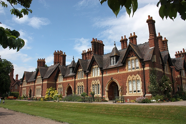
Madresfield Court is a historic manor house located in Worcestershire, England. It is situated about four miles east of Malvern and is considered a significant heritage site due to its architectural beauty and rich history. The origins of the estate can be traced back to the 12th century when it was owned by the Beauchamp family.

The current building, however, dates back to the early 19th century when it was reconstructed in the Jacobean style. The manor house is renowned for its stunning red brick exterior adorned with elegant mullioned windows, gables, and a large central tower. The interiors are equally impressive, featuring grand reception rooms, intricate woodwork, and elaborate plaster ceilings.

Madresfield Court is also famous for its association with the Lygon family, who have owned the estate for over 900 years. The Lygons are a prominent aristocratic family, and their history is deeply intertwined with the house. The most notable member of the family was the 7th Earl Beauchamp, who served as Lord President of the Council during the 1920s. His life and scandalous affair with a male servant inspired Evelyn Waugh's novel "Brideshead Revisited."

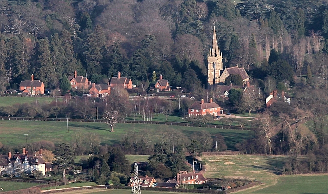
The estate is set within extensive parkland, encompassing beautiful gardens, a deer park, and a lake. Visitors can explore the stunning grounds and take in the picturesque views. Madresfield Court is open to the public on specific days throughout the year, allowing visitors to appreciate its architectural splendor and immerse themselves in its fascinating history.

If you have any feedback on the listing, please let us know in the comments section below.

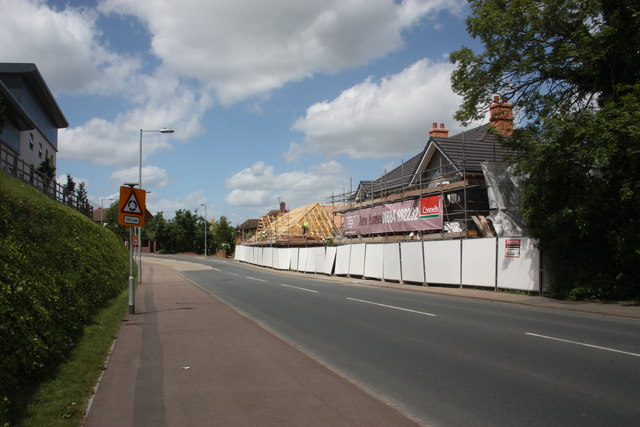
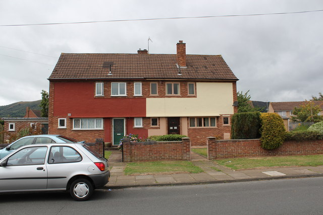
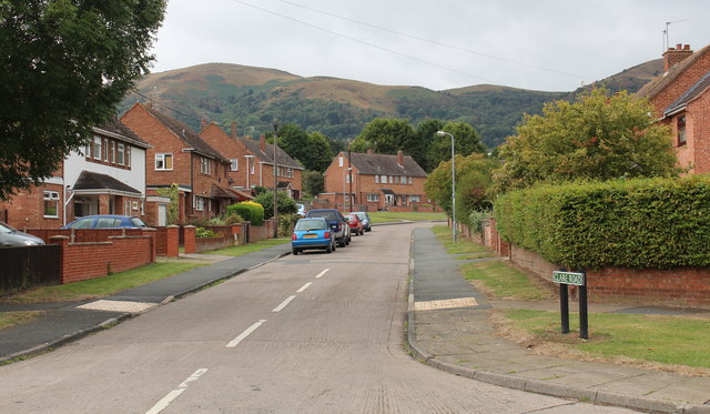
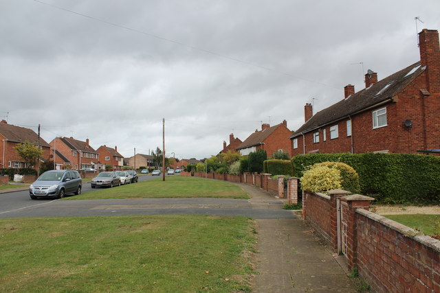
Madresfield Court Images

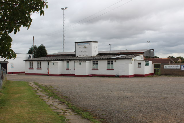
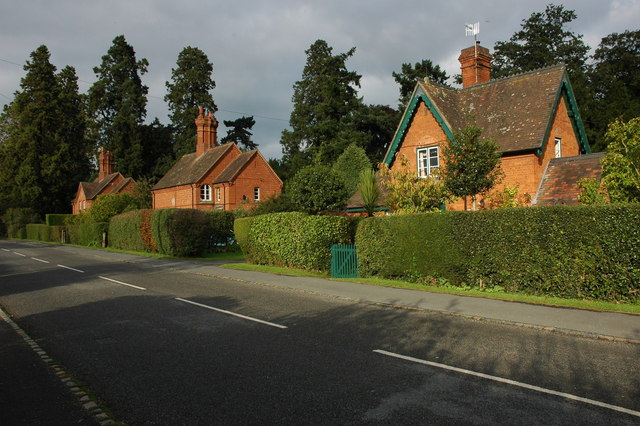
Images are sourced within 2km of 52.125/-2.285 or Grid Reference SO8047. Thanks to Geograph Open Source API. All images are credited.

Construction of the new Tesco Express On the site of the Gas Tavern pub.
Construction of the new Tesco Express
On the site of the Gas Tavern pub.
Construction of the new Tesco Express Built on the site of the Gas Tavern pub.
Construction of the new Tesco Express
Built on the site of the Gas Tavern pub.
Construction of the new Tesco Express Built on the site of the demolished Gas Tavern pub.
Three 2-bedroom houses are included in the plan.
Construction of the new Tesco Express
Built on the site of the demolished Gas Tavern pub. Three 2-bedroom houses are included in the plan.
New Tesco Express on Pickersleigh Road On the site of the old "New Gas Tavern" pub.
The slates are on the roofs of the new homes and the rafters are up for the store.
New Tesco Express on Pickersleigh Road
On the site of the old "New Gas Tavern" pub. The slates are on the roofs of the new homes and the rafters are up for the store.
Morgan visitors' centre In a mixture of old wartime buildings and newer.
This was the RRE Sports and Social Club.
The long, low arched building, behind the white doors, was our skittle alley.
<a href="https://www.geograph.org.uk/photo/2494092">SO7847 : Morgan Aero Supersport</a>
Morgan visitors' centre
In a mixture of old wartime buildings and newer. This was the RRE Sports and Social Club. The long, low arched building, behind the white doors, was our skittle alley. SO7847 : Morgan Aero Supersport
Morgan Aero Supersport In the Morgan visitors'centre salesroom near to the Malvern Motor Company's Pickersleigh Road factory.  
4.8 litre, 170 mph, 6 speed gearbox.
<a href="https://www.geograph.org.uk/photo/2494061">SO7847 : Morgan visitors' centre</a>
Morgan Aero Supersport
In the Morgan visitors'centre salesroom near to the Malvern Motor Company's Pickersleigh Road factory. 4.8 litre, 170 mph, 6 speed gearbox. SO7847 : Morgan visitors' centre
The 500th council house in post-war Malvern There was a huge shortage of housing in the post war period so new building programmes started in March 1946.
The first council house was completed in November 1946 and the hundredth in January 1948.
The 500th house (27, Orford Way - the cream coloured one on the right) was completed in April 1951 and a special ceremony took place outside on Thursday April 26th.
After unlocking the door Mr James Wilkins, Chairman of the Council, handed the key over to the new occupier, Mr S. Wall.
There was tea and a cake was cut - a replica of the house.
Another 110 houses were under construction at that time.
The private sector were also building houses for sale and the Ministry of Supply were constructing houses for scientists who worked at the Radar Research Establishment as it was then called making a total of 870 new houses since the war.
The 500th council house in post-war Malvern
There was a huge shortage of housing in the post war period so new building programmes started in March 1946. The first council house was completed in November 1946 and the hundredth in January 1948. The 500th house (27, Orford Way - the cream coloured one on the right) was completed in April 1951 and a special ceremony took place outside on Thursday April 26th. After unlocking the door Mr James Wilkins, Chairman of the Council, handed the key over to the new occupier, Mr S. Wall. There was tea and a cake was cut - a replica of the house. Another 110 houses were under construction at that time. The private sector were also building houses for sale and the Ministry of Supply were constructing houses for scientists who worked at the Radar Research Establishment as it was then called making a total of 870 new houses since the war.
Clare Road, Sherrards Green, Malvern Part of the massive post-war boom in council house construction. 
500 council houses were completed in 5 years.
From the alterations that have taken place it would appear that many of these have been sold off.
Worcestershire Beacon in the background.
Clare Road, Sherrards Green, Malvern
Part of the massive post-war boom in council house construction. 500 council houses were completed in 5 years. From the alterations that have taken place it would appear that many of these have been sold off. Worcestershire Beacon in the background.
Sherrards Green Road - Madresfield Road junction Taken from the Langland Avenue junction.
Madresfield Road heads straight towards Great Malvern and the Malvern Hills.
Sherrards Green tapers off to the left towards Barnards Green.
Sherrards Green Road - Madresfield Road junction
Taken from the Langland Avenue junction. Madresfield Road heads straight towards Great Malvern and the Malvern Hills. Sherrards Green tapers off to the left towards Barnards Green.
Orford Way, Sherrards Green, Malvern Part of the post-war council house construction programme.
The 500th council house to be finished in five years is just visible 
(with the cream coloured front on the left-hand side of the road).
The name Orford probably reflects Malvern's radar research connection with Orford Ness.
Orford Way, Sherrards Green, Malvern
Part of the post-war council house construction programme. The 500th council house to be finished in five years is just visible (with the cream coloured front on the left-hand side of the road). The name Orford probably reflects Malvern's radar research connection with Orford Ness.
Malvern Town Football Club The outside of the pavilion.
Malvern Town Football Club
The outside of the pavilion.
Entrance gateway to Malvern Town Football Club Interesting brick and Malvern Granite gate pillars.
Entrance gateway to Malvern Town Football Club
Interesting brick and Malvern Granite gate pillars.
Langland Avenue, Sherrards Green, Malvern Part of the post-war council house building programme which saw 500 council houses built in 5 years. 
Not much of an avenue 60 years on.
Note how the front gardens having been given over to the parking of cars.
Langland Avenue, Sherrards Green, Malvern
Part of the post-war council house building programme which saw 500 council houses built in 5 years. Not much of an avenue 60 years on. Note how the front gardens having been given over to the parking of cars.
Superstore and part of its car park Morrisons supermarket is on the site of a former Safeway store.
Superstore and part of its car park
Morrisons supermarket is on the site of a former Safeway store.
Entering Malvern on the A449
Madresfield Village Many of the buildings were built for workers on the Madresfield estate.
The church, dedicated to St Mary the Virgin,  was consecrated 10 November 1867.
This view is from the Worcestershire Beacon.
Madresfield Village
Many of the buildings were built for workers on the Madresfield estate. The church, dedicated to St Mary the Virgin, was consecrated 10 November 1867. This view is from the Worcestershire Beacon.
A449 at Newland Roundabout
Show me another place!

Madresfield Court is located at Grid Ref: SO8047 (Lat: 52.125, Lng: -2.285)

Administrative County: Worcestershire

District: Malvern Hills

Police Authority: West Mercia

What 3 Words

///treatment.adjuster.sprain. Near Great Malvern, Worcestershire

Related Wikis

Madresfield

Madresfield is a village and civil parish in the administrative district of Malvern Hills in the county of Worcestershire, England. It is located about...

Madresfield Court

Madresfield Court is a country house in Malvern, Worcestershire, England. The home of the Lygon family for nearly six centuries, it has never been sold...

Newland, Worcestershire

Newland is a village and civil parish on the north-eastern edge of Malvern Link, Worcestershire, England, on the A449 road. The village lies on the edge...

Sherrard's Green

Sherrard's Green is a village and a suburb of Malvern, Worcestershire, England, situated approximately 1.5 miles (2.4 km) southeast of Great Malvern, the...

Nearby Amenities

Located within 500m of 52.125,-2.285
Madresfield
Place: village
Source: survey
Wikidata: Q592529
Lat/Long: 52.1275204/-2.2892347
Madresfield Church
Naptan AtcoCode: 2000G058500
Naptan Bearing: N
Naptan BusStopType: CUS
Naptan CommonName: Madresfield Church
Naptan Indicator: Opp
Naptan Landmark: School
Naptan NaptanCode: wocdjgmg
Naptan PlusbusZoneRef: GTMLVRN
Naptan Street: Madresfield Road
Naptan Verified: no
Source: naptan_import
Lat/Long: 52.1249579/-2.2870905
Post Box
Historic Operator: Post Office
Old Ref: M116
Post Box Type: wall
Ref: WR13 116
Royal Cypher: GR
Royal Cypher Wikidata: Q33102273
Source: survey
Lat/Long: 52.1255934/-2.287004
Public Bookcase
Booth: K6
Colour: red
Disused Amenity: telephone
Man Made: telephone_box
Old Phone: +44 1684 573290
Public Bookcase Type: phone_box
Lat/Long: 52.1252152/-2.2871545
Barrier: kissing_gate
Foot: yes
Lat/Long: 52.1273078/-2.2905378
Barrier: kissing_gate
Foot: yes
Lat/Long: 52.1258713/-2.2910079
Barrier: kissing_gate
Foot: yes
Lat/Long: 52.1263637/-2.287698
Barrier: cattle_grid
Foot: yes
Lat/Long: 52.1212131/-2.2855462
Barrier: stile
Foot: yes
Lat/Long: 52.1243217/-2.2910895
Barrier: stile
Foot: yes
Lat/Long: 52.1243426/-2.2910643
Barrier: kissing_gate
Bicycle: yes
Foot: yes
Lat/Long: 52.1257755/-2.28979
Fixme: not sure were this path goes
Lat/Long: 52.1252566/-2.288423
Fixme: Incomplete
Lat/Long: 52.1261469/-2.2819403
Bench
Lat/Long: 52.1254086/-2.2870731
Madresfield Court
Power: pole
Transformer: distribution
Voltage Primary: 11000
Lat/Long: 52.1260309/-2.2812221
Power: pole
Lat/Long: 52.1232154/-2.2820724
Power: pole
Lat/Long: 52.1236056/-2.282065
Home Farm
Power: pole
Transformer: distribution
Voltage Primary: 11000
Lat/Long: 52.1228279/-2.2820824
Location Transition: yes
Power: pole
Lat/Long: 52.1240396/-2.2820549
Power: pole
Lat/Long: 52.1246007/-2.2912167
Power: pole
Lat/Long: 52.1247999/-2.2902136
Power: pole
Lat/Long: 52.1248329/-2.2857262
Power: pole
Lat/Long: 52.1248979/-2.2845675
Location Transition: yes
Power: pole
Lat/Long: 52.1249654/-2.2833109
Power: pole
Lat/Long: 52.125224/-2.2884205
Power: pole
Lat/Long: 52.1248563/-2.2884125
Power: pole
Lat/Long: 52.1247864/-2.2869466
Madresfield School
Power: pole
Transformer: distribution
Voltage Primary: 11000
Lat/Long: 52.1247695/-2.2874039
Power: pole
Lat/Long: 52.1249387/-2.2894424
Hayswood Farm
Power: pole
Transformer: distribution
Voltage Primary: 11000
Lat/Long: 52.1269561/-2.289257
Power: pole
Lat/Long: 52.1268258/-2.2901378
Saint Marys Church
Power: pole
Transformer: distribution
Voltage Primary: 11000
Lat/Long: 52.1255154/-2.2884218
Power: pole
Lat/Long: 52.1260531/-2.288442
Power: pole
Lat/Long: 52.1266908/-2.2898414
Power: pole
Lat/Long: 52.1264845/-2.2893941
Power: pole
Lat/Long: 52.1270975/-2.29075
The data included in this document is from www.openstreetmap.org. The data is made available under ODbL.

Have you been to Madresfield Court?

Leave your review of Madresfield Court below (or comments, questions and feedback).