Luath's Stone

Heritage Site in Aberdeenshire

Scotland

Luath's Stone

Tillyfourie Recumbent Stone Circle (1) Just to confuse people, this circle is signposted as Whitehill Stone Circle, and also so named in the 'Stone Circle Trail' leaflet published in 2014. I am sticking to the name used by the Royal Commission on the Ancient and Historical Monuments of Scotland, now part of Historic Environment Scotland. See <span class="nowrap"><a title="https://canmore.org.uk/site/18074/tillyfourie" rel="nofollow ugc noopener" href="https://canmore.org.uk/site/18074/tillyfourie">Link</a><img style="margin-left:2px;" alt="External link" title="External link - shift click to open in new window" src="https://s1.geograph.org.uk/img/external.png" width="10" height="10"/></span> for more information. <a href="https://www.geograph.org.uk/photo/4855469">NJ6413 : Tillyfourie Recumbent Stone Circle (2)</a>
Tillyfourie Recumbent Stone Circle (1) Credit: Anne Burgess

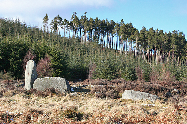
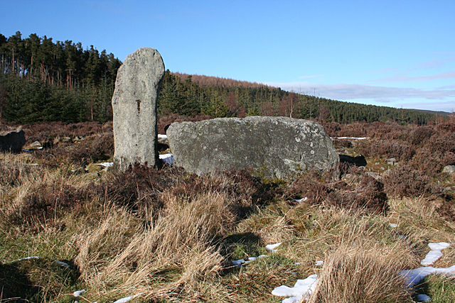
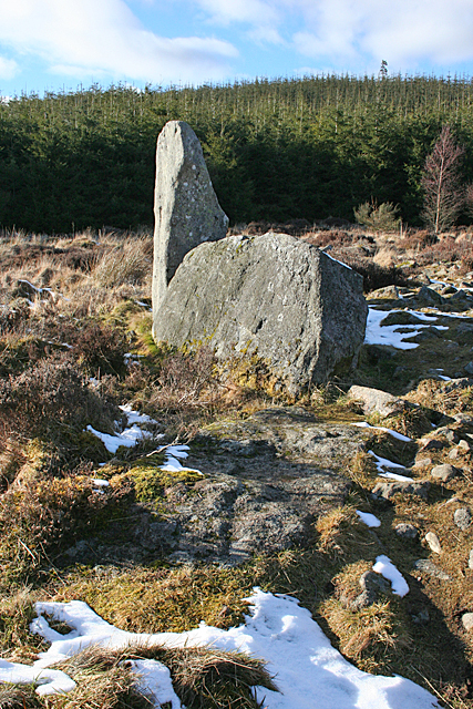
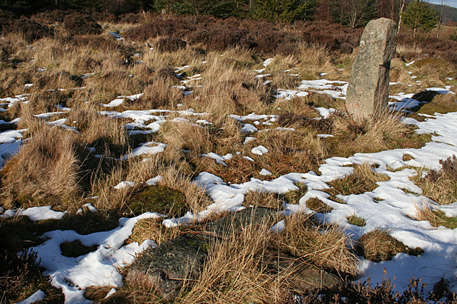
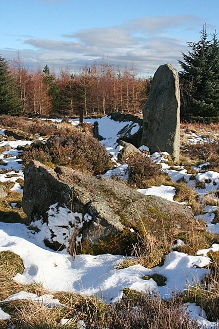
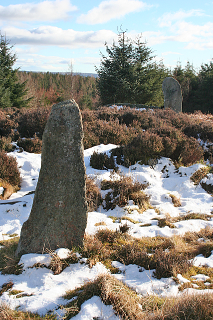
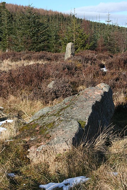
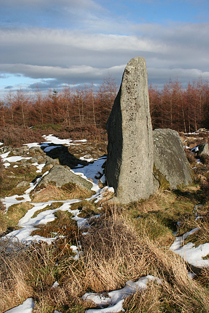
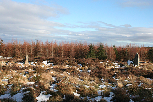
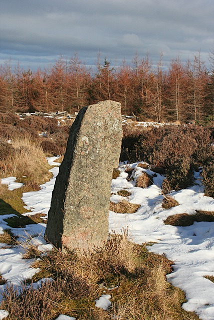
Luath's Stone is a notable heritage site located in Aberdeenshire, Scotland. It is an ancient standing stone that holds significant historical and cultural value. Standing at around 15 feet tall, the stone is believed to have been erected during the Bronze Age, around 4,000 years ago.

The stone is named after Luath, a legendary hound from Scottish folklore who was said to be petrified and turned into the stone as punishment for killing a deer. This folklore adds an intriguing mystical aspect to the stone and contributes to its allure.

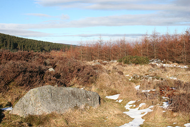
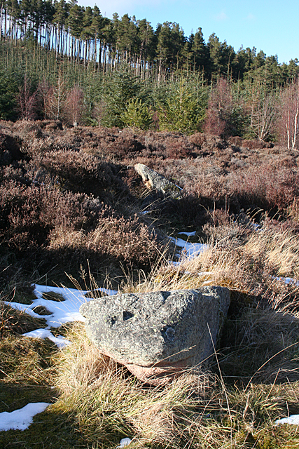
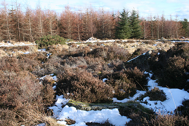
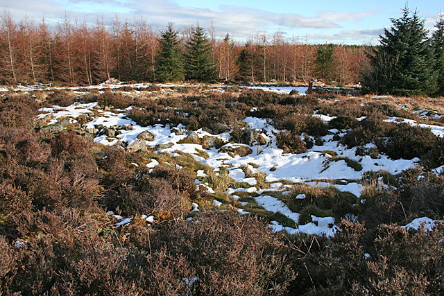
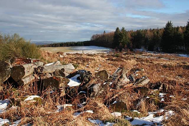
Luath's Stone is made of granite, a common type of rock found in the area, and is characterized by its rough texture and weathered appearance. It stands on a slight slope in a rural landscape, surrounded by fields and hills, giving it a majestic and picturesque setting.

The stone has endured the test of time and has become an enduring symbol of Aberdeenshire's ancient past. It attracts visitors from near and far who are interested in exploring Scotland's rich history and folklore. Many people also visit the stone for its reputed spiritual significance and healing properties.

Despite its remote location, Luath's Stone is easily accessible to the public, with a small car park nearby and a short walk to reach the site. Information boards provide visitors with details about the stone's history and significance.

Overall, Luath's Stone is a remarkable heritage site that offers a glimpse into Scotland's ancient past and captures the imagination of those who encounter it.

If you have any feedback on the listing, please let us know in the comments section below.

Luath's Stone Images

Images are sourced within 2km of 57.22/-2.588 or Grid Reference NJ6414. Thanks to Geograph Open Source API. All images are credited.

Tillyfourie Recumbent Stone Circle (1) Just to confuse people, this circle is signposted as Whitehill Stone Circle, and also so named in the 'Stone Circle Trail' leaflet published in 2014. I am sticking to the name used by the Royal Commission on the Ancient and Historical Monuments of Scotland, now part of Historic Environment Scotland. See <span class="nowrap"><a title="https://canmore.org.uk/site/18074/tillyfourie" rel="nofollow ugc noopener" href="https://canmore.org.uk/site/18074/tillyfourie">Link</a><img style="margin-left:2px;" alt="External link" title="External link - shift click to open in new window" src="https://s1.geograph.org.uk/img/external.png" width="10" height="10"/></span> for more information. <a href="https://www.geograph.org.uk/photo/4855469">NJ6413 : Tillyfourie Recumbent Stone Circle (2)</a>
Tillyfourie Recumbent Stone Circle (1)
Just to confuse people, this circle is signposted as Whitehill Stone Circle, and also so named in the 'Stone Circle Trail' leaflet published in 2014. I am sticking to the name used by the Royal Commission on the Ancient and Historical Monuments of Scotland, now part of Historic Environment Scotland. See LinkExternal link for more information. NJ6413 : Tillyfourie Recumbent Stone Circle (2)
Tillyfourie Recumbent Stone Circle (2) This is the recumbent setting. Only the west flanker and the recumbent are still standing.  See <span class="nowrap"><a title="https://canmore.org.uk/site/18074/tillyfourie" rel="nofollow ugc noopener" href="https://canmore.org.uk/site/18074/tillyfourie">Link</a><img style="margin-left:2px;" alt="External link" title="External link - shift click to open in new window" src="https://s1.geograph.org.uk/img/external.png" width="10" height="10"/></span> for more information. <a href="https://www.geograph.org.uk/photo/4855473">NJ6413 : Tillyfourie Recumbent Stone Circle (3)</a>
Tillyfourie Recumbent Stone Circle (2)
This is the recumbent setting. Only the west flanker and the recumbent are still standing. See LinkExternal link for more information. NJ6413 : Tillyfourie Recumbent Stone Circle (3)
Tillyfourie Recumbent Stone Circle (3) From this angle, the fallen east flanker can be seen embedded in the ground almost in line with the recumbent. When erect it would have been about the same height as the west flanker. See <span class="nowrap"><a title="https://canmore.org.uk/site/18074/tillyfourie" rel="nofollow ugc noopener" href="https://canmore.org.uk/site/18074/tillyfourie">Link</a><img style="margin-left:2px;" alt="External link" title="External link - shift click to open in new window" src="https://s1.geograph.org.uk/img/external.png" width="10" height="10"/></span> for more information. 
<a href="https://www.geograph.org.uk/photo/4855479">NJ6413 : Tillyfourie Recumbent Stone Circle (4)</a>
Tillyfourie Recumbent Stone Circle (3)
From this angle, the fallen east flanker can be seen embedded in the ground almost in line with the recumbent. When erect it would have been about the same height as the west flanker. See LinkExternal link for more information. NJ6413 : Tillyfourie Recumbent Stone Circle (4)
Tillyfourie Recumbent Stone Circle (4) The large stone in the left foreground is a fallen orthostat, and another one is visible lying in the grass towards the right. The heather behind the nearer one is growing on the internal cairn, which is raised above the level of the base of the stones.  See <span class="nowrap"><a title="https://canmore.org.uk/site/18074/tillyfourie" rel="nofollow ugc noopener" href="https://canmore.org.uk/site/18074/tillyfourie">Link</a><img style="margin-left:2px;" alt="External link" title="External link - shift click to open in new window" src="https://s1.geograph.org.uk/img/external.png" width="10" height="10"/></span> for more information. <a href="https://www.geograph.org.uk/photo/4855481">NJ6413 : Tillyfourie Recumbent Stone Circle (5)</a>
Tillyfourie Recumbent Stone Circle (4)
The large stone in the left foreground is a fallen orthostat, and another one is visible lying in the grass towards the right. The heather behind the nearer one is growing on the internal cairn, which is raised above the level of the base of the stones. See LinkExternal link for more information. NJ6413 : Tillyfourie Recumbent Stone Circle (5)
Tillyfourie Recumbent Stone Circle (5) The two fallen stones in this view are part of the eastern arc of the circle.  See <span class="nowrap"><a title="https://canmore.org.uk/site/18074/tillyfourie" rel="nofollow ugc noopener" href="https://canmore.org.uk/site/18074/tillyfourie">Link</a><img style="margin-left:2px;" alt="External link" title="External link - shift click to open in new window" src="https://s1.geograph.org.uk/img/external.png" width="10" height="10"/></span> for more information. <a href="https://www.geograph.org.uk/photo/4855485">NJ6413 : Tillyfourie Recumbent Stone Circle (6)</a>
Tillyfourie Recumbent Stone Circle (5)
The two fallen stones in this view are part of the eastern arc of the circle. See LinkExternal link for more information. NJ6413 : Tillyfourie Recumbent Stone Circle (6)
Tillyfourie Recumbent Stone Circle (6) It's quite hard to make out the fallen stones in this view. There is one in the foreground, with snow on the nearer face of it, and the next one is lying at an angle, with a thin layer of snow on top picking it out. These are the orthostats on the north-eastern arc of the circle.  See <span class="nowrap"><a title="https://canmore.org.uk/site/18074/tillyfourie" rel="nofollow ugc noopener" href="https://canmore.org.uk/site/18074/tillyfourie">Link</a><img style="margin-left:2px;" alt="External link" title="External link - shift click to open in new window" src="https://s1.geograph.org.uk/img/external.png" width="10" height="10"/></span> for more information. <a href="https://www.geograph.org.uk/photo/4855491">NJ6413 : Tillyfourie Recumbent Stone Circle (7)</a>
Tillyfourie Recumbent Stone Circle (6)
It's quite hard to make out the fallen stones in this view. There is one in the foreground, with snow on the nearer face of it, and the next one is lying at an angle, with a thin layer of snow on top picking it out. These are the orthostats on the north-eastern arc of the circle. See LinkExternal link for more information. NJ6413 : Tillyfourie Recumbent Stone Circle (7)
Tillyfourie Recumbent Stone Circle (7) At top right is the only orthostat still standing, and in the foreground are several fragments of another stone, almost hidden by a combination of grass and shadow. See <span class="nowrap"><a title="https://canmore.org.uk/site/18074/tillyfourie" rel="nofollow ugc noopener" href="https://canmore.org.uk/site/18074/tillyfourie">Link</a><img style="margin-left:2px;" alt="External link" title="External link - shift click to open in new window" src="https://s1.geograph.org.uk/img/external.png" width="10" height="10"/></span> for more information. <a href="https://www.geograph.org.uk/photo/4855496">NJ6413 : Tillyfourie Recumbent Stone Circle (8)</a>
Tillyfourie Recumbent Stone Circle (7)
At top right is the only orthostat still standing, and in the foreground are several fragments of another stone, almost hidden by a combination of grass and shadow. See LinkExternal link for more information. NJ6413 : Tillyfourie Recumbent Stone Circle (8)
Tillyfourie Recumbent Stone Circle (8) Nearest the camera is a large fallen orthostat, and behind it is the recumbent setting.  See <span class="nowrap"><a title="https://canmore.org.uk/site/18074/tillyfourie" rel="nofollow ugc noopener" href="https://canmore.org.uk/site/18074/tillyfourie">Link</a><img style="margin-left:2px;" alt="External link" title="External link - shift click to open in new window" src="https://s1.geograph.org.uk/img/external.png" width="10" height="10"/></span> for more information. <a href="https://www.geograph.org.uk/photo/4855503">NJ6413 : Tillyfourie Recumbent Stone Circle (9)</a>
Tillyfourie Recumbent Stone Circle (8)
Nearest the camera is a large fallen orthostat, and behind it is the recumbent setting. See LinkExternal link for more information. NJ6413 : Tillyfourie Recumbent Stone Circle (9)
Tillyfourie Recumbent Stone Circle (9) In this view are all the stones still standing. The closest one is the stone standing on the north arc, and in the background is the west flanker. The recumbent, to the left of the flanker, is almost hidden by the heather growing on the raised internal cairn.  See <span class="nowrap"><a title="https://canmore.org.uk/site/18074/tillyfourie" rel="nofollow ugc noopener" href="https://canmore.org.uk/site/18074/tillyfourie">Link</a><img style="margin-left:2px;" alt="External link" title="External link - shift click to open in new window" src="https://s1.geograph.org.uk/img/external.png" width="10" height="10"/></span> for more information. <a href="https://www.geograph.org.uk/photo/4855507">NJ6413 : Tillyfourie Recumbent Stone Circle (10)</a>
Tillyfourie Recumbent Stone Circle (9)
In this view are all the stones still standing. The closest one is the stone standing on the north arc, and in the background is the west flanker. The recumbent, to the left of the flanker, is almost hidden by the heather growing on the raised internal cairn. See LinkExternal link for more information. NJ6413 : Tillyfourie Recumbent Stone Circle (10)
Tillyfourie Recumbent Stone Circle (10) The nearest stone is the fallen stone next to the recumbent setting, and in the background is the only orthostat still upright.  See <span class="nowrap"><a title="https://canmore.org.uk/site/18074/tillyfourie" rel="nofollow ugc noopener" href="https://canmore.org.uk/site/18074/tillyfourie">Link</a><img style="margin-left:2px;" alt="External link" title="External link - shift click to open in new window" src="https://s1.geograph.org.uk/img/external.png" width="10" height="10"/></span> for more information. <a href="https://www.geograph.org.uk/photo/4855510">NJ6413 : Tillyfourie Recumbent Stone Circle (11)</a>
Tillyfourie Recumbent Stone Circle (10)
The nearest stone is the fallen stone next to the recumbent setting, and in the background is the only orthostat still upright. See LinkExternal link for more information. NJ6413 : Tillyfourie Recumbent Stone Circle (11)
Tillyfourie Recumbent Stone Circle (11) The recumbent setting, with the west flanker nearer the camera and the recumbent behind it.  See <span class="nowrap"><a title="https://canmore.org.uk/site/18074/tillyfourie" rel="nofollow ugc noopener" href="https://canmore.org.uk/site/18074/tillyfourie">Link</a><img style="margin-left:2px;" alt="External link" title="External link - shift click to open in new window" src="https://s1.geograph.org.uk/img/external.png" width="10" height="10"/></span> for more information. <a href="https://www.geograph.org.uk/photo/4855513">NJ6413 : Tillyfourie Recumbent Stone Circle (12)</a>
Tillyfourie Recumbent Stone Circle (11)
The recumbent setting, with the west flanker nearer the camera and the recumbent behind it. See LinkExternal link for more information. NJ6413 : Tillyfourie Recumbent Stone Circle (12)
Tillyfourie Recumbent Stone Circle (12) Thanks to the forest having been cleared around it, it is possible to get the whole circle in view, though all you really see are the west flanker, on the right, and the sole standing orthostat, on the left. You can also see that the height of the cairn in the interior of the circle is above the height of the base of the stones.  See <span class="nowrap"><a title="https://canmore.org.uk/site/18074/tillyfourie" rel="nofollow ugc noopener" href="https://canmore.org.uk/site/18074/tillyfourie">Link</a><img style="margin-left:2px;" alt="External link" title="External link - shift click to open in new window" src="https://s1.geograph.org.uk/img/external.png" width="10" height="10"/></span> for more information. <a href="https://www.geograph.org.uk/photo/4855515">NJ6413 : Tillyfourie Recumbent Stone Circle (13)</a>
Tillyfourie Recumbent Stone Circle (12)
Thanks to the forest having been cleared around it, it is possible to get the whole circle in view, though all you really see are the west flanker, on the right, and the sole standing orthostat, on the left. You can also see that the height of the cairn in the interior of the circle is above the height of the base of the stones. See LinkExternal link for more information. NJ6413 : Tillyfourie Recumbent Stone Circle (13)
Tillyfourie Recumbent Stone Circle (13) This is the only orthostat still standing. It is on the north arc of the circle.  See <span class="nowrap"><a title="https://canmore.org.uk/site/18074/tillyfourie" rel="nofollow ugc noopener" href="https://canmore.org.uk/site/18074/tillyfourie">Link</a><img style="margin-left:2px;" alt="External link" title="External link - shift click to open in new window" src="https://s1.geograph.org.uk/img/external.png" width="10" height="10"/></span> for more information. <a href="https://www.geograph.org.uk/photo/4855523">NJ6413 : Tillyfourie Recumbent Stone Circle (14)</a>
Tillyfourie Recumbent Stone Circle (13)
This is the only orthostat still standing. It is on the north arc of the circle. See LinkExternal link for more information. NJ6413 : Tillyfourie Recumbent Stone Circle (14)
Tillyfourie Recumbent Stone Circle (14) The raised cairn in the centre of the circle has itself been hollowed out to form a central court. It is surrounded by a kerb of 32 low stones, most of them obscured by the vegetation, even in dead of winter.  See <span class="nowrap"><a title="https://canmore.org.uk/site/18074/tillyfourie" rel="nofollow ugc noopener" href="https://canmore.org.uk/site/18074/tillyfourie">Link</a><img style="margin-left:2px;" alt="External link" title="External link - shift click to open in new window" src="https://s1.geograph.org.uk/img/external.png" width="10" height="10"/></span> for more information. <a href="https://www.geograph.org.uk/photo/4855467">NJ6413 : Tillyfourie Recumbent Stone Circle (1)</a>
Tillyfourie Recumbent Stone Circle (14)
The raised cairn in the centre of the circle has itself been hollowed out to form a central court. It is surrounded by a kerb of 32 low stones, most of them obscured by the vegetation, even in dead of winter. See LinkExternal link for more information. NJ6413 : Tillyfourie Recumbent Stone Circle (1)
Lichen I beileve these are the fruiting bodies of a lichen growing on one of the stones in the recumbent stone circle. I do not know what species they are.
Lichen
I beileve these are the fruiting bodies of a lichen growing on one of the stones in the recumbent stone circle. I do not know what species they are.
Forgotten Logs These large logs have evidently been forgotten when the forest was being cleared. They will no doubt provide habitat for assorted small wildlife.
Forgotten Logs
These large logs have evidently been forgotten when the forest was being cleared. They will no doubt provide habitat for assorted small wildlife.
Whitehills Just to show that there is more in this grid square than the recumbent stone circle, this is the farm from which the stone circle takes one of its names.
Whitehills
Just to show that there is more in this grid square than the recumbent stone circle, this is the farm from which the stone circle takes one of its names.
Bogmore Wood The bluish hint on the trees suggests that they are Douglas Fir. They make a pleasant change from Sitka Spruce. Through the gap, there's a distant glimpse of the village of Monymusk.
Bogmore Wood
The bluish hint on the trees suggests that they are Douglas Fir. They make a pleasant change from Sitka Spruce. Through the gap, there's a distant glimpse of the village of Monymusk.
Show me another place!

Luath's Stone is located at Grid Ref: NJ6414 (Lat: 57.22, Lng: -2.588)

Unitary Authority: Aberdeenshire

Police Authority: North East

What 3 Words

///jubilant.seriously.pipe. Near Sauchen, Aberdeenshire

Nearby Locations

Green Hill Luath's Stone

Related Wikis

Tillyfourie railway station

Tillyfourie railway station was a railway station serving Tillyfourie, Aberdeenshire, Scotland. The station opened on 2 June 1860 on the Alford Valley...

Whitehouse railway station (Scotland)

Whitehouse railway station was a station in Whitehouse, Aberdeenshire. It opened with the along with the rest of the Alford Valley Railway line from Kintore...

Kirkton of Tough

Kirkton of Tough, usually shortened to Tough ( TUUKH), is a settlement in the Marr area of Aberdeenshire, Scotland at grid reference NJ615129. It is about...

Tillycairn Castle

Tillycairn Castle is an L-plan castle, dating from the 16th century, standing on high ground around 2.0 miles (3.2 km) south-east of Cluny in Aberdeenshire...

Nearby Amenities

Located within 500m of 57.22,-2.588
Green Hill
Ele: 398
Natural: peak
Lat/Long: 57.2206311/-2.5936345
The data included in this document is from www.openstreetmap.org. The data is made available under ODbL.

Have you been to Luath's Stone?

Leave your review of Luath's Stone below (or comments, questions and feedback).