Long Ditch

Heritage Site in Wiltshire

England

Long Ditch

Bridleway and view across Vale of Pewsey This picture is taken from where this bridleway joins the White Horse Trail which at this point forms the perimeter track of the Larkhill Artillery Range.  The hill in the centre of the image is Walker's Hill.  Unfortunately the rather grey looking White Horse on this hill is not clear at this resolution.
Bridleway and view across Vale of Pewsey Credit: Doug Lee

Long Ditch, located in Wiltshire, England, is a significant heritage site with a rich history dating back to the Iron Age. This ancient earthwork, also known as a linear dyke, stretches for approximately four miles (6.4 kilometers) across the landscape, making it one of the longest and most well-preserved examples of its kind in the country.

Thought to have been constructed during the late Bronze Age or early Iron Age, Long Ditch is believed to have served as a defensive structure, possibly acting as a boundary or fortification. The earthwork consists of a deep ditch, measuring up to 20 feet (6 meters) wide and 8 feet (2.4 meters) deep, and an accompanying bank. The bank stands about 10 feet (3 meters) high and runs parallel to the ditch, creating a formidable barrier.

Over the centuries, Long Ditch has witnessed various uses and adaptations. During the Roman period, it is thought to have been repurposed as a territorial boundary or a trackway. In more recent times, it has been utilized for agricultural purposes, with traces of plowing visible along its length.

The site is of great archaeological significance, providing insights into prehistoric settlement patterns and defensive strategies. It offers a unique opportunity to study the construction techniques and engineering skills of the ancient inhabitants. Moreover, Long Ditch's location within the wider landscape adds to its cultural and historical importance, as it provides a link to other nearby ancient sites and monuments.

Today, Long Ditch is recognized as a Scheduled Ancient Monument, ensuring its protection and preservation for future generations. It is open to the public, allowing visitors to explore and appreciate its historical significance, as well as enjoy the breathtaking views of the surrounding countryside.

If you have any feedback on the listing, please let us know in the comments section below.
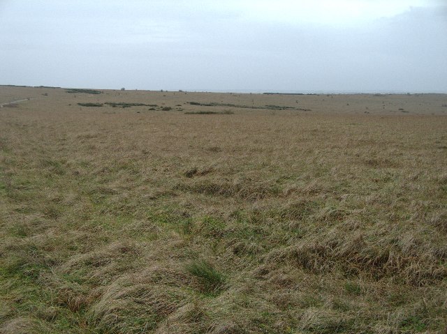
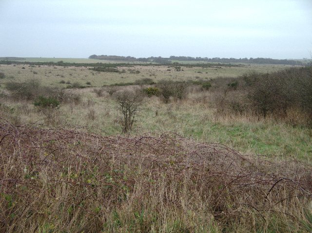
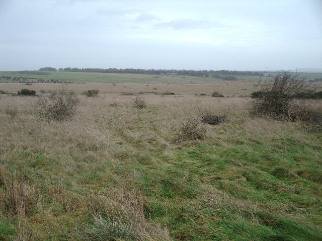
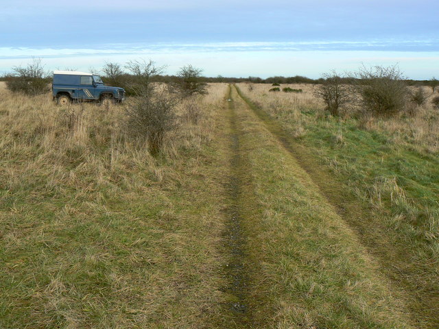
Long Ditch Images

Images are sourced within 2km of 51.28/-1.892 or Grid Reference SU0753. Thanks to Geograph Open Source API. All images are credited.

Bridleway and view across Vale of Pewsey This picture is taken from where this bridleway joins the White Horse Trail which at this point forms the perimeter track of the Larkhill Artillery Range.  The hill in the centre of the image is Walker's Hill.  Unfortunately the rather grey looking White Horse on this hill is not clear at this resolution.
Bridleway and view across Vale of Pewsey
This picture is taken from where this bridleway joins the White Horse Trail which at this point forms the perimeter track of the Larkhill Artillery Range. The hill in the centre of the image is Walker's Hill. Unfortunately the rather grey looking White Horse on this hill is not clear at this resolution.
Perimeter track of Larkhill Artillery Range A view here across the northern end of the Larkhill Artillery Range
Perimeter track of Larkhill Artillery Range
A view here across the northern end of the Larkhill Artillery Range
Larkhill Artillery Range At points where roads or byways enter the Larkhill Artillery Range you will find identical warning signs and flag masts to warn of activity on the ranges.  The rear sign says "Warning to Public.  Danger from unexploded Shells and mortar bombs.  Upon entering the training area you must stay on public rights of way.  On no account should any object be moved or touched.  It may explode".
Larkhill Artillery Range
At points where roads or byways enter the Larkhill Artillery Range you will find identical warning signs and flag masts to warn of activity on the ranges. The rear sign says "Warning to Public. Danger from unexploded Shells and mortar bombs. Upon entering the training area you must stay on public rights of way. On no account should any object be moved or touched. It may explode".
Warning signs at entry to Larkhill Artillery Range These warning signs and flag posts to warn of activity in the range are to be found at most points where byways or roads enter the range.
Warning signs at entry to Larkhill Artillery Range
These warning signs and flag posts to warn of activity in the range are to be found at most points where byways or roads enter the range.
Bridleway into Vale of Pewsey The bridleway is descending from the Larkhill Artillery Range
Bridleway into Vale of Pewsey
The bridleway is descending from the Larkhill Artillery Range
Larkhill Artillery Range
View across edge of Westdown Artillery Range This area is the eastern edge of the Westdown Artillery Range.  The track through this grid square can be seen in the middle distances to the left of the image.
View across edge of Westdown Artillery Range
This area is the eastern edge of the Westdown Artillery Range. The track through this grid square can be seen in the middle distances to the left of the image.
Byway through artillery range This is a popular track for cyclists and 4x4s to gain access to the range from the north.
Byway through artillery range
This is a popular track for cyclists and 4x4s to gain access to the range from the north.
View across Urchfont Down
View across artillery range Just south of this image is an area called Chirton Gorse.  Whether this relates to the plant or not this area does indeed seem to have more gorse than other areas of the artillery range.  As can be seen in the image brambles can also be found here whilst being not particularly widespread elsewhere in the artillery range.
View across artillery range
Just south of this image is an area called Chirton Gorse. Whether this relates to the plant or not this area does indeed seem to have more gorse than other areas of the artillery range. As can be seen in the image brambles can also be found here whilst being not particularly widespread elsewhere in the artillery range.
View across Chirton Down
Tank track near Chirton Down The tank track just crosses the north-east corner of the square with a bridleway just north of that, also just inside the square. Just visible on the right horizon is the access control hut at SU05995535. Photographer position verified with GPS and Google Earth.
Tank track near Chirton Down
The tank track just crosses the north-east corner of the square with a bridleway just north of that, also just inside the square. Just visible on the right horizon is the access control hut at SU05995535. Photographer position verified with GPS and Google Earth.
Track near Little Hill, Salisbury Plain Little Hill is behind the viewpoint and is used in the title simply as a means of identifying the location. This view is facing east out of the square, the Landrover being parked rather fortuitously just about on the eastern gridline.
Track near Little Hill, Salisbury Plain
Little Hill is behind the viewpoint and is used in the title simply as a means of identifying the location. This view is facing east out of the square, the Landrover being parked rather fortuitously just about on the eastern gridline.
Track near Chirton Down, Salisbury Plain The track isn't shown on the maps but is clearly visible on Google Earth. There are some ancient ditches and earthworks further on into the square but not visible in this image, taken as the light was starting to fade.
Track near Chirton Down, Salisbury Plain
The track isn't shown on the maps but is clearly visible on Google Earth. There are some ancient ditches and earthworks further on into the square but not visible in this image, taken as the light was starting to fade.
Track near Chirton Down, Salisbury Plain This view shows is facing west towards the edge of the square about 87 metres away. The Plain is pretty bleak at this time of year.
Track near Chirton Down, Salisbury Plain
This view shows is facing west towards the edge of the square about 87 metres away. The Plain is pretty bleak at this time of year.
Byway near Marden Down The byway is viewed here from a west-facing position. The fence at the right marks the northern gridline of this square.
Byway near Marden Down
The byway is viewed here from a west-facing position. The fence at the right marks the northern gridline of this square.
Byway near Chirton Maggot This is a view facing east. The day-glo red pyramid appears to mark an access point from the byway onto the tank track that runs parallel to it just to the south.
Byway near Chirton Maggot
This is a view facing east. The day-glo red pyramid appears to mark an access point from the byway onto the tank track that runs parallel to it just to the south.
Chirton Down, Salisbury Plain Bleak at this time of year but still an impressive place. Viewed from the byway facing south-east.
Chirton Down, Salisbury Plain
Bleak at this time of year but still an impressive place. Viewed from the byway facing south-east.
Show me another place!

Long Ditch is located at Grid Ref: SU0753 (Lat: 51.28, Lng: -1.892)

What 3 Words

///escalates.delved.neater. Near Wilsford, Wiltshire

Nearby Locations

Long Ditch

Related Wikis

Wiltshire

Wiltshire (; abbreviated to Wilts) is a ceremonial county in South West England. It borders Gloucestershire to the north and the north-west, Oxfordshire...

Casterley Camp

Casterley Camp is the site of an Iron Age univallate hillfort in Wiltshire, England, about 1+1⁄2 miles (2.4 km) south-west of the village of Upavon. The...

Chirton

Chirton is a village and civil parish in Wiltshire, England, on the southern edge of the Vale of Pewsey about 5 miles (8 km) south-east of Devizes. The...

Wilsford Henge

Wilsford Henge is the site of a Neolithic henge, west of the village of Wilsford, Wiltshire in the United Kingdom (grid reference SU09305732). The site...

Have you been to Long Ditch?

Leave your review of Long Ditch below (or comments, questions and feedback).