Laggan Camp

Heritage Site in Wigtownshire

Scotland

Laggan Camp

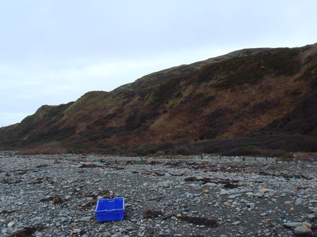
Scrub woodland, Craiglemine
Scrub woodland, Craiglemine Credit: Richard Webb

Laggan Camp, located in Wigtownshire, Scotland, is a historically significant heritage site that holds great importance in the region. Situated near the town of Newton Stewart, Laggan Camp was originally built as a military training camp during World War II.

Constructed in 1940, the camp was initially intended to accommodate and train soldiers preparing for combat. It consisted of a large number of temporary wooden huts that provided barracks, mess halls, and other essential facilities for the soldiers. The camp was strategically positioned to train troops for potential invasions, specifically targeting the nearby Galloway coast.

Over time, Laggan Camp evolved into a more permanent training center, especially for the Royal Artillery. It offered specialized training in artillery operations, including gunnery and target practice, and became instrumental in preparing soldiers for the various battlefronts of the war.

Today, Laggan Camp stands as a testament to the military history of the area. While the original wooden huts have long been dismantled, the site still retains the outline of the camp layout and some concrete foundations. It serves as a reminder of the significant role played by Wigtownshire during the war and the training that took place at Laggan Camp.

Laggan Camp is open to the public, allowing visitors to explore the grounds and learn about its historical significance. The site offers an opportunity to gain insights into the training methods and conditions faced by soldiers during World War II. It provides a valuable educational experience and is a destination of interest for history enthusiasts and those seeking to understand the impact of the war on local communities.

If you have any feedback on the listing, please let us know in the comments section below.

Laggan Camp Images

Images are sourced within 2km of 54.707/-4.492 or Grid Reference NX3937. Thanks to Geograph Open Source API. All images are credited.

Scrub woodland, Craiglemine
Herringbone dyking, Craiglemine
Machars farmland Beside the A747 at Craiglemine.
Machars farmland
Beside the A747 at Craiglemine.
A747, Craiglemine
A747, Craiglemine
Lochanscaddan
Lochanscaddan
Low Craiglemine Residue of Foot & Mouth protest slogan on farm building
Low Craiglemine
Residue of Foot & Mouth protest slogan on farm building
Fell of Carleton Beached Bird Survey walk
Fell of Carleton
Beached Bird Survey walk
Fields on raised beach above Carleton Port Beached Bird Survey walk
Fields on raised beach above Carleton Port
Beached Bird Survey walk
Bessie Yon Track View SW along the track from Craiglemine Tigh (A747) to Bessie Yon and Carleton.
Bessie Yon Track
View SW along the track from Craiglemine Tigh (A747) to Bessie Yon and Carleton.
Laggan Pond This is quite a remote spot, not easy to reach. The pond was reputed to have been stocked with carp sometime in the 19th century, although why and by whom is a mystery. Beyond the pond there is a steep drop of about 150 feet to the beach and the waters of Luce Bay.
Laggan Pond
This is quite a remote spot, not easy to reach. The pond was reputed to have been stocked with carp sometime in the 19th century, although why and by whom is a mystery. Beyond the pond there is a steep drop of about 150 feet to the beach and the waters of Luce Bay.
Laggan Camp and Pond Laggan Camp is a hill fort which looks especially impressive when viewed from above from the slopes of the Fell of Carleton. Next to it is Laggan Pond and beyond that steep heughs drop down to the shores of Luce Bay. (This picture is a composite of two photographs).
Laggan Camp and Pond
Laggan Camp is a hill fort which looks especially impressive when viewed from above from the slopes of the Fell of Carleton. Next to it is Laggan Pond and beyond that steep heughs drop down to the shores of Luce Bay. (This picture is a composite of two photographs).
Laggan Pond and the Fell of Carleton Viewed from the top of Laggan Camp hill fort. The 1:50000 map names the shoulder of the Fell of Carleton (on the skyline to the right of the picture) as "The Gled's Nest" (Gled is a Scots name for a kite or buzzard). However, the 1:25000 map seems to attach the name to the little hill to the seaward side of the pond, or possibly the steep heugh that drops off beyond it to the beach, and shows the shoulder of the Fell as being called the Fox Hunt.
Laggan Pond and the Fell of Carleton
Viewed from the top of Laggan Camp hill fort. The 1:50000 map names the shoulder of the Fell of Carleton (on the skyline to the right of the picture) as "The Gled's Nest" (Gled is a Scots name for a kite or buzzard). However, the 1:25000 map seems to attach the name to the little hill to the seaward side of the pond, or possibly the steep heugh that drops off beyond it to the beach, and shows the shoulder of the Fell as being called the Fox Hunt.
Mill Stone Howe Obviously where rocks suitable for use as millstones could be found. The view is along the eastern shore of Luce Bay towards the Point of Lag near Monreith.
Mill Stone Howe
Obviously where rocks suitable for use as millstones could be found. The view is along the eastern shore of Luce Bay towards the Point of Lag near Monreith.
Old Walls on the Fell of Carleton The raised beach along the shore of Luce Bay is well seen on this stretch of coast. The tidal pond visible near the high water mark is called Lochanscadden (Lochan sgadein - the herring pool) and is one of a group of similar pools called the Lochans of Cairndoon.
Old Walls on the Fell of Carleton
The raised beach along the shore of Luce Bay is well seen on this stretch of coast. The tidal pond visible near the high water mark is called Lochanscadden (Lochan sgadein - the herring pool) and is one of a group of similar pools called the Lochans of Cairndoon.
Old Walls, Laggan Pond I wonder if they meet underwater...  Beyond is the steep western face of the Fell of Carleton, and the tree lined gully called the Needles Eye.
Old Walls, Laggan Pond
I wonder if they meet underwater... Beyond is the steep western face of the Fell of Carleton, and the tree lined gully called the Needles Eye.
Low Craiglemine View of the farm entrance and buildings at the side of the A747.
Low Craiglemine
View of the farm entrance and buildings at the side of the A747.
Low Craiglemine View along the A747 past the farm in the direction of Glasserton.
Low Craiglemine
View along the A747 past the farm in the direction of Glasserton.
Bessie Yon This derelict cottage sits near to the end of a long farm track that winds its way down for about 1 mile from the A747 starting at Craiglemine Tigh and finishing at Carleton Farm. Left of picture in the background is Luce Bay.
Bessie Yon
This derelict cottage sits near to the end of a long farm track that winds its way down for about 1 mile from the A747 starting at Craiglemine Tigh and finishing at Carleton Farm. Left of picture in the background is Luce Bay.
Show me another place!

Laggan Camp is located at Grid Ref: NX3937 (Lat: 54.707, Lng: -4.492)

Unitary Authority: Dumfries and Galloway

Police Authority: Dumfries and Galloway

What 3 Words

///moral.skimmers.field. Near Whithorn, Dumfries & Galloway

Related Wikis

Glasserton

Glasserton is a civil parish in Dumfries and Galloway, south-west Scotland. It is on the Machars peninsula, in the traditional county of Wigtownshire....

St Ninian's Cave

St Ninian's Cave is a cave in Physgill Glen, Whithorn, Dumfries and Galloway, Scotland. It features in the climax of the acclaimed 1973 horror film The...

Rispain Camp

Rispain Camp is the remains of a fortified farmstead 1 mile west of Whithorn, Dumfries and Galloway, Scotland. It is one of the major Iron Age archaeological...

Monreith

Monreith ([mɒn'ri:θ] / 'mon-REETH'; Scottish Gaelic: Am Monadh Rèidh) is a small seaside village in the Machars, in the historical county of Wigtownshire...

Nearby Amenities

Located within 500m of 54.707,-4.492
Source: PGS
Lat/Long: 54.7048667/-4.4984064
Source: PGS
Lat/Long: 54.7046559/-4.4976768
Source: PGS
Lat/Long: 54.7042964/-4.4968185
Source: PGS
Lat/Long: 54.7040236/-4.4963035
Source: PGS
Lat/Long: 54.7037757/-4.4957886
Source: PGS
Lat/Long: 54.7036145/-4.4952092
Source: PGS
Lat/Long: 54.7033789/-4.4943294
Source: PGS
Lat/Long: 54.7031309/-4.4936642
Source: PGS
Lat/Long: 54.702883/-4.4927201
Source: PGS
Lat/Long: 54.7025854/-4.4919691
The data included in this document is from www.openstreetmap.org. The data is made available under ODbL.

Have you been to Laggan Camp?

Leave your review of Laggan Camp below (or comments, questions and feedback).