Knepp Castle

Heritage Site in Sussex

England

Knepp Castle

The Weir at Hatterell Bridge
The Weir at Hatterell Bridge Credit: Andy Walkden

Knepp Castle, located in West Sussex, England, is a historic site that holds significant cultural and historical importance. The castle has a rich history that dates back to the 12th century when it was initially built as a motte and bailey fortress. Over the centuries, Knepp Castle has undergone various renovations and expansions, transforming it into a magnificent country house.

The castle, nestled amidst a sprawling estate, is surrounded by picturesque landscapes, including woodlands, meadows, and a tranquil lake. These natural features add to the charm and beauty of the site, making it a popular destination for visitors.

Knepp Castle has witnessed several notable events and played a role in English history. During the Civil War, the castle was besieged and damaged by Parliamentarian forces. However, it was later restored and continued to serve as a residence for the Burrell family, who owned the estate for many generations.

Today, Knepp Castle is recognized as a Grade I listed building, acknowledging its architectural and historical significance. The castle itself is not open to the public, but the surrounding estate offers various activities and attractions for visitors. These include guided tours, nature walks, and wildlife safaris, as Knepp Castle is also renowned for its rewilding project. The estate has become a haven for numerous species, including rare birds, insects, and mammals, making it a paradise for nature enthusiasts.

In summary, Knepp Castle, with its centuries-old history and breathtaking surroundings, stands as a testament to the rich heritage and natural beauty of Sussex.

If you have any feedback on the listing, please let us know in the comments section below.
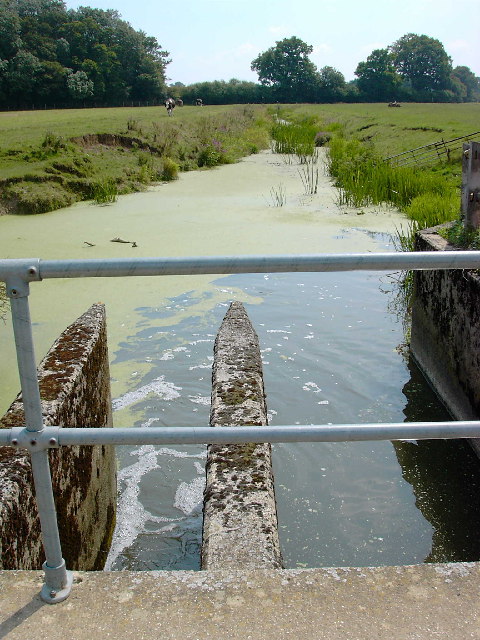
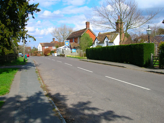
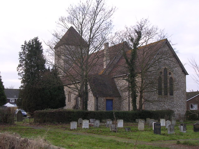
Knepp Castle Images

Images are sourced within 2km of 50.972/-0.34 or Grid Reference TQ1620. Thanks to Geograph Open Source API. All images are credited.

The Weir at Hatterell Bridge
Jasmine Cottage, Rookcross Lane Situated at the junction of the lane with the entrance to Rooklands Farm.
Jasmine Cottage, Rookcross Lane
Situated at the junction of the lane with the entrance to Rooklands Farm.
Worthing Road, Dial Post Hard to believe that the A24 used to thunder through this village until the 1980s. Now all is quiet and serene. Dial Post is a hamlet within the parish of West Grinstead and grew in size from the eighteenth century onwards. The in is The Crown.
Worthing Road, Dial Post
Hard to believe that the A24 used to thunder through this village until the 1980s. Now all is quiet and serene. Dial Post is a hamlet within the parish of West Grinstead and grew in size from the eighteenth century onwards. The in is The Crown.
Bridleway off the Downs Link This bridleway leaves the Downs Link near Partridge Green heading west to the River Adur and Hatterell bridge.
Bridleway off the Downs Link
This bridleway leaves the Downs Link near Partridge Green heading west to the River Adur and Hatterell bridge.
Bridleway to Hatterell bridge After dropping through Whitewick Rough (woodland) the bridleway crosses the flood plain to the river Adur and Hatterell bridge.
Bridleway to Hatterell bridge
After dropping through Whitewick Rough (woodland) the bridleway crosses the flood plain to the river Adur and Hatterell bridge.
Hatterell bridge Hatterell bridge crosses the river Adur and is now a gauging station.  Once, when the river was part of the Adur navigation, there was a drawbridge here.
For more on the Adur navigation and the Baybridge canal <span class="nowrap"><a title="http://www.sussex.co.uk/waterways/baybridge.htm" rel="nofollow ugc noopener" href="http://www.sussex.co.uk/waterways/baybridge.htm">Link</a><img style="margin-left:2px;" alt="External link" title="External link - shift click to open in new window" src="https://s1.geograph.org.uk/img/external.png" width="10" height="10"/></span> and on the river Adur <span class="nowrap"><a title="http://www.adur.org.uk/index.htm" rel="nofollow ugc noopener" href="http://www.adur.org.uk/index.htm">Link</a><img style="margin-left:2px;" alt="External link" title="External link - shift click to open in new window" src="https://s1.geograph.org.uk/img/external.png" width="10" height="10"/></span>
Hatterell bridge
Hatterell bridge crosses the river Adur and is now a gauging station. Once, when the river was part of the Adur navigation, there was a drawbridge here. For more on the Adur navigation and the Baybridge canal LinkExternal link and on the river Adur LinkExternal link
Pond at Hatterell's farm Hatterell farm has now gone and has been ploughed under (see Old Maps <span class="nowrap"><a title="http://www.old-maps.co.uk/" rel="nofollow ugc noopener" href="http://www.old-maps.co.uk/">Link</a><img style="margin-left:2px;" alt="External link" title="External link - shift click to open in new window" src="https://s1.geograph.org.uk/img/external.png" width="10" height="10"/></span> for an 1879 OS map) but its pond survives (but for how long?).
Pond at Hatterell's farm
Hatterell farm has now gone and has been ploughed under (see Old Maps LinkExternal link for an 1879 OS map) but its pond survives (but for how long?).
Clothall's Farmhouse Clothalls is on a moated site with the southern (right) representing the earliest portion.  A three-bay hall and northern cross-wing being added in the  C15.
Clothall is a small parish in Hertfordshire and a family from there seems to have made its way to Sussex.  Adam de Clothale married into the 'de Grensted' family about 1270.  The last, Richard de Clothale, died in 1454.
'Wealden Buildings' Editor John Warren.  Coach Publishing, Horsham 1990.  ISBN 0 902608 06 1
'The Victoria County History' A History of the County of Sussex: Volume 6 Part 2
Bramber Rape (North-Western Part) including Horsham
Clothall's Farmhouse
Clothalls is on a moated site with the southern (right) representing the earliest portion. A three-bay hall and northern cross-wing being added in the C15. Clothall is a small parish in Hertfordshire and a family from there seems to have made its way to Sussex. Adam de Clothale married into the 'de Grensted' family about 1270. The last, Richard de Clothale, died in 1454. 'Wealden Buildings' Editor John Warren. Coach Publishing, Horsham 1990. ISBN 0 902608 06 1 'The Victoria County History' A History of the County of Sussex: Volume 6 Part 2 Bramber Rape (North-Western Part) including Horsham
River Adur looking north from Hatterell bridge This section of the river Adur was part of the Baybridge canal which ran for 3.5 miles from Pike's brook, near Knepp castle, to Locks farm.  From Locks farm, as the Adur Navigation, the river ran to the sea at Shoreham.
See <span class="nowrap"><a title="http://www.sussex.co.uk/waterways/baybridge.htm" rel="nofollow ugc noopener" href="http://www.sussex.co.uk/waterways/baybridge.htm">Link</a><img style="margin-left:2px;" alt="External link" title="External link - shift click to open in new window" src="https://s1.geograph.org.uk/img/external.png" width="10" height="10"/></span>
for just a little more.
The canal had closed by 1875 due to competition from the Horsham to Shoreham railway.
River Adur looking north from Hatterell bridge
This section of the river Adur was part of the Baybridge canal which ran for 3.5 miles from Pike's brook, near Knepp castle, to Locks farm. From Locks farm, as the Adur Navigation, the river ran to the sea at Shoreham. See LinkExternal link for just a little more. The canal had closed by 1875 due to competition from the Horsham to Shoreham railway.
Furze Wood Viewed from the junction of footpaths near Sussex Farm at sunrise.
Furze Wood
Viewed from the junction of footpaths near Sussex Farm at sunrise.
Sunlight and Mud The first rays of a sun of the day shine on the gate opening that takes the footpath from Partridge Green northwards beside the eastern bank of the River Adur. The previous evenings rainfall made the mud thick and capable of sucking your boots off.
Sunlight and Mud
The first rays of a sun of the day shine on the gate opening that takes the footpath from Partridge Green northwards beside the eastern bank of the River Adur. The previous evenings rainfall made the mud thick and capable of sucking your boots off.
River Adur This is the western branch of the river which splits north-west of Henfield and rises near Itchingfield. Hookshile Wood provides the back drop.
River Adur
This is the western branch of the river which splits north-west of Henfield and rises near Itchingfield. Hookshile Wood provides the back drop.
Footpath to West Grinstead Following the eastern bank of the Adur though here it moves away from the river following the eastern edge of the flood plain.
Footpath to West Grinstead
Following the eastern bank of the Adur though here it moves away from the river following the eastern edge of the flood plain.
Farmland near the River Adur The line of reeds in the foreground mark the course of the river.
Farmland near the River Adur
The line of reeds in the foreground mark the course of the river.
River Adur Looking towards Hatterell Bridge which can just be made out in the distance. The woods to the east are blocking the sunlight and causing long shadows here. This is the western branch of the river that splits north-west of Henfield and rises near Itchingfield.
River Adur
Looking towards Hatterell Bridge which can just be made out in the distance. The woods to the east are blocking the sunlight and causing long shadows here. This is the western branch of the river that splits north-west of Henfield and rises near Itchingfield.
Hatterell Bridge Once a drawbridge over this section of the river that was straightened during the late 18th century and was navigable as far as Bay Bridge now the point where the A24 crosses the river. It was replaced by the current gauging station during the 1960s.
Hatterell Bridge
Once a drawbridge over this section of the river that was straightened during the late 18th century and was navigable as far as Bay Bridge now the point where the A24 crosses the river. It was replaced by the current gauging station during the 1960s.
River Adur Taken from Hatterell's Bridge. The river was straightened and made navigable in 1825 as far as the wharf at Bay Bridge and saw regular barges travelling the waterway until the opening of the Horsham-Shoreham railway in 1861 ruined it. The company operating it ceased to function in 1875 though some traffic remained until the 1890s.
River Adur
Taken from Hatterell's Bridge. The river was straightened and made navigable in 1825 as far as the wharf at Bay Bridge and saw regular barges travelling the waterway until the opening of the Horsham-Shoreham railway in 1861 ruined it. The company operating it ceased to function in 1875 though some traffic remained until the 1890s.
Bridleway to Clothalls Farm Linking the farm with Jolesfield Common via Haterells Bridge.
Bridleway to Clothalls Farm
Linking the farm with Jolesfield Common via Haterells Bridge.
Show me another place!

Knepp Castle is located at Grid Ref: TQ1620 (Lat: 50.972, Lng: -0.34)

What 3 Words

///estimate.worthy.given. Near Partridge Green, West Sussex

Nearby Locations

Knepp Castle

Related Wikis

St George's Church, West Grinstead

St George's Church is an Anglican church in West Grinstead, West Sussex, England. It is in the Diocese of Chichester, occupying a rural position in the...

West Grinstead

West Grinstead is a village and civil parish in the Horsham District of West Sussex, England. It lies just off the B2135 road four miles (6.3 km) northwest...

Knepp Castle

The medieval Knepp Castle (sometimes referred to as 'Old Knepp Castle', to distinguish it from the nearby 19th-century mansion) is to the west of the village...
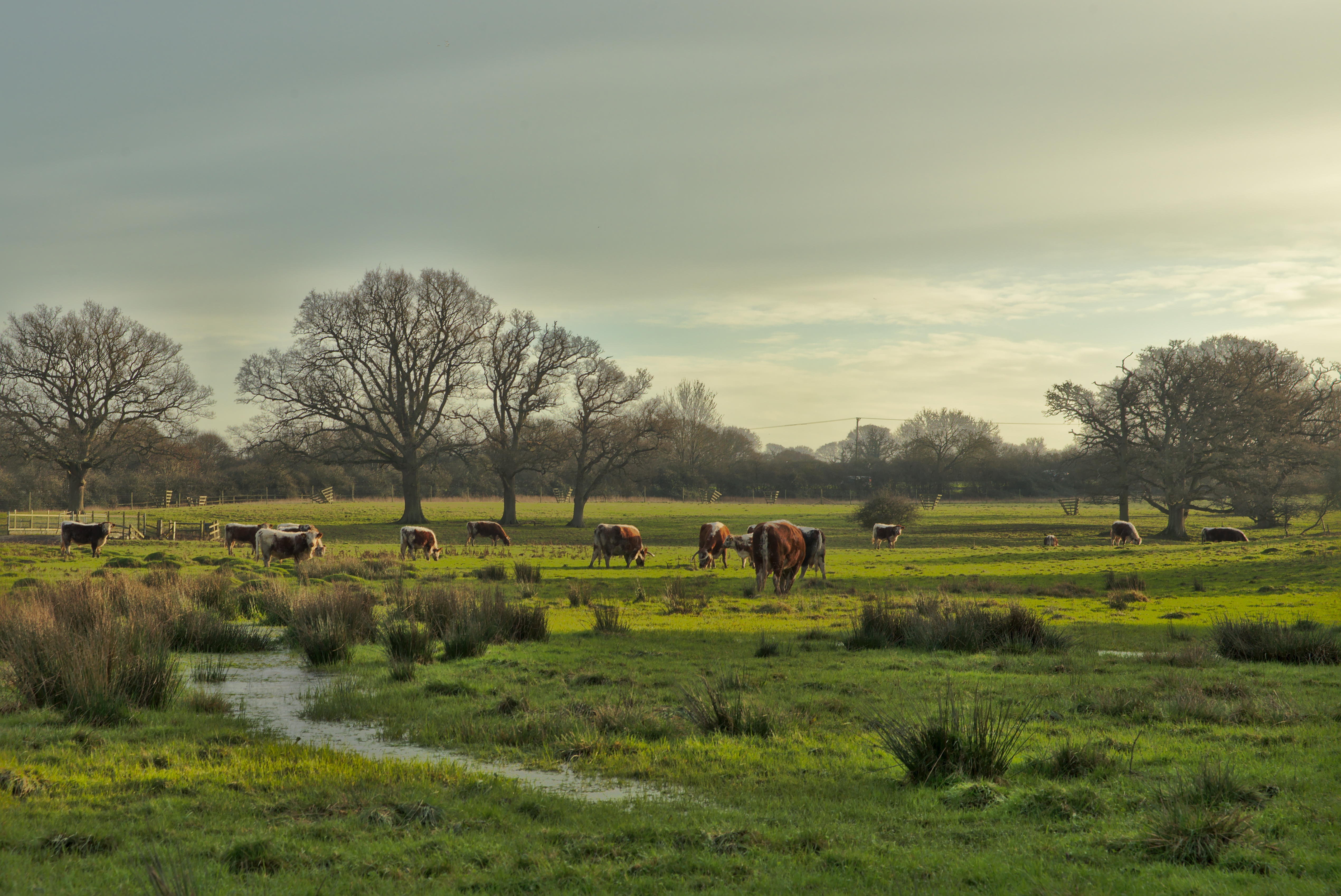
Knepp Wildland

Knepp Wildland is the first major lowland rewilding project in England. It comprises 1,400 hectares (3,500 acres; 5.4 square miles) of former arable and...

Shrine of Our Lady of Consolation

The Shrine of Our Lady of Consolation or Church of Our Lady of Consolation and Saint Francis is a Roman Catholic parish church in West Grinstead, in West...

Dial Post

Dial Post is a village in the Horsham District of West Sussex, England. The civil parish, where the lowest level political meetings are held, is West Grinstead...

St Michael and All Angels Church, Partridge Green

St Michael and All Angels Church is a late nineteenth-century church in the settlement of Partridge Green in the parish of West Grinstead in West Sussex...

St Mary's Church, Shipley

The Church of St Mary the Virgin is an Anglican church in the village of Shipley, in West Sussex, England. It is in the Diocese of Chichester. Built in...

Nearby Amenities

Located within 500m of 50.972,-0.34
Butcher's Row
Place: hamlet
Lat/Long: 50.9716004/-0.3340905
Power: pole
Lat/Long: 50.972041/-0.3349252
Power: pole
Lat/Long: 50.9719544/-0.3354838
Power: pole
Lat/Long: 50.9707347/-0.33533
Power: pole
Lat/Long: 50.9693863/-0.3345953
Barrier: stile
Lat/Long: 50.9729719/-0.3333363
Power: pole
Lat/Long: 50.9715117/-0.3467326
Power: pole
Lat/Long: 50.9716129/-0.3456589
Power: pole
Lat/Long: 50.9715545/-0.344872
Power: pole
Lat/Long: 50.9714864/-0.3439552
Power: pole
Lat/Long: 50.9719897/-0.342599
Power: pole
Lat/Long: 50.9729788/-0.3415142
Power: pole
Lat/Long: 50.9735407/-0.340909
Power: pole
Lat/Long: 50.9723298/-0.3422273
Power: pole
Lat/Long: 50.9753953/-0.338846
Power: pole
Lat/Long: 50.9742972/-0.339905
Power: pole
Lat/Long: 50.9744291/-0.3352591
Power: pole
Lat/Long: 50.9751524/-0.337944
Power: pole
Lat/Long: 50.9748237/-0.3367208
Bay Bridge
Place: locality
Lat/Long: 50.9741676/-0.3432536
Bassells Farm
Place: isolated_dwelling
Lat/Long: 50.9713027/-0.3418999
Waterway: weir
Lat/Long: 50.9734862/-0.3369947
Post Box
Lat/Long: 50.9716809/-0.3421254
The data included in this document is from www.openstreetmap.org. The data is made available under ODbL.

Have you been to Knepp Castle?

Leave your review of Knepp Castle below (or comments, questions and feedback).