Kinder Scout

Heritage Site in Derbyshire High Peak

England

Kinder Scout

Ashop Clough from Fairbrook Naze
Ashop Clough from Fairbrook Naze Credit: Mick Garratt

Kinder Scout, located in Derbyshire, England, is a prominent feature of the Peak District National Park and holds great historical and cultural significance as a heritage site. Standing at an impressive height of 636 meters (2,087 feet), it is the highest peak in the Peak District and attracts numerous visitors each year.

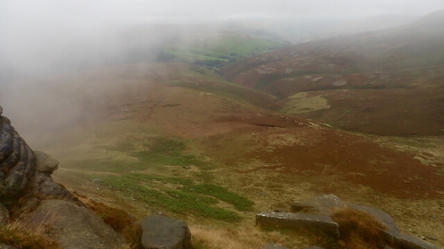
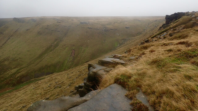
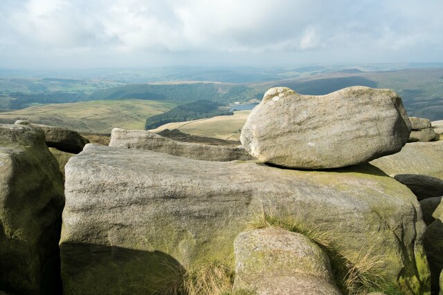
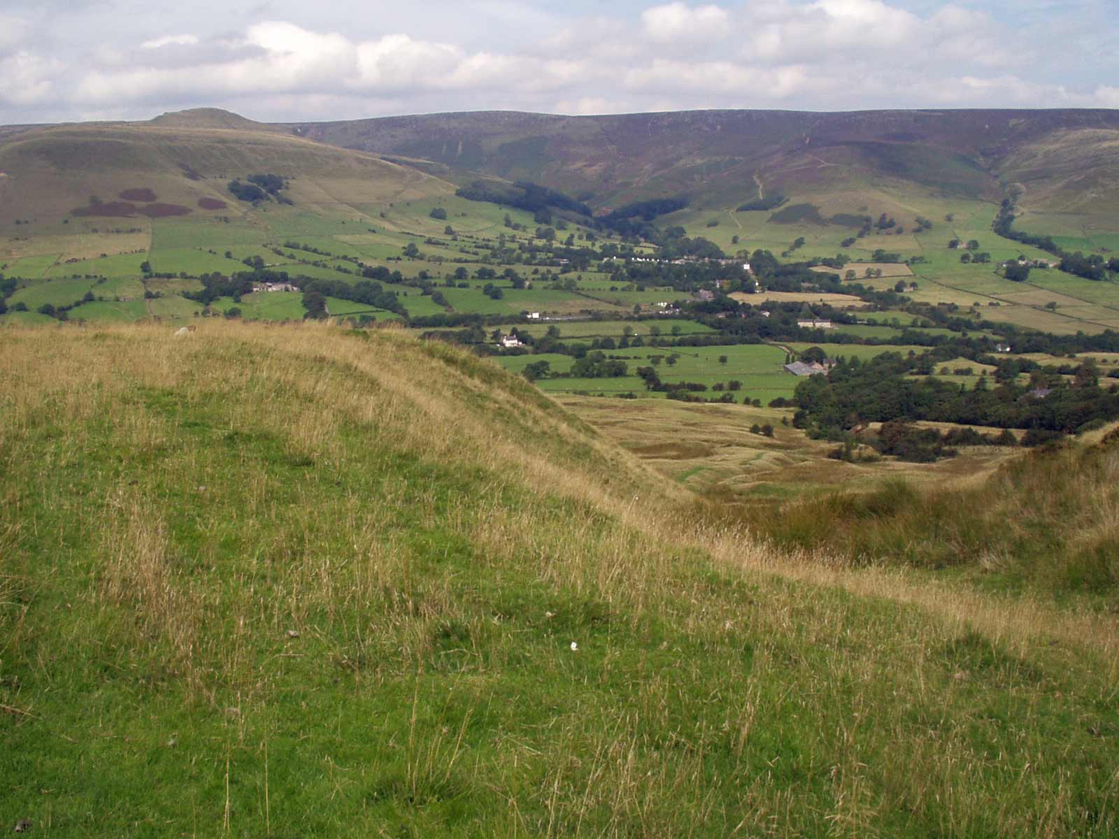
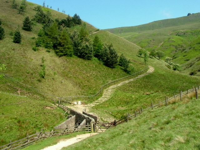
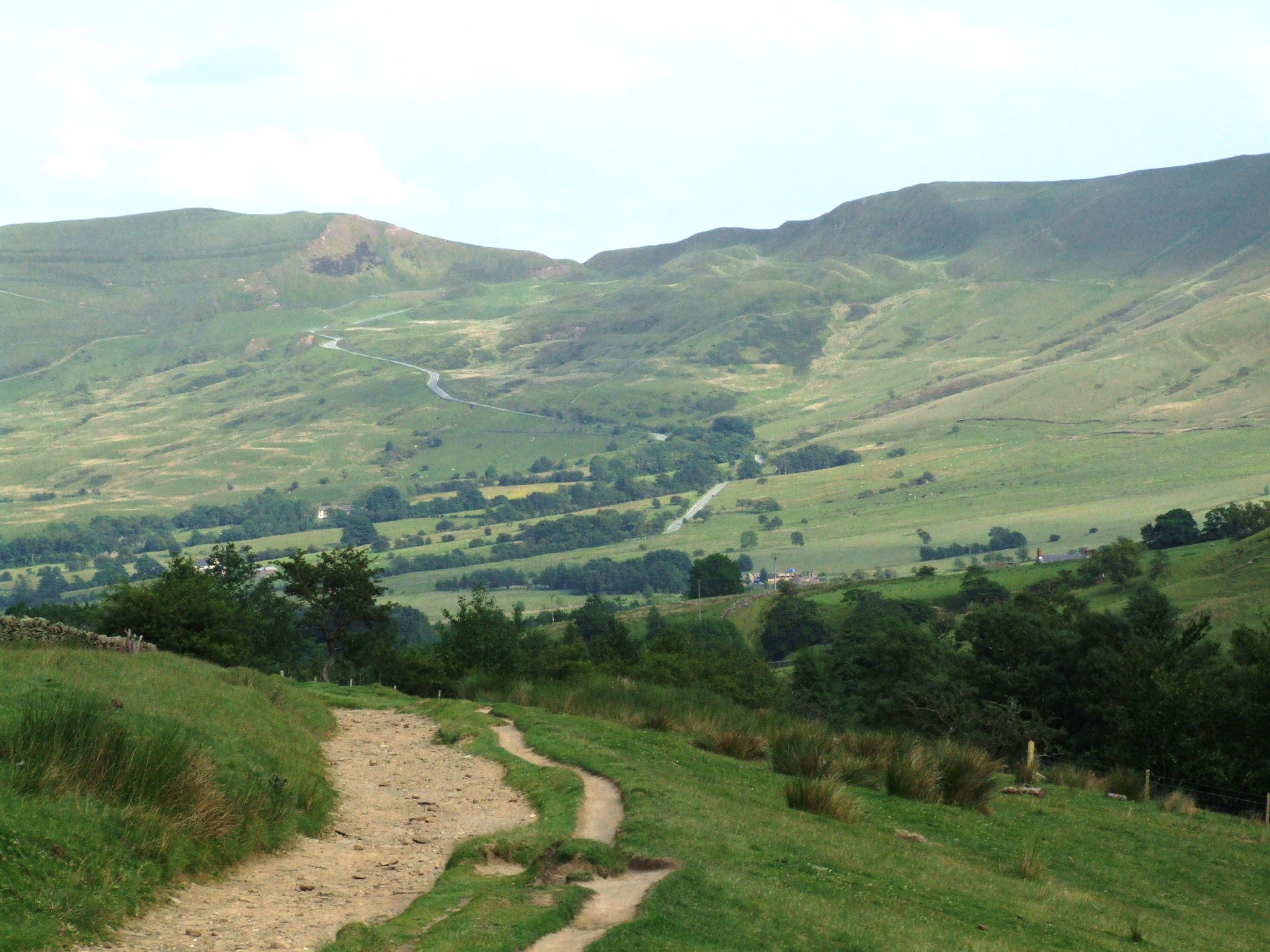
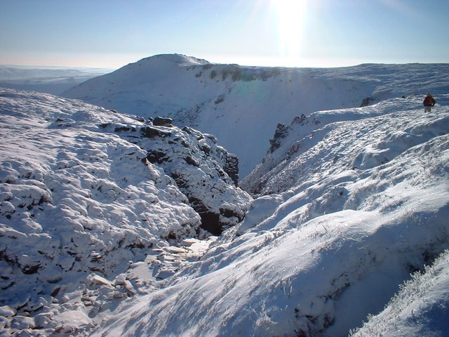
The landscape of Kinder Scout is characterized by its vast expanses of peat moorland, rocky outcrops, and wild heather, giving it a unique and rugged beauty. It is renowned for its breathtaking panoramic views, stretching across the surrounding valleys and hills, making it a favorite spot for hikers, nature enthusiasts, and photographers.

Kinder Scout also holds a significant place in history as the birthplace of the mass trespass movement. In 1932, a group of ramblers organized a protest march to assert their rights to access the open countryside, which was denied to them by the landowners. This event eventually led to the establishment of national parks and the right to roam in the United Kingdom.

Today, visitors to Kinder Scout can explore a network of well-maintained footpaths and trails, allowing them to immerse themselves in the stunning natural surroundings. The area is home to an array of wildlife, including red grouse, mountain hares, and numerous bird species, making it a popular destination for birdwatching.

Kinder Scout's rich cultural and historical heritage, combined with its outstanding natural beauty, makes it an essential visit for those seeking a deeper understanding of the Peak District and the importance of preserving its landscapes and access rights.

If you have any feedback on the listing, please let us know in the comments section below.

Kinder Scout Images

Images are sourced within 2km of 53.397/-1.877 or Grid Reference SK0888. Thanks to Geograph Open Source API. All images are credited.

Ashop Clough from Fairbrook Naze
Fair Brook from Fairbrook Naze
Kinder Low Trig Point Kinder Low at 633 metres (2,077 ft) above sea level is a subsidiary summit at the south west corner of Kinder Scout, it is often mistaken as the highest point. Low is an old dialect word meaning 'hill top'.
Kinder Low Trig Point
Kinder Low at 633 metres (2,077 ft) above sea level is a subsidiary summit at the south west corner of Kinder Scout, it is often mistaken as the highest point. Low is an old dialect word meaning 'hill top'.
The summit of Kinder Low Kinder Low at 633 metres (2,077 ft) above sea level is a subsidiary summit at the south west corner of Kinder Scout, it is often mistaken as the highest point. Low is an old dialect word meaning 'hill top'.
The summit of Kinder Low
Kinder Low at 633 metres (2,077 ft) above sea level is a subsidiary summit at the south west corner of Kinder Scout, it is often mistaken as the highest point. Low is an old dialect word meaning 'hill top'.
On Kinder Low Kinder Low at 633 metres (2,077 ft) above sea level is a subsidiary summit at the south west corner of Kinder Scout, it is often mistaken as the highest point. Low is an old dialect word meaning 'hill top'.
On Kinder Low
Kinder Low at 633 metres (2,077 ft) above sea level is a subsidiary summit at the south west corner of Kinder Scout, it is often mistaken as the highest point. Low is an old dialect word meaning 'hill top'.
Gritstone rocks below Kinder Scout One of the amazing looking Gritstone outcrops below Kinder Scout next to the Pennine Way.
Gritstone rocks below Kinder Scout
One of the amazing looking Gritstone outcrops below Kinder Scout next to the Pennine Way.
Gritstone Outcrop below Kinder Scout One of the amazing looking Gritstone outcrops below Kinder Scout next to the Pennine Way.
Gritstone Outcrop below Kinder Scout
One of the amazing looking Gritstone outcrops below Kinder Scout next to the Pennine Way.
Gritstone Rocks below Kinder Scout Gritstone rocks next to the Pennine Way, Kinder Reservoir is in the distance.
Gritstone Rocks below Kinder Scout
Gritstone rocks next to the Pennine Way, Kinder Reservoir is in the distance.
The Pennine Way north of Kinder Low Heading north along the Pennine Way from Kinder Low.
The Pennine Way north of Kinder Low
Heading north along the Pennine Way from Kinder Low.
Gritstone rock formations near Kinder Scout The strange and fascinating gritstone rock formations next to the Pennine Way near Kinder Scout.
Gritstone rock formations near Kinder Scout
The strange and fascinating gritstone rock formations next to the Pennine Way near Kinder Scout.
The Pennine Way along the Gritstone Edge Heading north on the Pennine Way along the Gritstone Edge near Kinder Scout.
The Pennine Way along the Gritstone Edge
Heading north on the Pennine Way along the Gritstone Edge near Kinder Scout.
View from the Gritstone Edge The strange and fascinating gritstone rock formations next to the Pennine Way near Kinder Scout. Kinder Reservoir can be seen in the distance.
View from the Gritstone Edge
The strange and fascinating gritstone rock formations next to the Pennine Way near Kinder Scout. Kinder Reservoir can be seen in the distance.
View from the Gritstone Edge Gritstone boulders next to the Pennine Way near Kinder Scout. Kinder Reservoir can be seen in the distance.
View from the Gritstone Edge
Gritstone boulders next to the Pennine Way near Kinder Scout. Kinder Reservoir can be seen in the distance.
Gritstone Rocks and the Peak District Gritstone boulders next to the Pennine Way near Kinder Scout.
Gritstone Rocks and the Peak District
Gritstone boulders next to the Pennine Way near Kinder Scout.
Gritstone Boulders in the Peak District Gritstone boulders next to the Pennine Way near Kinder Scout.
Gritstone Boulders in the Peak District
Gritstone boulders next to the Pennine Way near Kinder Scout.
View from the Pennine Way Looking northwest across the gritstone edge near Kinder Scout.
View from the Pennine Way
Looking northwest across the gritstone edge near Kinder Scout.
The Pennine Way below Kinder Scout Heading north along the Pennine Way towards Kinder Downfall below Kinder Scout.
The Pennine Way below Kinder Scout
Heading north along the Pennine Way towards Kinder Downfall below Kinder Scout.
Kinder Downfall The tallest waterfall in the Peak District was not so much a downfall as a trickle when I took this photo.

Wikipedia <span class="nowrap"><a title="https://en.wikipedia.org/wiki/River_Kinder" rel="nofollow ugc noopener" href="https://en.wikipedia.org/wiki/River_Kinder">Link</a><img style="margin-left:2px;" alt="External link" title="External link - shift click to open in new window" src="https://s1.geograph.org.uk/img/external.png" width="10" height="10"/></span>
Kinder Downfall
The tallest waterfall in the Peak District was not so much a downfall as a trickle when I took this photo. Wikipedia LinkExternal link
Show me another place!

Kinder Scout is located at Grid Ref: SK0888 (Lat: 53.397, Lng: -1.877)

Administrative County: Derbyshire

District: High Peak

Police Authority: Derbyshire

What 3 Words

///cascaded.opposing.rocker. Near High Peak, Derbyshire

Related Wikis

Mermaid's Pool (Peak District)

Mermaid's Pool is a small pool on Kinder Scout in Derbyshire, England, which, according to legend, is inhabited by a beautiful mermaid who can be seen...

Kinder Scout

Kinder Scout is a moorland plateau and national nature reserve in the Dark Peak of the Derbyshire Peak District in England. Part of the moor, at 636 metres...

Mill Hill (Derbyshire)

Mill Hill is an open, flat-topped hill, 1,785 feet (544 m) above sea level, in the Peak District in the county of Derbyshire in England. == Location... ==

Jacob's Ladder, Derbyshire

Jacob's Ladder is a bridleway between Kinder Scout plateau and the hamlet of Upper Booth in the Vale of Edale, in the Derbyshire Peak District of England...

Forest of High Peak

The Forest of High Peak was, in medieval times, a moorland forest covering most of the north west of Derbyshire, England, extending as far south as Tideswell...

Featherbed Top

Featherbed Top is an open, flat-topped hill, 544 metres (1,785 ft) high, in the Peak District in the county of Derbyshire in England. == Description... ==

Grindslow Knoll

Grindslow Knoll is a hill in the Dark Peak area of the Peak District National Park in Derbyshire, England. It is joined to Kinder Scout by a high col though...

Vale of Edale

The Vale of Edale is the upper valley of the River Noe, in the Derbyshire Peak District of England. The village of Edale lies in the middle of the valley...

Nearby Amenities

Located within 500m of 53.397,-1.877
Ford: yes
Lat/Long: 53.397342/-1.8762352
Kinder Downfall
Waterway: waterfall
Lat/Long: 53.3968159/-1.8773825
The data included in this document is from www.openstreetmap.org. The data is made available under ODbL.

Have you been to Kinder Scout?

Leave your review of Kinder Scout below (or comments, questions and feedback).