Kerswell Priory

Heritage Site in Devon East Devon

England

Kerswell Priory

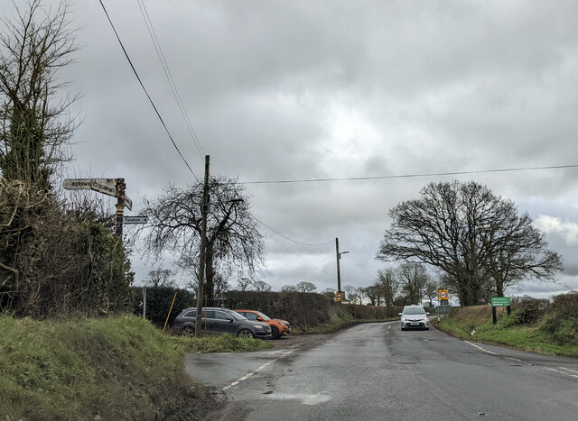
Steep downhill from the Blackdowns
Steep downhill from the Blackdowns Credit: Rob Purvis

Kerswell Priory is a historical site located in Devon, England. It was a former priory and is considered a significant heritage site in the region. The priory was founded in the 12th century, during the reign of King Henry II, by the Premonstratensian order of canons.

The original structure of Kerswell Priory consisted of a church, cloister, chapter house, and living quarters for the canons. Over the centuries, the priory underwent several renovations and expansions. Today, only the ruins of the priory remain, creating a picturesque and atmospheric setting.

The priory played a crucial role in the local community, serving as a religious center and providing spiritual guidance and support to the people of Devon. It also had significant agricultural and economic influence in the area, owning vast lands and managing various farms.

Visitors to Kerswell Priory can explore the remnants of the church, which still retain some architectural features, such as Gothic arches and intricate stone carvings. The tranquil surroundings and peaceful ambiance of the site make it a popular destination for those seeking a glimpse into the region's medieval history.

Kerswell Priory is managed and maintained by the local heritage authorities, ensuring its preservation for future generations. Guided tours and educational programs are also available, allowing visitors to learn about the priory's rich history and its impact on the local community.

If you have any feedback on the listing, please let us know in the comments section below.

Kerswell Priory Images

Images are sourced within 2km of 50.85/-3.313 or Grid Reference ST0706. Thanks to Geograph Open Source API. All images are credited.

Steep downhill from the Blackdowns
Heading east on the A373 at the Keepers Cottage Inn
In Dulford heading towards Honiton
At Four Lanes junction heading east on A373 near Dulford
Old Milestoneby the A373, Kentisbeare parish Carved stone post by the A373, in parish of Kentisbeare (Mid Devon District), 100m Northwest of Keepers Cottage Inn, on grass verge, on North side of road. Honiton gabled stone, erected by the Honiton turnpike trust in the 19th century. An earlier photograph can be found here <a title="https://www.geograph.org.uk/photo/6050432" href="https://www.geograph.org.uk/photo/6050432">Link</a>.

Inscription reads:-
(H)ONITON
8
(CU)LLOMPTON
3

Milestone Society National ID: DV_CMHN03
Old Milestoneby the A373, Kentisbeare parish
Carved stone post by the A373, in parish of Kentisbeare (Mid Devon District), 100m Northwest of Keepers Cottage Inn, on grass verge, on North side of road. Honiton gabled stone, erected by the Honiton turnpike trust in the 19th century. An earlier photograph can be found here Link. Inscription reads:- (H)ONITON 8 (CU)LLOMPTON 3 Milestone Society National ID: DV_CMHN03
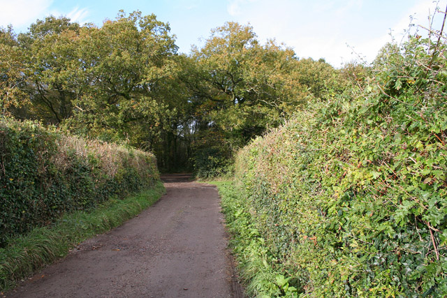
Deep Lane An ancient lane to a farm mentioned in the Domesday Book.
Deep Lane
An ancient lane to a farm mentioned in the Domesday Book.
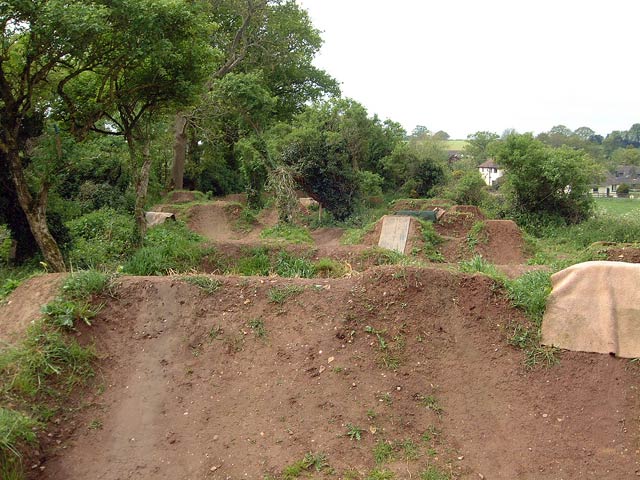
Kerswell jumps This area of land has been lovingly sculpted into a bike trail. Ownership of the land is in dispute and the trail itself is under threat due to injuries which have occurred.
Kerswell jumps
This area of land has been lovingly sculpted into a bike trail. Ownership of the land is in dispute and the trail itself is under threat due to injuries which have occurred.
Fish ponds at Kerswell priory These lakes are now a commercial fish farm
Fish ponds at Kerswell priory
These lakes are now a commercial fish farm
Orway Porch farm An ancient cob wall forms part of the farm building.
Orway Porch farm
An ancient cob wall forms part of the farm building.
Bridlepath to North Hill This path skirts the summit of the Blackdown Hills plateau.
Bridlepath to North Hill
This path skirts the summit of the Blackdown Hills plateau.
Kentisbeare playing fields Village cricket is thriving in Kentisbeare.
Kentisbeare playing fields
Village cricket is thriving in Kentisbeare.
Gallops Gallops adjacent to Dulford House
Gallops
Gallops adjacent to Dulford House
East Devon farmland A typical summer's evening scene of English farmland. The south west view from Broad Road.
East Devon farmland
A typical summer's evening scene of English farmland. The south west view from Broad Road.
Broadhembury: view over the parish Looking south west from above Orway Cross.  The high ground to the right is the hill above Bradninch, beyond the Culm valley. About 6pm
Broadhembury: view over the parish
Looking south west from above Orway Cross. The high ground to the right is the hill above Bradninch, beyond the Culm valley. About 6pm
Broadhembury: woods at Kentis Moor Seen from the lane that leads to Dulford Nursery. These woods were hardly in existence when the 1940s Ordnance Survey map was surveyed
Broadhembury: woods at Kentis Moor
Seen from the lane that leads to Dulford Nursery. These woods were hardly in existence when the 1940s Ordnance Survey map was surveyed
Broadhembury: lane at Kentis Moor Looking north east through woodland towards the junction with the A373 Cullompton-Honiton road
Broadhembury: lane at Kentis Moor
Looking north east through woodland towards the junction with the A373 Cullompton-Honiton road
Kentisbeare: near Court Barton Farm Looking east from the lane running north from Dulford Cross
Kentisbeare: near Court Barton Farm
Looking east from the lane running north from Dulford Cross
Ford, near St Andrew's Wood, Dulford The view is from the north side of the shallow ford on a minor road, with a simple bridge for pedestrians to one side
Ford, near St Andrew's Wood, Dulford
The view is from the north side of the shallow ford on a minor road, with a simple bridge for pedestrians to one side
Show me another place!

Kerswell Priory is located at Grid Ref: ST0706 (Lat: 50.85, Lng: -3.313)

Administrative County: Devon

District: East Devon

Police Authority: Devon and Cornwall

What 3 Words

///peanut.happily.tadpole. Near Willand, Devon

Nearby Locations

Kerswell Priory Kerswell

Related Wikis

Kerswell Priory

Kerswell Priory (alias Carswell) was a small Cluniac priory in the parish of Broadhembury in Devon, England. == History == According to the Ecclesiastical...

Orway

Orway is a small hamlet, approximately 1.5 miles squared, situated just on the edge of the Blackdown Hills in Devon, United Kingdom. It is located in the...

Kentisbeare

Kentisbeare is a village and civil parish in the Mid Devon district of Devon, England. Its nearest town is Cullompton. == Descent of the manor == In the...

Aller, Devon

Aller is a village in the civil parish of Kentisbeare in the historic county of Devon, England. Aller is situated about 2 miles (3.2 km) east of Cullompton...

Nearby Amenities

Located within 500m of 50.85,-3.313
Barrier: stile
Lat/Long: 50.8509482/-3.3172105
Barrier: stile
Lat/Long: 50.8460649/-3.3103013
Post Box
Post Box Type: wall
Lat/Long: 50.8466182/-3.3087491
Telephone
Defibrillator
Booth: K6
Covered: booth
Defibrillator Location: inside old red phone box, Kerswell
Emergency: defibrillator
Man Made: telephone_box
Lat/Long: 50.8464369/-3.3098086
Generator Method: photovoltaic
Generator Output Electricity: yes
Generator Source: solar
Generator Type: solar_photovoltaic_panel
Location: roof
Power: generator
Lat/Long: 50.8467974/-3.3093238
Generator Method: photovoltaic
Generator Output Electricity: yes
Generator Source: solar
Generator Type: solar_photovoltaic_panel
Location: roof
Power: generator
Lat/Long: 50.8462269/-3.3093887
Generator Method: photovoltaic
Generator Output Electricity: yes
Generator Source: solar
Generator Type: solar_photovoltaic_panel
Location: roof
Power: generator
Lat/Long: 50.8462368/-3.3100197
Generator Method: photovoltaic
Generator Output Electricity: yes
Generator Source: solar
Generator Type: solar_photovoltaic_panel
Location: roof
Power: generator
Lat/Long: 50.8474482/-3.3075375
Generator Method: photovoltaic
Generator Output Electricity: yes
Generator Source: solar
Generator Type: solar_photovoltaic_panel
Location: roof
Power: generator
Lat/Long: 50.847331/-3.3105016
Generator Method: photovoltaic
Generator Output Electricity: yes
Generator Source: solar
Generator Type: solar_photovoltaic_panel
Location: roof
Power: generator
Lat/Long: 50.8475645/-3.3105554
The data included in this document is from www.openstreetmap.org. The data is made available under ODbL.

Have you been to Kerswell Priory?

Leave your review of Kerswell Priory below (or comments, questions and feedback).