Barton, Middle

Settlement in Oxfordshire West Oxfordshire

England

Barton, Middle

Ford at Middle Barton This is the first of two fords at Middle Barton. Shown after heavy rain this is the Fox Lane ford just down from the Fox Inn.
<a title="https://www.geograph.org.uk/photo/3269394" href="https://www.geograph.org.uk/photo/3269394">Link</a>
Ford at Middle Barton Credit: John Walton

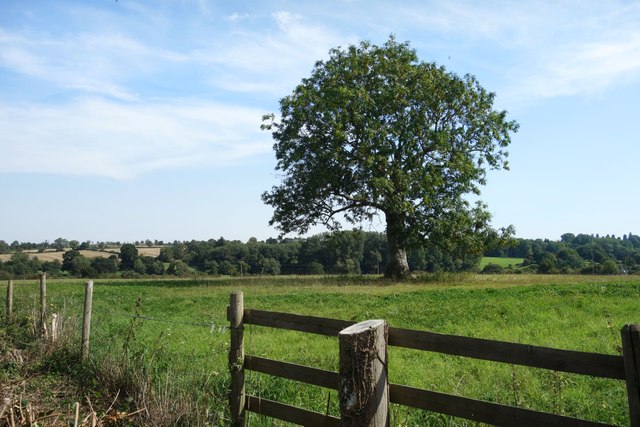
Barton, Middle is a small village located in Oxfordshire, England. Situated approximately 8 miles southwest of Oxford city center, Barton is part of the Cherwell district. The village is nestled amidst picturesque countryside, surrounded by rolling hills and meadows, providing residents with a tranquil and idyllic setting.

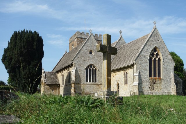
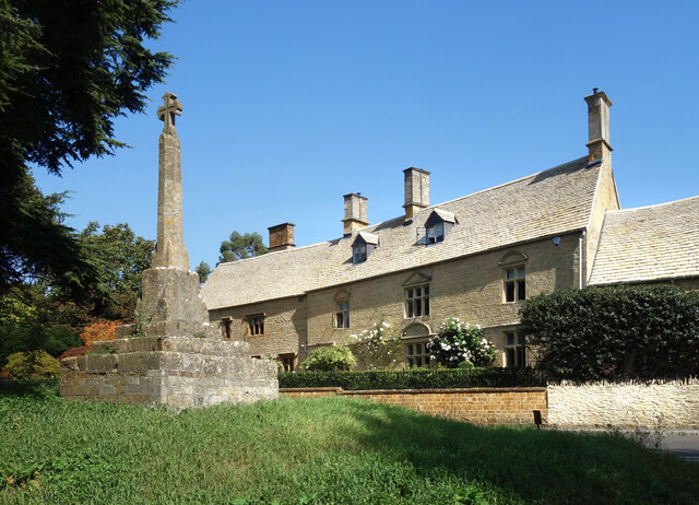
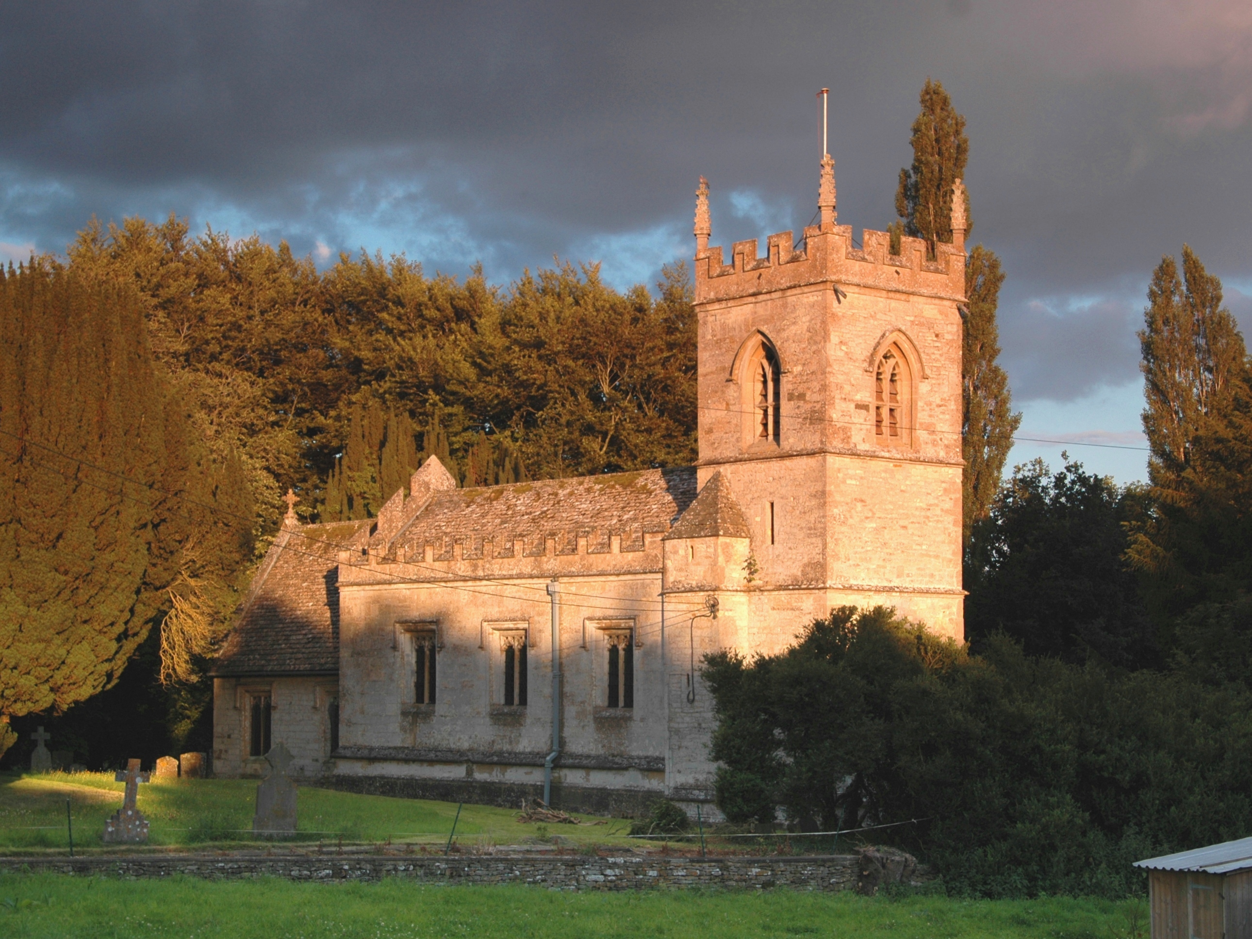
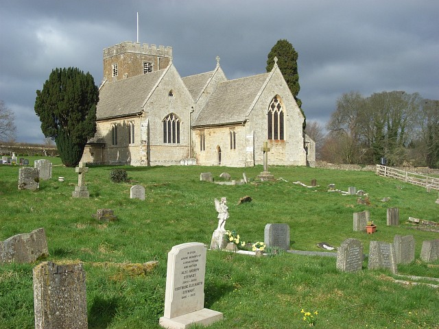
Barton boasts a rich history dating back to the medieval period and still retains much of its original charm. The village is home to a number of historic buildings, including St. James' Church, which dates back to the 12th century and features beautiful architecture and stained glass windows.

Despite its small size, Barton has a strong sense of community, with various local events and activities taking place throughout the year. The village has a primary school, providing education for the local children, and a village hall that serves as a central hub for social gatherings and community events.

The surrounding countryside offers ample opportunities for outdoor activities, including walking, cycling, and horse riding. The nearby Shotover Country Park, a designated nature reserve, provides stunning views and diverse wildlife.

For amenities, residents of Barton have access to essential services and amenities in nearby towns such as Oxford and Abingdon. These towns offer a wide range of shops, restaurants, and leisure facilities, ensuring that residents have all they need within a short distance.

Overall, Barton, Middle offers a peaceful and picturesque setting, rich in history and community spirit, making it an attractive place to live for those seeking a countryside lifestyle with easy access to nearby towns.

If you have any feedback on the listing, please let us know in the comments section below.

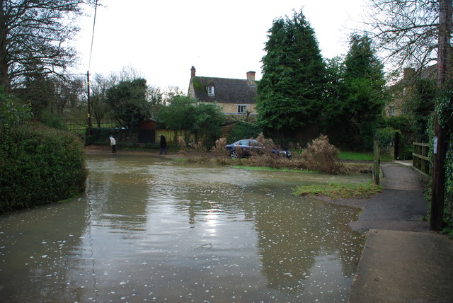
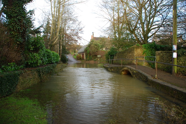
Barton, Middle Images

Images are sourced within 2km of 51.930297/-1.362946 or Grid Reference SP4325. Thanks to Geograph Open Source API. All images are credited.

Ford at Middle Barton This is the first of two fords at Middle Barton. Shown after heavy rain this is the Fox Lane ford just down from the Fox Inn.
<a title="https://www.geograph.org.uk/photo/3269394" href="https://www.geograph.org.uk/photo/3269394">Link</a>
Ford at Middle Barton
This is the first of two fords at Middle Barton. Shown after heavy rain this is the Fox Lane ford just down from the Fox Inn. Link
Middle Barton Ford This is the second of the two Middle Barton fords. Shown here in full flood this is the Mill Lane ford. The first ford is found at SP433255.
<a title="https://www.geograph.org.uk/photo/3269383" href="https://www.geograph.org.uk/photo/3269383">Link</a>
Middle Barton Ford
This is the second of the two Middle Barton fords. Shown here in full flood this is the Mill Lane ford. The first ford is found at SP433255. Link
The Cinnamon Stick, Middle Barton It's a Lebanese restaurant (and bar) now. The building looks like it may have been a pub in the past.
The Cinnamon Stick, Middle Barton
It's a Lebanese restaurant (and bar) now. The building looks like it may have been a pub in the past.
St Mary's, Steeple Barton
Church of St Edward the Confessor, Westcote Barton
Barton Abbey
Barton Abbey
Sub-station, Glympton Heath Out here in the middle of an otherwise agricultural landscape.
Sub-station, Glympton Heath
Out here in the middle of an otherwise agricultural landscape.
The Turn for Steeple Barton It's not all winding little country lanes round here. Open roads with wide verges like this one are quite usual.
The Turn for Steeple Barton
It's not all winding little country lanes round here. Open roads with wide verges like this one are quite usual.
St Mary's Church, Steeple Barton On a slope overlooking the valley of the small River Dorn, St Mary's is quite a large church for the little hamlet of Steeple Barton. Most of its parishioners are in Middle Barton, a nearby village along a busier road.
St Mary's Church, Steeple Barton
On a slope overlooking the valley of the small River Dorn, St Mary's is quite a large church for the little hamlet of Steeple Barton. Most of its parishioners are in Middle Barton, a nearby village along a busier road.
Lighting up the Church A floodlight at the back of St Mary's Church. The church is at the top of a slope and probably looks good when lit up.
Lighting up the Church
A floodlight at the back of St Mary's Church. The church is at the top of a slope and probably looks good when lit up.
Tombstones, old & new The very neat churchyard at St Mary's church with its orderly rows of regulation size graves in marble or whatever.
It seems a bit of a shame though that a lot of the old tombstones, some going back to the 17th and 18th centuries, have been laid flat into a sort of path to nowhere to make room.
Tombstones, old & new
The very neat churchyard at St Mary's church with its orderly rows of regulation size graves in marble or whatever. It seems a bit of a shame though that a lot of the old tombstones, some going back to the 17th and 18th centuries, have been laid flat into a sort of path to nowhere to make room.
Tombstones, new & old Another look at St Mary's Churchyard where old stones have been moved and laid flat to make room for more modern ones.
This is an unusually neat churchyard. Someone obviously takes pride in looking after it.
Tombstones, new & old
Another look at St Mary's Churchyard where old stones have been moved and laid flat to make room for more modern ones. This is an unusually neat churchyard. Someone obviously takes pride in looking after it.
St Mary's Churchyard, Steeple Barton The church is on top of a slope overlooking the valley of the River Dorn down in the trees.
St Mary's Churchyard, Steeple Barton
The church is on top of a slope overlooking the valley of the River Dorn down in the trees.
A Leaning Apple Tree, Steeple Barton A view from Church Lane towards Pritchards Cottage, one of the few houses in the very small village of Steeple Barton.
A Leaning Apple Tree, Steeple Barton
A view from Church Lane towards Pritchards Cottage, one of the few houses in the very small village of Steeple Barton.
Church Farm, Steeple Barton Stone barns belonging to one of the larger properties in this very small village.
Church Farm, Steeple Barton
Stone barns belonging to one of the larger properties in this very small village.
Countryside near Middle Barton Gentle hills and shallow valleys, fields and  small woods. A typical view for this area.
Countryside near Middle Barton
Gentle hills and shallow valleys, fields and small woods. A typical view for this area.
The Bungalow, Whistlow A small house beside B4030 near Steeple Barton.
The Bungalow, Whistlow
A small house beside B4030 near Steeple Barton.
Brandon House, and Cross A large former farmhouse from the 17th century. Listing on <span class="nowrap"><a title="https://historicengland.org.uk/listing/the-list/list-entry/1052507?section=official-list-entry" rel="nofollow ugc noopener" href="https://historicengland.org.uk/listing/the-list/list-entry/1052507?section=official-list-entry">Link</a><img style="margin-left:2px;" alt="External link" title="External link - shift click to open in new window" src="https://s1.geograph.org.uk/img/external.png" width="10" height="10"/></span>
The cross is medieval, restored in 1856.
Brandon House, and Cross
A large former farmhouse from the 17th century. Listing on LinkExternal link The cross is medieval, restored in 1856.
Show me another place!

Barton, Middle is located at Grid Ref: SP4325 (Lat: 51.930297, Lng: -1.362946)

Administrative County: Oxfordshire

District: West Oxfordshire

Police Authority: Thames Valley

What 3 Words

///recruiter.barmaid.enigma. Near Deddington, Oxfordshire

Related Wikis

Westcott Barton

Westcott Barton, also spelt Wescot Barton or Wescote Barton, is a village and civil parish on the River Dorn in West Oxfordshire about 7 miles (11 km)...

Steeple Barton

Steeple Barton is a civil parish and scattered settlement on the River Dorn in West Oxfordshire, about 8+1⁄2 miles (13.7 km) east of Chipping Norton, a...

Horsehay Quarries

Horsehay Quarries is a 8.4-hectare (21-acre) geological Site of Special Scientific Interest west of Bicester in Oxfordshire. It is a Geological Conservation...

Sandford St Martin

Sandford St Martin is a village and civil parish in West Oxfordshire about 7 miles (11 km) east of Chipping Norton and about 12 miles (19 km) south of...

Horsehay Sand Formation

The Horsehay Sand Formation is a geological formation in England. Part of the Great Oolite Group, it was deposited in the Bajocian to Bathonian stages...
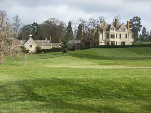
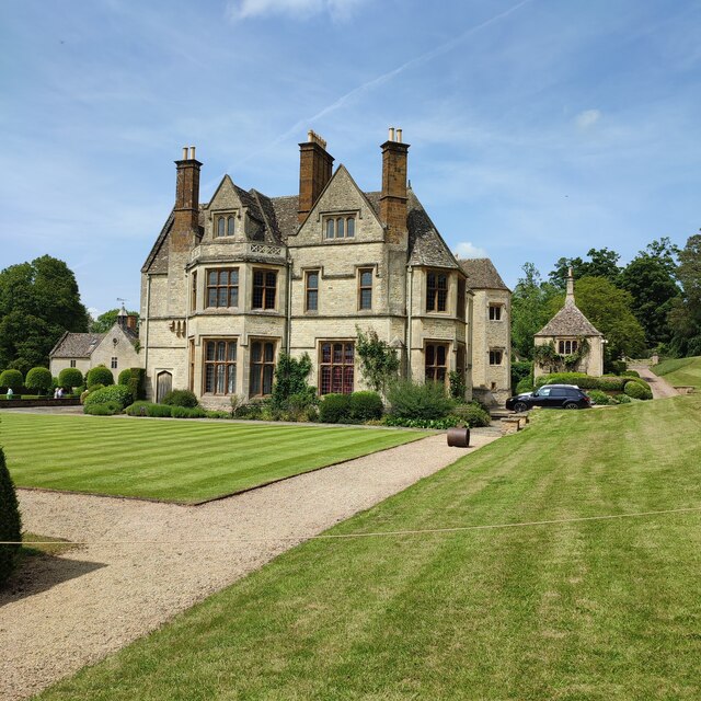
Barton Abbey

Barton Abbey is a privately owned house in Oxfordshire, England located in the parish of Steeple Barton. Parts of the building date from the 16th Century...

Gagingwell

Gagingwell is a hamlet in West Oxfordshire, about 6 miles (10 km) east of Chipping Norton and about 1.8 miles (3 km) east of Enstone. The hamlet surrounds...

Duns Tew

Duns Tew is an English village and civil parish about 7+1⁄2 miles (12 km) south of Banbury in Oxfordshire. The 2011 Census recorded the parish's population...

Nearby Amenities

Located within 500m of 51.930297,-1.362946
Steeple Barton
Place: parish
Lat/Long: 51.9272368/-1.3613199
Post Office
Middle Barton Post Office
Addr Postcode: OX7 7EE
Brand: Post Office
Brand Wikidata: Q1783168
Ref Pol Id: 3289
Lat/Long: 51.9304805/-1.3698465
Barrier: stile
Foot: yes
Lat/Long: 51.9305885/-1.359528
Barrier: stile
Foot: yes
Lat/Long: 51.9296873/-1.3594534
Garage
Naptan AtcoCode: 340001765MLC
Naptan Bearing: W
Naptan BusStopType: CUS
Naptan CommonName: Garage
Naptan Indicator: Mill Lane corner
Naptan Landmark: Garage
Naptan NaptanCode: oxfgdapg
Naptan Street: North Street
Naptan Verified: no
Source: naptan_import
Lat/Long: 51.9288487/-1.3643786
Bus Stop
Garage
Bus: yes
Naptan AtcoCode: 340001765OPM
Naptan Bearing: E
Naptan CommonName: Garage
Naptan Indicator: Opposite Mill Lane
Naptan Landmark: Garage
Naptan NaptanCode: oxfgdapd
Naptan Street: North Street
Naptan Verified: no
Public Transport: platform
Source: naptan_import
Lat/Long: 51.928938/-1.36433
Playing Fields
Naptan AtcoCode: 340001766NOR
Naptan Bearing: N
Naptan BusStopType: CUS
Naptan CommonName: Playing Fields
Naptan Indicator: Northbound
Naptan Landmark: Playing Fields
Naptan NaptanCode: oxfgdapa
Naptan Street: Worton Road
Naptan Verified: no
Source: naptan_import
Lat/Long: 51.9313236/-1.3698959
Bus Stop
Playing Fields
Bus: yes
Naptan AtcoCode: 340001766SOU
Naptan Bearing: S
Naptan CommonName: Playing Fields
Naptan Indicator: Southbound
Naptan Landmark: Playing Fields
Naptan NaptanCode: oxfgdamw
Naptan Street: Worton Road
Naptan Verified: no
Public Transport: platform
Source: naptan_import
Lat/Long: 51.9313139/-1.3697506
Restaurant
Carpenters Arms
Cuisine: international;lebanese
Phone: +44 1869 340440
Real Ale: yes
Wikidata: Q26495452
Lat/Long: 51.9289416/-1.360937
Turning Circle
Lat/Long: 51.9279656/-1.3676114
Kindergarten
Middle Barton Pre-school
Addr Housenumber: 29
Addr Postcode: OX7 7BX
Addr Street: Church Lane
Fixme: Position
Isced Level: 0
Source Geometry: Bing
Lat/Long: 51.926401/-1.3621163
Middle Barton
Place: village
Lat/Long: 51.9287079/-1.3661592
Power: pole
Source: Bing
Lat/Long: 51.930257/-1.355991
Power: pole
Source: Bing
Lat/Long: 51.9290241/-1.3568572
Power: pole
Source: Bing
Lat/Long: 51.9275162/-1.3579555
Power: pole
Source: Bing
Lat/Long: 51.9313891/-1.355965
Middle Barton Stores
Shop: yes
Lat/Long: 51.9304757/-1.369695
JAS Services
Shop: car_repair
Lat/Long: 51.9305696/-1.3698966
Cafe
The Tea House
Lat/Long: 51.9305183/-1.3697534
Power: pole
Source: Bing
Lat/Long: 51.9273226/-1.3606103
Power: pole
Source: Bing
Lat/Long: 51.9273971/-1.3585417
Power: pole
Source: Bing
Lat/Long: 51.927364/-1.3594563
Turning Circle
Lat/Long: 51.9269007/-1.3622445
Power: pole
Lat/Long: 51.9308619/-1.3560506
Power: pole
Lat/Long: 51.9308204/-1.356762
Power: pole
Lat/Long: 51.930755/-1.3578698
Power: pole
Lat/Long: 51.9306873/-1.3589315
Power: pole
Lat/Long: 51.9306273/-1.3598783
Power: pole
Lat/Long: 51.930576/-1.3609931
Power: pole
Lat/Long: 51.930504/-1.362115
Power: pole
Lat/Long: 51.9274079/-1.357619
Power: pole
Lat/Long: 51.9273127/-1.3618143
Power: pole
Lat/Long: 51.9272971/-1.3623946
Power: pole
Lat/Long: 51.9269749/-1.3635667
The data included in this document is from www.openstreetmap.org. The data is made available under ODbL.

Have you been to Barton, Middle?

Leave your review of Barton, Middle below (or comments, questions and feedback).