Hanworth Hall

Heritage Site in Norfolk North Norfolk

England

Hanworth Hall

Repainted Sustead village sign The sign depicts the three dolphins of the Damme family and "the manor of Damms in Sustede" in the reign of Queen Elizabeth I.
Repainted Sustead village sign Credit: Jane Rackham

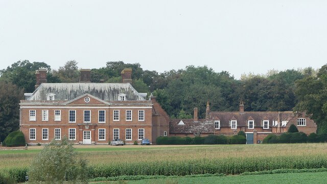
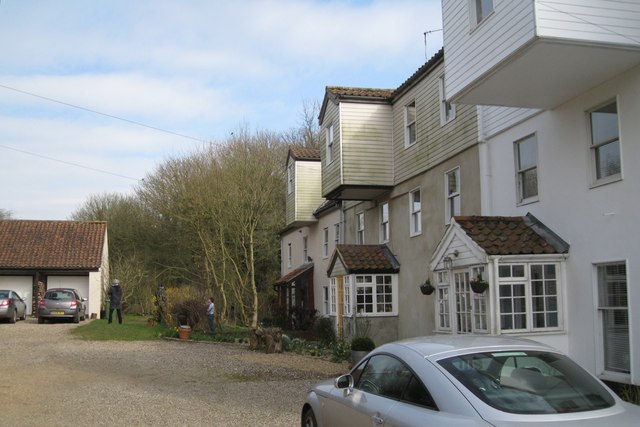
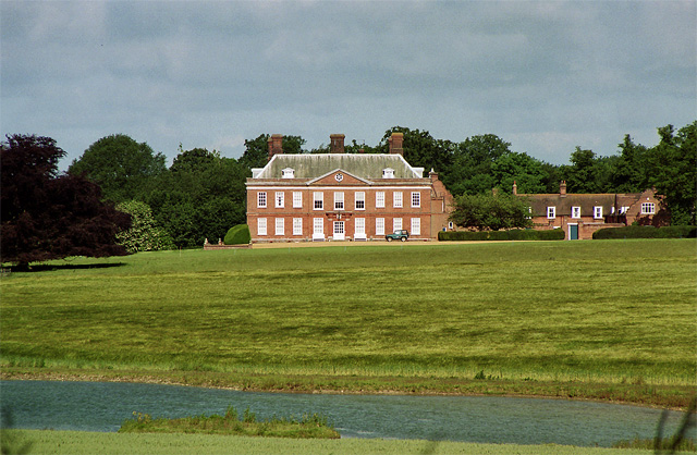
Hanworth Hall is a historic mansion located in Norfolk, England. This magnificent heritage site is renowned for its architectural beauty and rich history. The hall dates back to the 17th century and has been meticulously preserved, offering visitors a glimpse into the grandeur of the past.

The hall is a fine example of Jacobean architecture, characterized by its symmetrical design, ornate decorations, and intricate detailing. The exterior of the building features red brick walls, mullioned windows, and a steeply pitched roof, reminiscent of the era. Inside, visitors can explore the opulent rooms adorned with oak paneling, elaborate plasterwork, and grand fireplaces.

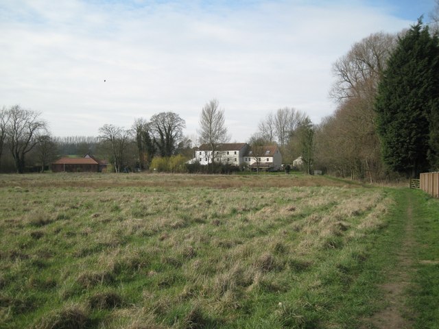
Surrounding the hall is a picturesque landscape, complete with manicured gardens, sprawling lawns, and charming ornamental features. The gardens are a delight to wander through, with vibrant flower beds, ancient trees, and a tranquil pond. The estate also boasts a beautiful walled garden, which was once used for growing herbs and vegetables.

Hanworth Hall has a fascinating history, having been home to several notable families throughout the centuries. It was originally built for the Astley family, who were prominent landowners in the area. Over the years, the hall changed hands and underwent various modifications, each leaving its mark on the building's architecture and design.

Today, the hall is open to the public, offering guided tours that provide insight into its rich history and architectural significance. Hanworth Hall is not only a remarkable heritage site but also a testament to the grandeur and elegance of the past.

If you have any feedback on the listing, please let us know in the comments section below.

Hanworth Hall Images

Images are sourced within 2km of 52.872/1.262 or Grid Reference TG1935. Thanks to Geograph Open Source API. All images are credited.

Repainted Sustead village sign The sign depicts the three dolphins of the Damme family and "the manor of Damms in Sustede" in the reign of Queen Elizabeth I.
Repainted Sustead village sign
The sign depicts the three dolphins of the Damme family and "the manor of Damms in Sustede" in the reign of Queen Elizabeth I.
Church of St. Andrew, Metton <span class="nowrap"><a title="https://historicengland.org.uk/listing/the-list/list-entry/1049496?section=official-list-entry" rel="nofollow ugc noopener" href="https://historicengland.org.uk/listing/the-list/list-entry/1049496?section=official-list-entry">Link</a><img style="margin-left:2px;" alt="External link" title="External link - shift click to open in new window" src="https://s1.geograph.org.uk/img/external.png" width="10" height="10"/></span>
Church of St. Andrew, Metton
Hanworth Hall <span class="nowrap"><a title="https://historicengland.org.uk/listing/the-list/list-entry/1049863?section=official-list-entry" rel="nofollow ugc noopener" href="https://historicengland.org.uk/listing/the-list/list-entry/1049863?section=official-list-entry">Link</a><img style="margin-left:2px;" alt="External link" title="External link - shift click to open in new window" src="https://s1.geograph.org.uk/img/external.png" width="10" height="10"/></span>
Hanworth Hall
Church of All Saints, Thurgarton <span class="nowrap"><a title="https://historicengland.org.uk/listing/the-list/list-entry/1373472?section=official-list-entry" rel="nofollow ugc noopener" href="https://historicengland.org.uk/listing/the-list/list-entry/1373472?section=official-list-entry">Link</a><img style="margin-left:2px;" alt="External link" title="External link - shift click to open in new window" src="https://s1.geograph.org.uk/img/external.png" width="10" height="10"/></span>
Church of All Saints, Thurgarton
2023-03-01 Thurgarton - All Saints Church South Porch of All Saints Church now looked after by the Churches Conservation Trust. Pew end carvings of fantastic beasts including dragon, elephant, harpies, fighting dogs and many more.
2023-03-01 Thurgarton - All Saints Church
South Porch of All Saints Church now looked after by the Churches Conservation Trust. Pew end carvings of fantastic beasts including dragon, elephant, harpies, fighting dogs and many more.
2023-03-01 Thurgarton - All Saints Church - Elephant with Howdah Mediaeval pew end carving featuring an elephant complete with howdah. Church disused but now in the care of the Churches Conservation Trust.
2023-03-01 Thurgarton - All Saints Church - Elephant with Howdah
Mediaeval pew end carving featuring an elephant complete with howdah. Church disused but now in the care of the Churches Conservation Trust.
2023-03-01 Thurgarton - All Saints Church - Dragon pew end carving Mediaeval pew end carving of a dragon with folded wings.
2023-03-01 Thurgarton - All Saints Church - Dragon pew end carving
Mediaeval pew end carving of a dragon with folded wings.
'Manor House', Thwaite Road There are farm buildings behind the house. Streetmap identifies this as Manor Farm while OS gives that name to a property to the south which Streetmap calls Old School Cottages <a href="https://www.geograph.org.uk/photo/2368487">TG1833 : Orchard southwest of Aldborough</a>
'Manor House', Thwaite Road
There are farm buildings behind the house. Streetmap identifies this as Manor Farm while OS gives that name to a property to the south which Streetmap calls Old School Cottages TG1833 : Orchard southwest of Aldborough
Community bus at Manor Farm Streetmap calls this Manor Farm while OS gives the name to a property to the south, which Streetmap calls Old School Cottages <a href="https://www.geograph.org.uk/photo/2368487">TG1833 : Orchard southwest of Aldborough</a>. The photo was taken from a footpath that continues to the northeast corner of an orchard, then along its northern edge <a href="https://www.geograph.org.uk/photo/2367405">TG1734 : Orchard, mid-March</a>.
Community bus at Manor Farm
Streetmap calls this Manor Farm while OS gives the name to a property to the south, which Streetmap calls Old School Cottages TG1833 : Orchard southwest of Aldborough. The photo was taken from a footpath that continues to the northeast corner of an orchard, then along its northern edge TG1734 : Orchard, mid-March.
Houses along Middle Hill
Grassland east of Aldborough Mill The property on the left, seen from the rear, is 'The Granary'.
Grassland east of Aldborough Mill
The property on the left, seen from the rear, is 'The Granary'.
Footbridge over Scarrow Beck Flowing from right to left. Footpath approaches Aldborough Mill, now in residential use.
Footbridge over Scarrow Beck
Flowing from right to left. Footpath approaches Aldborough Mill, now in residential use.
Scarrow Beck above Aldborough Mill Flowing towards the camera, the mill and a footbridge.
Scarrow Beck above Aldborough Mill
Flowing towards the camera, the mill and a footbridge.
Villagers chat at Aldborough Mill
West side of the Green, Aldborough The large triangular green has many uses. Here is a goalmouth and in the foreground some running lanes have been marked out.
West side of the Green, Aldborough
The large triangular green has many uses. Here is a goalmouth and in the foreground some running lanes have been marked out.
East corner of the Green, Aldborough The building on the left is the post office, with postbox number NR11 1125 outside. The road on the right continues past the Community Hall as Chapel Road.
East corner of the Green, Aldborough
The building on the left is the post office, with postbox number NR11 1125 outside. The road on the right continues past the Community Hall as Chapel Road.
Older houses on the Green, Aldborough
South corner of the Green, Aldborough An improvised sign advertises a jumble sale that morning.
South corner of the Green, Aldborough
An improvised sign advertises a jumble sale that morning.
Show me another place!

Hanworth Hall is located at Grid Ref: TG1935 (Lat: 52.872, Lng: 1.262)

Administrative County: Norfolk

District: North Norfolk

Police Authority: Norfolk

What 3 Words

///slick.incisions.quietly. Near Cromer, Norfolk

Related Wikis

Hanworth Hall

Hanworth Hall is a large late 17th-century country house some 500 m to the south of the village of Hanworth, Norfolk, England. It is protected and recognised...
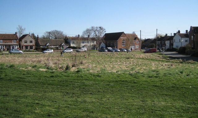
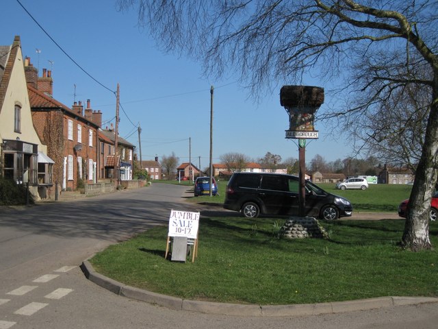
Hanworth, Norfolk

Hanworth is a village and a civil parish in the English county of Norfolk. It is 18.8 miles (30.3 km) north of Norwich, 5.4 miles (8.7 km) south-west of...
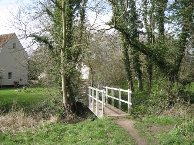
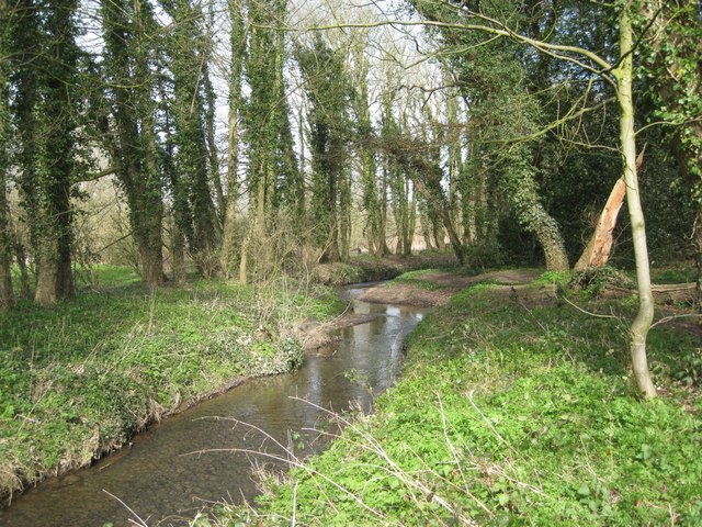
Gur Beck

Gur Beck is a minor watercourse which rises in the north of the English county of Norfolk. It is a tributary of the Scarrow Beck. Its spring is a little...

Thurgarton, Norfolk

Thurgarton is a village and former civil parish, now in the parish of Aldborough and Thurgarton, in the North Norfolk district of the county of Norfolk...

Nearby Amenities

Located within 500m of 52.872,1.262
Barrier: cattle_grid
Bicycle: yes
Foot: yes
Motorcycle: yes
Lat/Long: 52.8732174/1.2666661
Barrier: cattle_grid
Bicycle: yes
Foot: yes
Motorcar: yes
Motorcycle: yes
Lat/Long: 52.8714453/1.2567944
Barrier: cattle_grid
Bicycle: yes
Foot: yes
Motorcar: yes
Motorcycle: yes
Lat/Long: 52.8707553/1.2652761
Bench
Backrest: yes
Material: wood
Seats: 2
Lat/Long: 52.8715713/1.257988
Hanworth
Place: village
Wikidata: Q5651433
Wikipedia: en:Hanworth, Norfolk
Lat/Long: 52.8718245/1.2629584
Barrier: stile
Bicycle: no
Foot: yes
Material: wood
Stile: stepover
Lat/Long: 52.8729451/1.265168
Barrier: stile
Bicycle: no
Foot: yes
Material: wood
Stile: stepover
Lat/Long: 52.8735063/1.264895
Post Box
Operator: Royal Mail
Post Box Type: wall
Lat/Long: 52.872499/1.2590612
Give Way
Lat/Long: 52.8725771/1.258294
Give Way
Lat/Long: 52.8726248/1.2581293
Notice Board
Lat/Long: 52.872278/1.2579759
Give Way
Lat/Long: 52.8725408/1.258196
Give Way
Lat/Long: 52.8720605/1.2599071
Power: pole
Lat/Long: 52.8762984/1.2627867
Power: pole
Lat/Long: 52.8754405/1.2626821
Power: pole
Lat/Long: 52.8746132/1.2625882
Power: pole
Lat/Long: 52.8738329/1.2624836
Power: pole
Lat/Long: 52.8733764/1.2617648
Power: pole
Lat/Long: 52.8729457/1.2609306
Power: pole
Lat/Long: 52.8729279/1.2597477
Power: pole
Lat/Long: 52.8728923/1.2581921
Power: pole
Lat/Long: 52.8728146/1.2561777
Power: pole
Lat/Long: 52.8728437/1.2576717
Barrier: stile
Bicycle: no
Foot: yes
Material: wood
Note: Broken, difficult.
Stile: stepover
Lat/Long: 52.8761912/1.2646388
The data included in this document is from www.openstreetmap.org. The data is made available under ODbL.

Have you been to Hanworth Hall?

Leave your review of Hanworth Hall below (or comments, questions and feedback).