Belchford

Settlement in Lincolnshire East Lindsey

England

Belchford

Direction Sign – Signpost on Main Road in Belchford Located on the north side of the T junction of Main Road and Fulletby Road in Belchford parish. 3 arms and no finial.

Milestone Society National ID: LI_TF2975
Direction Sign – Signpost on Main Road in Belchford Credit: A Riley

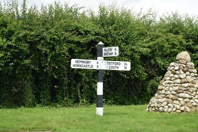
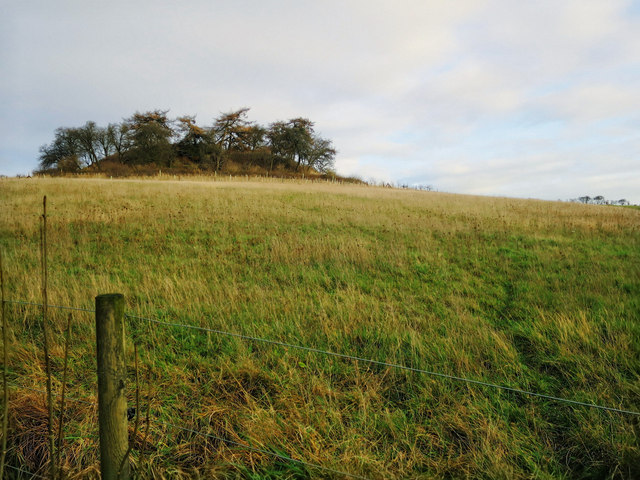
Belchford is a small village located in the East Lindsey district of Lincolnshire, England. Situated on the eastern edge of the Lincolnshire Wolds, it is surrounded by picturesque rolling hills and beautiful countryside. The village is positioned approximately 5 miles northeast of Horncastle and 15 miles southwest of the coastal town of Louth.

Belchford has a rich history dating back to the medieval period, and this is evident in its charming architecture and quaint atmosphere. The village is known for its traditional stone cottages, many of which date back several centuries, giving it a timeless and authentic feel.

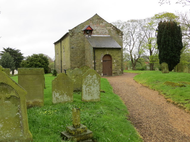
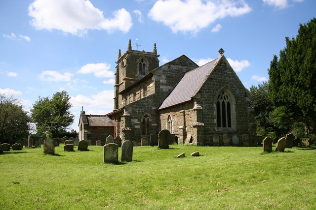
While Belchford is a small village, it is not devoid of amenities. The local community is served by a village hall, which acts as a hub for various social events and gatherings. There is also a church, St. Peter and St. Paul's, which stands as a prominent landmark in the village.

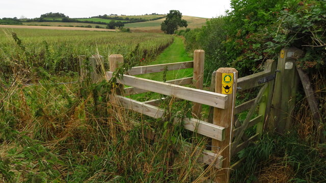
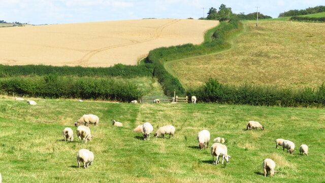
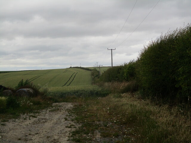
One of Belchford's main attractions is its natural beauty and the opportunities it provides for outdoor activities. The surrounding countryside offers numerous walking and cycling trails, allowing visitors to explore the stunning landscape. Additionally, the village is situated near the Viking Way, a long-distance footpath that stretches across Lincolnshire.

Overall, Belchford is a tranquil and picturesque village, ideal for those seeking a peaceful retreat or an escape to nature. Its historic charm, combined with its stunning surroundings, makes it a hidden gem within the Lincolnshire countryside.

If you have any feedback on the listing, please let us know in the comments section below.

Belchford Images

Images are sourced within 2km of 53.260261/-0.063745 or Grid Reference TF2975. Thanks to Geograph Open Source API. All images are credited.

Direction Sign – Signpost on Main Road in Belchford Located on the north side of the T junction of Main Road and Fulletby Road in Belchford parish. 3 arms and no finial.

Milestone Society National ID: LI_TF2975
Direction Sign – Signpost on Main Road in Belchford
Located on the north side of the T junction of Main Road and Fulletby Road in Belchford parish. 3 arms and no finial. Milestone Society National ID: LI_TF2975
The Viking Way north of Belchford
Viking Way heading north from Fulletby
Field edge near Belchford
Track to Field Farm
Track to Field Farm
Wood Farm, looking towards Scamblesby: aerial 2015
North of Fulletby The Viking Way path heads across fine undulating countryside after passing through the historic village of Fulletby.
North of Fulletby
The Viking Way path heads across fine undulating countryside after passing through the historic village of Fulletby.
Juicetrump Hill A prominent mound, viewed from the Viking Way.
Juicetrump Hill
A prominent mound, viewed from the Viking Way.
Warning signs by the Viking Way The landowner clearly wants to keep walkers from straying off the path here! If you get past the barbed wire and electric fence you'll be in a bit of woodland. Then again, you could just walk on...
Warning signs by the Viking Way
The landowner clearly wants to keep walkers from straying off the path here! If you get past the barbed wire and electric fence you'll be in a bit of woodland. Then again, you could just walk on...
Ordnance Survey Cut Mark This OS cut mark can be found on the north face of St Peter & St Paul's Church. It marks a point 83.660m above mean sea level.
Ordnance Survey Cut Mark
This OS cut mark can be found on the north face of St Peter & St Paul's Church. It marks a point 83.660m above mean sea level.
Sandy Lane, Belchford to River Waring: aerial 2017 Sandy Lane bottom left, leading upwards. Unnamed road across shot in the foreground. River Waring diagonally across centre. Cold winter light and some frost on field edges.
Sandy Lane, Belchford to River Waring: aerial 2017
Sandy Lane bottom left, leading upwards. Unnamed road across shot in the foreground. River Waring diagonally across centre. Cold winter light and some frost on field edges.
The church of St Peter and St Paul in Belchford Looking eastward.
The church of St Peter and St Paul in Belchford
Looking eastward.
Give Way to the A153 at South Wold Looking north-eatsward.
Give Way to the A153 at South Wold
Looking north-eatsward.
Road to Belchford at East Farm Looking eastward.
Road to Belchford at East Farm
Looking eastward.
Ordnance Survey Cut Mark This mark can be found on the wall of St Peter's Church in Belchford.
For more detail see : <span class="nowrap"><a title="http://www.bench-marks.org.uk/bm40750" rel="nofollow ugc noopener" href="http://www.bench-marks.org.uk/bm40750">Link</a><img style="margin-left:2px;" alt="External link" title="External link - shift click to open in new window" src="https://s1.geograph.org.uk/img/external.png" width="10" height="10"/></span>
Ordnance Survey Cut Mark
This mark can be found on the wall of St Peter's Church in Belchford. For more detail see : LinkExternal link
Hills and Holes, plus enclosures, near Belchford: aerial 2018 "Hills and Holes" is the name on the map of the rough field on the left.
Hills and Holes, plus enclosures, near Belchford: aerial 2018
"Hills and Holes" is the name on the map of the rough field on the left.
Upper Glebe Farm and area, near Belchford: aerial 2018
Field near Wood Farm, West of Belchford Wood: aerial 2018
Show me another place!

Belchford is located at Grid Ref: TF2975 (Lat: 53.260261, Lng: -0.063745)

Division: Parts of Lindsey

Administrative County: Lincolnshire

District: East Lindsey

Police Authority: Lincolnshire

What 3 Words

///trackers.trombone.mammoth. Near Horncastle, Lincolnshire

Nearby Locations

Belchford Belchford

Related Wikis

Belchford

Belchford is a village and civil parish in the East Lindsey district of Lincolnshire, England. The village is situated approximately 4 miles (6 km) north...

Juicetrump Hill

Juicetrump Hill is a hill around half a mile north of Belchford and 4.5 miles north-east of Horncastle in Lincolnshire, UK within the Lincolnshire Wolds...

East Lindsey

East Lindsey is a local government district in Lincolnshire, England. Its council is based in Horncastle and the largest town is Skegness. Other towns...

Fulletby

Fulletby is a village and a civil parish in the East Lindsey district of Lincolnshire, England. It is in the Lincolnshire Wolds, and 3 miles (5 km) north...

Oxcombe

Oxcombe is a small village in the civil parish of Maidenwell, in the East Lindsey district of Lincolnshire, England. It is situated 3 miles (5 km) west...

Scamblesby

Scamblesby is a village and civil parish in the East Lindsey district from Lincolnshire, England. It is situated 6 miles (10 km) south-west from Louth...

Tetford

Tetford is a village and civil parish in the East Lindsey district of Lincolnshire, England. == History == Tetford is listed as "Tesforde" in the Domesday...

Salmonby

Salmonby is a village in the civil parish of Tetford, in the East Lindsey district of Lincolnshire, England. It is situated 5.5 miles (8.9 km) north-east...

Nearby Amenities

Located within 500m of 53.260261,-0.063745
Belchford
Is In: Lincolnshire, England, UK
Place: village
Source: Bing
Lat/Long: 53.2607735/-0.0628264
Bus Stop
Blue Bell PH
Bench: no
Bin: no
Lit: no
Naptan AtcoCode: 270000009778
Naptan Bearing: NW
Naptan BusStopType: CUS
Naptan CommonName: Blue Bell PH
Naptan Indicator: NW - bound
Naptan Landmark: Blue Bell PH
Naptan NaptanCode: linjdwgd
Naptan Street: Main Road
Naptan Verified: no
Shelter: no
Source: naptan_import
Tactile Paving: no
Lat/Long: 53.2604817/-0.0641088
Bus Stop
Blue Bell PH
Naptan AtcoCode: 2700LBBB5470
Naptan Bearing: SE
Naptan BusStopType: CUS
Naptan CommonName: Blue Bell PH
Naptan Indicator: SE - bound
Naptan Landmark: Blue Bell PH
Naptan Street: Main Road
Naptan Verified: no
Source: naptan_import
Lat/Long: 53.2605045/-0.0638198
Pub
Bluebell Inn
Addr City: Horncastle
Addr Country: GB
Addr Postcode: LN9 6LQ
Addr Street: Main Road
Addr Village: Belchford
Fhrs Authority: East Lindsey
Fhrs Id: 155772
Fhrs Local Authority Id: EHFDI/00818/08
Url: http://www.bluebellbelchford.co.uk/
Wifi: yes
Lat/Long: 53.2606529/-0.0638073
Power: pole
Source: Bing
Lat/Long: 53.2570504/-0.0604771
Power: pole
Source: Bing
Lat/Long: 53.2578209/-0.0610596
Power: pole
Source: Bing
Lat/Long: 53.2598591/-0.0599836
Power: pole
Source: Bing
Lat/Long: 53.2584258/-0.0615492
Power: pole
Source: Bing
Lat/Long: 53.2590625/-0.060854
Power: pole
Source: Bing
Lat/Long: 53.2608207/-0.0671462
Power: pole
Lat/Long: 53.2619281/-0.0679431
Power: pole
Source: Bing
Lat/Long: 53.2626653/-0.0685117
Power: pole
Source: Bing
Lat/Long: 53.2633816/-0.0690374
Power: pole
Source: Bing
Lat/Long: 53.2616923/-0.0677982
Dams Farm
Place: farm
Source: Bing
Lat/Long: 53.2569088/-0.0664491
Bench
Source: Bing
Lat/Long: 53.2600283/-0.0623711
Waste Basket
Source: Bing
Lat/Long: 53.2600288/-0.0624068
Power: pole
Source: Bing
Lat/Long: 53.2584274/-0.0631299
Power: pole
Source: Bing
Lat/Long: 53.2584578/-0.0641436
Power: pole
Source: Bing
Lat/Long: 53.2584755/-0.0653167
Power: pole
Source: Bing
Lat/Long: 53.2586733/-0.0658874
Power: pole
Source: Bing
Lat/Long: 53.2597157/-0.0665234
Ryehill Farm
Place: farm
Source: Bing
Lat/Long: 53.2606666/-0.0663495
Power: pole
Lat/Long: 53.2625169/-0.0701362
White House Farm
Place: farm
Source: Bing
Lat/Long: 53.2573938/-0.058291
Place: farm
Source: Bing
Lat/Long: 53.2620647/-0.0663282
Advertising: board
Lat/Long: 53.260019/-0.0624656
Shelter
Shelter Type: public_transport
Lat/Long: 53.2600244/-0.0623315
The data included in this document is from www.openstreetmap.org. The data is made available under ODbL.

Have you been to Belchford?

Leave your review of Belchford below (or comments, questions and feedback).