Greenlands Howe

Heritage Site in Yorkshire

England

Greenlands Howe

Sleights Moor Farm Track Leading to High Quebec Farm.
Sleights Moor Farm Track Credit: Ian Rob

Greenlands Howe is a historic heritage site located in the picturesque village of Yorkshire, England. Situated amidst rolling hills and lush greenery, this site holds immense cultural and historical significance.

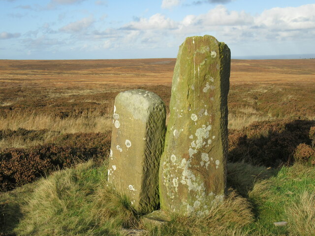
Greenlands Howe is an ancient burial mound, dating back to the early Bronze Age, around 2500 to 1500 BC. It stands as a testament to the early human settlements and their burial practices in this region. The mound is approximately 4 meters in height and 30 meters in diameter, making it an imposing structure that has withstood the test of time.

The site is known for its archaeological importance, as it has yielded numerous fascinating artifacts during excavations. These discoveries include burial urns, metal objects, and flint tools, providing valuable insights into the lives and customs of the people who inhabited this area thousands of years ago.

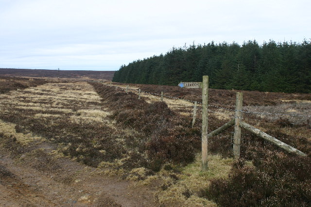
Greenlands Howe is also revered for its stunning natural surroundings. The mound offers panoramic views of the surrounding countryside, allowing visitors to appreciate the beauty of Yorkshire's landscape. The site is often visited by nature enthusiasts and history buffs alike, who come to soak in the tranquility and explore the rich historical heritage it offers.

In recent years, efforts have been made to preserve and protect Greenlands Howe, ensuring that future generations can continue to appreciate its historical significance. Interpretive panels and information boards have been placed to educate visitors about the site's importance and its role in the region's cultural heritage.

Visiting Greenlands Howe is a truly immersive experience, allowing individuals to step back in time and connect with the ancient inhabitants of Yorkshire.

If you have any feedback on the listing, please let us know in the comments section below.

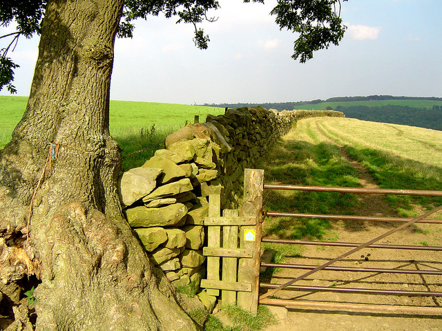
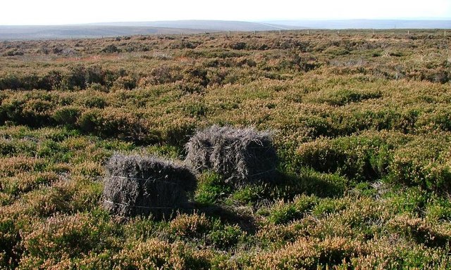
Greenlands Howe Images

Images are sourced within 2km of 54.418/-0.667 or Grid Reference NZ8603. Thanks to Geograph Open Source API. All images are credited.

Sleights Moor Farm Track Leading to High Quebec Farm.
Sleights Moor Farm Track
Leading to High Quebec Farm.
Breckon Howe stone Boundary stone on Breckon Howe.
Breckon Howe stone
Boundary stone on Breckon Howe.
Near Greenland's Howe Looking NE from the edge of the moor.
Near Greenland's Howe
Looking NE from the edge of the moor.
Double boundary stones For some reason, one stone is not enough here.
Double boundary stones
For some reason, one stone is not enough here.
Newton House Plantation Conifer trees in Newton House Plantation.
Newton House Plantation
Conifer trees in Newton House Plantation.
The view from Little Beck Lane Looking SE.
The view from Little Beck Lane
Looking SE.
Near Bleach Garth Looking east.
Near Bleach Garth
Looking east.
Parsley Beck Rigg Looking NE, the power lines shown on the map have now been demolished.
Parsley Beck Rigg
Looking NE, the power lines shown on the map have now been demolished.
Whinstone quarry The Whinstone quarry above Goathland.
Whinstone quarry
The Whinstone quarry above Goathland.
Just west of the A169 looking south westwards towards Goathland. This provides a long slog to cycle up from Goathland... I've only done it once!
Just west of the A169 looking south westwards towards Goathland.
This provides a long slog to cycle up from Goathland... I've only done it once!
Chapel at Daisy Bank
Moorland at Robbed Howe Looking N from position
Moorland at Robbed Howe
Looking N from position
Gated track onto moorland Looking SE to position
Gated track onto moorland
Looking SE to position
Moorland Moorland views in the Parish of Eskdaleside cum Ugglebarnby with Scarry Wood in the distance. Information and history of the parish can be found here.
<span class="nowrap"><a title="http://www.genuki.org.uk/big/eng/YKS/NRY/Eskdalesidewithugglebarnby/Eskdalesidewithugglebarnby90.html" rel="nofollow ugc noopener" href="http://www.genuki.org.uk/big/eng/YKS/NRY/Eskdalesidewithugglebarnby/Eskdalesidewithugglebarnby90.html">Link</a><img style="margin-left:2px;" alt="External link" title="External link - shift click to open in new window" src="https://s1.geograph.org.uk/img/external.png" width="10" height="10"/></span>
Moorland
Moorland views in the Parish of Eskdaleside cum Ugglebarnby with Scarry Wood in the distance. Information and history of the parish can be found here. LinkExternal link
Leas Head Road
Leas Head Road
Sleights Moor Footpath Looking east from the road to Grosmont. The path heads east to the A169. This is a typical view of the moorland in this grid square.
Sleights Moor Footpath
Looking east from the road to Grosmont. The path heads east to the A169. This is a typical view of the moorland in this grid square.
The Goathland to Whitby Road This is typical moorland scenery for this area.
The Goathland to Whitby Road
This is typical moorland scenery for this area.
Heather Baling, Sneaton Moor Traditionally heather or ling was cut for bedding for both animals and humans. Nowadays the bales of heather are more likely to be sold to the Forestry Commission for erosion control on 'soft' footpaths.
Heather Baling, Sneaton Moor
Traditionally heather or ling was cut for bedding for both animals and humans. Nowadays the bales of heather are more likely to be sold to the Forestry Commission for erosion control on 'soft' footpaths.
Show me another place!

Greenlands Howe is located at Grid Ref: NZ8603 (Lat: 54.418, Lng: -0.667)

Division: North Riding

What 3 Words

///quilting.coasters.bravo. Near Sleights, North Yorkshire

Nearby Locations

Greenlands Howe

Related Wikis

Littlebeck, North Yorkshire

Littlebeck is a hamlet in the North York Moors National Park, near Whitby, in North Yorkshire, England. It stands on the Little Beck, a minor tributary...
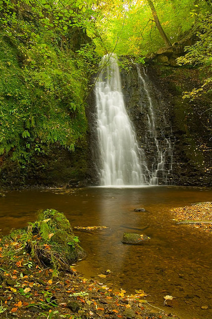
Falling Foss

Falling Foss is a waterfall that lies in the north-east section of The North York Moors National Park and is a popular spot for walking. It is 5 miles...

Eskdaleside cum Ugglebarnby

Eskdaleside cum Ugglebarnby is a civil parish in the Scarborough district of North Yorkshire, England, comprising the two villages of Sleights and Ugglebarnby...

Woodsmith Mine

Woodsmith Mine is a deep potash and polyhalite mine located near to the hamlet of Sneatonthorpe, Whitby in North Yorkshire, England. The venture was started...

Nearby Amenities

Located within 500m of 54.418,-0.667
Note: Power line has been removed - not present west of Littlebeck
Lat/Long: 54.418426/-0.6703801
Ford: yes
Lat/Long: 54.4143704/-0.6706315
Note: Power line has been removed - not present west of Littlebeck
Lat/Long: 54.4153826/-0.6708645
Note: Power line has been removed - not present west of Littlebeck
Lat/Long: 54.4169649/-0.6706126
Note: Power line has been removed - not present west of Littlebeck
Lat/Long: 54.4200455/-0.6701164
Note: Power line has been removed - not present west of Littlebeck
Lat/Long: 54.4215602/-0.6698697
The data included in this document is from www.openstreetmap.org. The data is made available under ODbL.

Have you been to Greenlands Howe?

Leave your review of Greenlands Howe below (or comments, questions and feedback).