Fen Causeway

Heritage Site in Cambridgeshire

England

Fen Causeway

Track to Eldernell Farm
Track to Eldernell Farm Credit: Mat Fascione

Fen Causeway is a historic road located in Cambridgeshire, England. It is a designated heritage site due to its historical significance and the preservation of its original features. The causeway stretches over a distance of approximately 7 miles, running from the city of Cambridge to the village of Trumpington.

Dating back to Roman times, Fen Causeway was once a major thoroughfare connecting the Roman settlement of Camboritum (modern-day Cambridge) to the Roman road network. The road was constructed on a raised embankment to traverse the low-lying fenland, which was prone to flooding. This engineering feat allowed for safe travel across the marshy terrain.

Today, the Fen Causeway serves as a popular walking and cycling route, offering visitors a chance to explore the picturesque countryside of Cambridgeshire. The road is lined with beautiful greenery, including trees, shrubs, and wildflowers, creating a tranquil and scenic atmosphere.

Along the route, there are several points of interest that showcase the area's rich history. These include ancient bridges, remnants of Roman fortifications, and archaeological sites. The causeway also passes by the renowned Cambridge University Botanic Garden, which is home to a diverse collection of plants from around the world.

Fen Causeway provides a fascinating glimpse into the past, allowing visitors to experience the same path that was once traveled by Roman soldiers and traders. Its historical and natural significance make it a must-visit location for history enthusiasts, nature lovers, and anyone seeking a peaceful escape in the heart of Cambridgeshire.

If you have any feedback on the listing, please let us know in the comments section below.
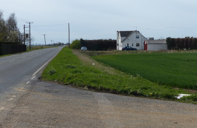
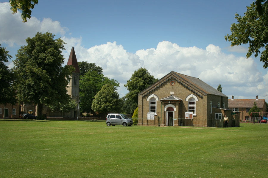
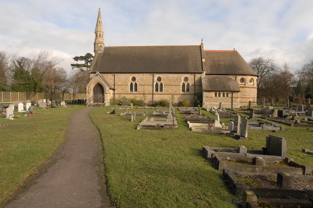
Fen Causeway Images

Images are sourced within 2km of 52.577/-0.015 or Grid Reference TL3499. Thanks to Geograph Open Source API. All images are credited.

Track to Eldernell Farm
House along the A605 Wisbech Road
Bend in the A605 Wisbech Road
A605 Wisbech Road towards Whittlesey
Junction of the A605 Wisbech Road and Duncombes Road
Greenwich Meridian marker The point where the Greenwich Meridian crosses the A605 Wisbech Road.
Greenwich Meridian marker
The point where the Greenwich Meridian crosses the A605 Wisbech Road.
Kingsland, across the Twenty Foot River and the A605 to Turves: aerial 2016
Ditch in Nene Washes With sheep grazing the bank.
Ditch in Nene Washes
With sheep grazing the bank.
Fields by Nene Washes Beyond the Counter Drain
Fields by Nene Washes
Beyond the Counter Drain
Poplar House Farm Flanked by a dramatic straw stack,and surrounded by trees, Poplar House Farm sits at the end of a muddy Fenland lane near Whittlesey, Cambridgeshire
Poplar House Farm
Flanked by a dramatic straw stack,and surrounded by trees, Poplar House Farm sits at the end of a muddy Fenland lane near Whittlesey, Cambridgeshire
Morton's Leam Very full of water after heavy rainfall. See <span class="nowrap"><a title="http://jillweekes.com/" rel="nofollow ugc noopener" href="http://jillweekes.com/">Link</a><img style="margin-left:2px;" alt="External link" title="External link - shift click to open in new window" src="https://s1.geograph.org.uk/img/external.png" width="10" height="10"/></span>
Morton's Leam
Very full of water after heavy rainfall. See LinkExternal link
Trig Point, Swans and Kingsland Farm Watch for the swans in flight in this square <a href="https://www.geograph.org.uk/photo/665756">TF3400 : Poetry in Motion</a>.
Trig Point, Swans and Kingsland Farm
Watch for the swans in flight in this square TF3400 : Poetry in Motion.
Poetry in Motion Wonderful, just wonderful!
Poetry in Motion
Wonderful, just wonderful!
Stile on the Nene Way More water than usual in Morton's Leam after heavy rain.
Stile on the Nene Way
More water than usual in Morton's Leam after heavy rain.
Flooding on Morton's Leam
Swan Swimming Over a Fence Today it's possible for the swan to swim a few feet higher than normal, due to flooding on Morton's Leam.
Swan Swimming Over a Fence
Today it's possible for the swan to swim a few feet higher than normal, due to flooding on Morton's Leam.
The A605 passing Bedford Farm The A605 heading for Whittlesey passing Bedford Farm
The A605 passing Bedford Farm
The A605 heading for Whittlesey passing Bedford Farm
Guyhirn Wash - The Nene Washes Morton's Leam in full flood.
Guyhirn Wash - The Nene Washes
Morton's Leam in full flood.
Show me another place!

Fen Causeway is located at Grid Ref: TL3499 (Lat: 52.577, Lng: -0.015)

Division: Isle of Ely

What 3 Words

///daffodils.farms.attend. Near March, Cambridgeshire

Nearby Locations

Fen Causeway

Related Wikis

Adventurers' Land

Adventurers' Land is a 10.1-hectare (25-acre) geological Site of Special Scientific Interest (SSSI) north of March in Cambridgeshire. It is a Geological...

Turves, Cambridgeshire

Turves is a village in the civil parish of Whittlesey, Fenland District, Cambridgeshire, England. It lies east of the town of Whittlesey, south of the...

Nene Washes

Nene Washes is a 1,522-hectare (3,760-acre) biological Site of Special Scientific Interest on the bank of the River Nene east of Peterborough in Cambridgeshire...

Coates, Cambridgeshire

Coates is a small village close to the town of Whittlesey, in the English county of Cambridgeshire. Coates has a shop which includes a post office. �...

Fenland District

Fenland is a local government district in Cambridgeshire, England. It was historically part of the Isle of Ely. The district covers around 500 square kilometres...

Thorney Toll

Thorney Toll is a hamlet in Fenland District, in the Isle of Ely, Cambridgeshire, England. The hamlet sits either side of the A47 between Guyhirn and Peterborough...

Westry

Westry is a village in Cambridgeshire, England. It lies to the northwest of March on the A141 to Wisbech. The Church of St Mary was erected in 1873 to...

Eastrea

Eastrea is a village in Cambridgeshire, located on the A605 between Whittlesey and Coates. The site has been inhabited since Roman times. The population...

Nearby Amenities

Located within 500m of 52.577,-0.015
Power: pole
Lat/Long: 52.5753981/-0.0200067
Power: pole
Lat/Long: 52.5772759/-0.0223751
Power: pole
Lat/Long: 52.5750395/-0.0196124
Power: pole
Lat/Long: 52.5760273/-0.0208195
Power: pole
Lat/Long: 52.5766435/-0.0215865
Power: pole
Lat/Long: 52.5806285/-0.0133011
Power: pole
Lat/Long: 52.5790003/-0.0115013
Power: pole
Lat/Long: 52.5798282/-0.012365
Power: pole
Lat/Long: 52.5788355/-0.0103633
Power: pole
Lat/Long: 52.5788507/-0.0090974
Power: pole
Lat/Long: 52.5765913/-0.0158462
Power: pole
Lat/Long: 52.576073/-0.0171258
Power: pole
Lat/Long: 52.5786269/-0.0110016
Power: pole
Lat/Long: 52.5745228/-0.0208111
Power: pole
Lat/Long: 52.5755627/-0.0183568
Power: pole
Lat/Long: 52.5776019/-0.0135104
Power: pole
Lat/Long: 52.5770933/-0.0147225
Power: pole
Lat/Long: 52.5781071/-0.0122979
Place: farm
Lat/Long: 52.5807651/-0.0136742
The data included in this document is from www.openstreetmap.org. The data is made available under ODbL.

Have you been to Fen Causeway ?

Leave your review of Fen Causeway below (or comments, questions and feedback).