Dùn Uisealan

Heritage Site in Inverness-shire

Scotland

Dùn Uisealan

A865 on the edge of Loch an Daill
A865 on the edge of Loch an Daill Credit: Sandy Gerrard

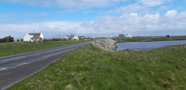
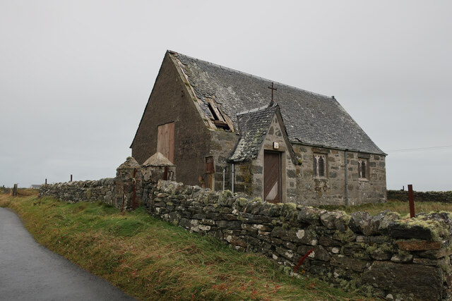
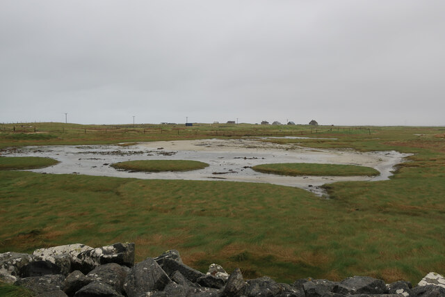
Dùn Uisealan, located in Inverness-shire, Scotland, is a historic heritage site that dates back to the Iron Age. The site consists of the remains of an ancient broch, a type of round stone tower unique to Scotland. Dùn Uisealan is situated on a hill overlooking the surrounding landscape, providing a strategic vantage point for its ancient inhabitants.

The broch at Dùn Uisealan is believed to have been constructed around 2000 years ago, and would have served as a fortified residence for a local chief or noble. The structure is built of large stones, with a central tower surrounded by a thick wall and an outer courtyard. Archaeological excavations at the site have uncovered evidence of domestic activities, as well as artifacts such as pottery and tools.

Today, Dùn Uisealan is a popular tourist attraction, offering visitors the chance to explore the ancient ruins and learn about the history of the site. The stunning views from the hilltop location make it a picturesque spot for a visit, and the site is easily accessible by foot or by car.

If you have any feedback on the listing, please let us know in the comments section below.
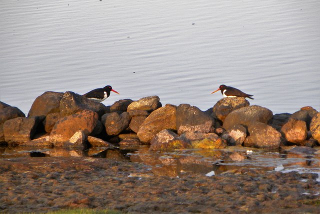
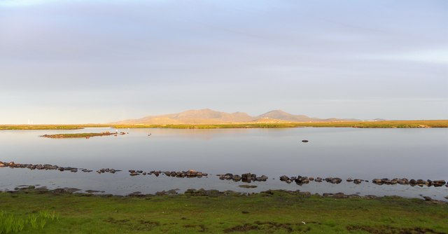
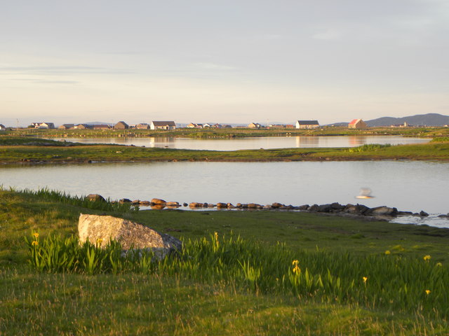
Dùn Uisealan Images

Images are sourced within 2km of 57.3841/-7.3645 or Grid Reference NF7745. Thanks to Geograph Open Source API. All images are credited.

A865 on the edge of Loch an Daill
Old chapel at Buaile Dhubh
Causeway near Hebridean Jewellery, Iochdar
New house at Iochdar
Saltmarsh near Balgarva
Sands at Iochdar A flat horizon and a large sky.
Sands at Iochdar
A flat horizon and a large sky.
On the strand at Iochdar Looking towards Eaval on North Uist - the hill that breaks the skyline. The sand is wet - but the tide is out.
On the strand at Iochdar
Looking towards Eaval on North Uist - the hill that breaks the skyline. The sand is wet - but the tide is out.
On the strand near Iochdar Enjoying the sand and the fine weather.
On the strand near Iochdar
Enjoying the sand and the fine weather.
Minor road beside the strand at Iochdar Vehicle tracks leave here to gain access to the strand.
Minor road beside the strand at Iochdar
Vehicle tracks leave here to gain access to the strand.
Inside Hebridean Jewellery A fine cafe as well as a good shop to examine a wide range of local authentic crafts.
Inside Hebridean Jewellery
A fine cafe as well as a good shop to examine a wide range of local authentic crafts.
Crossing the sand to Gualan A group with a dog enjoying the fine weather.
Crossing the sand to Gualan
A group with a dog enjoying the fine weather.
Coastal protection near Iochdar And just along from Hebridean Jewellery - worth a visit, if only for the café.
Coastal protection near Iochdar
And just along from Hebridean Jewellery - worth a visit, if only for the café.
Rivet opposite old church at Buaile Dhubh Ordnance Survey rivet benchmark on rock, described on database at <span class="nowrap"><a title="http://www.bench-marks.org.uk/bm76608" rel="nofollow ugc noopener" href="http://www.bench-marks.org.uk/bm76608">Link</a><img style="margin-left:2px;" alt="External link" title="External link - shift click to open in new window" src="https://s1.geograph.org.uk/img/external.png" width="10" height="10"/></span>.
Rivet opposite old church at Buaile Dhubh
Ordnance Survey rivet benchmark on rock, described on database at LinkExternal link.
Frozen Wind blown icicles on the downwind shore of a lochan.
Frozen
Wind blown icicles on the downwind shore of a lochan.
Frozen Ripples Wind blown ice on a lochan shore.
Frozen Ripples
Wind blown ice on a lochan shore.
Oystercatchers at Loch Bi You are never far from the loud piping calls of oystercatchers on the Uists. These two appeared to be having a chat on the edge of Loch Bi.
Oystercatchers at Loch Bi
You are never far from the loud piping calls of oystercatchers on the Uists. These two appeared to be having a chat on the edge of Loch Bi.
Evening light, Loch Bi One curious feature here is the line of stones just offshore and shown on the OS map as a boundary. One would hardly consider this as a wall.
Evening light, Loch Bi
One curious feature here is the line of stones just offshore and shown on the OS map as a boundary. One would hardly consider this as a wall.
Across a corner of Loch Bi Loch Bi is an extensive area of brackish water extending across much of the northern end of South Uist and almost cutting it in half. This view is across one small inlet towards houses at Lochdar.
Across a corner of Loch Bi
Loch Bi is an extensive area of brackish water extending across much of the northern end of South Uist and almost cutting it in half. This view is across one small inlet towards houses at Lochdar.
Show me another place!

Dùn Uisealan is located at Grid Ref: NF7745 (Lat: 57.3841, Lng: -7.3645)

Unitary Authority: Na h-Eileanan an Iar

Police Authority: Highlands and Islands

What 3 Words

///asterisk.custodial.tightrope. Near Balivanich, Na h-Eileanan Siar

Related Wikis

Iochdar

Iochdar (Scottish Gaelic: An t-Ìochdair), also spelled Eochar, is a hamlet and community on the west coast of the island of South Uist, in the Outer Hebrides...

Loch Bee

Loch Bì, sometimes anglicised as Loch Bee, is the largest loch on the island of South Uist in the Outer Hebrides of Scotland. It lies at the northern end...

Balgarva

Balgarva (Scottish Gaelic: Baile Gharbhaidh) is a crofting settlement on South Uist in the Outer Hebrides, Scotland. Balgarva is within the parish of South...

Carnan (townland)

Carnan is a townland in County Tyrone, Northern Ireland. It is situated in the historic barony of Dungannon Upper and the civil parish of Arboe and covers...

Nearby Amenities

Located within 500m of 57.3841,-7.3645
Passing Place
Lat/Long: 57.3838841/-7.3594163
Power: pole
Lat/Long: 57.3873536/-7.3699764
Power: pole
Lat/Long: 57.3871671/-7.3692421
Power: pole
Lat/Long: 57.3869838/-7.3685801
Power: pole
Lat/Long: 57.3866692/-7.3674335
Power: pole
Lat/Long: 57.3864437/-7.3665879
Power: pole
Lat/Long: 57.386181/-7.3655888
Power: pole
Lat/Long: 57.3858923/-7.3645296
Power: pole
Lat/Long: 57.3856765/-7.363702
Power: pole
Lat/Long: 57.3854543/-7.3628654
Power: pole
Lat/Long: 57.3852078/-7.3619115
Power: pole
Lat/Long: 57.3849807/-7.3610749
Power: pole
Lat/Long: 57.3847585/-7.3602443
Power: pole
Lat/Long: 57.3845055/-7.3592934
Power: pole
Lat/Long: 57.3842427/-7.3583334
Power: pole
Lat/Long: 57.3839832/-7.3573344
Power: pole
Lat/Long: 57.3837739/-7.356582
Passing Place
Lat/Long: 57.3834063/-7.3577505
Barrier: cattle_grid
Lat/Long: 57.3855767/-7.3650301
Passing Place
Lat/Long: 57.3854151/-7.36639
Power: pole
Lat/Long: 57.3863097/-7.370416
Power: pole
Lat/Long: 57.3867651/-7.3702014
Power: pole
Lat/Long: 57.3858109/-7.3706279
Passing Place
Lat/Long: 57.3848433/-7.3621012
The data included in this document is from www.openstreetmap.org. The data is made available under ODbL.

Have you been to Dùn Uisealan?

Leave your review of Dùn Uisealan below (or comments, questions and feedback).