Merton

Settlement in Oxfordshire Cherwell

England

Merton

M40 near Merton A view eastwards of the M40 at the bridge near Merton.
M40 near Merton Credit: Bob Walters

Merton is a picturesque village located in the Cherwell Valley, Oxfordshire, England. It lies approximately 5 miles north of Bicester and 12 miles southwest of Banbury. With a population of around 400 people, Merton maintains a close-knit community atmosphere.

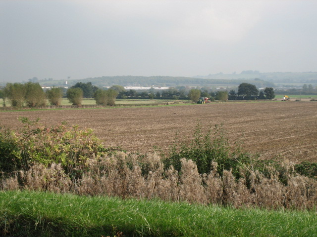
The village is renowned for its charming thatched cottages, which add to its quintessential English countryside appeal. Surrounded by beautiful rolling hills and scenic farmland, Merton offers breathtaking views of the Oxfordshire countryside. The village is also home to the River Ray, which meanders through the area, providing opportunities for peaceful walks along its banks.

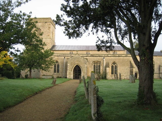
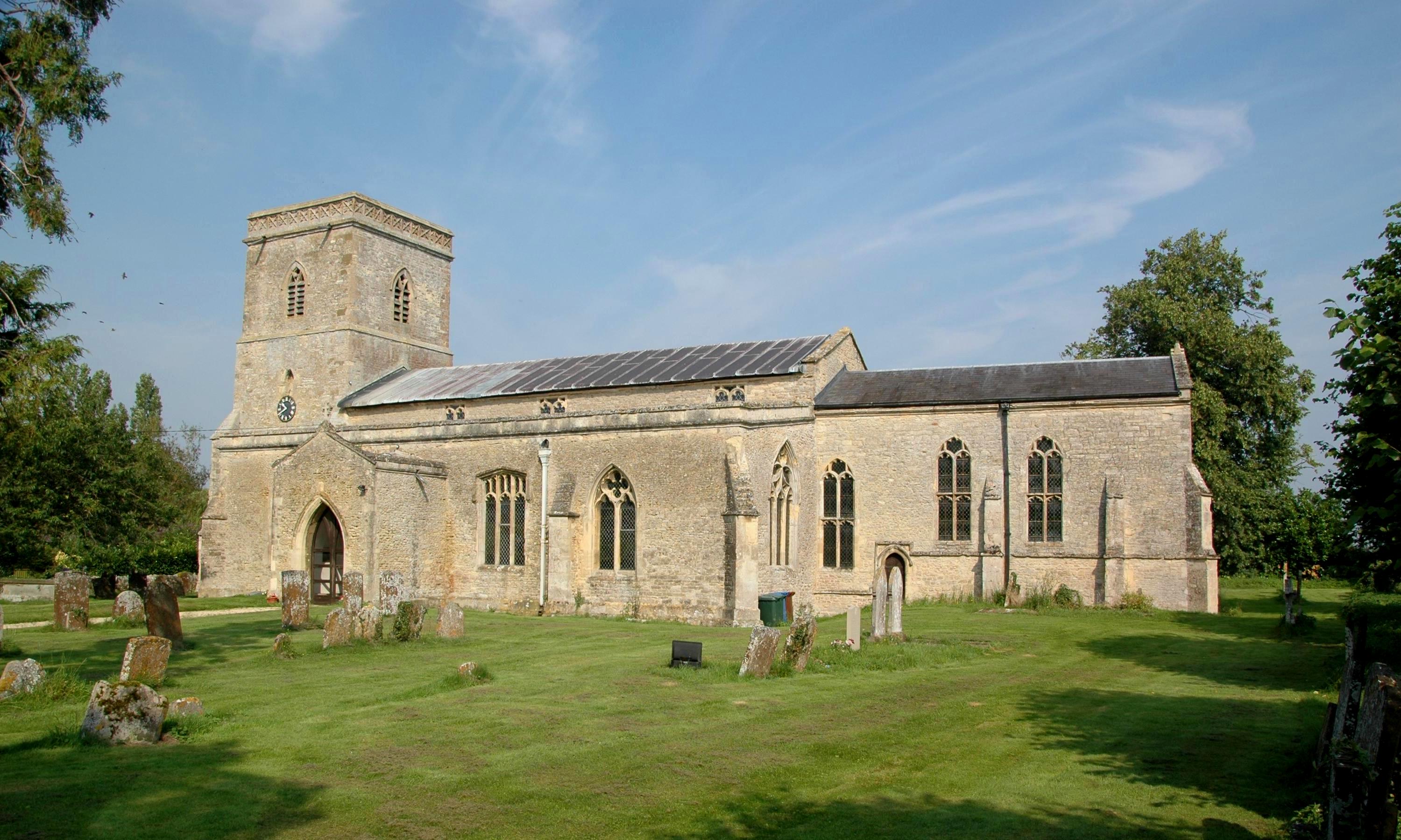
Merton boasts a rich history dating back to the 11th century. The village church, St. Swithun's, is a notable landmark, featuring a 13th-century tower and a Norman font. The church is a significant part of the village's heritage and is often admired for its architectural beauty.

Though small in size, Merton offers several amenities to its residents, including a primary school, a village hall, and a local pub. The village hall hosts various community events and serves as a hub for social gatherings. Additionally, the nearby town of Bicester provides additional amenities and services, including shopping centers, supermarkets, and healthcare facilities.

Merton's location also provides easy access to major transportation routes. The M40 motorway is within a short drive, connecting the village to London and Birmingham. Furthermore, the train stations in Bicester offer regular services to Oxford, London, and other major cities.

Overall, Merton offers a tranquil and idyllic setting, making it an attractive place to reside for those seeking a peaceful retreat in the heart of Oxfordshire.

If you have any feedback on the listing, please let us know in the comments section below.

Merton Images

Images are sourced within 2km of 51.854654/-1.164661 or Grid Reference SP5717. Thanks to Geograph Open Source API. All images are credited.

M40 near Merton A view eastwards of the M40 at the bridge near Merton.
M40 near Merton
A view eastwards of the M40 at the bridge near Merton.
Fencott Road, Murcott
Tree by Fencott Road
Brook Court, Fencott
Blackbull Lane, Fencott From Fencott Road
Blackbull Lane, Fencott
From Fencott Road
St Swithun's Church, Merton
Fields looking north
Road looking east
Road looking east
Road looking north-east
View west towards Upper Arncott Hill
Ivy Farm, Fencott In a small village on the edge of Otmoor.
Ivy Farm, Fencott
In a small village on the edge of Otmoor.
Growing wheat near Fencott A footpath from Fencott to Murcott runs across this field.
Growing wheat near Fencott
A footpath from Fencott to Murcott runs across this field.
Village hall, Murcott There is a playing field and playground here as well.
Village hall, Murcott
There is a playing field and playground here as well.
House in Fencott Fencott is a small village on the edge of Otmoor.
House in Fencott
Fencott is a small village on the edge of Otmoor.
Cottage in Fencott This is in Black Bull Lane.
Cottage in Fencott
This is in Black Bull Lane.
Corner Farm, Fencott Smart new thatched roof on this farmhouse.
Corner Farm, Fencott
Smart new thatched roof on this farmhouse.
Gates as street furniture at entrance to Fencott The white gates either side of the road are an indication to drivers that this is the entrance to the village. Gates like this are seen on many rural roads. There are 30 mph speed limit signs a few yards down the road, but perhaps the gates have more immediate effect on drivers.
Gates as street furniture at entrance to Fencott
The white gates either side of the road are an indication to drivers that this is the entrance to the village. Gates like this are seen on many rural roads. There are 30 mph speed limit signs a few yards down the road, but perhaps the gates have more immediate effect on drivers.
Grass edge to wheat field, Murcott Many fields of crops in this area have a substantial width of grass at the side. This one has a footpath through it. There is cow parsley at the base of the hedge, and hawthorn in the hedge.
Grass edge to wheat field, Murcott
Many fields of crops in this area have a substantial width of grass at the side. This one has a footpath through it. There is cow parsley at the base of the hedge, and hawthorn in the hedge.
Show me another place!

Merton is located at Grid Ref: SP5717 (Lat: 51.854654, Lng: -1.164661)

Administrative County: Oxfordshire

District: Cherwell

Police Authority: Thames Valley

What 3 Words

///correct.shelving.unloading. Near Ambrosden, Oxfordshire

Nearby Locations

Merton

Related Wikis

Merton, Oxfordshire

Merton is a village and civil parish near the River Ray, about 4 miles (6.4 km) south of Bicester in Oxfordshire, England. The 2011 Census recorded the...

Wendlebury Meads and Mansmoor Closes

Wendlebury Meads and Mansmoor Closes is a 73.2-hectare (181-acre) biological Site of Special Scientific Interest south of Wendlebury in Oxfordshire.Wendlebury...

Fencott

Fencott is a hamlet between the River Ray and Otmoor in the civil parish of Fencott and Murcott, about 4 miles (6.4 km) south of Bicester in Oxfordshire...

Alice's Meadow

Alice's Meadow is the name given to a small field in the Oxfordshire parish of Fencott and Murcott, England. It became the focus of a campaign by local...

Woodsides Meadow

Woodsides Meadow is a 4-hectare (9.9-acre) nature reserve south of Wendlebury in Oxfordshire. It is managed by the Berkshire, Buckinghamshire and Oxfordshire...

Murcott, Oxfordshire

Murcott is a village between the River Ray and Otmoor in the civil parish of Fencott and Murcott, about 4 miles (6.4 km) south of Bicester in Oxfordshire...

Charlton-on-Otmoor

Charlton-on-Otmoor is a village and civil parish about 9 miles (14 km) NE of Oxford and 6 miles (10 km) SW of Bicester in Oxfordshire, England. The village...

Charlton Halt railway station (Oxfordshire)

Charlton Halt was a railway station on the Varsity Line 1 mile (1.6 km) north of the village of Charlton-on-Otmoor. The London and North Western Railway...

Nearby Amenities

Located within 500m of 51.854654,-1.164661
Merton
Is In: Oxfordshire, England, UK
Place: village
Wikidata: Q1776936
Wikipedia: en:Merton, Oxfordshire
Lat/Long: 51.8546355/-1.1648287
Old Phone: +44 1865 331246
Removed Amenity: telephone
Lat/Long: 51.8541787/-1.1655457
Post Box
Post Box Type: pillar
Postal Code: OX25
Ref: OX25 332
Royal Cypher: EIIR
Lat/Long: 51.854301/-1.1652467
Bus Stop
The Plough Inn
Bus: yes
Local Ref: opp
Naptan AtcoCode: 340001860OPP
Naptan Bearing: SW
Naptan CommonName: The Plough PH
Naptan Indicator: Opposite
Naptan Landmark: Bus Shelter
Naptan NaptanCode: oxfgjdag
Naptan Street: Village Road
Naptan Verified: no
Public Transport: platform
Source: naptan_import
Lat/Long: 51.8544409/-1.1650658
Bus Stop
The Plough Inn
Bus: yes
Local Ref: o/s
Naptan AtcoCode: 340001860OUT
Naptan Bearing: NE
Naptan BusStopType: CUS
Naptan CommonName: The Plough PH
Naptan Indicator: Outside
Naptan Landmark: Opp Bus Shelter
Naptan NaptanCode: oxfgjdad
Naptan Street: Village Road
Naptan Verified: no
Public Transport: platform
Source: naptan_import
Lat/Long: 51.8545043/-1.1651372
Barrier: kissing_gate
Lat/Long: 51.855713/-1.1708654
Barrier: stile
Lat/Long: 51.8550515/-1.168212
Power: pole
Source: Bing
Lat/Long: 51.8509532/-1.163714
Power: pole
Source: Bing
Lat/Long: 51.851891/-1.1631742
Recycling
Source: Bing
Lat/Long: 51.8542924/-1.1673561
Power: pole
Source: Bing
Lat/Long: 51.8539915/-1.1600389
Power: pole
Source: Bing
Lat/Long: 51.8530166/-1.1605244
Power: pole
Source: Bing
Lat/Long: 51.8545956/-1.1611586
Power: pole
Source: Bing
Lat/Long: 51.85356/-1.1592129
Power: pole
Source: Bing
Lat/Long: 51.8524328/-1.161858
Power: pole
Source: Bing
Lat/Long: 51.8525812/-1.164092
Power: pole
Lat/Long: 51.8521776/-1.1696228
Power: pole
Lat/Long: 51.8522345/-1.168824
Power: pole
Lat/Long: 51.8523429/-1.1673488
Power: pole
Lat/Long: 51.8524509/-1.1658751
Power: pole
Lat/Long: 51.8525626/-1.1643993
The data included in this document is from www.openstreetmap.org. The data is made available under ODbL.

Have you been to Merton?

Leave your review of Merton below (or comments, questions and feedback).