Dray's Ditches

Heritage Site in Bedfordshire

England

Dray's Ditches

Sloping striated field south east of Warden Hill
Sloping striated field south east of Warden Hill Credit: Peter S

Dray's Ditches, located in Bedfordshire, England, is a historically significant heritage site that attracts visitors from around the world. This ancient earthwork, also known as a linear dyke, stretches approximately two miles in length and is believed to have been constructed during the Iron Age, around 2,000 years ago.

The ditches consist of two parallel banks, with a deep trench in between, and are believed to have served a defensive purpose, protecting the local population from potential invaders. The earthwork is well-preserved and provides valuable insights into the region's ancient history and fortification techniques.

Dray's Ditches is surrounded by picturesque countryside, offering visitors a serene and peaceful environment to explore and appreciate the historical significance of the site. The surrounding area is dotted with vibrant flora and fauna, making it a popular destination for nature enthusiasts as well.

The site has been carefully managed and preserved by local authorities, ensuring that its historical integrity is maintained. Visitors can take guided tours or explore the ditches independently, with informative signage providing details about its construction and historical context.

Dray's Ditches is not only a site of archaeological importance but also serves as a recreational space for locals and tourists alike. The area offers opportunities for walking, picnicking, and birdwatching, attracting visitors with various interests.

Overall, Dray's Ditches in Bedfordshire is a captivating heritage site that provides a fascinating glimpse into the region's ancient past. Its historical significance, combined with its natural beauty, makes it a must-visit destination for history enthusiasts and nature lovers alike.

If you have any feedback on the listing, please let us know in the comments section below.

Dray's Ditches Images

Images are sourced within 2km of 51.925/-0.422 or Grid Reference TL0826. Thanks to Geograph Open Source API. All images are credited.

Sloping striated field south east of Warden Hill
Hedgerow path Nearing the top are three horse riders.  Once on the ridge a left turn leads to Warden and Galley Hills.
Hedgerow path
Nearing the top are three horse riders. Once on the ridge a left turn leads to Warden and Galley Hills.
Luton view from the slopes of Stopsley Common
Bridleway towards Butterfield Green
Bridleway towards Galley Hill
Sloping hillside on Galley Hill Looking towards the highest point of the hill from a section of the John Bunyan Trail.
Sloping hillside on Galley Hill
Looking towards the highest point of the hill from a section of the John Bunyan Trail.
Fence on Galley Hill Unlike nearby Warden Hill there is no trig point on this hill but this appears to be the highest point at the top of the rise shown in this photo.
Fence on Galley Hill
Unlike nearby Warden Hill there is no trig point on this hill but this appears to be the highest point at the top of the rise shown in this photo.
Warden Hill from Galley Hill Despite the sunshine this was a very windy day on the tops of the hills and colder than it looks.
Warden Hill from Galley Hill
Despite the sunshine this was a very windy day on the tops of the hills and colder than it looks.
Trig point, Warden Hill A path leads a short distance to the trig point but this is apparently not encouraged due to a fence rather than a gate.
Trig point, Warden Hill
A path leads a short distance to the trig point but this is apparently not encouraged due to a fence rather than a gate.
View west from Warden Hill Looking down on Luton from Warden Hill.
View west from Warden Hill
Looking down on Luton from Warden Hill.
Path to the south east of Warden Hill
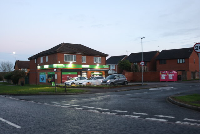
Mr Singh's Local on Kirby Drive, Marsh Farm It was yellow in 2012, purple in 2019 and now green.
Mr Singh's Local on Kirby Drive, Marsh Farm
It was yellow in 2012, purple in 2019 and now green.
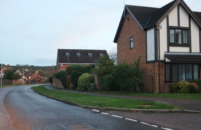
Ingram Gardens, Warden Hill
Cromer Way, Warden Hill
Cromer Way, Luton
Cromer Way, Luton
Old Bedford Road, Luton
House on Old Bedford Road, Luton
Old Bedford Road, Luton
Show me another place!

Dray's Ditches is located at Grid Ref: TL0826 (Lat: 51.925, Lng: -0.422)

What 3 Words

///upper.vast.liver. Near Streatley, Bedfordshire

Nearby Locations

Dray's Ditches

Related Wikis

South Beds Golf Club

South Beds Golf Club is a golf club in Galley Hill, near Bramingham and north of Luton, Bedfordshire, England. It was established in 1892 and is ranked...

Galley and Warden Hills

Galley and Warden Hills is a 47 hectare biological Site of Special Scientific Interest in Warden Hill, a suburb of Luton in Bedfordshire. The local planning...

Warden Hill, Luton

Warden Hill is a suburb of Luton, about 3 miles (4.8 km) north of the town centre, in Bedfordshire, England. It is roughly bounded by Central Bedfordshire...

Bramingham

Bramingham is a suburb of Luton, in the Borough of Luton district, in the ceremonial county of Bedfordshire, England. The area is situated in the north...

Nearby Amenities

Located within 500m of 51.925,-0.422
Barrier: stile
Lat/Long: 51.9235264/-0.4160452
Barrier: stile
Lat/Long: 51.9238402/-0.4155115
Turning Circle
Lat/Long: 51.9262592/-0.4249889
Dray's Ditches
Place: locality
Lat/Long: 51.92698/-0.4251788
Sunshine Riding School
Phone: +44 1582505040
Shop: outdoor
Lat/Long: 51.924635/-0.422337
Turning Circle
Lat/Long: 51.9245886/-0.4267357
Turning Circle
Lat/Long: 51.9236707/-0.4253716
Turning Circle
Lat/Long: 51.9255966/-0.4263794
Turning Circle
Lat/Long: 51.9267369/-0.428509
Turning Circle
Lat/Long: 51.9244092/-0.4256355
Turning Circle
Lat/Long: 51.926669/-0.427354
Turning Circle
Lat/Long: 51.9235811/-0.426357
Turning Circle
Lat/Long: 51.9240992/-0.4241377
Turning Circle
Lat/Long: 51.9256108/-0.4260425
Turning Circle
Lat/Long: 51.923472/-0.4274667
Turning Circle
Lat/Long: 51.9240485/-0.428091
Post Box
Collection Times: Mo-Fr 17:30; Sa 12:00
Operator: Royal Mail
Post Box Type: lamp
Ref: LU3 195
Royal Cypher: EIIR
Royal Cypher Wikidata: Q33102113
Source: survey
Lat/Long: 51.9250861/-0.4283968
Barrier: kissing_gate
Bicycle: no
Foot: yes
Source: GPS
Lat/Long: 51.9259513/-0.4149657
Barrier: kissing_gate
Bicycle: no
Foot: yes
Source: GPS
Lat/Long: 51.9237728/-0.4155165
Traffic Calming: cushion
Lat/Long: 51.9209629/-0.4249137
Direction: 165
Generator Method: photovoltaic
Generator Output Electricity: yes
Generator Solar Modules: 10
Generator Source: solar
Generator Type: solar_photovoltaic_panel
Location: roof
Power: generator
Lat/Long: 51.9231136/-0.4284201
Direction: 260
Generator Method: photovoltaic
Generator Output Electricity: yes
Generator Solar Modules: 6
Generator Source: solar
Generator Type: solar_photovoltaic_panel
Location: roof
Power: generator
Lat/Long: 51.9240604/-0.4288656
Direction: 80
Generator Method: photovoltaic
Generator Output Electricity: yes
Generator Solar Modules: 10
Generator Source: solar
Generator Type: solar_photovoltaic_panel
Location: roof
Power: generator
Lat/Long: 51.9240711/-0.4287965
Parking
Lat/Long: 51.9239694/-0.4235614
Direction: 165
Generator Method: photovoltaic
Generator Output Electricity: yes
Generator Solar Modules: 6
Generator Source: solar
Generator Type: solar_photovoltaic_panel
Location: roof
Power: generator
Lat/Long: 51.9239861/-0.4237118
Direction: 165
Generator Method: photovoltaic
Generator Output Electricity: yes
Generator Solar Modules: 6
Generator Source: solar
Generator Type: solar_photovoltaic_panel
Location: roof
Power: generator
Lat/Long: 51.9239761/-0.4237693
Direction: 165
Generator Method: photovoltaic
Generator Output Electricity: yes
Generator Solar Modules: 6
Generator Source: solar
Generator Type: solar_photovoltaic_panel
Location: roof
Power: generator
Lat/Long: 51.9239673/-0.4238306
Direction: 165
Generator Method: photovoltaic
Generator Output Electricity: yes
Generator Solar Modules: 6
Generator Source: solar
Generator Type: solar_photovoltaic_panel
Location: roof
Power: generator
Lat/Long: 51.9239575/-0.4238912
Direction: 165
Generator Method: photovoltaic
Generator Output Electricity: yes
Generator Solar Modules: 16
Generator Source: solar
Generator Type: solar_photovoltaic_panel
Location: roof
Power: generator
Lat/Long: 51.9235691/-0.4266246
The data included in this document is from www.openstreetmap.org. The data is made available under ODbL.

Have you been to Dray's Ditches?

Leave your review of Dray's Ditches below (or comments, questions and feedback).