Dere Street

Heritage Site in Roxburghshire

Scotland

Dere Street

Old milestone This stone in front of the cottage, with the legends now painted black, was found somewhere by the farmer about 30 years ago.   It must have been originally set at about NT763140 on the way to Towford, Nether and Upper Hindhope under Hangingshaw Hill on the old drovers' route.
Old milestone Credit: Chris Minto

Dere Street, located in Roxburghshire, Scotland, is a significant heritage site that holds historical and cultural importance. This ancient Roman road stretches approximately 200 miles, linking the city of York in England to the Roman settlements in Scotland. It was built during the Roman occupation of Britain, primarily during the 1st and 2nd centuries AD.

Dere Street, also known as "Via Regia" or "Royal Way," played a crucial role in connecting the Roman Empire's southern and northern regions. It served as a major trade and communication route, facilitating the movement of troops, goods, and ideas. The road's construction involved laying a well-engineered foundation of stone and gravel, ensuring its durability and longevity.

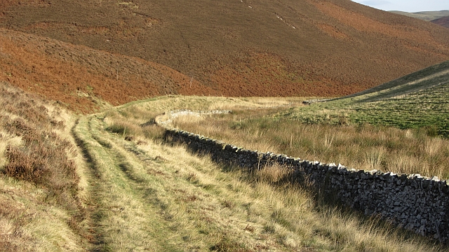
Today, Dere Street remains partially intact and is a popular destination for history enthusiasts, archaeologists, and hikers alike. Many sections of the road can still be seen, with some preserved stretches showcasing the original Roman construction techniques. The path takes visitors through picturesque landscapes, including rolling hills, forests, and charming villages, providing a unique opportunity to experience the ancient route.

As a heritage site, Dere Street offers visitors a glimpse into the Roman occupation of Britain and provides insights into the daily life, infrastructure, and cultural exchange during that era. It serves as a reminder of the historical significance of the region and the legacy left behind by the Roman Empire. Dere Street is not only a fascinating archaeological site but also a scenic and educational experience for those interested in exploring the past.

If you have any feedback on the listing, please let us know in the comments section below.
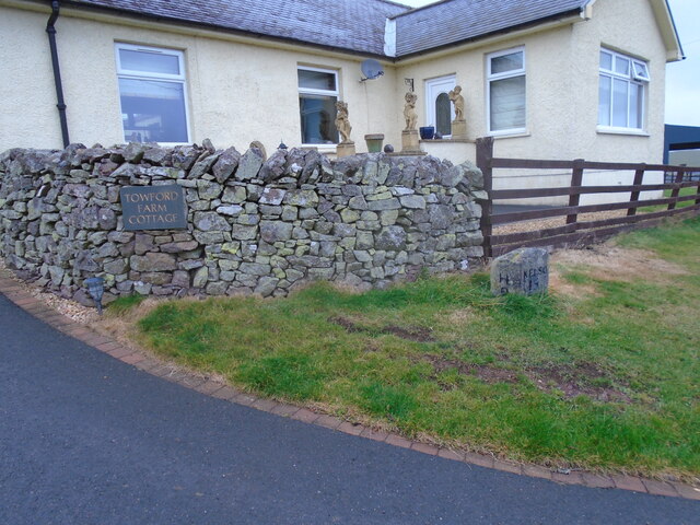
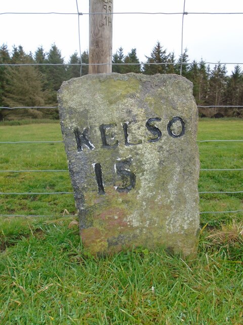
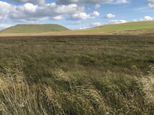
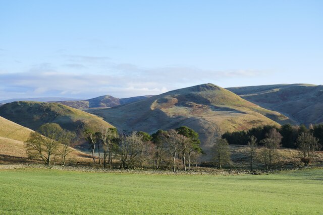
Dere Street Images

Images are sourced within 2km of 55.415/-2.387 or Grid Reference NT7513. Thanks to Geograph Open Source API. All images are credited.

Old milestone This stone in front of the cottage, with the legends now painted black, was found somewhere by the farmer about 30 years ago.   It must have been originally set at about NT763140 on the way to Towford, Nether and Upper Hindhope under Hangingshaw Hill on the old drovers' route.
Old milestone
This stone in front of the cottage, with the legends now painted black, was found somewhere by the farmer about 30 years ago. It must have been originally set at about NT763140 on the way to Towford, Nether and Upper Hindhope under Hangingshaw Hill on the old drovers' route.
Old milestone This stone is opposite the northern end of the farm buildings just near the sharp corner.   Travelling past this stone westwards leads to what is now the A68 Carter Bar road at Edgerstone.   However it is also another way to Towford, Nether Hindhope and Upper Hindhope and the old drovers' route to England.
Old milestone
This stone is opposite the northern end of the farm buildings just near the sharp corner. Travelling past this stone westwards leads to what is now the A68 Carter Bar road at Edgerstone. However it is also another way to Towford, Nether Hindhope and Upper Hindhope and the old drovers' route to England.
Field, Pennymuir Site of a pair of Roman camps on Dere Street.
Field, Pennymuir
Site of a pair of Roman camps on Dere Street.
Falla Knowe Above the Pennymuir Show.
Falla Knowe
Above the Pennymuir Show.
Moorland near Middlesknowes
Beside the How Burn Rough grazing in the hills upstream of Oxnam.
Beside the How Burn
Rough grazing in the hills upstream of Oxnam.
Alongside Dere Street A view across sheep pasture adjacent to the route of Dere Street.  Standard Knowe stands prominent in the background.
Alongside Dere Street
A view across sheep pasture adjacent to the route of Dere Street. Standard Knowe stands prominent in the background.
Showground, Pennymuir A large flat area beside the community hall.
Showground, Pennymuir
A large flat area beside the community hall.
Beside the Kale Water Wetland pasture beside the Kale Water near Pennymuir Bridge.
Beside the Kale Water
Wetland pasture beside the Kale Water near Pennymuir Bridge.
Road to Buchtrig A single track road climbs from the Kale Water over a pass to the farm at Buchtrig.
Road to Buchtrig
A single track road climbs from the Kale Water over a pass to the farm at Buchtrig.
Minor road, Towford Looking down a steep hill towards Pennymuir Bridge and Humblemoor Hill.
Minor road, Towford
Looking down a steep hill towards Pennymuir Bridge and Humblemoor Hill.
Buchtrig sign Farm sign on a road junction near Pennymuir Bridge.
Buchtrig sign
Farm sign on a road junction near Pennymuir Bridge.
Upper Kale Water Hill farm in the Cheviots, a view down to Pennymuir Bridge and Towford.
Upper Kale Water
Hill farm in the Cheviots, a view down to Pennymuir Bridge and Towford.
Enclosures, Buchtrig Two circular earthbanks, possibly ruined fanks.
Enclosures, Buchtrig
Two circular earthbanks, possibly ruined fanks.
Road to Buchtrig
Road to Buchtrig
Humblemoor Hill Humblemoor Hill seen from the path which runs beside the Capehope Burn. The path is mapped but stops around Felter Cleuch.
Humblemoor Hill
Humblemoor Hill seen from the path which runs beside the Capehope Burn. The path is mapped but stops around Felter Cleuch.
Head of the Capelaw Burn Path beneath Humblemoor Hill. The path is shown going to The Yett, but seems to pack in around Felter Cleuch.
Head of the Capelaw Burn
Path beneath Humblemoor Hill. The path is shown going to The Yett, but seems to pack in around Felter Cleuch.
Hindhope road Like most Cheviot roads, this one runs up to the last farm as a dead end.
Hindhope road
Like most Cheviot roads, this one runs up to the last farm as a dead end.
Show me another place!

Dere Street is located at Grid Ref: NT7513 (Lat: 55.415, Lng: -2.387)

What 3 Words

///confining.applied.yelled. Near Jedburgh, Scottish Borders

Nearby Locations

Dere Street

Related Wikis

Pennymuir Roman camps

The Pennymuir Roman camps are situated southeast of Jedburgh in the Scottish Borders area of Scotland, near the Anglo-Scottish border, in the former Roxburghshire...

Chew Green

Chew Green is the site of the ancient Roman encampment, commonly but erroneously called Ad Fines (Latin: The Limits) on the 1885-1900 edition of the Ordnance...

Hownam

Hownam or Hounam is a small village and parish situated 8 miles east of Jedburgh in the Scottish Borders area of Scotland, near the Anglo-Scottish border...

Edgerston

Edgerston is a village and an estate about 4 miles (6.4 km) north of the Anglo-Scottish border, and 8 miles (13 km) south of Jedburgh in the Scottish Borders...

Nearby Amenities

Located within 500m of 55.415,-2.387
Tow Ford
Ford: yes
Lat/Long: 55.4130678/-2.3802915
Pennymuir Rig
Place: locality
Lat/Long: 55.416271/-2.3896445
Power: pole
Lat/Long: 55.4123853/-2.3813418
Power: pole
Lat/Long: 55.4126002/-2.3820782
Power: pole
Lat/Long: 55.4128765/-2.3829923
Power: pole
Lat/Long: 55.4131191/-2.3830181
The data included in this document is from www.openstreetmap.org. The data is made available under ODbL.

Have you been to Dere Street ?

Leave your review of Dere Street below (or comments, questions and feedback).