Denny Abbey

Heritage Site in Cambridgeshire

England

Denny Abbey

The Undertakers This strangely named area of fenland lies to the west of the A10 at Chittering.
The Undertakers Credit: Bob Jones

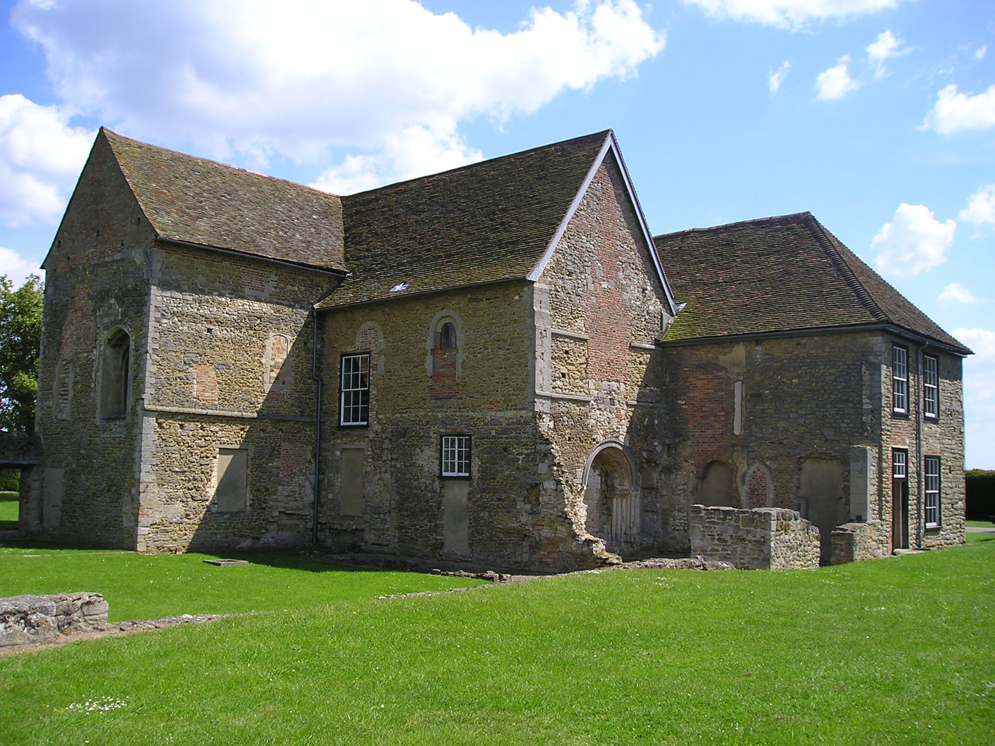
Denny Abbey, located in Cambridgeshire, is a well-preserved medieval abbey with a rich history that spans over 800 years. Originally founded in the late 12th century, it served as a Benedictine monastery until its dissolution in the 16th century during the English Reformation.

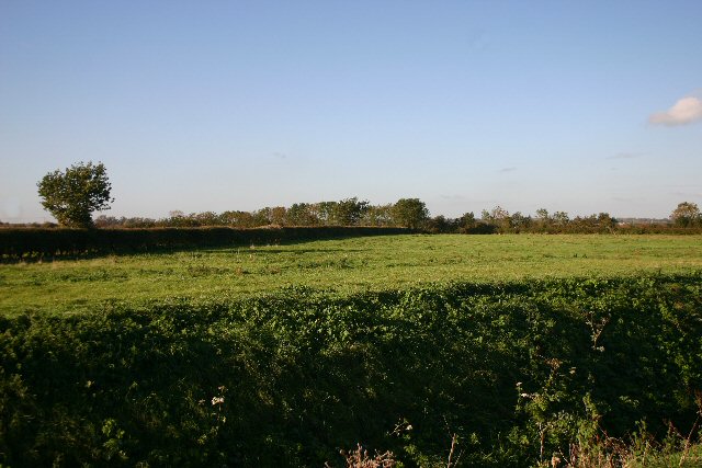
The abbey is situated in a picturesque rural setting, surrounded by farmland and meadows. The architectural style of the buildings reflects the transition from Romanesque to Gothic, with notable features including elegant arches, intricate stonework, and a towering bell tower. The abbey church, dedicated to St. Mary, was the central place of worship for the monks and is still intact today.

After the dissolution, the abbey underwent various changes and was eventually converted into a farmhouse. The interior rooms were modified, but the medieval structure remained largely untouched. In the 20th century, the abbey was acquired by the Farmland Museum and Denny Abbey Trust, who have diligently restored and preserved the site.

Today, Denny Abbey is open to the public as a heritage site and museum. Visitors can explore the abbey's beautiful grounds, including the cloister, chapter house, and refectory, gaining insights into the daily lives of the monks. The museum exhibits a fascinating collection of artifacts, providing a glimpse into the history of the abbey and the agricultural heritage of the region.

Denny Abbey, Cambridgeshire, offers a unique opportunity to experience the tranquil beauty of a medieval abbey while learning about the religious, cultural, and agricultural significance of the site throughout the centuries.

If you have any feedback on the listing, please let us know in the comments section below.

Denny Abbey Images

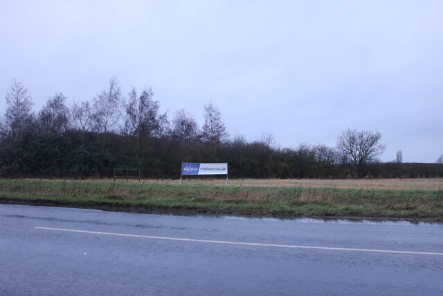
Images are sourced within 2km of 52.293/0.192 or Grid Reference TL4968. Thanks to Geograph Open Source API. All images are credited.

The Undertakers This strangely named area of fenland lies to the west of the A10 at Chittering.
The Undertakers
This strangely named area of fenland lies to the west of the A10 at Chittering.
The Traveller's Rest, Chittering Pub and Restaurant beside the A10
The Traveller's Rest, Chittering
Pub and Restaurant beside the A10
Sign of the Traveller's Rest Here's a conundrum - in what do travellers wrap their belongings, in these days of paper handkerchiefs? The distance 65 miles to London seems to be rather more than the actual - see <a href="https://www.geograph.org.uk/photo/696318">TL4867 : Milestone IX Ely</a>, <a href="https://www.geograph.org.uk/photo/384068">TL4866 : Milestone beside A10, VI Miles to Cambridge</a> and <a href="https://www.geograph.org.uk/photo/666564">TL4863 : Milestone XII Miles to Ely.</a>
Sign of the Traveller's Rest
Here's a conundrum - in what do travellers wrap their belongings, in these days of paper handkerchiefs? The distance 65 miles to London seems to be rather more than the actual - see TL4867 : Milestone IX Ely, TL4866 : Milestone beside A10, VI Miles to Cambridge and TL4863 : Milestone XII Miles to Ely.
The Old Schoolhouse, Chittering Built in 1877 for 54 children, attendance declined to 19 by 1938. Even so it remained in use until 1969.<span class="nowrap"><a title="http://www.british-history.ac.uk/report.aspx?compid=15429" rel="nofollow ugc noopener" href="http://www.british-history.ac.uk/report.aspx?compid=15429">Link</a><img style="margin-left:2px;" alt="External link" title="External link - shift click to open in new window" src="https://s1.geograph.org.uk/img/external.png" width="10" height="10"/></span>
The Old Schoolhouse, Chittering
Built in 1877 for 54 children, attendance declined to 19 by 1938. Even so it remained in use until 1969.LinkExternal link
Travellers Rest, Chittering
Entrance to The Fruit Farm Chittering From A10. Used to be Red Models
Entrance to The Fruit Farm Chittering
From A10. Used to be Red Models
Play area, Chittering
Caravan Park, Chittering
Footpath from Chittering Across The Lots.
Footpath from Chittering
Across The Lots.
Footpath to Chittering
The Undertakers Footpath from Chittering to Cottenham Long Drove.
The Undertakers
Footpath from Chittering to Cottenham Long Drove.
Ely Road, Chittering
Reeds at Chittering These reeds are growing by the side of a no through road east of Chittering.
Reeds at Chittering
These reeds are growing by the side of a no through road east of Chittering.
Chittering: The Fruit Farm Looking across the A10 from the corner of School Lane.
Chittering: The Fruit Farm
Looking across the A10 from the corner of School Lane.
Chittering: School Lane and The Old School House The pot of daffodils on the right, encouraged to flower by a mild November and December, prove that it's January 2016 - but after the lowest night-time temperatures of the year so far, this was a very cold morning for daffodils and cyclists.
Chittering: School Lane and The Old School House
The pot of daffodils on the right, encouraged to flower by a mild November and December, prove that it's January 2016 - but after the lowest night-time temperatures of the year so far, this was a very cold morning for daffodils and cyclists.
Ely Road, Chittering Hidden among all the greenery is a house, it is actually their garden.
Ely Road, Chittering
Hidden among all the greenery is a house, it is actually their garden.
Ely Road, Chittering
Show me another place!

Denny Abbey is located at Grid Ref: TL4968 (Lat: 52.293, Lng: 0.192)

What 3 Words

///scaffold.bind.crusted. Near Waterbeach, Cambridgeshire

Nearby Locations

Denny Abbey

Related Wikis

Denny Abbey

Denny Abbey is a former abbey near Waterbeach, about 6 miles (10 km) north of Cambridge in Cambridgeshire, England. It is now the Farmland Museum and Denny...

Chittering, Cambridgeshire

Chittering is a hamlet about 8 miles (13 km) north of Cambridge in Cambridgeshire, England. For administrative purposes it is part of the parish of Waterbeach...
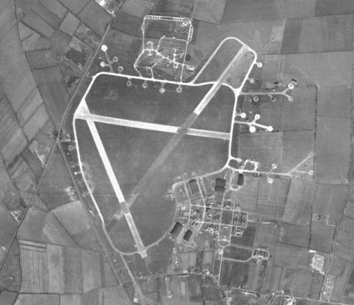
RAF Waterbeach

Royal Air Force Waterbeach or more simply RAF Waterbeach is a former Royal Air Force station located in Waterbeach, Cambridgeshire which is about 5.5 miles...

Waterbeach Barracks

Waterbeach Barracks is a former military installation in Waterbeach, Cambridgeshire. The site was an RAF Station, RAF Waterbeach and then used by the Royal...

Nearby Amenities

Located within 500m of 52.293,0.192
Denny Abbey
Place: locality
Lat/Long: 52.2932925/0.1869856
Cafe
Lat/Long: 52.2940369/0.1863825
Barrier: cattle_grid
Lat/Long: 52.2952091/0.1879526
Power: pole
Source: bing
Lat/Long: 52.2940958/0.1858019
The data included in this document is from www.openstreetmap.org. The data is made available under ODbL.

Have you been to Denny Abbey?

Leave your review of Denny Abbey below (or comments, questions and feedback).