Court Stane

Heritage Site in Kincardineshire

Scotland

Court Stane

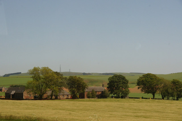
Farmland towards Broombank Farm
Farmland towards Broombank Farm Credit: JThomas

Court Stane is a significant heritage site located in Kincardineshire, Scotland. It is an ancient standing stone that holds historical and cultural importance. The stone stands proudly amidst the scenic landscape, surrounded by lush greenery and rolling hills.

The Court Stane is a massive upright monolith, measuring approximately 13 feet in height and weighing several tons. It is believed to have been erected during the Bronze Age, making it over 4,000 years old. The stone is made of a local granite, giving it a rugged and weathered appearance.

The significance of the Court Stane lies in its historical and ceremonial role. It is thought to have been a gathering place for local communities, serving as a meeting point for legal matters and important discussions. The stone's name, "Court Stane," reflects its association with these judicial proceedings.

Visitors to Court Stane can marvel at its impressive size and ponder the rituals and traditions that took place around it in ancient times. The stone's location offers breathtaking views of the surrounding countryside, providing an opportunity to connect with the natural beauty of the area.

Court Stane is a protected heritage site, and its preservation is carefully managed by local authorities. Interpretive signage and information boards provide visitors with historical context and insights into the stone's significance. The site is easily accessible, with ample parking and well-maintained footpaths leading to the monument.

Overall, Court Stane stands as a testament to the rich history and cultural heritage of Kincardineshire, offering visitors a glimpse into the ancient past of the region.

If you have any feedback on the listing, please let us know in the comments section below.

Court Stane Images

Images are sourced within 2km of 56.907/-2.37 or Grid Reference NO7779. Thanks to Geograph Open Source API. All images are credited.

Farmland towards Broombank Farm
Drumlithie Steeple Looking west along the High Street to Drumlithie Steeple bell tower.
Drumlithie Steeple
Looking west along the High Street to Drumlithie Steeple bell tower.
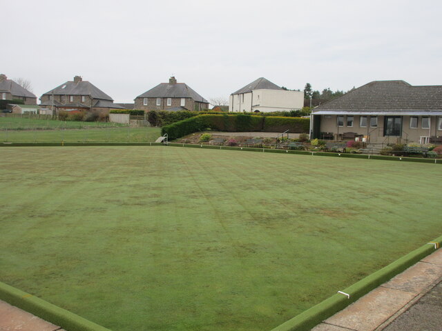
Drumlithie Bowling Green Looking from the north-east corner across the green at Drumlithie Bowling Club.
Drumlithie Bowling Green
Looking from the north-east corner across the green at Drumlithie Bowling Club.
East Coast Line at Drumlithie The East Coast Railway Line heading north-east from the bridge on Station Road, Drumlithie.
East Coast Line at Drumlithie
The East Coast Railway Line heading north-east from the bridge on Station Road, Drumlithie.
Prepared field near Glenbervie Looking south over a prepared field to the east of Glenbervie Home Farm.
Prepared field near Glenbervie
Looking south over a prepared field to the east of Glenbervie Home Farm.
Minor road in Angus
Minor road in Angus
Angus farmland
Angus farmland
Old Mondynes Bridge The old road bridge over the Bervie Water at Mondynes.
Old Mondynes Bridge
The old road bridge over the Bervie Water at Mondynes.
Bervie Water The Bervie Water flowing between the rail bridge and old road bridge at Monydnes.
Bervie Water
The Bervie Water flowing between the rail bridge and old road bridge at Monydnes.
Approaching exit for Arbuthnott This scene is as viewed from the southbound travel lane of A90, somewhat before the exit to Inverbervie and Arbuthnott.
Approaching exit for Arbuthnott
This scene is as viewed from the southbound travel lane of A90, somewhat before the exit to Inverbervie and Arbuthnott.
Corbies Heugh Fields leading to Corbies Heugh and the hidden Corby Pot of the Bervie Water.
Corbies Heugh
Fields leading to Corbies Heugh and the hidden Corby Pot of the Bervie Water.
Abbeyton Farm, near Mondynes
Gyratesmyre Farm, near Mondynes
Entrance to Drumlithie
Drumlithie Hotel
Drumlithie Hotel
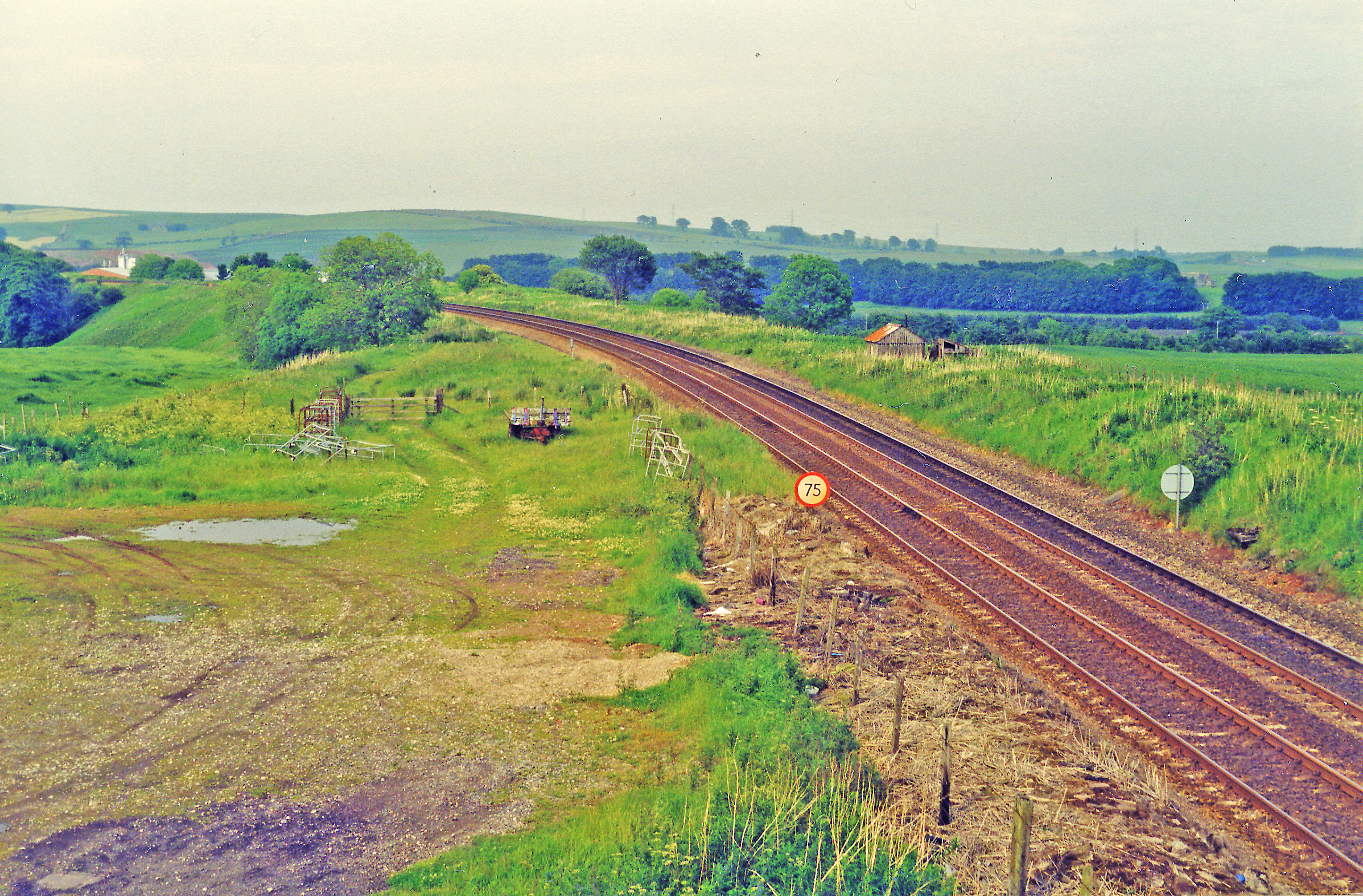
Site of Drumlithie station, 1997 View NE, towards Aberdeen: ex-Caledonian Railway Perth etc. - Forfar - Kinnaber Junction - Aberdeen main line, over which the ex-NBR had running powers north of Kinnaber Junction. The station was closed to passengers 11/6/56, to goods 23/3/64. The ex-CR main line was closed 4/9/67, since when all trains have run from the south via Montrose to Kinnaber Junction.
Site of Drumlithie station, 1997
View NE, towards Aberdeen: ex-Caledonian Railway Perth etc. - Forfar - Kinnaber Junction - Aberdeen main line, over which the ex-NBR had running powers north of Kinnaber Junction. The station was closed to passengers 11/6/56, to goods 23/3/64. The ex-CR main line was closed 4/9/67, since when all trains have run from the south via Montrose to Kinnaber Junction.
Houses in Drumlithie Two traditional two-storey houses. The one on the right is probably 18th century.
Houses in Drumlithie
Two traditional two-storey houses. The one on the right is probably 18th century.
High Street Passing through Drumlithie, you can easily overlook the mae of narrow streets to the north of the present main road. This one, although called High Street, is narrow and twisting, and one section of it has an 'Unsuitable for HGVs' sign.
High Street
Passing through Drumlithie, you can easily overlook the mae of narrow streets to the north of the present main road. This one, although called High Street, is narrow and twisting, and one section of it has an 'Unsuitable for HGVs' sign.
Show me another place!

Court Stane is located at Grid Ref: NO7779 (Lat: 56.907, Lng: -2.37)

Unitary Authority: Aberdeenshire

Police Authority: North East

What 3 Words

///upwards.cucumber.straying. Near Inverbervie, Aberdeenshire

Nearby Locations

Court Stane Mondynes

Related Wikis

Glenbervie House

Glenbervie House is a mansion house, which has incorporated parts of an earlier castle, located near Glenbervie, Kincardine and Mearns, Scotland. ��2...

Glenbervie

Glenbervie (Scottish Gaelic: Gleann Biorbhaidh) is located in the north east of Scotland in the Howe o' the Mearns, one mile from the village of Drumlithie...

Abbeyton Bridge

Abbeyton Bridge was a road bridge that carried the B966 road over the Dundee–Aberdeen line. == History == In June 2018, Aberdeenshire Council introduced...

Drumlithie

Drumlithie is a village in the Howe of the Mearns in southern Aberdeenshire, Scotland. Situated seven miles south of Stonehaven in the parish of Glenbervie...

Drumlithie railway station

Drumlithie railway station served the village of Drumlithie, Aberdeenshire, Scotland from 1849 to 1956 on the Aberdeen Railway. == History == The station...

Droop Hill

Droop Hill is a mountain landform in the Kincardine and Mearns region of Aberdeenshire, Scotland. The locale had been featured in a windfarm proposal...

Carmont railway station

Carmont railway station, on the Aberdeen Railway, served the rural area of Carmont in Aberdeenshire, Scotland from 1855 to 1964. == History == The station...

Fordoun railway station

Fordoun railway station served the village of Fordoun, Aberdeenshire, Scotland from 1849 to 1956 on the Aberdeen Railway. == History == The station opened...

Nearby Amenities

Located within 500m of 56.907,-2.37
Speed Camera
Ref: 217
Website: http://www.nescamp.co.uk/details?cid=13
Lat/Long: 56.9062757/-2.3619662
Power: pole
Lat/Long: 56.909364/-2.3635317
Power: pole
Lat/Long: 56.908768/-2.3643887
Power: pole
Lat/Long: 56.9081983/-2.3652041
Power: pole
Lat/Long: 56.9076484/-2.3660034
Power: pole
Lat/Long: 56.9070765/-2.3668349
Power: pole
Lat/Long: 56.9067104/-2.3677146
Material: wood
Power: pole
Lat/Long: 56.9062454/-2.368817
Material: wood
Power: pole
Lat/Long: 56.9057607/-2.3699959
Material: wood
Power: pole
Lat/Long: 56.9052927/-2.3711814
Material: wood
Power: pole
Lat/Long: 56.9048006/-2.372379
Material: wood
Power: pole
Lat/Long: 56.9042983/-2.3736531
Material: wood
Power: pole
Lat/Long: 56.9036092/-2.3744711
Railway: crossing
Lat/Long: 56.9025481/-2.3704909
Railway: crossing
Lat/Long: 56.9025772/-2.3705427
Power: pole
Lat/Long: 56.9054887/-2.3775749
Material: wood
Power: pole
Lat/Long: 56.9049949/-2.3627044
Material: wood
Power: pole
Lat/Long: 56.9053701/-2.3624952
Material: wood
Power: pole
Lat/Long: 56.9057084/-2.362294
Material: wood
Power: pole
Lat/Long: 56.906299/-2.3623418
Material: wood
Power: pole
Lat/Long: 56.9065372/-2.3623199
Material: wood
Power: pole
Lat/Long: 56.9068722/-2.3618119
Power: pole
Lat/Long: 56.9067711/-2.3628797
Power: pole
Lat/Long: 56.9069984/-2.3634215
Power: pole
Lat/Long: 56.9071332/-2.3637442
Power: pole
Lat/Long: 56.9068559/-2.3643637
The data included in this document is from www.openstreetmap.org. The data is made available under ODbL.

Have you been to Court Stane?

Leave your review of Court Stane below (or comments, questions and feedback).