Corbie Knowe

Heritage Site in Angus

Scotland

Corbie Knowe

Second Knowes The beach at the Second Knowes is covered with large boulders. On the left is a sea stack of volcanic rock.
Second Knowes Credit: Anne Burgess

Corbie Knowe is a significant heritage site located in Angus, Scotland. Nestled amidst picturesque countryside, it holds historical, cultural, and archaeological importance. The site is believed to date back to the Iron Age, making it over 2,000 years old.

Situated on a raised mound, Corbie Knowe was once home to an ancient settlement. The remains of circular stone structures and defensive ditches reveal the fortified nature of the settlement, suggesting it may have been a hillfort. Archaeological excavations have unearthed various artifacts, including pottery fragments and tools, shedding light on the daily lives of its residents.

The site offers visitors a glimpse into the rich history of the region. As they explore the area, they can learn about the ancient inhabitants and their way of life. Interpretive panels provide information about the site's historical significance, helping visitors understand its cultural importance.

Corbie Knowe is also a popular destination for nature enthusiasts. The surrounding landscape boasts stunning views, with rolling hills and lush greenery. Visitors can enjoy leisurely walks, taking in the serene beauty of the countryside.

The site is easily accessible, with designated parking and well-maintained paths. It offers a serene and peaceful atmosphere, making it an ideal spot for relaxation and contemplation. Whether one is interested in history, archaeology, or simply seeking tranquility, Corbie Knowe in Angus promises a memorable experience.

If you have any feedback on the listing, please let us know in the comments section below.
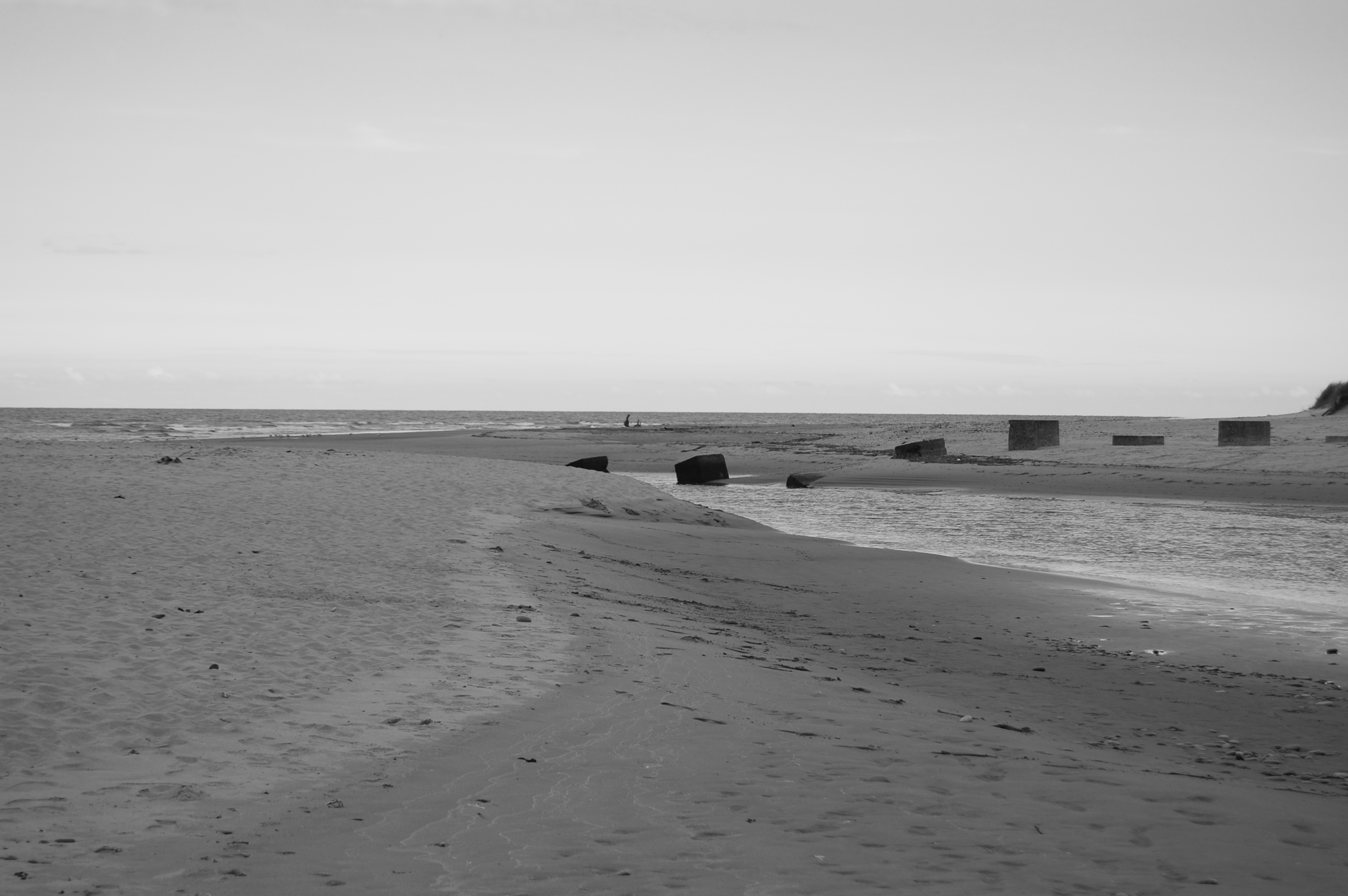
Corbie Knowe Images

Images are sourced within 2km of 56.637/-2.497 or Grid Reference NO6949. Thanks to Geograph Open Source API. All images are credited.

Second Knowes The beach at the Second Knowes is covered with large boulders. On the left is a sea stack of volcanic rock.
Second Knowes
The beach at the Second Knowes is covered with large boulders. On the left is a sea stack of volcanic rock.
Second Knowes The west end of the beach is made up of pebbles and cobbles, and supports a variety of plants including Sea Mayweed (Tripleurospermum maritimum).
Second Knowes
The west end of the beach is made up of pebbles and cobbles, and supports a variety of plants including Sea Mayweed (Tripleurospermum maritimum).
The Knowes at Sunset The setting sun has tinged the red volcanic rocks with pink.
The Knowes at Sunset
The setting sun has tinged the red volcanic rocks with pink.
Interesting Clouds Wispy Cirrus clouds being blown about above the Knowes, with a contrail through the middle of the view.
Interesting Clouds
Wispy Cirrus clouds being blown about above the Knowes, with a contrail through the middle of the view.
Second Knowes Or, to be more precise, the boulder beach beside the Second Knowes. Oddly, it never seems to become covered with seaweed, even in the lowest part of the intertidal zone.
Second Knowes
Or, to be more precise, the boulder beach beside the Second Knowes. Oddly, it never seems to become covered with seaweed, even in the lowest part of the intertidal zone.
Rocky Shore The all the rocks here are volcanic and red in colour. The pale creamy colour of the ones in the middle is a thick crust of millions of barnacles, and the furthest ones are covered in dark seaweeds.
Rocky Shore
The all the rocks here are volcanic and red in colour. The pale creamy colour of the ones in the middle is a thick crust of millions of barnacles, and the furthest ones are covered in dark seaweeds.
Ancient Lava These rocks are part of the Ethie Lavas, which belong to the Montrose Volcanics, and were erupted about 400 million years ago.
Ancient Lava
These rocks are part of the Ethie Lavas, which belong to the Montrose Volcanics, and were erupted about 400 million years ago.
Sea Lion Rock With the eye of imagination, the pillar on the right looks like a sea lion propping itself up on its front flippers. In the background is the north end of the beach at Lunan Bay.
Sea Lion Rock
With the eye of imagination, the pillar on the right looks like a sea lion propping itself up on its front flippers. In the background is the north end of the beach at Lunan Bay.
Remains of a Dyke The drystane dyke between the cliff edge and the arable fields has fallen to form what looks like a series of unstable pillars.
Remains of a Dyke
The drystane dyke between the cliff edge and the arable fields has fallen to form what looks like a series of unstable pillars.
Soay Sheep A flock of Soay sheep grazes the cliff top and slopes between Lang Craig and Prail Castle. They are pretty wild and always flee when anyone approaches.
Soay Sheep
A flock of Soay sheep grazes the cliff top and slopes between Lang Craig and Prail Castle. They are pretty wild and always flee when anyone approaches.
Irrigation The eastern coastal fringe of Scotland has an average annual rainfall similar to that of parts of Kent and East Anglia, but most of the rain falls in the autumn and winter, so irrigation has long been a feature of farming here. This installation is providing water for a crop of potatoes.
Irrigation
The eastern coastal fringe of Scotland has an average annual rainfall similar to that of parts of Kent and East Anglia, but most of the rain falls in the autumn and winter, so irrigation has long been a feature of farming here. This installation is providing water for a crop of potatoes.
Farm track serving as a coastal path at Red Head, Angus Although the rocky coast and associated sea birds in this area make spectacular viewing, there is no formal coastal path which permits easy access. While good access and paths designed for walking can be desirable, it is also true that too many visitors to an area can spoil the elemental assets, like solitude, which is, in fact, the thing they have come to experience.
Farm track serving as a coastal path at Red Head, Angus
Although the rocky coast and associated sea birds in this area make spectacular viewing, there is no formal coastal path which permits easy access. While good access and paths designed for walking can be desirable, it is also true that too many visitors to an area can spoil the elemental assets, like solitude, which is, in fact, the thing they have come to experience.
Primrose (Primula vulgaris) The cliffs and banks here are liberally dotted with clumps of this spring favourite.
Primrose (Primula vulgaris)
The cliffs and banks here are liberally dotted with clumps of this spring favourite.
Stony Beach An exceptionally high spring tide has almost managed to submerge the boulder beach of the Second Knowes. This beach is fully exposed to the east and north-east, and is consequently covered with very large boulders.
Stony Beach
An exceptionally high spring tide has almost managed to submerge the boulder beach of the Second Knowes. This beach is fully exposed to the east and north-east, and is consequently covered with very large boulders.
Beach at The Knowes The shore here is very rocky, so tends to have smaller pebbles than the exposed beach beyond the headland. Note the very red colour of the volcanic rock on the left. On the horizon is an anchored ship, 'Siem Emerald'. She has been there for about a fortnight.
Beach at The Knowes
The shore here is very rocky, so tends to have smaller pebbles than the exposed beach beyond the headland. Note the very red colour of the volcanic rock on the left. On the horizon is an anchored ship, 'Siem Emerald'. She has been there for about a fortnight.
Midsummer Sunrise Not quite the longest day, but close; the sun rises in the north-east.
Midsummer Sunrise
Not quite the longest day, but close; the sun rises in the north-east.
Auld Mains, Ethie
Auld Mains, Ethie
Show me another place!

Corbie Knowe is located at Grid Ref: NO6949 (Lat: 56.637, Lng: -2.497)

What 3 Words

///waving.outsize.headboard. Near Montrose, Angus

Nearby Locations

Corbie Knowe

Related Wikis

Lunan Water

The Lunan Water is an easterly flowing river in Angus, Scotland, that discharges to the North Sea 11 kilometres (6.8 mi) north of the town of Arbroath...

Red Castle, Angus

Red Castle of Lunan is a ruined fortified house on the coast of Angus, Scotland. It is about 4 miles (6.4 km) south-southwest of Montrose. == History... ==

Lunan, Angus

Lunan is a hamlet in Angus, Scotland, in the parish of the same name, 6 kilometres (3.7 mi) south of Montrose. The hamlet overlooks Lunan Bay, which is...

Lunan Bay railway station

Lunan Bay railway station served the village of Lunan, Angus, Scotland from 1883 to 1964 on the North British, Arbroath and Montrose Railway. == History... ==

Have you been to Corbie Knowe?

Leave your review of Corbie Knowe below (or comments, questions and feedback).