Conksbury Village

Heritage Site in Derbyshire Derbyshire Dales

England

Conksbury Village

Broadmeadow Shaft Adjacent to the cottages here, which were once the offices of the Alport Mining Company, can be seen a large mound which marks the site of the Broadmeadow Shaft on the Alport mines. This company was an amalgamation of various separate mining concerns and operated the very rich lead mines of this area. They were classed as the most heavily watered mines in the country and suffered from inflows of more than 6000 gallons a minute. Consequently, heavy pumping was necessary, chiefly by water pressure engines which used a column of water to power them. The well known Cornish engineer, Richard Trevithick was consulted and he was responsible for the first of many such underground machines within this region. Water to power the engine in this shaft was taken from the River Lathkill and over Alport village in wooden launders and then by a tunnel to the shaft. All the pumped water, along with that used by the engines (of which there were upwards of seven scattered throughout the workings) was drained away by the deep Hillcarr Sough, a tunnel driven from the River Derwent near Darley Dale.
Broadmeadow Shaft Credit: Richard Bird

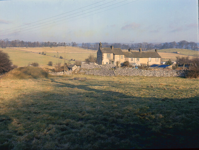
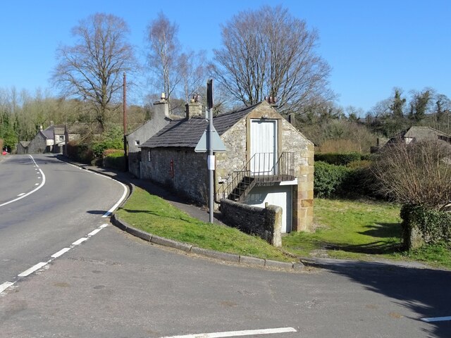
Conksbury Village, located in Derbyshire, England, is a charming heritage site that offers visitors a glimpse into the region's rich history and architectural heritage. Nestled in the picturesque countryside, this village is renowned for its well-preserved medieval buildings and captivating atmosphere.

Dating back to the 13th century, Conksbury Village exudes a sense of timelessness, with its narrow streets lined with traditional stone cottages and timber-framed houses. The village's architecture showcases a variety of styles, including Tudor and Georgian, providing a visual feast for history enthusiasts and architecture lovers alike.

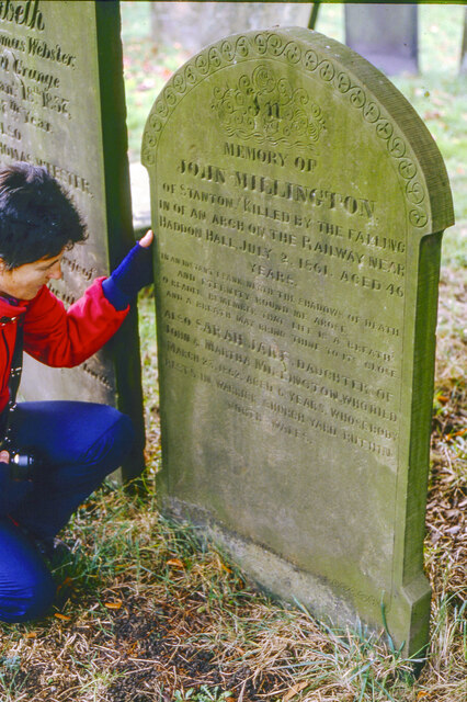
One of the prominent landmarks in Conksbury Village is the St. Mary's Church, a striking example of medieval craftsmanship. This ancient church features intricately carved stone details and a beautifully preserved interior, offering a tranquil place for reflection and worship. Visitors can also explore the village's historic market square, which has been a focal point of community life for centuries.

Conksbury Village is not only a testament to the region's past but also a thriving community with vibrant local shops, cozy tearooms, and traditional pubs. It offers visitors a chance to experience the warm hospitality of the locals while indulging in traditional English fare.

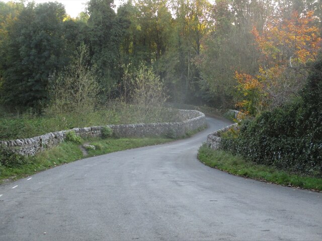
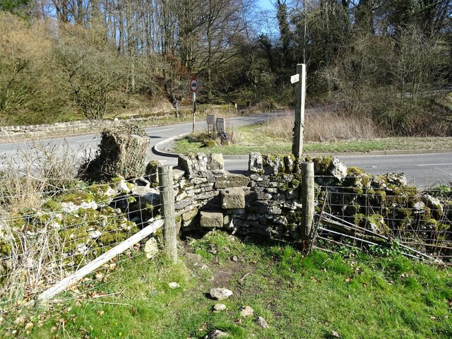
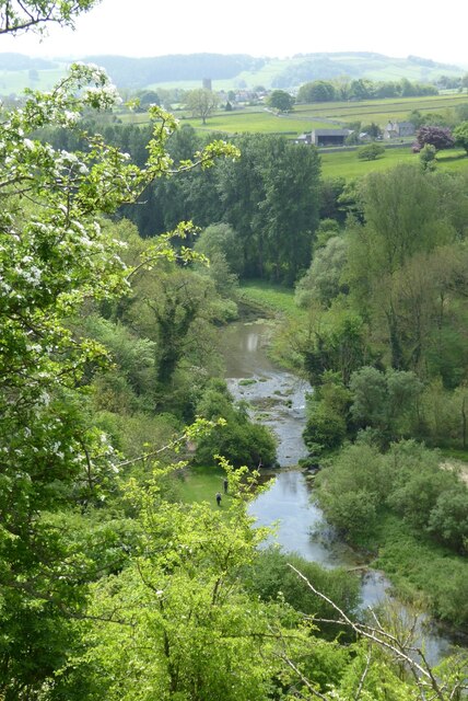
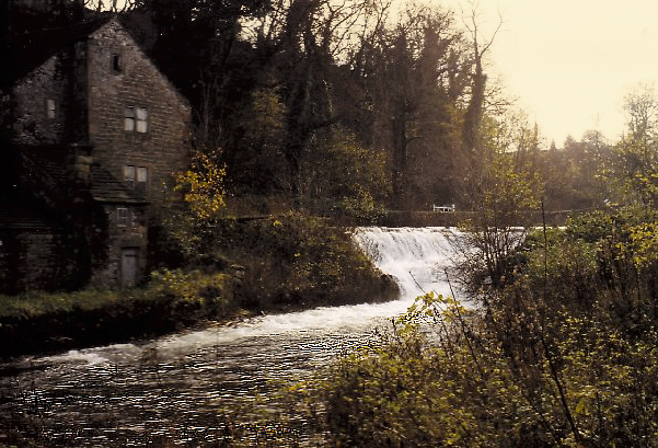
For those seeking outdoor adventures, the village is surrounded by breathtaking countryside, perfect for hiking and cycling enthusiasts. The nearby Conksbury Woods provide a serene escape, with ancient trees and wildlife to be discovered.

Conksbury Village truly encapsulates the essence of a quintessential English village, with its historic charm, architectural treasures, and natural beauty. A visit to this heritage site promises an unforgettable experience steeped in history and a chance to immerse oneself in the idyllic charm of rural England.

If you have any feedback on the listing, please let us know in the comments section below.

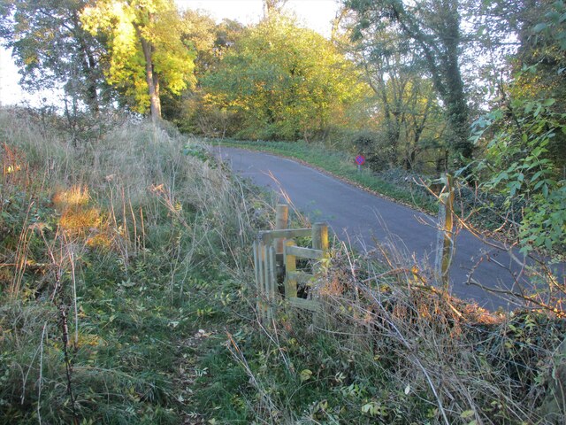
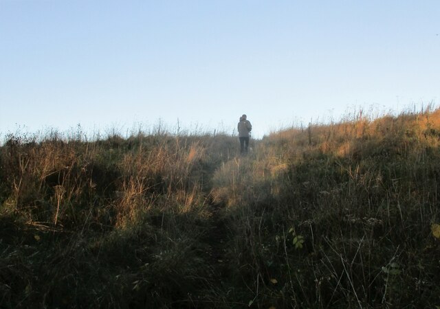
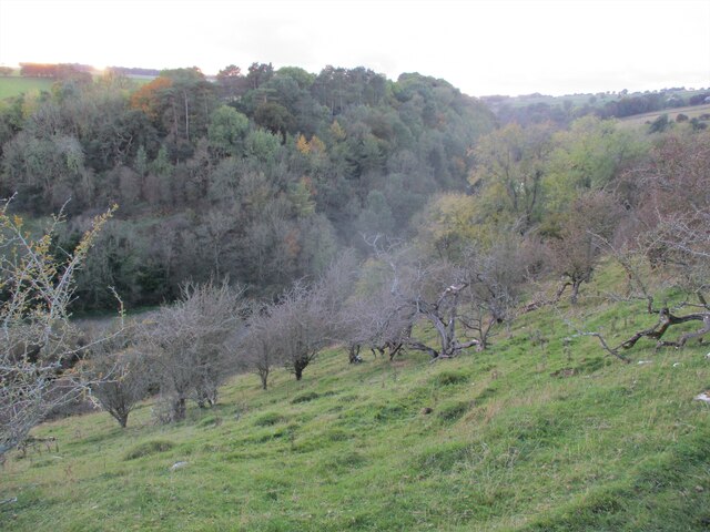
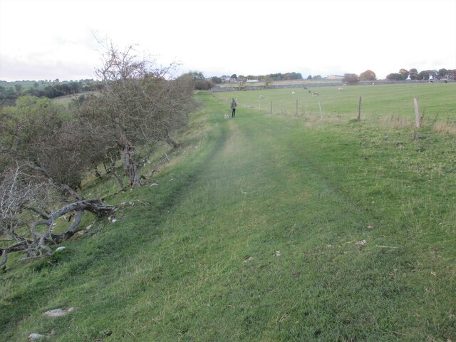
Conksbury Village Images

Images are sourced within 2km of 53.185/-1.678 or Grid Reference SK2165. Thanks to Geograph Open Source API. All images are credited.

Broadmeadow Shaft Adjacent to the cottages here, which were once the offices of the Alport Mining Company, can be seen a large mound which marks the site of the Broadmeadow Shaft on the Alport mines. This company was an amalgamation of various separate mining concerns and operated the very rich lead mines of this area. They were classed as the most heavily watered mines in the country and suffered from inflows of more than 6000 gallons a minute. Consequently, heavy pumping was necessary, chiefly by water pressure engines which used a column of water to power them. The well known Cornish engineer, Richard Trevithick was consulted and he was responsible for the first of many such underground machines within this region. Water to power the engine in this shaft was taken from the River Lathkill and over Alport village in wooden launders and then by a tunnel to the shaft. All the pumped water, along with that used by the engines (of which there were upwards of seven scattered throughout the workings) was drained away by the deep Hillcarr Sough, a tunnel driven from the River Derwent near Darley Dale.
Broadmeadow Shaft
Adjacent to the cottages here, which were once the offices of the Alport Mining Company, can be seen a large mound which marks the site of the Broadmeadow Shaft on the Alport mines. This company was an amalgamation of various separate mining concerns and operated the very rich lead mines of this area. They were classed as the most heavily watered mines in the country and suffered from inflows of more than 6000 gallons a minute. Consequently, heavy pumping was necessary, chiefly by water pressure engines which used a column of water to power them. The well known Cornish engineer, Richard Trevithick was consulted and he was responsible for the first of many such underground machines within this region. Water to power the engine in this shaft was taken from the River Lathkill and over Alport village in wooden launders and then by a tunnel to the shaft. All the pumped water, along with that used by the engines (of which there were upwards of seven scattered throughout the workings) was drained away by the deep Hillcarr Sough, a tunnel driven from the River Derwent near Darley Dale.
Grave of John Millington, railway navvy, Youlgreave Churchyard During the construction of the Midland Railway near Haddon Hall in 1861 a tunnel was insisted upon by the Duke of Rutland so that the line could not be seen from the hall. A part of this tunnel collapsed during construction on 2nd July 1861 killing five workers. The grave of one of these can be found in the churchyard. The inscription reads: "In memory of John Millington of Stanton, killed by the falling of an arch on the railway near Haddon Hall, July 2nd 1861 aged 46 years". Reference to his 6 year old daughter is also on the stone whose body rests in Warrick churchyard, Ruthin, North Wales.
Grave of John Millington, railway navvy, Youlgreave Churchyard
During the construction of the Midland Railway near Haddon Hall in 1861 a tunnel was insisted upon by the Duke of Rutland so that the line could not be seen from the hall. A part of this tunnel collapsed during construction on 2nd July 1861 killing five workers. The grave of one of these can be found in the churchyard. The inscription reads: "In memory of John Millington of Stanton, killed by the falling of an arch on the railway near Haddon Hall, July 2nd 1861 aged 46 years". Reference to his 6 year old daughter is also on the stone whose body rests in Warrick churchyard, Ruthin, North Wales.
St  Anne's  Church  Over  Haddon
St Anne's Church Over Haddon
Old  stone  barn  alongside  River  Lathkill
Old stone barn alongside River Lathkill
Stone  flagged  footbridge  over  dry  River  Lathkill
Stone flagged footbridge over dry River Lathkill
Evening  sun  on  Over  Haddon  Village  Hall
Evening sun on Over Haddon Village Hall
Commemorative  Plaque  on  Over  Haddon  Village  Hall
Commemorative Plaque on Over Haddon Village Hall
Field  footpath  to  Over  Haddon The large white building is the hotel/pub/restaurant. Eat in the bar if dog is with you, we dined there 3 times during our stay in the village, an excellent base to tour from.
Field footpath to Over Haddon
The large white building is the hotel/pub/restaurant. Eat in the bar if dog is with you, we dined there 3 times during our stay in the village, an excellent base to tour from.
War  Memorial  Over  Haddon
War Memorial Over Haddon
Conksbury  Bridge  over  River  Lathkill In Lathkill Dale
Conksbury Bridge over River Lathkill
In Lathkill Dale
Footpath  coming  off  minor  road Takes you over fields to Over Haddon
Footpath coming off minor road
Takes you over fields to Over Haddon
Footpath  through  rough  pasture  out  of  Lathkill  Dale
Footpath through rough pasture out of Lathkill Dale
Into  steep  sided  Lathkill  Dale From the field footpath to Over Haddon
Into steep sided Lathkill Dale
From the field footpath to Over Haddon
Footpath  over  fields  to  Over  Haddon
Footpath over fields to Over Haddon
Old barn on the edge of Alport Not yet converted into a luxury residence.
Old barn on the edge of Alport
Not yet converted into a luxury residence.
Old lead shaft capped with concrete Harthill Hall is in the background
Old lead shaft capped with concrete
Harthill Hall is in the background
Step stile and fingerpost Off the B5056 at the junction with Birchover Road.
Step stile and fingerpost
Off the B5056 at the junction with Birchover Road.
Lathkill Dale View down to the River Lathkill in Lathkill Dale.  The tower of Youlgreave church can be seen in the distance.
Lathkill Dale
View down to the River Lathkill in Lathkill Dale. The tower of Youlgreave church can be seen in the distance.
Show me another place!

Conksbury Village is located at Grid Ref: SK2165 (Lat: 53.185, Lng: -1.678)

Administrative County: Derbyshire

District: Derbyshire Dales

Police Authority: Derbyshire

What 3 Words

///reckoned.palms.mailing. Near Youlgreave, Derbyshire

Related Wikis

Alport

Alport is a hamlet in the White Peak area of Derbyshire, England. It lies east of Youlgreave, at the confluence of the River Bradford and the River Lathkill...

River Bradford

The River Bradford is a river in the Peak District National Park in Derbyshire. Its source is on Gratton Moor and after passing below Youlgreave it joins...

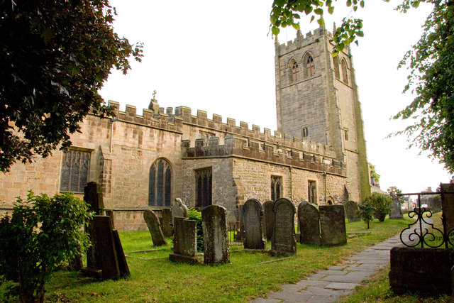
All Saints' Church, Youlgreave

All Saints’ Church, Youlgreave is a Grade I listed parish church in the Church of England in Youlgreave, Derbyshire. == History == The church dates from...

Youlgreave

Youlgreave or Youlgrave is a village and civil parish in the Peak District of Derbyshire, England, on the River Bradford 2+1⁄2 miles (4.0 km) south of...
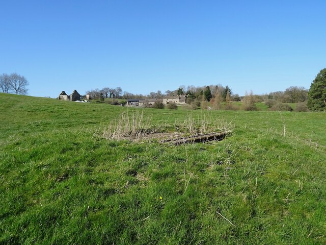
Conksbury

Conksbury is the site of a deserted medieval settlement between Over Haddon and Youlgreave in Derbyshire, England. == History == The village was recorded...

Harthill Hall

Harthill Hall was formerly the Manor House of a great 13th century Estate, and the hall is now a Grade II listed building within the civil parish of Harthill...

St Anne's Church, Over Haddon

St Anne's Church, Over Haddon is a Grade II listed parish church in the Church of England in Over Haddon, Derbyshire. == History == The church was built...

Over Haddon

Over Haddon is a small village and civil parish in Derbyshire, England. The population of the civil parish (including Nether Haddon) at the 2011 Census...

Nearby Amenities

Located within 500m of 53.185,-1.678
Barrier: stile
Stile: ladder
Lat/Long: 53.1864351/-1.6792581
Barrier: stile
Lat/Long: 53.1842499/-1.6852296
Barrier: stile
Lat/Long: 53.1852217/-1.6847475
Barrier: stile
Material: stone
Source: survey;gps
Stile: squeezer
Lat/Long: 53.1882739/-1.6823904
Bench
Source: survey;gps
Lat/Long: 53.1874576/-1.6840933
Bench
Source: survey;gps
Lat/Long: 53.1874753/-1.6841161
Bench
Source: survey;gps
Lat/Long: 53.1874986/-1.6841564
Barrier: stile
Stile: gate
Lat/Long: 53.1826728/-1.68134
Barrier: stile
Material: wood
Stile: stepover
Lat/Long: 53.1846583/-1.683715
Parking
Parking: street_side
Lat/Long: 53.187408/-1.6842176
The data included in this document is from www.openstreetmap.org. The data is made available under ODbL.

Have you been to Conksbury Village?

Leave your review of Conksbury Village below (or comments, questions and feedback).