Clytha Park Estate
Heritage Site in Monmouthshire
Wales
Clytha Park Estate

Clytha Park Estate is a picturesque heritage site located in Monmouthshire, Wales. Spread across 170 acres of rolling countryside, the estate is renowned for its stunning landscapes, historic buildings, and rich cultural heritage.
The centerpiece of Clytha Park Estate is Clytha House, a Grade II listed mansion built in the early 19th century. Designed by the renowned architect, John Nash, the house showcases an elegant Regency style with its symmetrical façade and classical proportions. The interior is equally impressive, featuring grand reception rooms, ornate ceilings, and a remarkable collection of period furniture.
Surrounding the mansion is an enchanting landscape garden, designed by the famous landscape artist, William Emes. The garden boasts a delightful mix of formal and informal elements, including sweeping lawns, ornamental ponds, and an impressive array of tree species. Visitors can wander along meandering paths, discovering hidden follies, ornate statues, and charming woodland areas.
Beyond the immediate vicinity of the mansion, Clytha Park Estate offers a diverse range of habitats, including woodlands, meadows, and a picturesque lake. These natural areas provide a haven for wildlife, with an abundance of bird species, butterflies, and wildflowers.
Due to its historical and cultural significance, Clytha Park Estate has been designated as a heritage site, attracting visitors from far and wide. Whether exploring the grandeur of Clytha House, strolling through the scenic gardens, or simply enjoying the tranquility of the natural surroundings, visitors to the estate are guaranteed a memorable and immersive experience.
If you have any feedback on the listing, please let us know in the comments section below.
Clytha Park Estate Images
Images are sourced within 2km of 51.777/-2.917 or Grid Reference SO3609. Thanks to Geograph Open Source API. All images are credited.


Clytha Park Estate is located at Grid Ref: SO3609 (Lat: 51.777, Lng: -2.917)
Unitary Authority: Monmouthshire
Police Authority: Gwent
What 3 Words
///emerge.checked.hockey. Near Llanarth, Monmouthshire
Nearby Locations
Related Wikis

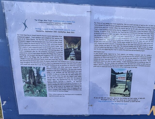
Clytha Park
Clytha Park, Clytha, Monmouthshire, is a 19th-century Neoclassical country house, "the finest early nineteenth century Greek Revival house in the county...

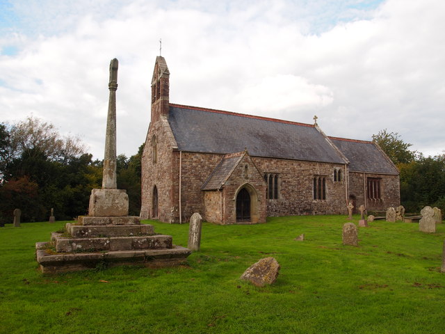
Chapel Farmhouse, Llanarth
Chapel Farmhouse and its attached outbuilding, Llanarth, Monmouthshire is a house dating from the 16th century. Greatly enlarged in the 17th century, it...
Little Pitt Cottage
Little Pitt Cottage is a medieval house in Llanarth, Monmouthshire, South Wales. It was designated a Grade II* listed building in 1956, its listing record...

Clytha Castle
Clytha Castle (Welsh: Castell Cleidda) is a folly near Clytha between Llanarth and Raglan in Monmouthshire, south east Wales. Dating from 1790, the castle...

Clytha
Clytha is a hamlet and historical area in Monmouthshire, Wales. == Overview == It lies just off the A40 road, to the south of Llanarth and west of Raglan...

Great House, Llanarth
Great House, Llanarth, Monmouthshire is a farmhouse dating from the late-16th century. Extended in the mid-17th century and little altered thereafter,...

Aberffrwd, Monmouthshire
Aberffrwd is a village in Monmouthshire, Wales. It lies above the River Usk just off the A40 between Llanvihangel Gobion and Clytha. The population of...
Church of St Mary the Virgin, Llanfair Kilgeddin
St Mary the Virgin is the former parish church for Llanfair Kilgeddin, near Usk in Monmouthshire, south east Wales. It is a Grade I listed building, notable...
Nearby Amenities
Located within 500m of 51.777,-2.917Have you been to Clytha Park Estate?
Leave your review of Clytha Park Estate below (or comments, questions and feedback).