Chûn Quoit

Heritage Site in Cornwall

England

Chûn Quoit

The Church of St Bridget of Sweden
The Church of St Bridget of Sweden Credit: Paul Barnett

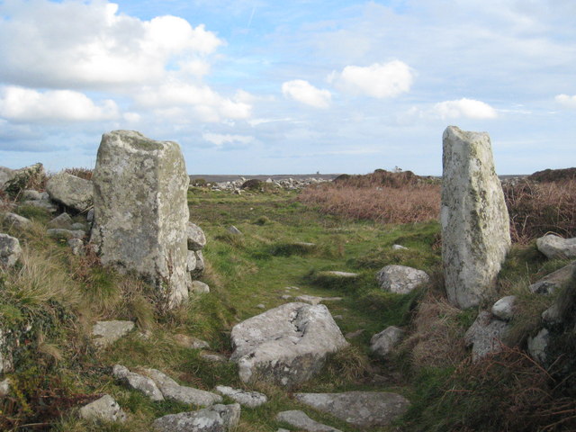
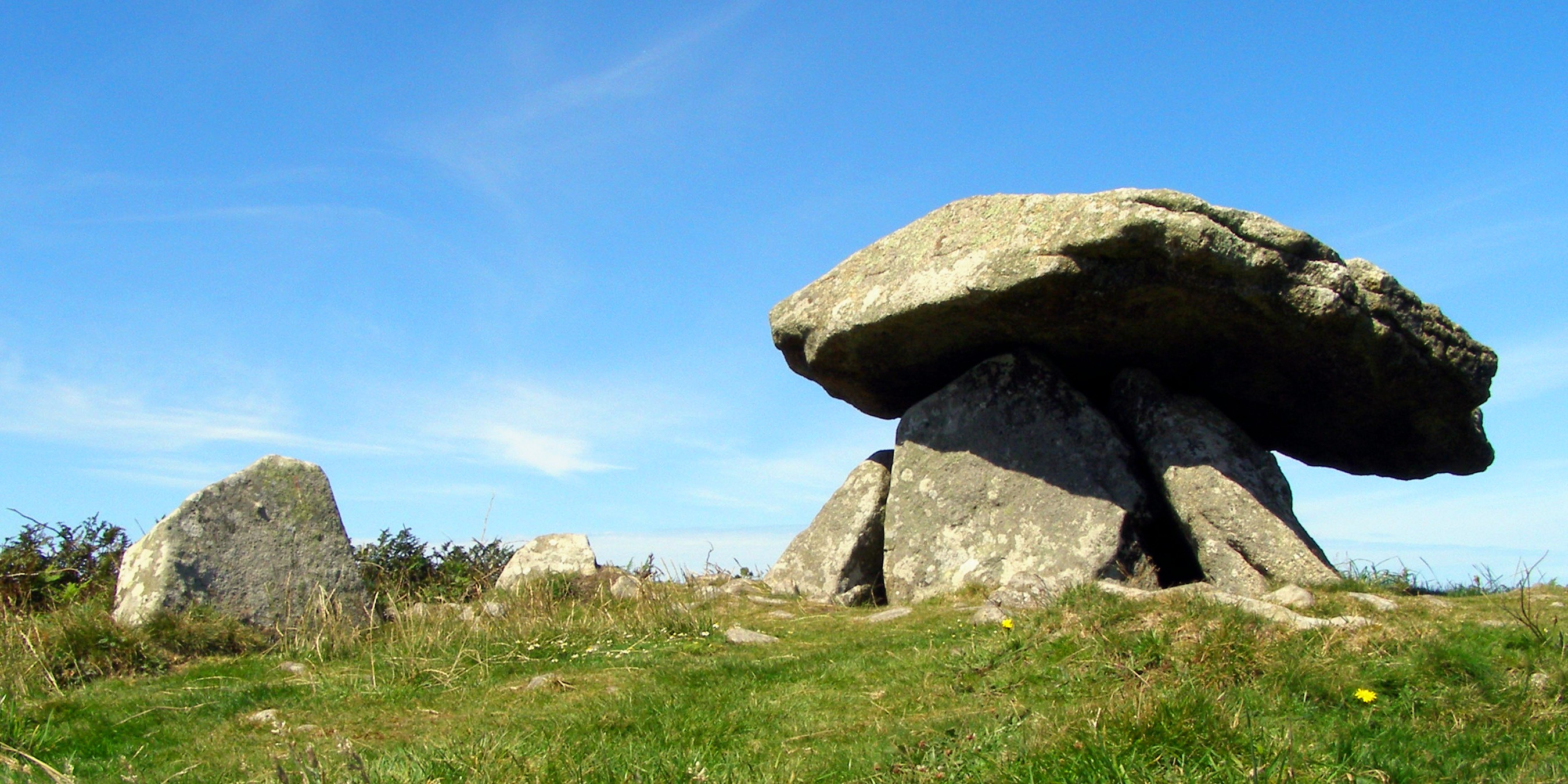
Chûn Quoit is a Neolithic burial monument located in Cornwall, England. It is situated on the western edge of the Penwith Peninsula, near the village of Morvah. Believed to have been constructed around 3500 BC, Chûn Quoit is one of the best-preserved examples of its kind in the region.

The monument consists of a large capstone, estimated to weigh around 12 tons, supported by four upright stones. The capstone forms a chamber, which would have housed the remains of the deceased. Originally, the chamber would have been covered by a mound of earth, but this has eroded over time, leaving the structure exposed.

Chûn Quoit is an important heritage site as it provides valuable insights into the burial practices and religious beliefs of the Neolithic people who inhabited the area. The monument is believed to have been part of a larger ritual landscape, with other Neolithic sites nearby, such as stone circles and standing stones.

Visitors to Chûn Quoit can explore the site and marvel at the impressive stone architecture. The monument is accessible by foot, with car parking available nearby. Interpretive panels provide information about the history and significance of the site. The surrounding landscape offers breathtaking views of the rugged Cornish coastline, adding to the overall experience.

Chûn Quoit is protected as a Scheduled Ancient Monument and is managed by English Heritage. Regular maintenance and conservation work ensure the preservation of this ancient site for future generations to appreciate and learn from.

If you have any feedback on the listing, please let us know in the comments section below.

Chûn Quoit Images

Images are sourced within 2km of 50.153/-5.633 or Grid Reference SW4034. Thanks to Geograph Open Source API. All images are credited.

The Church of St Bridget of Sweden
Former Wesleyan chapel With old schoolhouse beyond.
Former Wesleyan chapel
With old schoolhouse beyond.
Stone Stile, Morvah On the B3306 East of the entrance to a camping field, on Cornwall footpath 106/2/1 looking SE.
The view looking out is <a href="https://www.geograph.org.uk/photo/7557474">SW4035 : Stone Stile, Morvah</a>.
Stone Stile, Morvah
On the B3306 East of the entrance to a camping field, on Cornwall footpath 106/2/1 looking SE. The view looking out is SW4035 : Stone Stile, Morvah.
Stone Stile, Morvah On the B3306 East of the entrance to a camping field, on Cornwall footpath 106/2/1 looking out.
The view SE is <a href="https://www.geograph.org.uk/photo/7557473">SW4035 : Stone Stile, Morvah</a>.
Stone Stile, Morvah
On the B3306 East of the entrance to a camping field, on Cornwall footpath 106/2/1 looking out. The view SE is SW4035 : Stone Stile, Morvah.
Chyrose Farm Wonderful holiday cottage on farm with views over the Atlantic.
Chyrose Farm
Wonderful holiday cottage on farm with views over the Atlantic.
Morvah: Portheras Valley Tin was dressed here by water-powered stamping mills. Additional supplies of water were required, brought by high-level leats from the neighbouring Rose Valley. Used water was returned to the Rose Valley to drive corn mills nearer the sea. The stamps mills were derelict by 1908 and are now very overgrown. One can be seen in this shot. [Source: Adam Sharpe. St Just – An Archaeological Survey of the Mining District (2 volumes) Cornwall Archaeological Unit, 1992, cited by Bob Acton]
Morvah: Portheras Valley
Tin was dressed here by water-powered stamping mills. Additional supplies of water were required, brought by high-level leats from the neighbouring Rose Valley. Used water was returned to the Rose Valley to drive corn mills nearer the sea. The stamps mills were derelict by 1908 and are now very overgrown. One can be seen in this shot. [Source: Adam Sharpe. St Just – An Archaeological Survey of the Mining District (2 volumes) Cornwall Archaeological Unit, 1992, cited by Bob Acton]
Morvah: Lower Chypraze Farm Beyond the farm a footpath gives access to the coast path and Portheras Cove
Morvah: Lower Chypraze Farm
Beyond the farm a footpath gives access to the coast path and Portheras Cove
Milking time at Keigwin Looking east. Dry Carn in the background.
Milking time at Keigwin
Looking east. Dry Carn in the background.
Flooding on Woon Gumpus Common After several days of heavy rain the peaty ground is saturated and the paths filled with water running like streams.
Flooding on Woon Gumpus Common
After several days of heavy rain the peaty ground is saturated and the paths filled with water running like streams.
Tregaminion Cliff near Greeb Point The ruined building is probably a field barn.
Tregaminion Cliff near Greeb Point
The ruined building is probably a field barn.
January Frost Clear skies last night so unusually cold for this part of Cornwall, below freezing.
January Frost
Clear skies last night so unusually cold for this part of Cornwall, below freezing.
Amusing milestone This milestone is at the junction of the B3318 and the road to Trewellard. There are quite a few of this style in the area, this one caught my eye because it makes you wonder how far the mason got before he realised that it just wasn't going to fit on. The "Tre" in Cornish placenames means "farm".
Amusing milestone
This milestone is at the junction of the B3318 and the road to Trewellard. There are quite a few of this style in the area, this one caught my eye because it makes you wonder how far the mason got before he realised that it just wasn't going to fit on. The "Tre" in Cornish placenames means "farm".
Portherras This is the eastern end of the extended village collectively known as Pendeen.  Brown tourist signs are pointing out the road down past the white house which leads to Pendeen Watch lighthouse.
Portherras
This is the eastern end of the extended village collectively known as Pendeen. Brown tourist signs are pointing out the road down past the white house which leads to Pendeen Watch lighthouse.
Pendeen Rovers Football Club The hill in the background beyond the village is Carn Eanes.
Pendeen Rovers Football Club
The hill in the background beyond the village is Carn Eanes.
Grazing Cattle The pasture fields on the north Penwith slope are typically small and separated by low stone walls which are often covered with gorse.
Grazing Cattle
The pasture fields on the north Penwith slope are typically small and separated by low stone walls which are often covered with gorse.
The track to Portheras Cove Pendeen Watch just visible on the far headland.
The track to Portheras Cove
Pendeen Watch just visible on the far headland.
Keigwin
Keigwin
The main road to St Ives
Show me another place!

Chûn Quoit is located at Grid Ref: SW4034 (Lat: 50.153, Lng: -5.633)

Unitary Authority: Cornwall

Police Authority: Devon and Cornwall

What 3 Words

///rebirth.motels.uncle. Near St Just, Cornwall

Nearby Locations

Hale Downs Chûn Quoit

Related Wikis

Chûn Castle

Chûn Castle is a large Iron Age hillfort (ringfort) near Penzance in Cornwall, England, United Kingdom. The fort was built about 2,500 years ago, and fell...

Chûn Quoit

Chûn Quoit is one of the best preserved of all Neolithic quoits (also called dolmens or cromlechs) in western Cornwall, England, United Kingdom. Chûn Quoit...
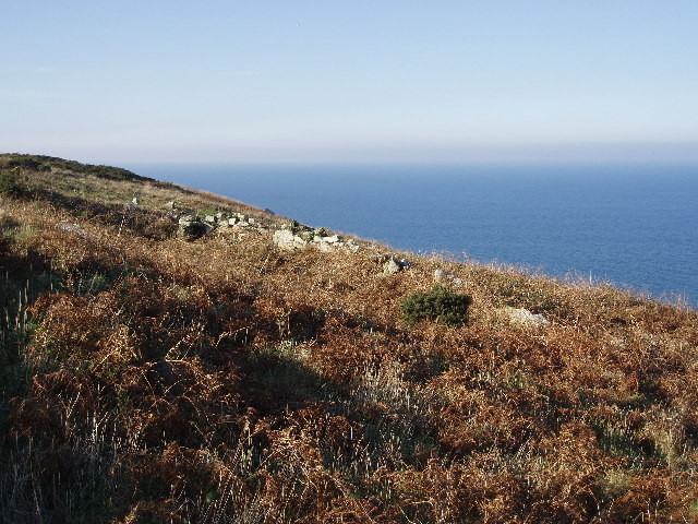
Higher Downs

Higher Downs is a moorland in the parish of Morvah in west Cornwall, England. == References ==
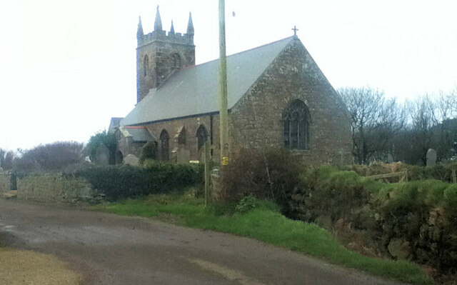
Morvah

Morvah is a civil parish and village on the Penwith peninsula in west Cornwall, England, United Kingdom. == Geography == The village is centred approximately...

Nearby Amenities

Located within 500m of 50.153,-5.633
Power: pole
Lat/Long: 50.1567319/-5.6340873
Power: pole
Lat/Long: 50.1563822/-5.6334946
Power: pole
Lat/Long: 50.1561038/-5.6325075
Power: pole
Lat/Long: 50.1553545/-5.6321856
Power: pole
Lat/Long: 50.1547505/-5.6318799
Power: pole
Lat/Long: 50.1542512/-5.6316546
Power: pole
Lat/Long: 50.1535501/-5.6313193
Power: pole
Lat/Long: 50.1527561/-5.6309384
Power: pole
Lat/Long: 50.1520446/-5.6305361
Power: pole
Lat/Long: 50.1516063/-5.6297864
Power: pole
Lat/Long: 50.1512892/-5.6292111
Power: pole
Lat/Long: 50.1508243/-5.6283823
Power: pole
Lat/Long: 50.1506241/-5.6272665
The data included in this document is from www.openstreetmap.org. The data is made available under ODbL.

Have you been to Chûn Quoit?

Leave your review of Chûn Quoit below (or comments, questions and feedback).