Castle Folds

Heritage Site in Westmorland Eden

England

Castle Folds

Windy wall
Windy wall Credit: Mick Garratt

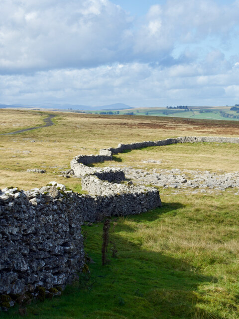
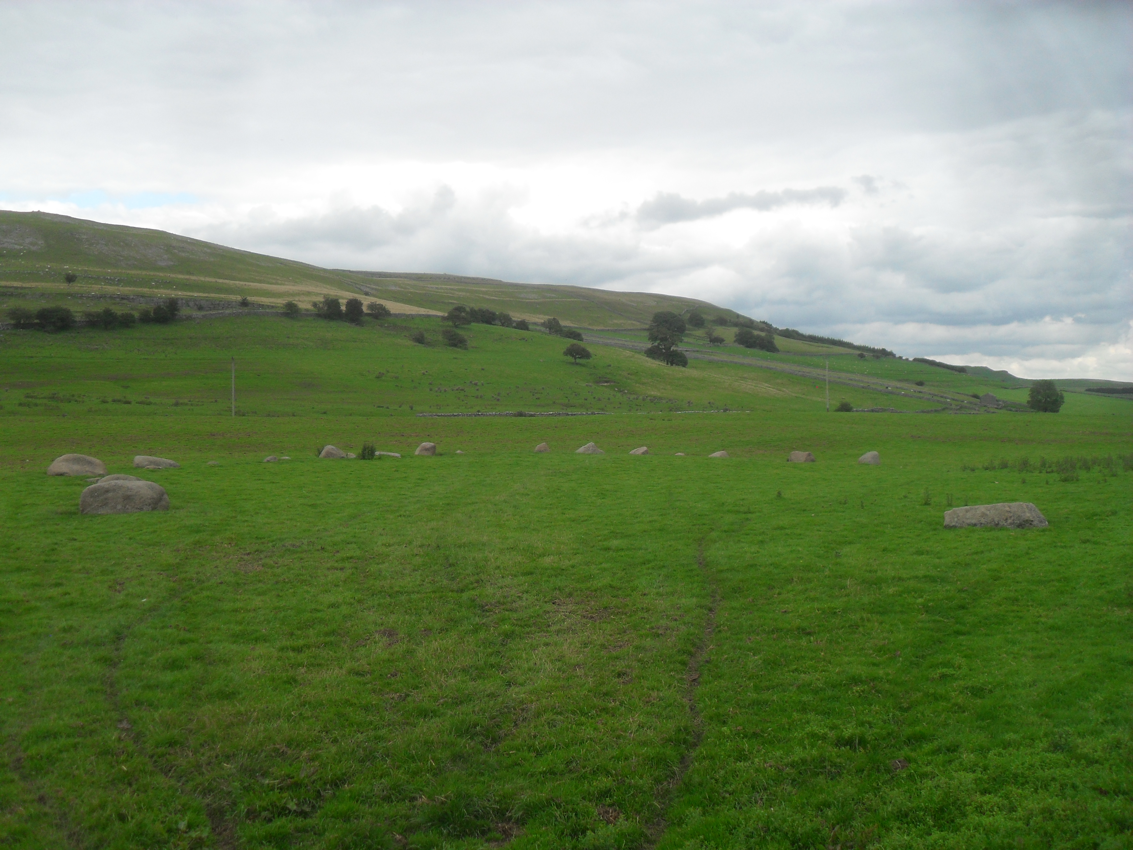
Castle Folds is a historical site located in Westmorland, England. This ancient monument is situated on a hilltop, commanding panoramic views of the surrounding countryside. It is believed to have been constructed in the late Bronze Age, making it over 3,000 years old.

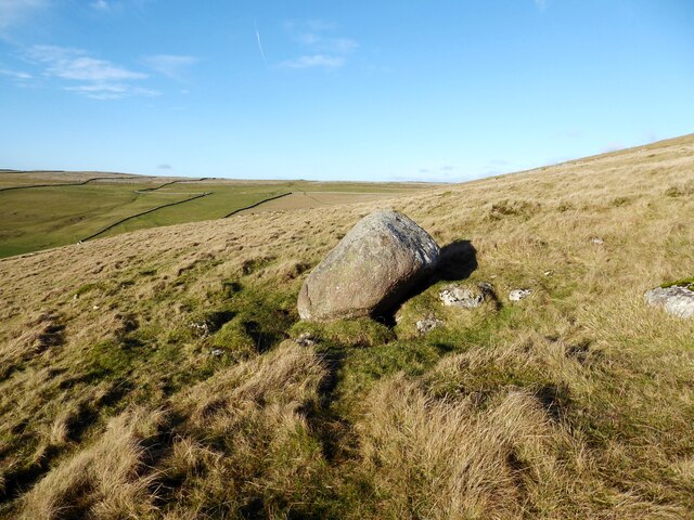
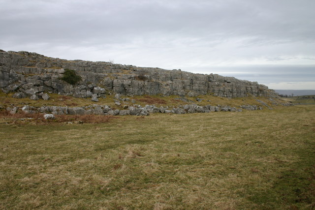
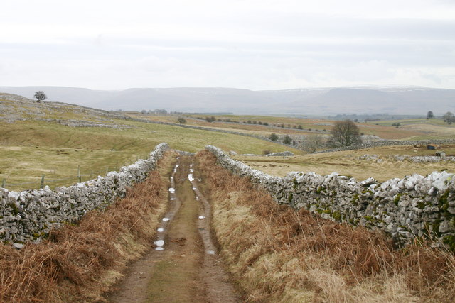
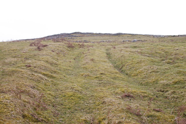
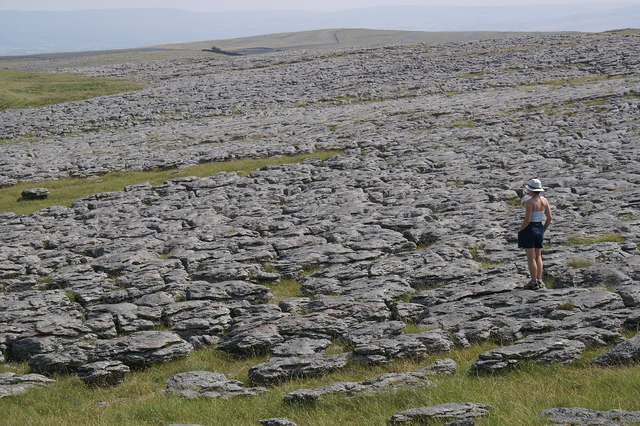
The site consists of a series of impressive defensive earthworks, which were likely used as fortifications during this period. These earthworks feature multiple concentric ditches and banks, forming a circular enclosure. The innermost bank is the highest and most formidable, indicating its importance as the primary line of defense.

Archaeological excavations have revealed evidence of human habitation within the enclosure. Discoveries such as pottery fragments and flint tools suggest that Castle Folds was not only a defensive structure but also served as a settlement during the Bronze Age. It is believed that the site was occupied by a small community, engaged in farming and other domestic activities.

Castle Folds has been recognized as a heritage site due to its historical significance and archaeological value. The site provides valuable insights into the lives and activities of Bronze Age communities in the Westmorland region. Its strategic location, commanding views, and impressive earthworks make it an important example of prehistoric fortification.

Today, Castle Folds is open to the public, allowing visitors to explore the ancient earthworks and experience the rich history of the area. Interpretative signage and information boards provide further context and details about the site's archaeological significance.

If you have any feedback on the listing, please let us know in the comments section below.

Castle Folds Images

Images are sourced within 2km of 54.48/-2.533 or Grid Reference NY6509. Thanks to Geograph Open Source API. All images are credited.

Windy wall
Windy wall
Trig pillar on Knott 412m
Triangulation pillar, Powson Knott The Ordnance Survey triangulation pillar on the summit of Powson Knott.
The flush bracket benchmark number 10674 on the west north west face of the pillar marks a height of 412.699m above sea level (Ordnance Datum Newlyn) last levelled in 1961 (photograph <a href="https://www.geograph.org.uk/photo/7075150">NY6409 : Flush Bracket benchmark, Powson Knott</a>).
Triangulation pillar, Powson Knott
The Ordnance Survey triangulation pillar on the summit of Powson Knott. The flush bracket benchmark number 10674 on the west north west face of the pillar marks a height of 412.699m above sea level (Ordnance Datum Newlyn) last levelled in 1961 (photograph NY6409 : Flush Bracket benchmark, Powson Knott).
Flush Bracket benchmark, Powson Knott Detail of the flush bracket benchmark on the Ordnance Survey triangulation pillar on the summit of Powson Knott. The flush bracket, benchmark number 10674, is on the west north west face of the pillar and marks a height of 412.699m above sea level (Ordnance Datum Newlyn), last levelled in 1961 (location photograph <a href="https://www.geograph.org.uk/photo/7075127">NY6409 : Triangulation pillar, Powson Knott</a>).
Flush Bracket benchmark, Powson Knott
Detail of the flush bracket benchmark on the Ordnance Survey triangulation pillar on the summit of Powson Knott. The flush bracket, benchmark number 10674, is on the west north west face of the pillar and marks a height of 412.699m above sea level (Ordnance Datum Newlyn), last levelled in 1961 (location photograph NY6409 : Triangulation pillar, Powson Knott).
Wind blown hawthorns Growing through outcropping limestone, these isolated hawthorn trees near the summit of Powson Knott leave no doubt about the direction of the prevailing south-west wind.
Most of the extensive limestone pavement on Beacon Hill in the background has been destroyed; stripped to be sold commercially as ornamental stone.
Wind blown hawthorns
Growing through outcropping limestone, these isolated hawthorn trees near the summit of Powson Knott leave no doubt about the direction of the prevailing south-west wind. Most of the extensive limestone pavement on Beacon Hill in the background has been destroyed; stripped to be sold commercially as ornamental stone.
Sheep near Scarside Mule sheep near Scarside.
Sheep near Scarside
Mule sheep near Scarside.
Glacial erratic, Knott This rounded boulder of Shap granite rests upon the carboniferous limestone of Knott.
Glacial erratic, Knott
This rounded boulder of Shap granite rests upon the carboniferous limestone of Knott.
Powson Knott Trig Point Flush Bracket 10674
Stone structure
Stone structure
Solitary tree viewed from Powson Knott
Limestone pavement near Powson Knott
Castle Folds "‌Stone-built remains of a Romano-British enclosed settlement containing hut circles, reused as a Medieval shieling."

‘Heritage Gateway - Results’. 2012. Heritagegateway.org.uk <<span class="nowrap"><a title="https://www.heritagegateway.org.uk/Gateway/Results_Single.aspx?uid=19a56ff5-bd5e-466f-9fd9-70ab22490715&resourceID=19191" rel="nofollow ugc noopener" href="https://www.heritagegateway.org.uk/Gateway/Results_Single.aspx?uid=19a56ff5-bd5e-466f-9fd9-70ab22490715&resourceID=19191">Link</a><img style="margin-left:2px;" alt="External link" title="External link - shift click to open in new window" src="https://s1.geograph.org.uk/img/external.png" width="10" height="10"/></span> > [accessed 12 October 2022]
Castle Folds
"‌Stone-built remains of a Romano-British enclosed settlement containing hut circles, reused as a Medieval shieling." ‘Heritage Gateway - Results’. 2012. Heritagegateway.org.uk <LinkExternal link > [accessed 12 October 2022]
Sheep with a blue smit mark
Andrew Scar A small limestone escarpment situated at Sayle Bottom.
Andrew Scar
A small limestone escarpment situated at Sayle Bottom.
Coppermine Lane Also known as Sayle Lane. The rock here is limestone.
Coppermine Lane
Also known as Sayle Lane. The rock here is limestone.
Old Mine Just off Coppermine Lane, this was probably a trial adit, driven in the search for lead.
Old Mine
Just off Coppermine Lane, this was probably a trial adit, driven in the search for lead.
Track onto Asby Winderwath Common Little used now, it has seen considerable traffic in the past and is noticeably sunken. Much weathered limestone has been removed from this area and carts have left their tell-tale grooves.
Track onto Asby Winderwath Common
Little used now, it has seen considerable traffic in the past and is noticeably sunken. Much weathered limestone has been removed from this area and carts have left their tell-tale grooves.
Lunch on a Limestone Pavement Lunch break on a limestone pavement, Great Asby Scar.  Umbrellas at the ready as a storm approaches from the Howgill Fells.  Looking from the northwest corner of the Great Asby Scar National Nature Reserve towards Castle Folds.  One of the best examples of massive limestone pavement in the UK - the Shining Stones - visible in far left background.
Lunch on a Limestone Pavement
Lunch break on a limestone pavement, Great Asby Scar. Umbrellas at the ready as a storm approaches from the Howgill Fells. Looking from the northwest corner of the Great Asby Scar National Nature Reserve towards Castle Folds. One of the best examples of massive limestone pavement in the UK - the Shining Stones - visible in far left background.
Show me another place!

Castle Folds is located at Grid Ref: NY6509 (Lat: 54.48, Lng: -2.533)

Administrative County: Cumbria

District: Eden

Police Authority: Cumbria

What 3 Words

///tomato.student.goodnight. Near Shap, Cumbria

Related Wikis

Great Asby Scar

Great Asby Scar is a Site of Special Scientific Interest (SSSI) and National Nature Reserve in Cumbria, UK. It is an area of limestone pavement, south...

Sunbiggin

Sunbiggin is a hamlet in the civil parish of Orton, in the Westmorland and Furness district, in the ceremonial county of Cumbria, England. == Location... ==

Gamelands stone circle

Gamelands stone circle (or Orton stone circle) is a stone circle at the foot of Knott Hill in Cumbria, England. The stones are mostly made of red granite...

Raisbeck

Raisbeck is a hamlet in the civil parish of Orton, in the Westmorland and Furness district of Cumbria, England. The surname Raisbeck originates from the...

Sunbiggin Tarn

Sunbiggin Tarn is a tarn near Sunbiggin in Cumbria. It is in a Site of Special Scientific Interest (SSSI) which also includes the surrounding moorland...
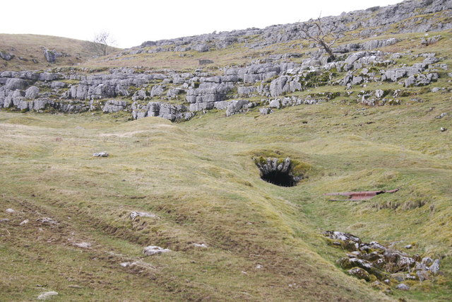
Pate Hole

Pate Hole is a solutional cave located adjacent to Asby Gill 1 kilometre (0.62 mi) south of Great Asby in Cumbria, England. It is 970 metres (3,180 ft...

Orton, Westmorland and Furness

Orton is a village and civil parish in Cumbria, England. It lies 15 miles (24 km) south of Penrith, 8 miles (13 km) from Appleby-in-Westmorland and 1.5...

All Saints Church, Orton

All Saints Church is in the village of Orton, Cumbria, England. It is an active Anglican parish church in the deanery of Appleby, the archdeaconry of Carlisle...

Nearby Amenities

Located within 500m of 54.48,-2.533
High Pike
Ele: 371.9
Man Made: survey_point
Natural: peak
Lat/Long: 54.4829401/-2.5275505
The data included in this document is from www.openstreetmap.org. The data is made available under ODbL.

Have you been to Castle Folds?

Leave your review of Castle Folds below (or comments, questions and feedback).