Carnyrhyrddod

Heritage Site in Cardiganshire

Wales

Carnyrhyrddod

Moorland and drainage lines
Moorland and drainage lines Credit: David Medcalf

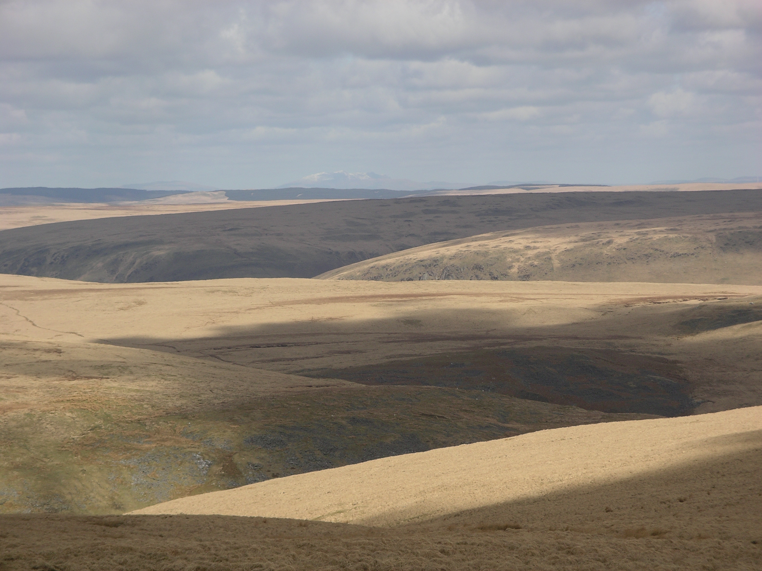
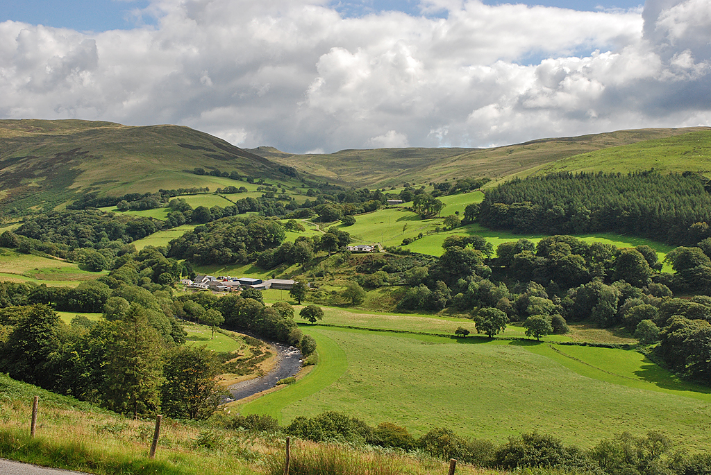
Carnyrhyrddod, located in Cardiganshire, Wales, is a highly significant heritage site that holds immense historical and cultural value. This ancient site is nestled amidst breathtaking natural beauty, surrounded by rolling hills and lush greenery. It is believed to have been inhabited since the Neolithic era and has witnessed the passage of time and numerous civilizations.

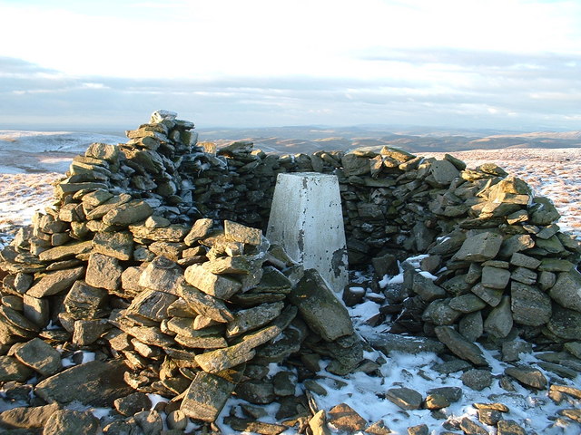
Carnyrhyrddod is renowned for its impressive stone circles, which are a testament to the rich prehistoric heritage of the region. The site features a collection of carefully arranged standing stones, forming concentric circles and intriguing patterns. Many of these stones are thought to date back to the Bronze Age, making them over 4,000 years old. The purpose of these stone circles remains a subject of debate among archaeologists and historians, with theories ranging from ceremonial gatherings to astronomical observations.

Visitors to Carnyrhyrddod can immerse themselves in the mysteries of the past while exploring the site's extensive walking trails. These trails lead through the picturesque landscape, allowing visitors to appreciate the beauty of the surroundings and gain a deeper understanding of the site's historical significance. Interpretive signage and information boards provide valuable insights into the site's history and archaeology, enhancing the visitor experience.

Carnyrhyrddod is a treasured heritage site, attracting both locals and tourists who are fascinated by the ancient history and cultural heritage of Wales. Its peaceful and serene setting, coupled with the enigmatic stone circles, make it a must-visit destination for history enthusiasts and those seeking a connection with the past.

If you have any feedback on the listing, please let us know in the comments section below.

Carnyrhyrddod Images

Images are sourced within 2km of 52.318/-3.768 or Grid Reference SN7970. Thanks to Geograph Open Source API. All images are credited.

Moorland and drainage lines
Llyn Fyrddon Fawr Llyn Fyrddon Fawr and its outflow, high in the western Elenydd.  The lake here is contained by a rather elderly-looking low stone dam.  It's flanked on the eastern shore by the Cambrian Way, often just a line on the map in these parts but here a reasonably discernible path.
Llyn Fyrddon Fawr
Llyn Fyrddon Fawr and its outflow, high in the western Elenydd. The lake here is contained by a rather elderly-looking low stone dam. It's flanked on the eastern shore by the Cambrian Way, often just a line on the map in these parts but here a reasonably discernible path.
Llyn y Fign from the east Llyn a Fign collects water from the shallow cwm, and then drains it southeastwards into the Afon Claerwen. It's surrounded by extensive boggy grassland, which gets progressively boggier as you approach the llyn, unless you're the Red Kite which was quartering the area in front of me.
Llyn y Fign from the east
Llyn a Fign collects water from the shallow cwm, and then drains it southeastwards into the Afon Claerwen. It's surrounded by extensive boggy grassland, which gets progressively boggier as you approach the llyn, unless you're the Red Kite which was quartering the area in front of me.
Across Llyn y Fign to nameless hills north of the llyn
The Nant y Fign just south of the lake Here the stream flows gently in a deep channel across the bog; a bit further south it opens up into occasional rapids.
The Nant y Fign just south of the lake
Here the stream flows gently in a deep channel across the bog; a bit further south it opens up into occasional rapids.
The Nant y Fign (and a rescued sheep) The unfortunate ewe just to the right of the stream had been on the verge of drowning in a deep pool; she was struggling to get out, and more or less exhausted when I arrived and pulled her out (A note to anyone with a bad back - saturated sheep are VERY heavy...) She stood and watched me walk away while the water dripped off her fleece; hopefully she recovered, but I suspect this year's lamb may not make it.
The Nant y Fign (and a rescued sheep)
The unfortunate ewe just to the right of the stream had been on the verge of drowning in a deep pool; she was struggling to get out, and more or less exhausted when I arrived and pulled her out (A note to anyone with a bad back - saturated sheep are VERY heavy...) She stood and watched me walk away while the water dripped off her fleece; hopefully she recovered, but I suspect this year's lamb may not make it.
Cwm Nant-llyn-y-fign Gweundir eang gyda Thomen Milwyn yn y pellter / Extensive moorland with Domen Milwyn in the distance.
Cwm Nant-llyn-y-fign
Gweundir eang gyda Thomen Milwyn yn y pellter / Extensive moorland with Domen Milwyn in the distance.
Llyn Fign
Llyn Fign
Outflow of Llyn Fyrddon Fawr Llyn Fyrddon Fawr is a natural lake that has been extended into a reservoir in the mid-19th century.  The dam is made of earth with stone reinforcement.  The water just spills over a small depression in the crown of the dam.  Water from this outflow used to be diverted in a ditch dug 180 degrees clockwise around the hill and then down to the Esgair Mwyn lead mine near Ffair Rhos (source: <span class="nowrap"><a title="http://www.penbanc.net/history/esgair/hist.html" rel="nofollow ugc noopener" href="http://www.penbanc.net/history/esgair/hist.html">Link</a><img style="margin-left:2px;" alt="External link" title="External link - shift click to open in new window" src="https://s1.geograph.org.uk/img/external.png" width="10" height="10"/></span> ).
Outflow of Llyn Fyrddon Fawr
Llyn Fyrddon Fawr is a natural lake that has been extended into a reservoir in the mid-19th century. The dam is made of earth with stone reinforcement. The water just spills over a small depression in the crown of the dam. Water from this outflow used to be diverted in a ditch dug 180 degrees clockwise around the hill and then down to the Esgair Mwyn lead mine near Ffair Rhos (source: LinkExternal link ).
Llyn Fyrddon Fawr Llyn Fyrddon Fawr straddles the western edge of this square.  The far end is in the adjacent square to the north.  There is a small strip of relatively dry land immediately east of the lake.  The ret of the square is rather wet moorland.
Llyn Fyrddon Fawr
Llyn Fyrddon Fawr straddles the western edge of this square. The far end is in the adjacent square to the north. There is a small strip of relatively dry land immediately east of the lake. The ret of the square is rather wet moorland.
View South from Domen Milwyn
Carreg Ddiddos from Domen Milwyn
Llyn Fyrddon Fawr Dwr yn llifo o Lyn Fyrddon Fawr i Nant y Fign - Water flowing from Llyn Fyrddon Fawr into Nant y Fign.
Llyn Fyrddon Fawr
Dwr yn llifo o Lyn Fyrddon Fawr i Nant y Fign - Water flowing from Llyn Fyrddon Fawr into Nant y Fign.
Llyn y Fign
Llyn y Fign
Llyn Fyrddon Fawr Ar ymyl Llyn Fyrddon Fawr - Beside Llyn Fyrddon Fawr.
Llyn Fyrddon Fawr
Ar ymyl Llyn Fyrddon Fawr - Beside Llyn Fyrddon Fawr.
Geifas Hill, topped with cairn.
Geifas
Hill, topped with cairn.
Cascades on the Nant y Fign The Nant y Fign, a small tributary of the Afon Claerwen, rises from Llyn y Fign in <a href="https://www.geograph.org.uk/gridref/SN8170">SN8170</a>, although that pool is itself fed by other streams in the wide cwm that surrounds it. Mostly it flows calmly, and rather deep, through boggy moorland, but in one or two places there are some small cascades such as these.
Cascades on the Nant y Fign
The Nant y Fign, a small tributary of the Afon Claerwen, rises from Llyn y Fign in SN8170, although that pool is itself fed by other streams in the wide cwm that surrounds it. Mostly it flows calmly, and rather deep, through boggy moorland, but in one or two places there are some small cascades such as these.
The infant Nant y Fign The stream here passes quite gently through boggy grassland, mostly deep and gentle; it runs to small cascades a little further downstream.
The infant Nant y Fign
The stream here passes quite gently through boggy grassland, mostly deep and gentle; it runs to small cascades a little further downstream.
Show me another place!

Carnyrhyrddod is located at Grid Ref: SN7970 (Lat: 52.318, Lng: -3.768)

Unitary Authority: Ceredigion

Police Authority: Dyfed Powys

What 3 Words

///parsnip.gadget.sofas. Near Cwmystwyth, Ceredigion

Related Wikis

Llan Ddu Fawr

Llan Ddu Fawr or Waun Claerddu is a hill located in Ceredigion, Wales, at 594 metres (1,949 ft) above sea level. It is located about 10 miles south of...

Wales

Wales (Welsh: Cymru [ˈkəm.rɨ] ) is a country that is part of the United Kingdom. It is bordered by England to the east, the Irish Sea to the north and...

Desert of Wales

The Desert of Wales, or Green Desert of Wales, is an archaic term for an area in central Wales, so called for its lack of roads and towns, and its inaccessibility...

Cwmystwyth

Cwmystwyth (also Cwm Ystwyth, Welsh pronunciation: [kʊmˈəstʊɨθ]; English: "valley of the River Ystwyth") is a village in Ceredigion, Wales near Devil's...

Nearby Amenities

Located within 500m of 52.318,-3.768
Source: npe
Lat/Long: 52.3191936/-3.7623174
Source: npe
Lat/Long: 52.3216359/-3.7637023
Source: npe
Lat/Long: 52.3199298/-3.7643217
Source: npe
Lat/Long: 52.3184472/-3.7641303
Source: npe
Lat/Long: 52.3146258/-3.7672104
Source: npe
Lat/Long: 52.3147658/-3.7682527
Source: npe
Lat/Long: 52.3178793/-3.7666861
Source: npe
Lat/Long: 52.3178405/-3.7661159
Source: npe
Lat/Long: 52.3151632/-3.7669097
Source: npe
Lat/Long: 52.3155069/-3.7653118
The data included in this document is from www.openstreetmap.org. The data is made available under ODbL.

Have you been to Carnyrhyrddod?

Leave your review of Carnyrhyrddod below (or comments, questions and feedback).