Carn y Defaid

Heritage Site in Monmouthshire

Wales

Carn y Defaid

Country road above Blaenavon Country road crossing open access land above Blaenavon.
Country road above Blaenavon Credit: Philip Halling

Carn y Defaid, located in Monmouthshire, Wales, is a significant heritage site with a rich historical background. The name "Carn y Defaid" translates to "Cairn of the Sheep," which provides a clue to its origins and purpose.

This ancient monument consists of a well-preserved Bronze Age burial cairn, dating back over 4,000 years. It is situated on a hilltop, offering stunning panoramic views of the surrounding countryside. The cairn itself is circular in shape, with a diameter of approximately 30 meters. It is made up of a mound of stones and earth, which were carefully arranged to cover a burial chamber.

Excavations carried out at Carn y Defaid have revealed the presence of human remains, pottery fragments, and various grave goods, including flint tools and arrowheads. These findings suggest that the site was used for ritualistic and burial practices during the Bronze Age.

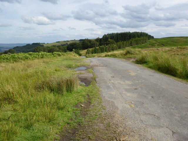
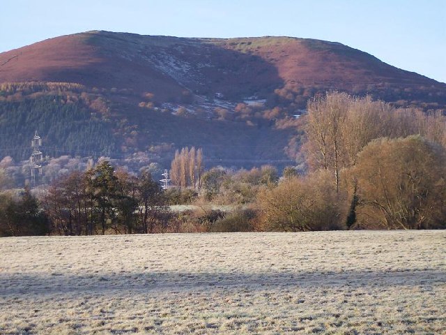
The significance of Carn y Defaid extends beyond its archaeological value. As a prominent landmark in the area, it has also become a popular spot for hikers and nature enthusiasts. The site offers a unique opportunity to explore and appreciate Wales' ancient history while enjoying the breathtaking views of the countryside.

Carn y Defaid is now protected as a Scheduled Ancient Monument, ensuring its preservation for future generations. It serves as a reminder of Wales' rich and diverse heritage, allowing visitors to connect with the past and gain a deeper understanding of the ancient civilizations that once inhabited this land.

If you have any feedback on the listing, please let us know in the comments section below.

Carn y Defaid Images

Images are sourced within 2km of 51.778/-3.05 or Grid Reference SO2709. Thanks to Geograph Open Source API. All images are credited.

Country road above Blaenavon Country road crossing open access land above Blaenavon.
Country road above Blaenavon
Country road crossing open access land above Blaenavon.
Field beside Blaengwenffrwd Field beside Blaengwenffrwd beside a narrow country road crossing from Blaenavon to the Usk valley to the east.
Field beside Blaengwenffrwd
Field beside Blaengwenffrwd beside a narrow country road crossing from Blaenavon to the Usk valley to the east.
Old railway waggon At the time of the Beeching closures in the 1960s as well as the axing of many railway lines and stations rolling stock was sold off.  Wagons such as this one were popular with farmers, I remember my father having one delivered and the large crane which lifted it off the lorry delivering it.  This particular wagon has seen batter days.
Old railway waggon
At the time of the Beeching closures in the 1960s as well as the axing of many railway lines and stations rolling stock was sold off. Wagons such as this one were popular with farmers, I remember my father having one delivered and the large crane which lifted it off the lorry delivering it. This particular wagon has seen batter days.
Field gateway Field gateway off a narrow country road near Hill Road.
Field gateway
Field gateway off a narrow country road near Hill Road.
Beech tree with exposed roads Beech tree with exposed routes beside a sunken country road above Llanover.
Beech tree with exposed roads
Beech tree with exposed routes beside a sunken country road above Llanover.
Cae-Dalwyn Farm Farm viewed across the valley from the Avon Lwyd Trail. The A4043 is at the bottom of the picture.
Cae-Dalwyn Farm
Farm viewed across the valley from the Avon Lwyd Trail. The A4043 is at the bottom of the picture.
Hillside view, Blaenavon Viewed across the B4246 Varteg Road and Rowan Way in May 2023.
Hillside view, Blaenavon
Viewed across the B4246 Varteg Road and Rowan Way in May 2023.
Coed-y-Prior and Ysgyryd Fawr The 'Marches Way,' after following  the Monmouth & Brecon Canal south of Abergavenny for two miles, climbs out of the Usk Valley. This is the view  from near Blaen Ochran over the Usk Valley to Ysgyryd Fawr
Coed-y-Prior and Ysgyryd Fawr
The 'Marches Way,' after following the Monmouth & Brecon Canal south of Abergavenny for two miles, climbs out of the Usk Valley. This is the view from near Blaen Ochran over the Usk Valley to Ysgyryd Fawr
Craig-y-Cwm, Monmouthshire After following the Monmouth & Brecon Canal south of Abergavenny for two miles the Marches Way turns west and climbs towards the ridge separating the Usk and Afon Valleys. This is the view east from Craig-y-Cwm looking over the Usk towards the Wye Valley.
Craig-y-Cwm, Monmouthshire
After following the Monmouth & Brecon Canal south of Abergavenny for two miles the Marches Way turns west and climbs towards the ridge separating the Usk and Afon Valleys. This is the view east from Craig-y-Cwm looking over the Usk towards the Wye Valley.
Memorial on the mountain side Unknown iron memorial, together with recent addition
Memorial on the mountain side
Unknown iron memorial, together with recent addition
Memorial on the mountain side Recent addition to the memorial
Memorial on the mountain side
Recent addition to the memorial
Carn y Defaid On the broad ridge of Mynydd y Garn Fawr.  The cairn - its centre is hollowed like a dish - is composed of the same rough gritstone that is strewn around the slopes of this hill, making for rough going underfoot.  It is one of a pair of Bronze Age burial mounds. ('defaid' = 'sheep')
Carn y Defaid
On the broad ridge of Mynydd y Garn Fawr. The cairn - its centre is hollowed like a dish - is composed of the same rough gritstone that is strewn around the slopes of this hill, making for rough going underfoot. It is one of a pair of Bronze Age burial mounds. ('defaid' = 'sheep')
Rifle range on Gwaun Felen Gwaun Felen is a rough piece of moorland forming a part of Mynydd y Garn Fawr between Blaenavon and Blorenge characterised by tussocky heather and plentiful bleached white sandstone blocks.  This intrusion into the semi-wilderness is depicted but not named on the modern OS map.  Older maps reveal the presence of a rifle range of which this is the butts.  'Gwaun' means 'moor' and 'Garn Fawr' - the 'big cairn', presumably referring to Carn y Defaid in <a href="https://www.geograph.org.uk/gridref/SO2709">SO2709</a>.
Rifle range on Gwaun Felen
Gwaun Felen is a rough piece of moorland forming a part of Mynydd y Garn Fawr between Blaenavon and Blorenge characterised by tussocky heather and plentiful bleached white sandstone blocks. This intrusion into the semi-wilderness is depicted but not named on the modern OS map. Older maps reveal the presence of a rifle range of which this is the butts. 'Gwaun' means 'moor' and 'Garn Fawr' - the 'big cairn', presumably referring to Carn y Defaid in SO2709.
Access to Graig Blaenavon Community Woodland
The steep drop to the Avon Lwyd river claims a victim
Steep and wooded side of the river
Nant Llanelen Flowing through the trees beside the lane.
Nant Llanelen
Flowing through the trees beside the lane.
Upper Llwyn-celyn The farm road and pasture is about 250m in elevation
Upper Llwyn-celyn
The farm road and pasture is about 250m in elevation
Show me another place!

Carn y Defaid is located at Grid Ref: SO2709 (Lat: 51.778, Lng: -3.05)

Unitary Authority: Monmouthshire

Police Authority: Gwent

What 3 Words

///pans.months.upper. Near Blaenavon, Torfaen

Nearby Locations

Carn y Defaid Pwll Mawr

Related Wikis

Blaenavon

Blaenavon (Welsh: Blaenafon) is a town and community in Torfaen county borough, Wales, high on a hillside on the source of the Afon Lwyd. It is within...

Llanellen

Llanellen (Welsh: Llanelen) is a village in Monmouthshire, south-east Wales, United Kingdom. It is located three miles (4.8 km) south of Abergavenny. The...

Municipal Offices, Blaenavon

The Municipal Offices (Welsh: Swyddfeydd Bwrdeistrefol Blaenafon) are in Lion Street, Blaenavon, Torfaen, Wales. The structure, which was used as the headquarters...

Blaenavon Low Level railway station

Blaenavon Low Level railway station was the northern terminus of the Monmouthshire Railway and Canal Company line from Pontypool to Blaenavon in Monmouthshire...

Gwent (county)

Gwent is a preserved county and former local government county in southeast Wales. A county of Gwent was formed on 1 April 1974, under the Local Government...

Blorenge

Blorenge, also called The Blorenge (; Welsh: Blorens), is a prominent hill overlooking the valley of the River Usk near Abergavenny, Monmouthshire, southeast...

Blaenavon High Level railway station

Blaenavon High Level is a railway station on the preserved Pontypool and Blaenavon Railway, serving the World Heritage Site and town of Blaenavon, south...

Blaenavon Blues A.F.C.

Blaenavon Blues A.F.C. are a Welsh football club from the town of Blaenavon, Monmouthshire in south eastern Wales. Formed in 1947, they have played in...

Have you been to Carn y Defaid?

Leave your review of Carn y Defaid below (or comments, questions and feedback).