Carn Penrhiwllwydog

Heritage Site in Cardiganshire

Wales

Carn Penrhiwllwydog

Byway at Ty'n Cornel in Cwm Doethie Fawr, Ceredigion Ty'n Cornel is a former YHA hostel, now very efficiently operated by the Elenydd Wilderness Hostels. <span class="nowrap"><a title="https://www.elenydd-hostels.co.uk/en" rel="nofollow ugc noopener" href="https://www.elenydd-hostels.co.uk/en">Link</a><img style="margin-left:2px;" alt="External link" title="External link - shift click to open in new window" src="https://s1.geograph.org.uk/img/external.png" width="10" height="10"/></span>
The track is a former drove road between Abergwesyn and Llanddewi-Brefi. The hostel is at an altitude of about 320 metres (1050 feet) so being enveloped by cloud is a regular and frequent occurrence.
It is five and a half miles (8·84 km) as the red kite flies between the hostel and the church tower in Llanddewi-Brefi. It is nearer seven miles by road!
Byway at Ty'n Cornel in Cwm Doethie Fawr, Ceredigion Credit: Roger D Kidd

Carn Penrhiwllwydog, located in Cardiganshire, Wales, is a prominent heritage site renowned for its historical and cultural significance. Situated on the western slopes of the Cambrian Mountains, this ancient hillfort offers a glimpse into the region's rich past.

Dating back to the Iron Age, Carn Penrhiwllwydog is believed to have been constructed around 2,500 years ago. The hillfort occupies a strategic position, overlooking the Teifi Valley and providing a vantage point for its inhabitants to monitor the surrounding landscape. The site covers an area of approximately 2.5 hectares and is protected by a series of defensive walls and ditches.

Archaeological excavations have revealed numerous artifacts, including pottery fragments, iron objects, and evidence of early settlement. These findings suggest that the hillfort was likely a hub of activity and possibly a significant political and social center during its occupation.

Today, visitors to Carn Penrhiwllwydog can explore the remnants of the ancient hillfort. The site offers breathtaking views of the surrounding countryside, allowing visitors to appreciate the strategic importance of its location. Information boards provide historical context and insights into the site's significance, enhancing the visitor experience.

Carn Penrhiwllwydog is an invaluable heritage site, contributing to our understanding of Iron Age settlement patterns and the cultural landscape of Cardiganshire. Its preservation and accessibility for visitors ensure that its historical significance is appreciated and celebrated by both locals and tourists interested in the region's rich heritage.

If you have any feedback on the listing, please let us know in the comments section below.

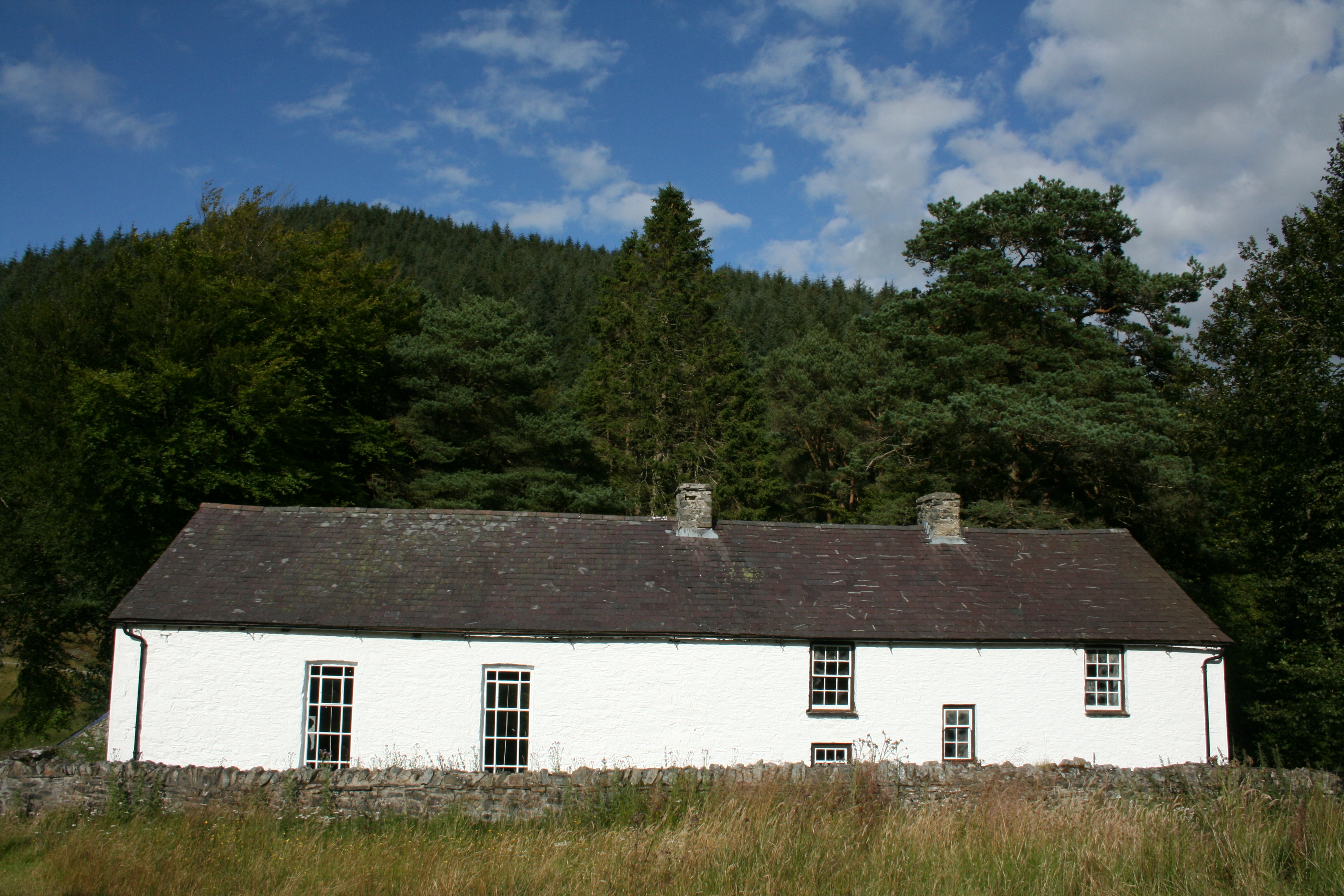
Carn Penrhiwllwydog Images

Images are sourced within 2km of 52.157/-3.85 or Grid Reference SN7352. Thanks to Geograph Open Source API. All images are credited.

Byway at Ty'n Cornel in Cwm Doethie Fawr, Ceredigion Ty'n Cornel is a former YHA hostel, now very efficiently operated by the Elenydd Wilderness Hostels. <span class="nowrap"><a title="https://www.elenydd-hostels.co.uk/en" rel="nofollow ugc noopener" href="https://www.elenydd-hostels.co.uk/en">Link</a><img style="margin-left:2px;" alt="External link" title="External link - shift click to open in new window" src="https://s1.geograph.org.uk/img/external.png" width="10" height="10"/></span>
The track is a former drove road between Abergwesyn and Llanddewi-Brefi. The hostel is at an altitude of about 320 metres (1050 feet) so being enveloped by cloud is a regular and frequent occurrence.
It is five and a half miles (8·84 km) as the red kite flies between the hostel and the church tower in Llanddewi-Brefi. It is nearer seven miles by road!
Byway at Ty'n Cornel in Cwm Doethie Fawr, Ceredigion
Ty'n Cornel is a former YHA hostel, now very efficiently operated by the Elenydd Wilderness Hostels. LinkExternal link The track is a former drove road between Abergwesyn and Llanddewi-Brefi. The hostel is at an altitude of about 320 metres (1050 feet) so being enveloped by cloud is a regular and frequent occurrence. It is five and a half miles (8·84 km) as the red kite flies between the hostel and the church tower in Llanddewi-Brefi. It is nearer seven miles by road!
Cwm Doethie Fawr in cloud, Ceredigion The view is looking south-east from the byway near Ty'n Cornel. The road is at an altitude of about 320 metres (1050 feet) so being in cloud is a regular and frequent occurrence.
Cwm Doethie Fawr in cloud, Ceredigion
The view is looking south-east from the byway near Ty'n Cornel. The road is at an altitude of about 320 metres (1050 feet) so being in cloud is a regular and frequent occurrence.
Hill pasture by Cwm Doethie Fawr in Ceredigion The view is looking south across Cwm Doethie Fawr from the byway near Ty'n Cornel. The road is at an altitude of about 320 metres (1050 feet) so being in cloud is a regular and frequent occurrence.
Hill pasture by Cwm Doethie Fawr in Ceredigion
The view is looking south across Cwm Doethie Fawr from the byway near Ty'n Cornel. The road is at an altitude of about 320 metres (1050 feet) so being in cloud is a regular and frequent occurrence.
Ty'n Cornel Hostel south-east of Llanddewi Brefi in Ceredigion Ty'n Cornel is a former YHA hostel, now very efficiently operated by the Elenydd Wilderness Hostels. <span class="nowrap"><a title="https://www.elenydd-hostels.co.uk/en" rel="nofollow ugc noopener" href="https://www.elenydd-hostels.co.uk/en">Link</a><img style="margin-left:2px;" alt="External link" title="External link - shift click to open in new window" src="https://s1.geograph.org.uk/img/external.png" width="10" height="10"/></span>
The track is a former drove road between Abergwesyn and Llanddewi-Brefi. The hostel is at an altitude of about 320 metres (1050 feet) so being enveloped by cloud is a regular and frequent occurrence.

It is five and a half miles (8·84 km) as the red kite flies between the hostel and the church tower in Llanddewi-Brefi. It is more like seven miles by road!
Ty'n Cornel Hostel south-east of Llanddewi Brefi in Ceredigion
Ty'n Cornel is a former YHA hostel, now very efficiently operated by the Elenydd Wilderness Hostels. LinkExternal link The track is a former drove road between Abergwesyn and Llanddewi-Brefi. The hostel is at an altitude of about 320 metres (1050 feet) so being enveloped by cloud is a regular and frequent occurrence. It is five and a half miles (8·84 km) as the red kite flies between the hostel and the church tower in Llanddewi-Brefi. It is more like seven miles by road!
Hill pasture in Cwm Doethie Fawr, Ceredigion Looking north-west from near Ty'n Cornel hostel.
Hill pasture in Cwm Doethie Fawr, Ceredigion
Looking north-west from near Ty'n Cornel hostel.
Former drove road to Llanddewi Brefi Looking north-west from near Ty'n Cornel hostel. It is about seven miles to Llanddewi Brefi, or five and a half miles (8·84 km) as the red kite flies. Those birds are often seen in this beautiful remote valley.
The old route linked Abergwesyn with Llanddewi Brefi.
Former drove road to Llanddewi Brefi
Looking north-west from near Ty'n Cornel hostel. It is about seven miles to Llanddewi Brefi, or five and a half miles (8·84 km) as the red kite flies. Those birds are often seen in this beautiful remote valley. The old route linked Abergwesyn with Llanddewi Brefi.
Rock outcrop in Cwm Doethie Fawr in Ceredigion About five hundred metres north-west of Ty'n Cornel hostel by the old drove road.
Rock outcrop in Cwm Doethie Fawr in Ceredigion
About five hundred metres north-west of Ty'n Cornel hostel by the old drove road.
Rock outcrop in Cwm Doethie Fawr in Ceredigion About five hundred metres north-west of Ty'n Cornel hostel by the old drove road.
Rock outcrop in Cwm Doethie Fawr in Ceredigion
About five hundred metres north-west of Ty'n Cornel hostel by the old drove road.
Former drover's road in Upper Cwm Doethie, Ceredigion Looking south-west about 350 metres from Ty'n Cornel hostel.
The drove road ran from Llanddewi Brefi to Abergwesyn via Cwm Doethie Fawr, Cwm Camddwr and Cwm Tywi.
Former drover's road in Upper Cwm Doethie, Ceredigion
Looking south-west about 350 metres from Ty'n Cornel hostel. The drove road ran from Llanddewi Brefi to Abergwesyn via Cwm Doethie Fawr, Cwm Camddwr and Cwm Tywi.
Byway to Llanddewi Brefi in Ceredigion Looking north-west from near Ty'n Cornel hostel. It is about seven miles to Llanddewi Brefi, or five and a half miles (8·84 km) as the red kite flies. Those birds are often seen in this beautiful remote valley.
This old drovers' route linked Abergwesyn with Llanddewi Brefi. It is now an unsurfaced byway open to all traffic, but often eroded by convoys of "off-roaders".
Byway to Llanddewi Brefi in Ceredigion
Looking north-west from near Ty'n Cornel hostel. It is about seven miles to Llanddewi Brefi, or five and a half miles (8·84 km) as the red kite flies. Those birds are often seen in this beautiful remote valley. This old drovers' route linked Abergwesyn with Llanddewi Brefi. It is now an unsurfaced byway open to all traffic, but often eroded by convoys of "off-roaders".
Byway in Cwm Doethie Fawr in Ceredigion Looking west-north-west towards Blaendoethie behind the barn, climbing from near Ty'n Cornel hostel. 
This former drove road ran between Llanddewi Brefi and Abergwesyn via Cwm Doethie Fawr, Cwm Camddwr and Cwm Tywi. Nowadays it is a byway "open to all traffic", but in practice it is only passable by some farm vehicles, and four wheel drive "off-roaders" whose convoys contribute a lot towards erosion which can become catastrophic. The road is tarmacked after the entrance to Blaendoethie. Llanddewi-Brefi is about six and a half miles ahead by road, five miles by crow or red kite.

The bridleway shown on maps passing through the woodland on the left has been unsignposted (just past the road summit ahead) since the 1990s and does not exist as a track on the ground. The bridge across the river disappeared before that. There is no public route through Blaendoethie farm buildings.

Note: Standard private cars can usually drive with care down to Ty'n Cornel hostel (behind the camera).
Byway in Cwm Doethie Fawr in Ceredigion
Looking west-north-west towards Blaendoethie behind the barn, climbing from near Ty'n Cornel hostel. This former drove road ran between Llanddewi Brefi and Abergwesyn via Cwm Doethie Fawr, Cwm Camddwr and Cwm Tywi. Nowadays it is a byway "open to all traffic", but in practice it is only passable by some farm vehicles, and four wheel drive "off-roaders" whose convoys contribute a lot towards erosion which can become catastrophic. The road is tarmacked after the entrance to Blaendoethie. Llanddewi-Brefi is about six and a half miles ahead by road, five miles by crow or red kite. The bridleway shown on maps passing through the woodland on the left has been unsignposted (just past the road summit ahead) since the 1990s and does not exist as a track on the ground. The bridge across the river disappeared before that. There is no public route through Blaendoethie farm buildings. Note: Standard private cars can usually drive with care down to Ty'n Cornel hostel (behind the camera).
Hill pasture in Upper Cwm Doethie Fawr, Ceredigion Steep sloped rough pasture by Blaendoethie farm, seen from a distance of three hundred metres from the former drovers' road north-west of Ty'n Cornel. The bridleway shown on maps passing through the woodland on the left has been unsignposted since the 1990s and does not exist as a track on the ground. The bridge across the river disappeared before that. There is no public route through Blaendoethie farm buildings.
Hill pasture in Upper Cwm Doethie Fawr, Ceredigion
Steep sloped rough pasture by Blaendoethie farm, seen from a distance of three hundred metres from the former drovers' road north-west of Ty'n Cornel. The bridleway shown on maps passing through the woodland on the left has been unsignposted since the 1990s and does not exist as a track on the ground. The bridge across the river disappeared before that. There is no public route through Blaendoethie farm buildings.
Elenydd moorland and valley, Cwm Doethie Fawr, Ceredigion Looking north-west near the head of the valley. Blaendoethie is high, off to the left. Ty'n Cornel hostel is half a mile to the south-east (behind the camera). The former Abergwesyn to Llanddewi Brefi drove road is on the right, halfway up the image.
Elenydd moorland and valley, Cwm Doethie Fawr, Ceredigion
Looking north-west near the head of the valley. Blaendoethie is high, off to the left. Ty'n Cornel hostel is half a mile to the south-east (behind the camera). The former Abergwesyn to Llanddewi Brefi drove road is on the right, halfway up the image.
Upper Cwm Doethie Fawr in Ceredigion Blaendoethie farm buildings are behind the trees, top left.
Upper Cwm Doethie Fawr in Ceredigion
Blaendoethie farm buildings are behind the trees, top left.
Byway in Cwm Doethie Fawr in Ceredigion Looking west-north-west towards Blaedoethie behind the barn, climbing from near Ty'n Cornel hostel. This has long been part of a route known as the Cambrian Way.
This former drove road ran between Llanddewi Brefi and Abergwesyn via Cwm Doethie Fawr, Cwm Camddwr and Cwm Tywi. Nowadays it is a byway "open to all traffic", but in practice it is only passable by some farm vehicles*, and four wheel drive "off-roaders" whose convoys contribute a lot towards erosion which can become catastrophic. The road is tarmacked after the entrance to Blaendoethie (which is high up, off to the left). Llanddewi-Brefi is about six and a half miles ahead by road, five miles by crow or red kite.

Note: Standard private cars can usually drive with care down to Ty'n Cornel hostel (behind the camera).
Byway in Cwm Doethie Fawr in Ceredigion
Looking west-north-west towards Blaedoethie behind the barn, climbing from near Ty'n Cornel hostel. This has long been part of a route known as the Cambrian Way. This former drove road ran between Llanddewi Brefi and Abergwesyn via Cwm Doethie Fawr, Cwm Camddwr and Cwm Tywi. Nowadays it is a byway "open to all traffic", but in practice it is only passable by some farm vehicles*, and four wheel drive "off-roaders" whose convoys contribute a lot towards erosion which can become catastrophic. The road is tarmacked after the entrance to Blaendoethie (which is high up, off to the left). Llanddewi-Brefi is about six and a half miles ahead by road, five miles by crow or red kite. Note: Standard private cars can usually drive with care down to Ty'n Cornel hostel (behind the camera).
Moorland track near Blaendoethie east of Llanddewi Brefi This track is easily followed for nearly a mile, then careful navigation will be needed to walk to the mountain road near Nant-y-Maen. Some fences require careful crossing. This is not marked as a public right of way, though it was used for many years to walk between Blaencaron and Ty'n Cornel youth hostels, and through to Strata Florida.

This has long been part of a route known as the Cambrian Way.
Moorland track near Blaendoethie east of Llanddewi Brefi
This track is easily followed for nearly a mile, then careful navigation will be needed to walk to the mountain road near Nant-y-Maen. Some fences require careful crossing. This is not marked as a public right of way, though it was used for many years to walk between Blaencaron and Ty'n Cornel youth hostels, and through to Strata Florida. This has long been part of a route known as the Cambrian Way.
Moorland track near Blaendoethie east of Llanddewi Brefi, Ceredigion This track is easily followed for nearly a mile, then careful navigation will be needed to walk to the mountain road near Nant-y-Maen. Some fences require careful crossing. This is not marked as a public right of way, though it was used for many years to walk between Blaencaron and Ty'n Cornel youth hostels, and through to Strata Florida.

This has long been part of a route known as the Cambrian Way. <span class="nowrap"><a title="https://www.cambrianway.org.uk/" rel="nofollow ugc noopener" href="https://www.cambrianway.org.uk/">Link</a><img style="margin-left:2px;" alt="External link" title="External link - shift click to open in new window" src="https://s1.geograph.org.uk/img/external.png" width="10" height="10"/></span>
Moorland track near Blaendoethie east of Llanddewi Brefi, Ceredigion
This track is easily followed for nearly a mile, then careful navigation will be needed to walk to the mountain road near Nant-y-Maen. Some fences require careful crossing. This is not marked as a public right of way, though it was used for many years to walk between Blaencaron and Ty'n Cornel youth hostels, and through to Strata Florida. This has long been part of a route known as the Cambrian Way. LinkExternal link
Afon Doethie Fawr near Blaendoethie in Ceredigion Looking north-north-west from the bridge carrying the old drove road, near Blaendoethie farm. Ahead is the very extensive Berwyn Plantation.
Afon Doethie Fawr near Blaendoethie in Ceredigion
Looking north-north-west from the bridge carrying the old drove road, near Blaendoethie farm. Ahead is the very extensive Berwyn Plantation.
Show me another place!

Carn Penrhiwllwydog is located at Grid Ref: SN7352 (Lat: 52.157, Lng: -3.85)

Unitary Authority: Ceredigion

Police Authority: Dyfed Powys

What 3 Words

///shorthand.soggy.result. Near Tregaron, Ceredigion

Nearby Locations

Carn Penrhiwllwydog

Related Wikis

Soar y mynydd

Soar-y-mynydd or Soar y mynydd is a Calvinist Methodist chapel near the eastern extremity of the large parish of Llanddewi Brefi, Ceredigion. It is claimed...

Camddwr

For the tributary of the River Wye, see Camddwr, Wye and for the tributary of the River Teifi, see Camddwr, Teifi.The Camddwr is a significant right-bank...

Pentre-rhew

Pentre-rhew is a hamlet in the community of Llanddewibrefi, Ceredigion, Wales, which is 58.3 miles (93.9 km) from Cardiff and 169.6 miles (272.9 km) from...

Llyn Brianne

Llyn Brianne is a man-made lake or reservoir in the headwaters of the River Towy in Wales. == Construction == The reservoir was constructed by Wimpey Construction...

Have you been to Carn Penrhiwllwydog?

Leave your review of Carn Penrhiwllwydog below (or comments, questions and feedback).