Carn Arthur

Heritage Site in Pembrokeshire

Wales

Carn Arthur

Ordnance Survey Cut Mark This OS cut mark can be found on the repositioned stone NE side of the road. It marked a point 237.092m above mean sea level.
Ordnance Survey Cut Mark Credit: Adrian Dust

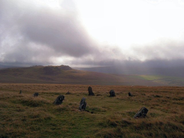
Carn Arthur is a prominent heritage site situated in the county of Pembrokeshire, Wales. It is a prehistoric monument that holds significant historical and cultural value. The site is located on the coastal cliffs near Abercastle, offering stunning views of the surrounding landscape.

This ancient site consists of a cluster of Neolithic burial chambers, known as dolmens, which date back to around 3,500 BC. The dolmens are constructed using large standing stones, creating a chamber-like structure with a capstone on top. The purpose of these structures is believed to be for communal burial practices, as human remains have been discovered in and around the area.

Carn Arthur is notable for its well-preserved dolmens, showcasing the architectural and engineering skills of the Neolithic people who constructed them. The site is also significant in terms of its placement, offering a strategic viewpoint over the nearby coastline. This suggests that Carn Arthur may have served as a lookout or defensive position during ancient times.

Visitors to Carn Arthur can explore the site and witness the impressive dolmens up close. There are pathways and signage in place to guide visitors and provide information about the historical context of the site. The location's natural beauty and rich history make it a popular destination for tourists and history enthusiasts alike.

Overall, Carn Arthur is an important heritage site that provides valuable insight into the lives and customs of the Neolithic people who once inhabited the area. Its unique dolmens and scenic surroundings make it a fascinating destination for those interested in ancient history and archaeology.

If you have any feedback on the listing, please let us know in the comments section below.

Carn Arthur Images

Images are sourced within 2km of 51.958/-4.715 or Grid Reference SN1332. Thanks to Geograph Open Source API. All images are credited.

Ordnance Survey Cut Mark This OS cut mark can be found on the repositioned stone NE side of the road. It marked a point 237.092m above mean sea level.
Ordnance Survey Cut Mark
This OS cut mark can be found on the repositioned stone NE side of the road. It marked a point 237.092m above mean sea level.
Ordnance Survey Rivet This OS rivet can be found on a stone north side of the road. It marks a point 213.589m above mean sea level.
Ordnance Survey Rivet
This OS rivet can be found on a stone north side of the road. It marks a point 213.589m above mean sea level.
Ordnance Survey Cut Mark This OS cut mark can be found on the gatepost SW side of the track. It marks a point 759.8ft above mean sea level.
Ordnance Survey Cut Mark
This OS cut mark can be found on the gatepost SW side of the track. It marks a point 759.8ft above mean sea level.
Ordnance Survey Cut Mark This OS cut mark can be found on the gatepost west side of the track. It marks a point 804.7ft above mean sea level.
Ordnance Survey Cut Mark
This OS cut mark can be found on the gatepost west side of the track. It marks a point 804.7ft above mean sea level.
Leaning Gatepost
Leaning Gatepost
Ordnance Survey Cut Mark This OS cut mark can be found on the gatepost NE side of the track. It marks a point 908.7ft above mean sea level.
Ordnance Survey Cut Mark
This OS cut mark can be found on the gatepost NE side of the track. It marks a point 908.7ft above mean sea level.
Ordnance Survey Cut Mark This OS cut mark can be found on the gatepost NE side of the track. It marks a point 887.9ft above mean sea level.
Ordnance Survey Cut Mark
This OS cut mark can be found on the gatepost NE side of the track. It marks a point 887.9ft above mean sea level.
Carn Menyn Cairn or Coetan Arthur A circular disturbed cairn 15m in diameter by 1.5m high. The capstone is 2.8m by 2.5m.
Carn Menyn Cairn or Coetan Arthur
A circular disturbed cairn 15m in diameter by 1.5m high. The capstone is 2.8m by 2.5m.
Boundary Stone <a title="https://www.geograph.org.uk/photo/7171258" href="https://www.geograph.org.uk/photo/7171258">Link</a>
Boundary Stone
Boundary Stone <a title="https://www.geograph.org.uk/photo/7171257" href="https://www.geograph.org.uk/photo/7171257">Link</a>
Boundary Stone
Carn Ferched Cairn, 16m in diameter by 0.7m high.
Carn Ferched
Cairn, 16m in diameter by 0.7m high.
Carn Maen-llwydrhos
Carn Maen-llwydrhos
Ordnance Survey Cut Mark This OS cut mark can be found on a stone south of Carn Ferched. It marks a point 1115.5ft above mean sea level.
Ordnance Survey Cut Mark
This OS cut mark can be found on a stone south of Carn Ferched. It marks a point 1115.5ft above mean sea level.
Preseli hills Northern slopes of the Preseli hills in late afternoon sunlight.
Preseli hills
Northern slopes of the Preseli hills in late afternoon sunlight.
View northwards from the Preseli hills An extensive plain between Newport and Cardigan.
View northwards from the Preseli hills
An extensive plain between Newport and Cardigan.
Across the northern Preseli slopes Carn Ddafad Las to the left, Carningli in the distance with a glimpse of Newport Bay on the horizon.
Across the northern Preseli slopes
Carn Ddafad Las to the left, Carningli in the distance with a glimpse of Newport Bay on the horizon.
Track towards Foel Drygarn
Carn Ddafad Las
Carn Ddafad Las
Show me another place!

Carn Arthur is located at Grid Ref: SN1332 (Lat: 51.958, Lng: -4.715)

Unitary Authority: Pembrokeshire

Police Authority: Dyfed Powys

What 3 Words

///snooping.push.impresses. Near Crymych, Pembrokeshire

Nearby Locations

Bedd Arthur Carn Arthur

Related Wikis

Bedd Arthur

Bedd Arthur ("Arthur's Grave") is a possibly Neolithic hengiform monument megalithic site in the Preseli Hills in the Welsh county of Pembrokeshire. Thirteen...

Carn Menyn

Carn Menyn is a grouping of craggy rock outcrops or tors in the Preseli Hills in the Welsh county of Pembrokeshire. == Name and location == The name means...

Mynachlog-ddu

Mynachlog-ddu (SN143306) is a village, parish and community in the Preseli Hills, Pembrokeshire, Wales. The community includes the parish of Llangolman...

Gweunydd Blaencleddau

Gweunydd Blaencleddau is a large wetland complex in a shallow south-west valley around the headwaters of the Eastern Cleddau river. It is a Site of Special...

Have you been to Carn Arthur?

Leave your review of Carn Arthur below (or comments, questions and feedback).