Car Dyke

Heritage Site in Lincolnshire South Kesteven

England

Car Dyke

Houses on Main Road, Dowsby
Houses on Main Road, Dowsby Credit: JThomas

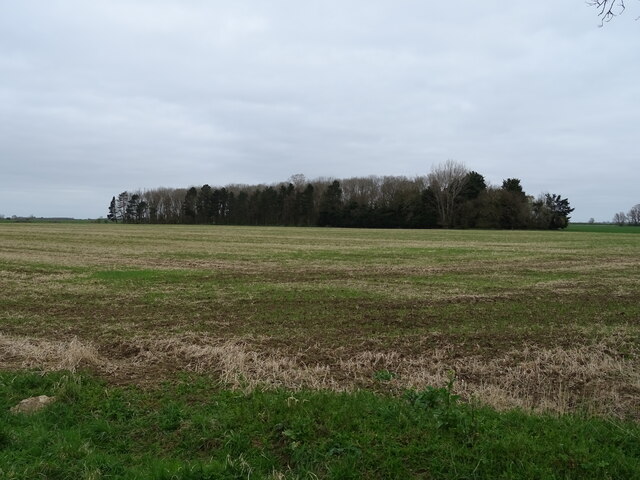
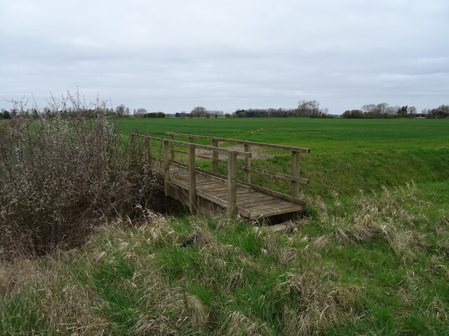
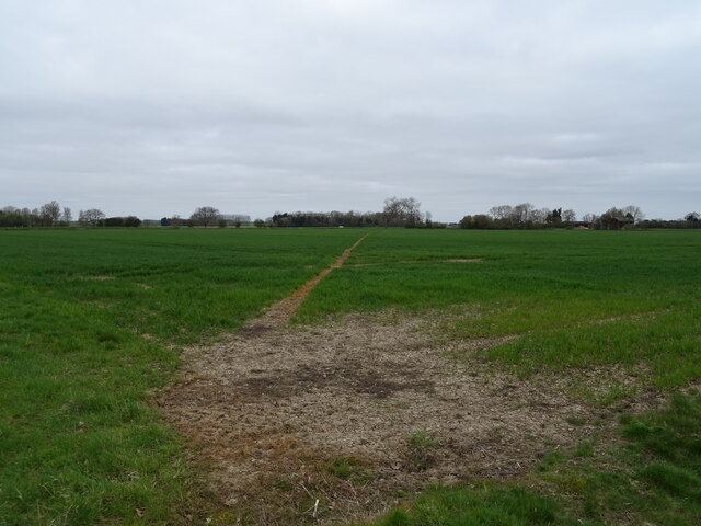
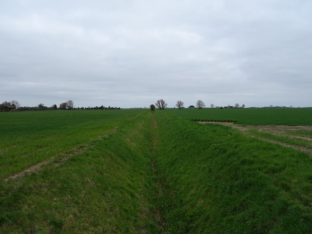
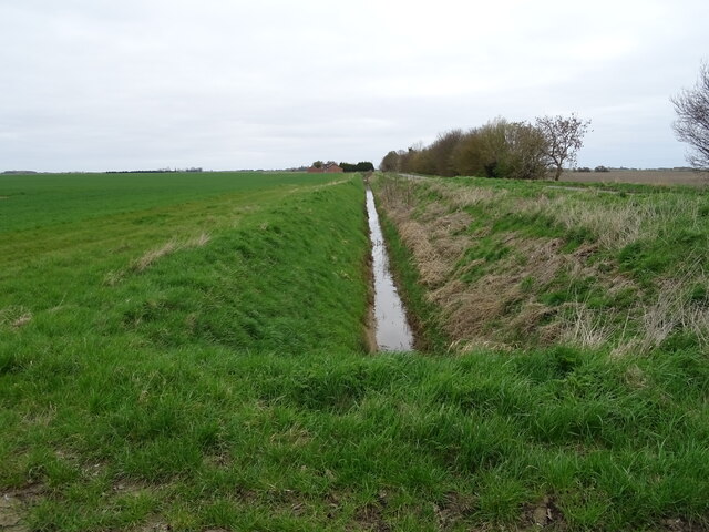
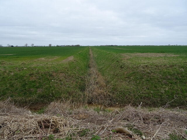
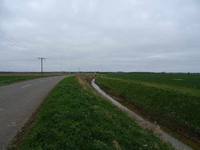
Car Dyke is an ancient man-made waterway located in Lincolnshire, England. It is considered a significant heritage site due to its historical and engineering importance. The dyke stretches for about 85 miles, running from the River Witham near Lincoln to the River Cam near Peterborough.

Constructed during the Roman period, Car Dyke was likely built as a drainage channel and transportation route. It is believed to have been dug around 2,000 years ago, making it one of the oldest man-made watercourses in the country. The name "Car Dyke" originates from the Old English word "carr," meaning "marsh" or "fen," and "dic," meaning "ditch."

The dyke is an impressive feat of engineering, measuring up to 30 meters wide and 5 meters deep in some sections. It is lined with well-preserved earth banks, suggesting that it may have been used for water transport as well. The purpose of Car Dyke was to drain water from the surrounding marshy areas, making the land more suitable for agriculture and settlement.

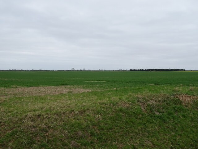
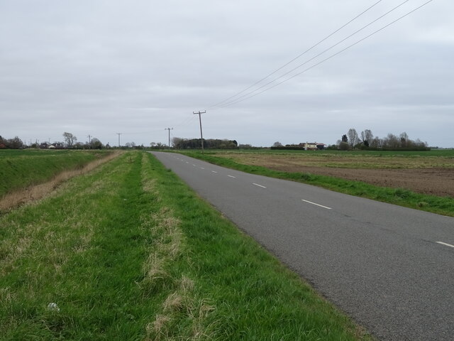
Today, Car Dyke remains a prominent feature in the landscape of Lincolnshire. It is a popular site for walkers, cyclists, and nature enthusiasts who can explore its scenic route. The dyke is home to a variety of wildlife, including waterfowl, fish, and rare plants. Additionally, various archaeological discoveries have been made along its course, including Roman coins, pottery, and other artifacts.

As a heritage site, Car Dyke serves as a testament to the ingenuity and engineering skills of the Romans, providing valuable insights into the region's history and development.

If you have any feedback on the listing, please let us know in the comments section below.

Car Dyke Images

Images are sourced within 2km of 52.842/-0.33 or Grid Reference TF1228. Thanks to Geograph Open Source API. All images are credited.

Houses on Main Road, Dowsby
Bus stop and shelter on Main Road, Dowsby
Woodland near Dowsby
Track (footpath) heading north from the B1397, Dowsby
B1397 heading east from Dowsby Towards Gosberton  Clough.
B1397 heading east from Dowsby
Towards Gosberton Clough.
Footbridge over Drain
Footpath over crop field Towards Old Decoy Farm.
Footpath over crop field
Towards Old Decoy Farm.
Drain north of Fen Road, Dowsby Fen The Fens, also known as the Fenland, is a naturally marshy region in eastern England. Most of the fens were drained several centuries ago, resulting in a flat, damp, low-lying agricultural region.
A fen is the local name for an individual area of marshland or former marshland and also designates the type of marsh typical of the area, which has neutral or alkaline water chemistry and relatively large quantities of dissolved minerals, but few other plant nutrients.
Fenland primarily lies around the coast of the Wash; it reaches into four counties: Lincolnshire, Cambridgeshire, Norfolk and a small area of Suffolk, as well as the historic county of Huntingdonshire. In whole it occupies an area of nearly 1,500 sq miles.
Most of the Fenland lies within a few metres of sea level. As with similar areas in the Netherlands, much of the Fenland originally consisted of fresh- or salt-water wetlands, which have been artificially drained and continue to be protected from floods by drainage banks and pumps.
Drain north of Fen Road, Dowsby Fen
The Fens, also known as the Fenland, is a naturally marshy region in eastern England. Most of the fens were drained several centuries ago, resulting in a flat, damp, low-lying agricultural region. A fen is the local name for an individual area of marshland or former marshland and also designates the type of marsh typical of the area, which has neutral or alkaline water chemistry and relatively large quantities of dissolved minerals, but few other plant nutrients. Fenland primarily lies around the coast of the Wash; it reaches into four counties: Lincolnshire, Cambridgeshire, Norfolk and a small area of Suffolk, as well as the historic county of Huntingdonshire. In whole it occupies an area of nearly 1,500 sq miles. Most of the Fenland lies within a few metres of sea level. As with similar areas in the Netherlands, much of the Fenland originally consisted of fresh- or salt-water wetlands, which have been artificially drained and continue to be protected from floods by drainage banks and pumps.
Drain beside Fen Road, Dowsby Fen The Fens, also known as the Fenland, is a naturally marshy region in eastern England. Most of the fens were drained several centuries ago, resulting in a flat, damp, low-lying agricultural region.
A fen is the local name for an individual area of marshland or former marshland and also designates the type of marsh typical of the area, which has neutral or alkaline water chemistry and relatively large quantities of dissolved minerals, but few other plant nutrients.
Fenland primarily lies around the coast of the Wash; it reaches into four counties: Lincolnshire, Cambridgeshire, Norfolk and a small area of Suffolk, as well as the historic county of Huntingdonshire. In whole it occupies an area of nearly 1,500 sq miles.
Most of the Fenland lies within a few metres of sea level. As with similar areas in the Netherlands, much of the Fenland originally consisted of fresh- or salt-water wetlands, which have been artificially drained and continue to be protected from floods by drainage banks and pumps.
Drain beside Fen Road, Dowsby Fen
The Fens, also known as the Fenland, is a naturally marshy region in eastern England. Most of the fens were drained several centuries ago, resulting in a flat, damp, low-lying agricultural region. A fen is the local name for an individual area of marshland or former marshland and also designates the type of marsh typical of the area, which has neutral or alkaline water chemistry and relatively large quantities of dissolved minerals, but few other plant nutrients. Fenland primarily lies around the coast of the Wash; it reaches into four counties: Lincolnshire, Cambridgeshire, Norfolk and a small area of Suffolk, as well as the historic county of Huntingdonshire. In whole it occupies an area of nearly 1,500 sq miles. Most of the Fenland lies within a few metres of sea level. As with similar areas in the Netherlands, much of the Fenland originally consisted of fresh- or salt-water wetlands, which have been artificially drained and continue to be protected from floods by drainage banks and pumps.
Drain, Dowsby Fen Looking north from Fen Road.
Drain, Dowsby Fen
Looking north from Fen Road.
Crop field, Dowsby Fen View over a drain from Fen Road.
Crop field, Dowsby Fen
View over a drain from Fen Road.
Fen Road, Dowsby Fen B1397 towards Gosberton  Clough.
Fen Road, Dowsby Fen
B1397 towards Gosberton Clough.
Drain beside Fen Road (B1397) The Fens, also known as the Fenland, is a naturally marshy region in eastern England. Most of the fens were drained several centuries ago, resulting in a flat, damp, low-lying agricultural region.
A fen is the local name for an individual area of marshland or former marshland and also designates the type of marsh typical of the area, which has neutral or alkaline water chemistry and relatively large quantities of dissolved minerals, but few other plant nutrients.
Fenland primarily lies around the coast of the Wash; it reaches into four counties: Lincolnshire, Cambridgeshire, Norfolk and a small area of Suffolk, as well as the historic county of Huntingdonshire. In whole it occupies an area of nearly 1,500 sq miles.
Most of the Fenland lies within a few metres of sea level. As with similar areas in the Netherlands, much of the Fenland originally consisted of fresh- or salt-water wetlands, which have been artificially drained and continue to be protected from floods by drainage banks and pumps.
Drain beside Fen Road (B1397)
The Fens, also known as the Fenland, is a naturally marshy region in eastern England. Most of the fens were drained several centuries ago, resulting in a flat, damp, low-lying agricultural region. A fen is the local name for an individual area of marshland or former marshland and also designates the type of marsh typical of the area, which has neutral or alkaline water chemistry and relatively large quantities of dissolved minerals, but few other plant nutrients. Fenland primarily lies around the coast of the Wash; it reaches into four counties: Lincolnshire, Cambridgeshire, Norfolk and a small area of Suffolk, as well as the historic county of Huntingdonshire. In whole it occupies an area of nearly 1,500 sq miles. Most of the Fenland lies within a few metres of sea level. As with similar areas in the Netherlands, much of the Fenland originally consisted of fresh- or salt-water wetlands, which have been artificially drained and continue to be protected from floods by drainage banks and pumps.
George VI postbox on Main Road, Dowsby Postbox No. PE10 224.

See <a href="https://www.geograph.org.uk/photo/7011611">TF1129 : Houses on Main Road, Dowsby</a> for context.
George VI postbox on Main Road, Dowsby
Postbox No. PE10 224. See TF1129 : Houses on Main Road, Dowsby for context.
Houses on Main Road, Dowsby Showing position of Postbox No. PE10 224.

See <a href="https://www.geograph.org.uk/photo/7011610">TF1129 : George VI postbox on Main Road, Dowsby</a> for postbox.
Houses on Main Road, Dowsby
Showing position of Postbox No. PE10 224. See TF1129 : George VI postbox on Main Road, Dowsby for postbox.
Elizabeth II postbox on Station Street, Rippingale Postbox No. PE10 227.

See <a href="https://www.geograph.org.uk/photo/7011618">TF1128 : Close up, Elizabeth II postbox on Station Street, Rippingale</a> for close up.
See <a href="https://www.geograph.org.uk/photo/7011620">TF1128 : Station Street, Rippingale</a> for context.
Elizabeth II postbox on Station Street, Rippingale
Close up, Elizabeth II postbox on Station Street, Rippingale Postbox No. PE10 227.

See <a href="https://www.geograph.org.uk/photo/7011616">TF1128 : Elizabeth II postbox on Station Street, Rippingale</a> for wider view.
Close up, Elizabeth II postbox on Station Street, Rippingale
Postbox No. PE10 227. See TF1128 : Elizabeth II postbox on Station Street, Rippingale for wider view.
Station Street, Rippingale Showing position of Postbox No. PE10 227.

See <a href="https://www.geograph.org.uk/photo/7011616">TF1128 : Elizabeth II postbox on Station Street, Rippingale</a> for postbox.
Station Street, Rippingale
Showing position of Postbox No. PE10 227. See TF1128 : Elizabeth II postbox on Station Street, Rippingale for postbox.
Show me another place!

Car Dyke is located at Grid Ref: TF1228 (Lat: 52.842, Lng: -0.33)

Division: Parts of Kesteven

Administrative County: Lincolnshire

District: South Kesteven

Police Authority: Lincolnshire

What 3 Words

///tangent.fight.upwards. Near Billingborough, Lincolnshire

Nearby Locations

Car Dyke Rippingale

Related Wikis

Rippingale railway station

Rippingale railway station was a station serving the villages of Rippingale, Dowsby and Dunsby, Lincolnshire on the Great Northern Railway Bourne and Sleaford...

Dowsby

Dowsby is a village and civil parish in the South Kesteven district of Lincolnshire, England. It is situated on the western edge of The Fens at the junction...

Dowsby Hall

Dowsby Hall is an early 17th-century house situated in Dowsby, Lincolnshire, England, and 6 miles (10 km) to the north of Bourne. Originally a much grander...

Dunsby

Dunsby is a small village and civil parish in the South Kesteven district of in Lincolnshire, England. It is 4 miles (6.4 km) north from Bourne, just east...

Have you been to Car Dyke ?

Leave your review of Car Dyke below (or comments, questions and feedback).