Caerau

Heritage Site in Cardiganshire

Wales

Caerau
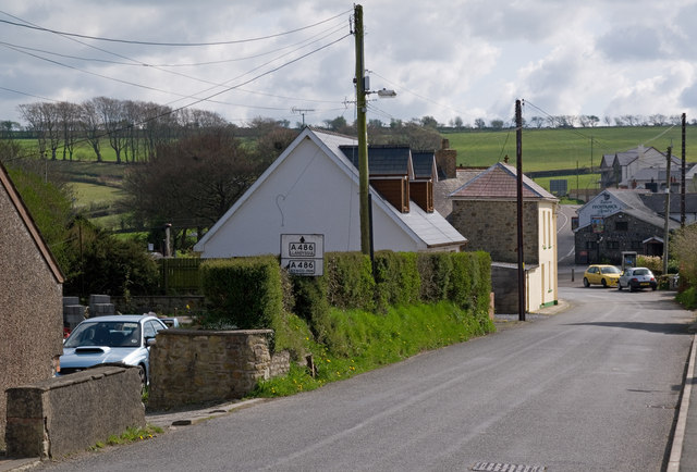
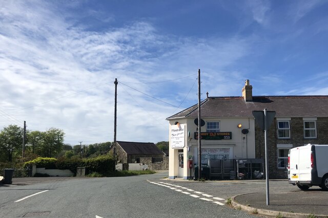
Ffostrasol The minor road from Plwmp on it approach to its junction with the A486.  Note the pre-Worboys road sign on the left - for close up see <a href="https://www.geograph.org.uk/photo/2396789">SN3747 : Pre Worboys sign, Ffostrasol</a>.
Ffostrasol Credit: Ian Capper

The requested URL returned error: 429 Too Many Requests

If you have any feedback on the listing, please let us know in the comments section below.

Caerau Images

Images are sourced within 2km of 52.12/-4.388 or Grid Reference SN3649. Thanks to Geograph Open Source API. All images are credited.

Ffostrasol The minor road from Plwmp on it approach to its junction with the A486.  Note the pre-Worboys road sign on the left - for close up see <a href="https://www.geograph.org.uk/photo/2396789">SN3747 : Pre Worboys sign, Ffostrasol</a>.
Ffostrasol
The minor road from Plwmp on it approach to its junction with the A486. Note the pre-Worboys road sign on the left - for close up see SN3747 : Pre Worboys sign, Ffostrasol.
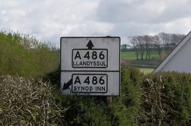
Pre Worboys sign, Ffostrasol One of four pre-Worboys signs within a couple of miles - see also <a href="https://www.geograph.org.uk/photo/2396789">SN3747 : Pre Worboys sign, Ffostrasol</a>, <a href="https://www.geograph.org.uk/photo/2396804">SN3445 : Pre Worboys sign, Penrhiwpal</a> and <a href="https://www.geograph.org.uk/photo/2396813">SN3445 : Pre Worboys sign, Penrhiwpal</a>.  For context see <a href="https://www.geograph.org.uk/photo/2396794">SN3747 : Ffostrasol</a>.
Pre Worboys sign, Ffostrasol
One of four pre-Worboys signs within a couple of miles - see also SN3747 : Pre Worboys sign, Ffostrasol, SN3445 : Pre Worboys sign, Penrhiwpal and SN3445 : Pre Worboys sign, Penrhiwpal. For context see SN3747 : Ffostrasol.
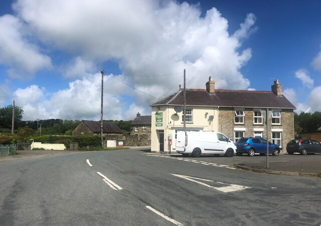
Post Office and DJ Stores, Ffostrasol
Storfa J J Jones Convenience store in the centre of the village
Storfa J J Jones
Convenience store in the centre of the village
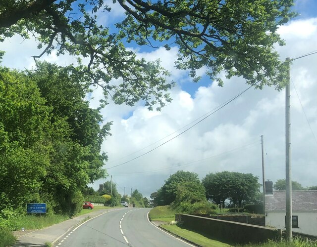
Entering Capel Cynon on the A486
Churn Stand
Churn Stand
Churn Stand There is an Ordnance Survey rivet on the top of the stand. <a title="https://www.geograph.org.uk/photo/7446182" href="https://www.geograph.org.uk/photo/7446182">Link</a>
Churn Stand
There is an Ordnance Survey rivet on the top of the stand. Link
Ordnance Survey Rivet This OS rivet can be found on the top of the churn stand. It marks a point 230.692m above mean sea level. <a title="https://www.geograph.org.uk/photo/7446181" href="https://www.geograph.org.uk/photo/7446181">Link</a>
Ordnance Survey Rivet
This OS rivet can be found on the top of the churn stand. It marks a point 230.692m above mean sea level. Link
Gabrielle's Galley Art gallery with workshops off the A486 between Ffostrasol and Capel Cynon
Gabrielle's Galley
Art gallery with workshops off the A486 between Ffostrasol and Capel Cynon
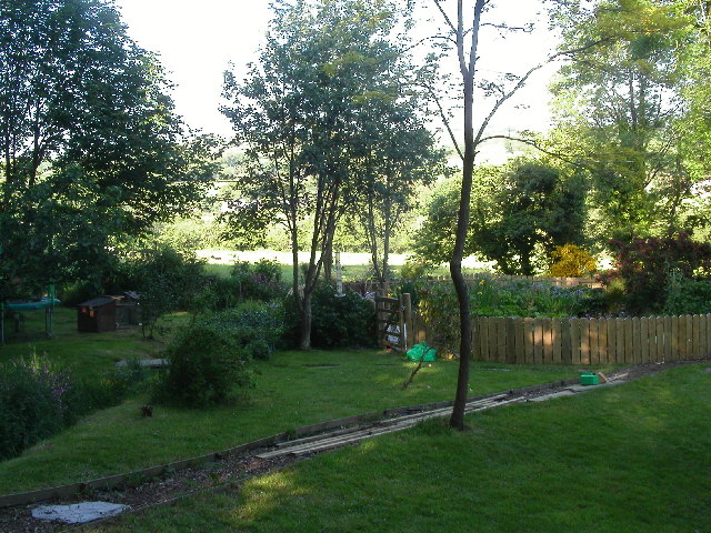
Farm land north of Capel Cynon
Ordnance Survey Cut Mark This OS cut mark can be found on Bwlch Rhyd. It marks a point 196.108m above mean sea level.
Ordnance Survey Cut Mark
This OS cut mark can be found on Bwlch Rhyd. It marks a point 196.108m above mean sea level.
Ordnance Survey Cut Mark This OS cut mark can be found on the NW parapet of the bridge. It marks a point 186.734m above mean sea level.
Ordnance Survey Cut Mark
This OS cut mark can be found on the NW parapet of the bridge. It marks a point 186.734m above mean sea level.
Ordnance Survey Cut Mark This OS cut mark can be found on Rhyd Fach. It marks a point 210.601m above mean sea level.
Ordnance Survey Cut Mark
This OS cut mark can be found on Rhyd Fach. It marks a point 210.601m above mean sea level.
Ordnance Survey Cut Mark This OS cut mark can be found on the roadside barn at Ty-rhos Farm. It marks a point 230.302m above mean sea level.
Ordnance Survey Cut Mark
This OS cut mark can be found on the roadside barn at Ty-rhos Farm. It marks a point 230.302m above mean sea level.
Plwmp Radio Tower This radio tower stands high near Plwmp just off the Welsh coast road. It used to belong to Swalec or South Wales Electric till it was acquired by Surf Telecoms.
Plwmp Radio Tower
This radio tower stands high near Plwmp just off the Welsh coast road. It used to belong to Swalec or South Wales Electric till it was acquired by Surf Telecoms.
Footbridge over Afon Bedw This stream running through a wooded valley may be typical of many in this part of West Wales but it is nonetheless charming as you walk the streamside public footpath and cross this bridge to climb the hillside beyond.
Footbridge over Afon Bedw
This stream running through a wooded valley may be typical of many in this part of West Wales but it is nonetheless charming as you walk the streamside public footpath and cross this bridge to climb the hillside beyond.
Level road, falling land For the time being the road stays level while the land to the left (south) falls away.  Soon, however, the road too descends - to Capel Cynon.
Level road, falling land
For the time being the road stays level while the land to the left (south) falls away. Soon, however, the road too descends - to Capel Cynon.
Heading south to Ffostrasol or head west instead: turn right!
Heading south to Ffostrasol
or head west instead: turn right!
Show me another place!

Caerau is located at Grid Ref: SN3649 (Lat: 52.12, Lng: -4.388)

Unitary Authority: Ceredigion

Police Authority: Dyfed Powys

What 3 Words

///punch.encoding.cover. Near Llanllwchaiarn, Ceredigion

Nearby Locations

Caerau

Related Wikis

A486 road

The A486 is an A road in Wales linking New Quay, Ceredigion, with the A484 in Saron (Llangeler), Carmarthenshire. == Route == The road begins in New Quay...

Ffostrasol

Ffostrasol is a small village in the south of Ceredigion, Wales. It is located on the A486 between Synod Inn and Llandysul, and it forms part of the parish...

Blaenbedw Fawr

Blaenbedw Fawr is a small village in the community of Llandysiliogogo, Ceredigion, Wales, which is 68.9 miles (110.8 km) from Cardiff and 187 miles (300...

Cwmcoednerth

Cwmcoednerth is a hamlet in the community of Penbryn, Ceredigion, Wales, which is 68.6 miles (110.4 km) from Cardiff and 188 miles (302.5 km) from London...

Nearby Amenities

Located within 500m of 52.12,-4.388
Ford: yes
Lat/Long: 52.1186386/-4.3921895
The data included in this document is from www.openstreetmap.org. The data is made available under ODbL.

Have you been to Caerau?

Leave your review of Caerau below (or comments, questions and feedback).