Burfa Camp

Heritage Site in Herefordshire

England

Burfa Camp

Cottage at Walton Green Just - and only just - over the border into Waless.
Cottage at Walton Green Credit: Oliver Dixon

Burfa Camp, located in Herefordshire, England, is a fascinating heritage site that holds historical and cultural significance. It is an Iron Age hillfort nestled within the picturesque landscape of the Welsh Marches. The site is positioned on a prominent hill, offering panoramic views of the surrounding countryside.

Dating back to the late Bronze Age and Iron Age, Burfa Camp is believed to have been constructed around 800 BC and was occupied until Roman times. The camp measures approximately 1.6 hectares and is enclosed by a well-preserved defensive rampart. The rampart, made of earth and stone, is still visible today, showcasing the impressive craftsmanship of the ancient inhabitants.

Excavations carried out at the site have revealed evidence of human occupation, including the remains of roundhouses and storage pits. These findings indicate a settled and organized community that relied on agriculture and animal husbandry for sustenance.

Visitors to Burfa Camp can explore the site and imagine what life was like for its Iron Age inhabitants. The panoramic views from the hilltop provide a glimpse into the strategic importance of the location, likely chosen to monitor and control movements in the surrounding area.

Burfa Camp's historical significance and well-preserved features make it a popular destination for history enthusiasts, archaeologists, and those seeking to connect with the region's ancient past. It allows visitors to gain insights into the lives and cultures of the Iron Age people who once called this hillfort home.

If you have any feedback on the listing, please let us know in the comments section below.
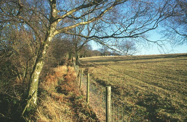
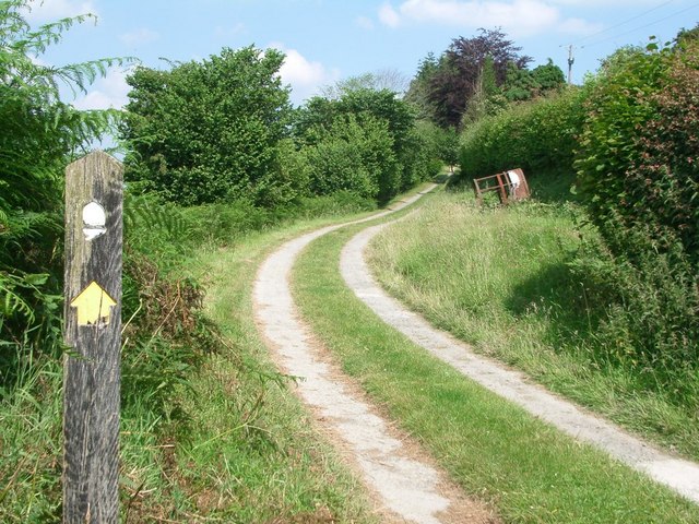
Burfa Camp Images

Images are sourced within 2km of 52.237/-3.047 or Grid Reference SO2860. Thanks to Geograph Open Source API. All images are credited.

Cottage at Walton Green Just - and only just - over the border into Waless.
Cottage at Walton Green
Just - and only just - over the border into Waless.
Below Bradnor Hill View across farmland to Bradnor Hill from near Dunfield.
Below Bradnor Hill
View across farmland to Bradnor Hill from near Dunfield.
Farmland below Herrock Hill View over farmland in the broad flat bottom valley below Herrock Hill on the right and the village of Evenjob to the north.
Farmland below Herrock Hill
View over farmland in the broad flat bottom valley below Herrock Hill on the right and the village of Evenjob to the north.
Herrock Hill Herrock Hill, one of a number of steep side hills in this borberland to the west of Kington.
Herrock Hill
Herrock Hill, one of a number of steep side hills in this borberland to the west of Kington.
A little used country road Always an indication of a little used country road when grass grows in the centre.  This lane is near Walton on the Welsh borders.
A little used country road
Always an indication of a little used country road when grass grows in the centre. This lane is near Walton on the Welsh borders.
A growing wheat field A growing wheat field below Herrock Hill, Bradnor Hill can be seen in the background in this view across this wheat field.
A growing wheat field
A growing wheat field below Herrock Hill, Bradnor Hill can be seen in the background in this view across this wheat field.
Herrock Hill (Viewed from Knill) This hill is 1,217ft (371m) high and the summit has fantastic views of the Radnor Forest, along with the settlements of New Radnor, Kinnerton, Evenjobb and Knill.
Herrock Hill (Viewed from Knill)
This hill is 1,217ft (371m) high and the summit has fantastic views of the Radnor Forest, along with the settlements of New Radnor, Kinnerton, Evenjobb and Knill.
Countryside from Herrock Hill Herrock Hill is 1,217ft (371m) high and the summit has fantastic views of the Radnor Forest, along with the settlements of New Radnor, Kinnerton, Evenjobb and Knill. This view does not show the previously mentioned names, but some hills in the county of Shropshire, England are visible (e.g., the Wrekin, Brown Clee Hill and Titterstone Clee Hill).
Countryside from Herrock Hill
Herrock Hill is 1,217ft (371m) high and the summit has fantastic views of the Radnor Forest, along with the settlements of New Radnor, Kinnerton, Evenjobb and Knill. This view does not show the previously mentioned names, but some hills in the county of Shropshire, England are visible (e.g., the Wrekin, Brown Clee Hill and Titterstone Clee Hill).
Bradnor Hill (Viewed from Herrock Hill) Here is Bradnor Hill from the summit at Herrock Hill, which is 1,217ft (371m) high. The summit of Bradnor Hill is 1,282ft (391m) high, and is home to the Kington Golf Club. The hill can be viewed from Kington, where I photographed the hill from the churchyard three years ago <a href="https://www.geograph.org.uk/photo/6347661">SO2956 : Bradnor Hill (Viewed from the churchyard at St. Mary's Church at Kington)</a>.
Bradnor Hill (Viewed from Herrock Hill)
Here is Bradnor Hill from the summit at Herrock Hill, which is 1,217ft (371m) high. The summit of Bradnor Hill is 1,282ft (391m) high, and is home to the Kington Golf Club. The hill can be viewed from Kington, where I photographed the hill from the churchyard three years ago SO2956 : Bradnor Hill (Viewed from the churchyard at St. Mary's Church at Kington).
The Black Mountains (Viewed from Herrock Hill) Many miles south from Herrock Hill are the Black Mountains in Wales, and if my memory serves me right the hill with the slope is Pen Allt-mawr.
The Black Mountains (Viewed from Herrock Hill)
Many miles south from Herrock Hill are the Black Mountains in Wales, and if my memory serves me right the hill with the slope is Pen Allt-mawr.
On the Mortimer Trail - eastern shoulder of Rushoak Hill
Track to Herrock Hill
Knill Garraway Wood Viewed from a track to Herrock Hill.
Knill Garraway Wood
Viewed from a track to Herrock Hill.
Bench on Herrock Hill This bench is on the peak of the 1,217ft (371m) high Herrock Hill, with a quote from Muhammad Ali that reads "Don't count the days, make the days count".
Bench on Herrock Hill
This bench is on the peak of the 1,217ft (371m) high Herrock Hill, with a quote from Muhammad Ali that reads "Don't count the days, make the days count".
Trees by Herrock Hill The two trees in view are situated east from Herrock Hill.
Trees by Herrock Hill
The two trees in view are situated east from Herrock Hill.
Herrock Hill This 1,217ft (371m) high hill has fantastic views from its summit, where the Radnor Forest is visible as well as settlements like New Radnor, Kinnerton, Evenjobb and Knill.
Herrock Hill
This 1,217ft (371m) high hill has fantastic views from its summit, where the Radnor Forest is visible as well as settlements like New Radnor, Kinnerton, Evenjobb and Knill.
Little Brampton Scar Above the scarp slopes on the long Silurian limestone ridge running from the Severn to the Wye. The plateau and dip slopes are agricultural, the scarp, north facing is wooded. Sometimes there were common grazings on the scarp slopes, but these have often reverted to woodland, a process visible at Byton SO3763 and Yatton Commons. SO4366. A footpath is squeezed between the fence and the wood.
Little Brampton Scar
Above the scarp slopes on the long Silurian limestone ridge running from the Severn to the Wye. The plateau and dip slopes are agricultural, the scarp, north facing is wooded. Sometimes there were common grazings on the scarp slopes, but these have often reverted to woodland, a process visible at Byton SO3763 and Yatton Commons. SO4366. A footpath is squeezed between the fence and the wood.
St Michael, Knill Very much tucked away, overlooking the grounds of Knill Court.
St Michael, Knill
Very much tucked away, overlooking the grounds of Knill Court.
Show me another place!

Burfa Camp is located at Grid Ref: SO2860 (Lat: 52.237, Lng: -3.047)

Unitary Authority: County of Herefordshire

Police Authority: West Mercia

What 3 Words

///forgot.apart.ritual. Near Kington, Herefordshire

Related Wikis

Knill

Knill is a village and civil parish in Herefordshire, England. == History == Recorded in the Domesday Book of 1086 as Chenille (from the Old English meaning...

Burfa Castle

Burfa Castle (also known as Burfa Hillfort, Burfa Bank Hillfort, or Burfa Camp) is an Iron Age hillfort near the tiny town of Old Radnor, Radnorshire in...

Lower Harpton

Lower Harpton is a settlement and civil parish about 2.5 miles of Knighton, in the county of Herefordshire, England. In 2001, the parish had a population...

Stanner Rocks

Stanner Rocks is a rounded hill, steep in parts, which lies close to the Wales border with England between Walton and Kington. A superb collection of wild...

Rushock, Herefordshire

Rushock is a small village in Herefordshire, England. It lies about 1 mile north-east of Kington. The population of the civil parish was 131 at the 2011...

Walton, Powys

Walton is a village in Powys, Wales, 1,300 yards (1,200 m) west from the border with Herefordshire, England. The village is 3 miles (5 km) east from New...

Stanner Halt railway station

Stanner railway station was a station in Stanner, Powys, Wales. The station was opened by the Kington and Eardisley Railway in 1875. == References... ==

Kington Castle

Kington Castle stood in the medieval market town of Kington in Herefordshire, England (grid reference SO291569). It was built in the 11th century and destroyed...

Nearby Amenities

Located within 500m of 52.237,-3.047
Barrier: stile
Lat/Long: 52.2349702/-3.0508947
Barrier: stile
Lat/Long: 52.2351975/-3.053695
Information: guidepost
Tourism: information
Lat/Long: 52.2337258/-3.051176
Entrance: yes
Lat/Long: 52.2376552/-3.0400973
The data included in this document is from www.openstreetmap.org. The data is made available under ODbL.

Have you been to Burfa Camp?

Leave your review of Burfa Camp below (or comments, questions and feedback).