Bravoniacvm

Heritage Site in Westmorland Eden

England

Bravoniacvm

Foresters Hall, Kirkby Thore This has two date stones: 'FORESTERS HALL / No, 844 / 1844'/ UNITAS BENEVOLENTIA ET CONCORDIA, surmounted by a deer's head, and 'ERECTED / BY SUBSCRIPTION / 1832 / scientia millaeres est praestantior'. The hall was first built as a single-storey reading room, according to the listing details.
Foresters Hall, Kirkby Thore Credit: Humphrey Bolton

Bravoniacvm, located in Westmorland, is a significant heritage site in the United Kingdom. It holds historical importance as an ancient Roman fort and settlement that dates back to the first century AD. The site is situated on the eastern edge of the Lake District National Park, providing visitors with picturesque views and a glimpse into the Roman era.

The remains of Bravoniacvm showcase the architectural prowess of the Romans, with the foundations of the fort still visible today. The fort was strategically constructed to guard the Roman road that connected the forts in the region, as well as to maintain control over the local population. The fort covered an area of approximately 3.5 acres and was home to a garrison of around 500 soldiers.

Excavations at Bravoniacvm have unearthed various artifacts, including coins, pottery, and weaponry, shedding light on the daily life of the Romans stationed there. The site also features a museum that displays these artifacts, providing visitors with a comprehensive understanding of the Roman presence in the area.

With its historical significance, Bravoniacvm attracts both history enthusiasts and tourists interested in exploring the Roman heritage of the region. The site offers guided tours, allowing visitors to explore the fort's remains and gain insight into the Roman way of life. The surrounding area offers opportunities for hiking and scenic walks, making Bravoniacvm a popular destination for nature lovers as well.

In summary, Bravoniacvm in Westmorland is a captivating heritage site that offers a glimpse into the Roman era. With its well-preserved remains, artifacts, and picturesque surroundings, it provides visitors with a unique opportunity to delve into the rich history of the region.

If you have any feedback on the listing, please let us know in the comments section below.

Bravoniacvm Images

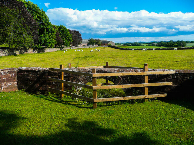
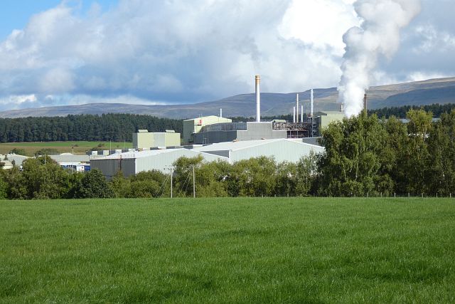
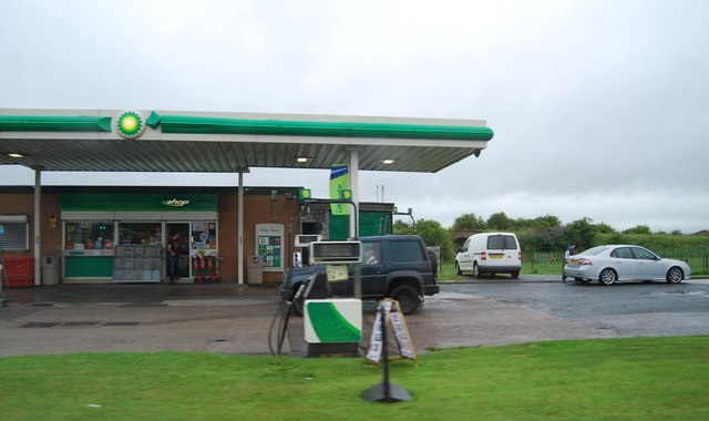
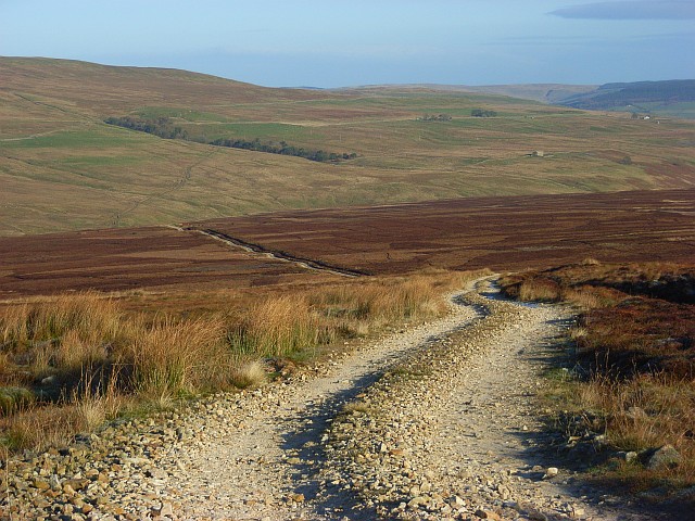
Images are sourced within 2km of 54.623/-2.565 or Grid Reference NY6325. Thanks to Geograph Open Source API. All images are credited.

Foresters Hall, Kirkby Thore This has two date stones: 'FORESTERS HALL / No, 844 / 1844'/ UNITAS BENEVOLENTIA ET CONCORDIA, surmounted by a deer's head, and 'ERECTED / BY SUBSCRIPTION / 1832 / scientia millaeres est praestantior'. The hall was first built as a single-storey reading room, according to the listing details.
Foresters Hall, Kirkby Thore
This has two date stones: 'FORESTERS HALL / No, 844 / 1844'/ UNITAS BENEVOLENTIA ET CONCORDIA, surmounted by a deer's head, and 'ERECTED / BY SUBSCRIPTION / 1832 / scientia millaeres est praestantior'. The hall was first built as a single-storey reading room, according to the listing details.
Triangular green near the school, Kirkby Thore
Arch in a wall, Kirkby Thore Not one of the 'Roman Arches', which are alongside the main street to the south. This one seems to be a bridge to carry the wall over a stream.
Arch in a wall, Kirkby Thore
Not one of the 'Roman Arches', which are alongside the main street to the south. This one seems to be a bridge to carry the wall over a stream.
Stamp Hill Farm Viewed from a passing train. The yard in the foreground appears to have been surfaced since an earlier photo <a href="https://www.geograph.org.uk/photo/3820658">NY6526 : Stamp Hill Farm</a>.
Stamp Hill Farm
Viewed from a passing train. The yard in the foreground appears to have been surfaced since an earlier photo NY6526 : Stamp Hill Farm.
Gypsum works, Kirkby Thore Melmerby Fell is in the background.
Gypsum works, Kirkby Thore
Melmerby Fell is in the background.
Kirkby Thore, St. Michael's Church: Southern aspect
Ordnance Survey Cut Mark This OS cut mark can be found on the east angle of the school.
Ordnance Survey Cut Mark
This OS cut mark can be found on the east angle of the school.
Ordnance Survey 1GL Bolt This OS bolt can be found on the south face of St Michael's Church. It marks a point 119.707m above mean sea level.
Ordnance Survey 1GL Bolt
This OS bolt can be found on the south face of St Michael's Church. It marks a point 119.707m above mean sea level.
Ordnance Survey Cut Mark This OS cut mark can be found on the corner shop. It marks a point 114.163m above mean sea level.
Ordnance Survey Cut Mark
This OS cut mark can be found on the corner shop. It marks a point 114.163m above mean sea level.
Ordnance Survey Cut Mark This OS cut mark can be found on the former post office on Main Street. It marks a point 113.937m above mean sea level.
Ordnance Survey Cut Mark
This OS cut mark can be found on the former post office on Main Street. It marks a point 113.937m above mean sea level.
Ordnance Survey Rivet This OS rivet can be found on the SE parapet of the railway bridge. It marks a point 144.664m above mean sea level.
Ordnance Survey Rivet
This OS rivet can be found on the SE parapet of the railway bridge. It marks a point 144.664m above mean sea level.
Small island, River Eden
Filling Station at Kirkby Thore, A66
Bridge End Farm, Kirkby Thore
House at Eden View
House at Eden View
Low Moor Row
Low Moor Row
Town End Looking over to Kirkby Thore and the North Pennine Fells still covered in snow from earlier in the week.
Town End
Looking over to Kirkby Thore and the North Pennine Fells still covered in snow from earlier in the week.
Kirkby Thore Looking along the A66 at Town End.
Kirkby Thore
Looking along the A66 at Town End.
Show me another place!

Bravoniacvm is located at Grid Ref: NY6325 (Lat: 54.623, Lng: -2.565)

Administrative County: Cumbria

District: Eden

Police Authority: Cumbria

What 3 Words

///acrobatic.wiping.trace. Near Appleby-in-Westmorland, Cumbria

Related Wikis

Maiden Way

The Maiden Way or Maidenway (Middle English: Maydengathe; Medieval Latin: Via Puellarum) was a roughly 20-mile (32 km) Roman road in northern Britain connecting...

Kirkby Thore

Kirkby Thore is a small village and civil parish in Cumbria, England (grid reference NY639257), in the historic county of Westmorland. It is close to the...

Kirkby Thore railway station

Kirkby Thore railway station was a railway station situated on the Eden Valley Railway between Penrith and Kirkby Stephen East. It served the village of...

Eden Grove School

Eden Grove School was a residential special school in Bolton near the town of Appleby-in-Westmorland in Cumbria, England. The school was opened in September...

All Saints Church, Bolton

All Saints Church is in the village of Bolton, Cumbria, England. It is an active Anglican parish church in the deanery of Appleby, the archdeaconry of...

Bolton, Cumbria

Bolton is a village and civil parish in the Eden District of Cumbria, England, about 4 miles (6 km) north west of Appleby-in-Westmorland, and on the River...

Temple Sowerby railway station

Temple Sowerby railway station was a railway station situated on the Eden Valley Railway between Penrith and Kirkby Stephen East. It served the village...

New Biggin railway station

New Biggin or Newbiggin was a railway station which served the village of Newbiggin near Kirkby Thore in Newbiggin parish, Cumbria, England. It was located...

Nearby Amenities

Located within 500m of 54.623,-2.565
Kirkby Thore
Place: village
Lat/Long: 54.6255475/-2.5608439
Oak Barn
Local Ref: AT
Naptan AtcoCode: 090074350990
Naptan Bearing: E
Naptan BusStopType: CUS
Naptan CommonName: Oak Barn
Naptan Indicator: at
Naptan Landmark: North View
Naptan NaptanCode: cumdamta
Naptan Street: Oak Barn
Naptan Verified: no
Source: naptan_import
Lat/Long: 54.6222839/-2.5660873
War Memorial Hall
Historic: memorial
Local Ref: AT
Memorial: war_memorial
Naptan AtcoCode: 090074351057
Naptan Bearing: E
Naptan BusStopType: CUS
Naptan CommonName: War Memorial Hall
Naptan Indicator: at
Naptan Landmark: war Memorial Hall
Naptan NaptanCode: cumdamtg
Naptan Street: No name
Naptan Verified: no
Source: naptan_import
Lat/Long: 54.6255314/-2.5598658
Bus Stop
Kirkby Thore Bridge End
Bench: yes
Covered: yes
Naptan AtcoCode: 090074351060
Naptan Bearing: W
Naptan CommonName: Bridge End Inn (W bound)
Naptan Indicator: near
Naptan Landmark: Bridge End Inn PH
Naptan NaptanCode: cumdamtj
Naptan Street: A66
Shelter: yes
Source: naptan_import
Lat/Long: 54.6216839/-2.5666214
Bus Stop
Kirkby Thore Bridge End
Bench: no
Covered: no
Naptan AtcoCode: 090074653889
Naptan Bearing: E
Naptan BusStopType: CUS
Naptan CommonName: Bridge End Inn (E bound)
Naptan Indicator: o/s
Naptan Landmark: Bridge End Inn
Naptan NaptanCode: cumdpdaw
Naptan Street: A66
Shelter: no
Source: naptan_import
Lat/Long: 54.6221908/-2.5671621
Turning Circle
Noexit: yes
Lat/Long: 54.6259516/-2.5591498
Post Office
Kirkby Thore Post Office
Addr Country: GB
Addr Postcode: CA10 1UD
Branch: Kirkby Thore
Brand: Post Office
Brand Wikidata: Q1783168
Check Date: 2022-05-27
Check Date Opening Hours: 2022-05-27
Contact Website: https://www.postoffice.co.uk/branch-finder/2494108/kirkby-thore
Opening Hours: Mo-Fr 07:30-17:30; Sa 08:00-12:00; Su 09:00-12:00
Ref Pol Id: 9802
Lat/Long: 54.6249476/-2.5610643
Bench
Lat/Long: 54.62212/-2.5668537
Waste Basket
Check Date: 2021-08-05
Lat/Long: 54.6221579/-2.566877
Telephone
Booth: K6
Covered: booth
Lat/Long: 54.6256621/-2.5613778
Post Box
Post Box Type: wall
Ref: CA10 13
Lat/Long: 54.6255053/-2.561182
Waste Basket
Lat/Long: 54.6256388/-2.5613429
Bench
Lat/Long: 54.6267495/-2.5623054
Post Box
Post Box Type: lamp
Ref: CA10 57
Royal Cypher: EIIR
Royal Cypher Wikidata: Q33102113
Lat/Long: 54.6223338/-2.5660018
Generator Method: photovoltaic
Generator Output Electricity: yes
Generator Source: solar
Generator Type: solar_photovoltaic_panel
Location: roof
Power: generator
Lat/Long: 54.6225492/-2.5650962
Generator Method: photovoltaic
Generator Output Electricity: yes
Generator Source: solar
Generator Type: solar_photovoltaic_panel
Location: roof
Power: generator
Lat/Long: 54.625306/-2.5635674
Generator Method: photovoltaic
Generator Output Electricity: yes
Generator Source: solar
Generator Type: solar_photovoltaic_panel
Location: roof
Power: generator
Lat/Long: 54.6260066/-2.5636679
Generator Method: photovoltaic
Generator Output Electricity: yes
Generator Source: solar
Generator Type: solar_photovoltaic_panel
Location: roof
Power: generator
Lat/Long: 54.6260479/-2.5593067
Defibrillator
Defibrillator Location: outside the Memorial Hall in Kirkby Thore
Emergency: defibrillator
Indoor: no
Lat/Long: 54.6254664/-2.5599876
Power: pole
Lat/Long: 54.6224668/-2.5685753
Power: pole
Lat/Long: 54.6229638/-2.5697148
Power: pole
Lat/Long: 54.62323/-2.5703162
Power: pole
Lat/Long: 54.6235239/-2.5709873
Power: pole
Lat/Long: 54.6240991/-2.5706474
Power: pole
Lat/Long: 54.624716/-2.5696386
Power: pole
Lat/Long: 54.6253543/-2.5685404
Power: pole
Lat/Long: 54.6263293/-2.5668539
Power: pole
Lat/Long: 54.6268995/-2.5658625
Power: pole
Lat/Long: 54.6272337/-2.5652721
Power: pole
Lat/Long: 54.6240361/-2.5699131
Power: pole
Lat/Long: 54.620133/-2.5631455
Power: pole
Lat/Long: 54.6205051/-2.5631934
Power: pole
Lat/Long: 54.6216947/-2.5633263
Power: pole
Lat/Long: 54.6224416/-2.5637272
Power: pole
Lat/Long: 54.6221792/-2.5653244
Power: pole
Lat/Long: 54.6227582/-2.5617924
Power: pole
Lat/Long: 54.6230635/-2.5598989
Power: pole
Lat/Long: 54.6233624/-2.5581078
Power: pole
Lat/Long: 54.624248/-2.5590491
Power: pole
Lat/Long: 54.6252243/-2.5600776
The data included in this document is from www.openstreetmap.org. The data is made available under ODbL.

Have you been to Bravoniacvm ?

Leave your review of Bravoniacvm below (or comments, questions and feedback).